Stunning Rock Formations…You Will be Amazed
Mirima National Park is a beautiful and easy accessible nature preserve that is a true delight to explore
The Park is located on the outskirts of Kununurra in the Kimberley region of Western Australia. It was established in 1982 and covers an area of 20.68 square km (8 square miles).
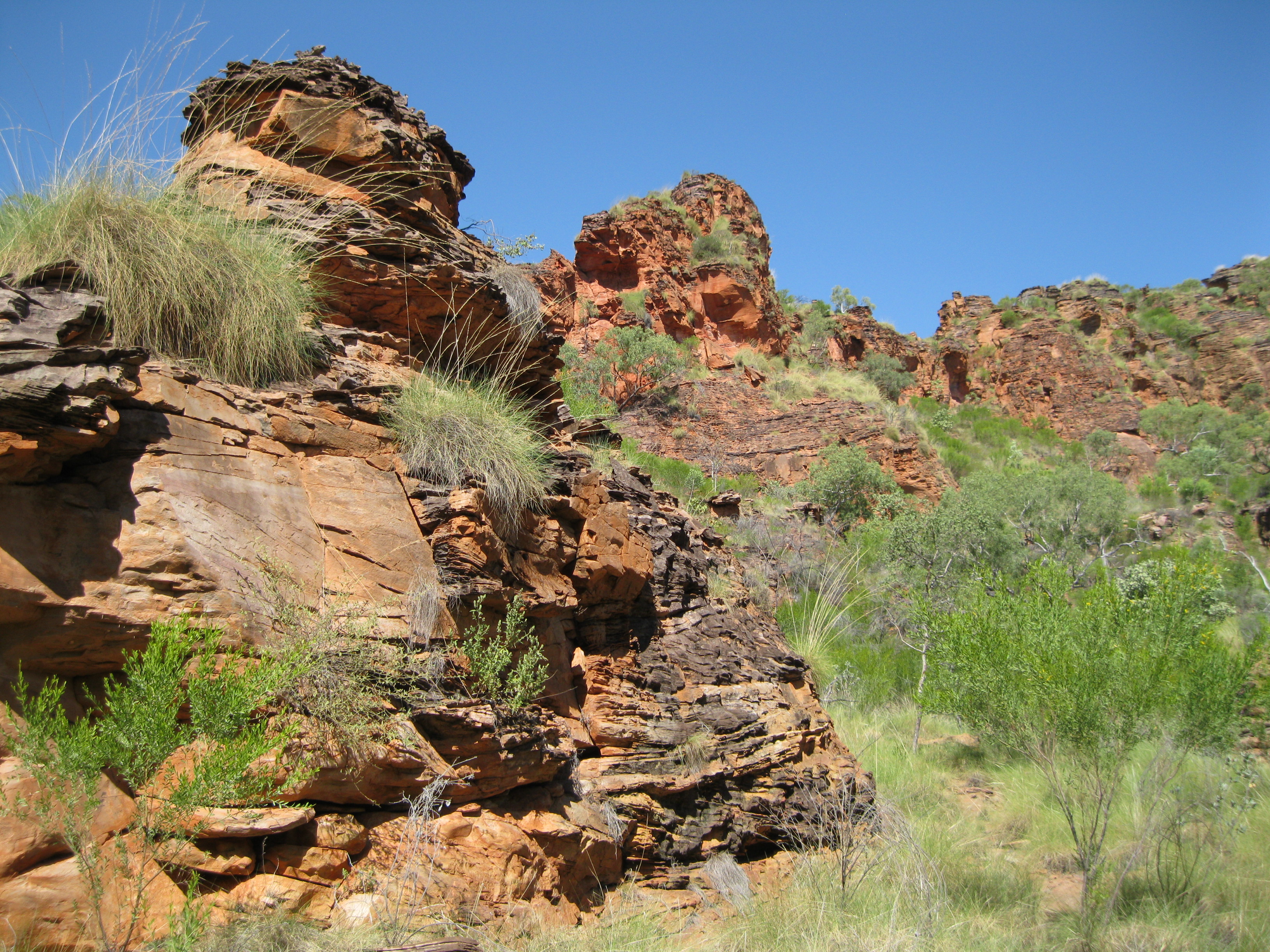
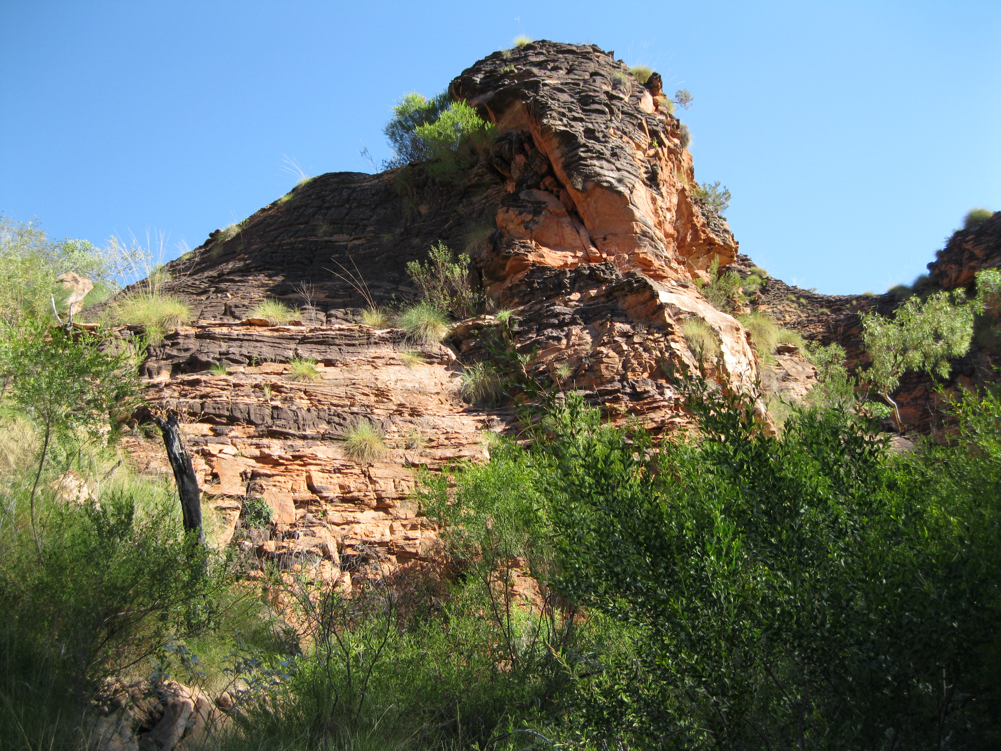
It is also known as the Hidden Valley and referred to as the “Mini Bungle Bungles” by many but it is actually more reminiscent of certain parts of Karijini National Park with the bedded sedimentary rock scenery. That being said the park does have a bit of the swirled dome structure which the Bungle Bungles of Purnululu National Park is known for.
Geology: Formation of the Amazing Rocks
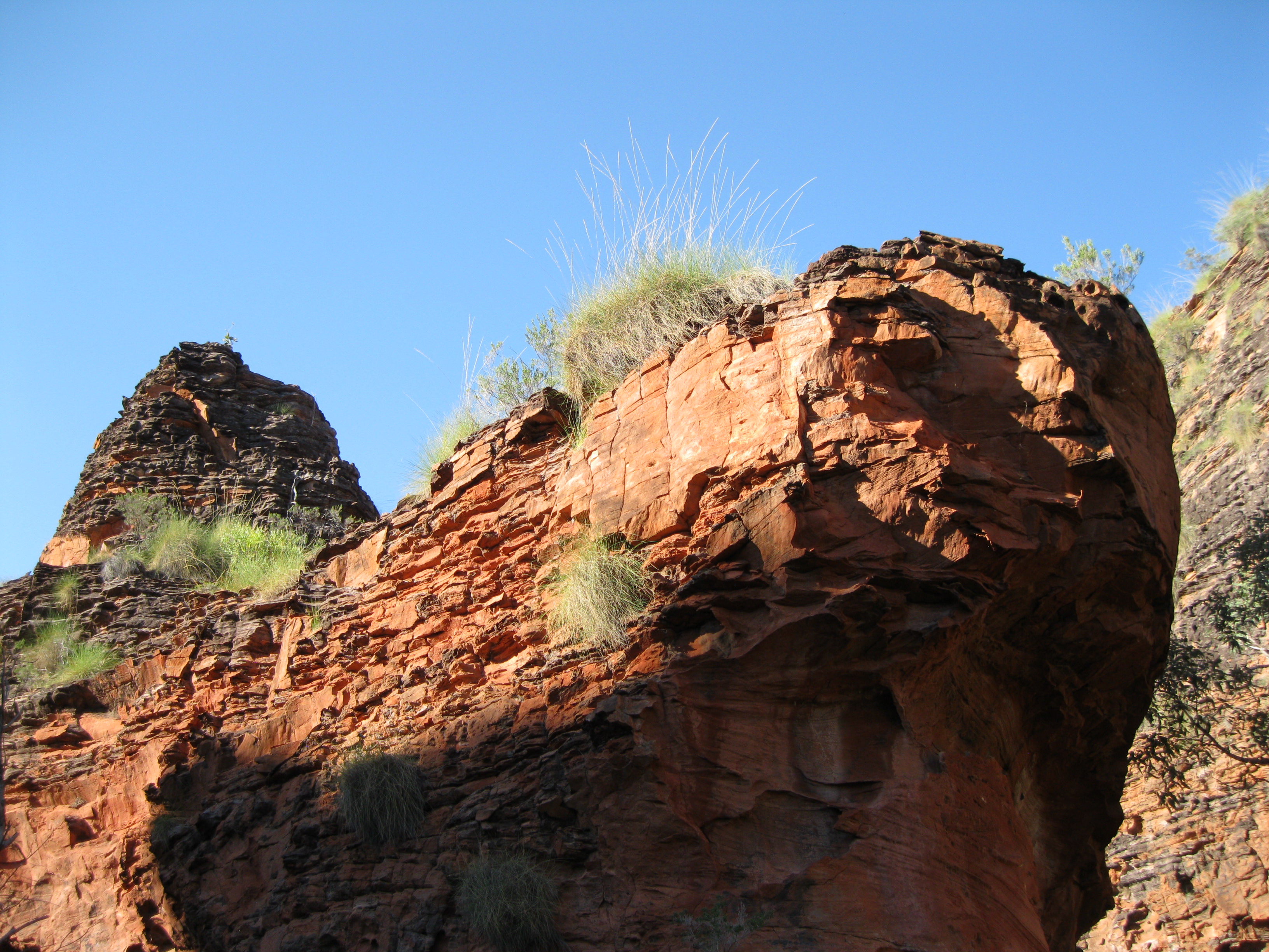
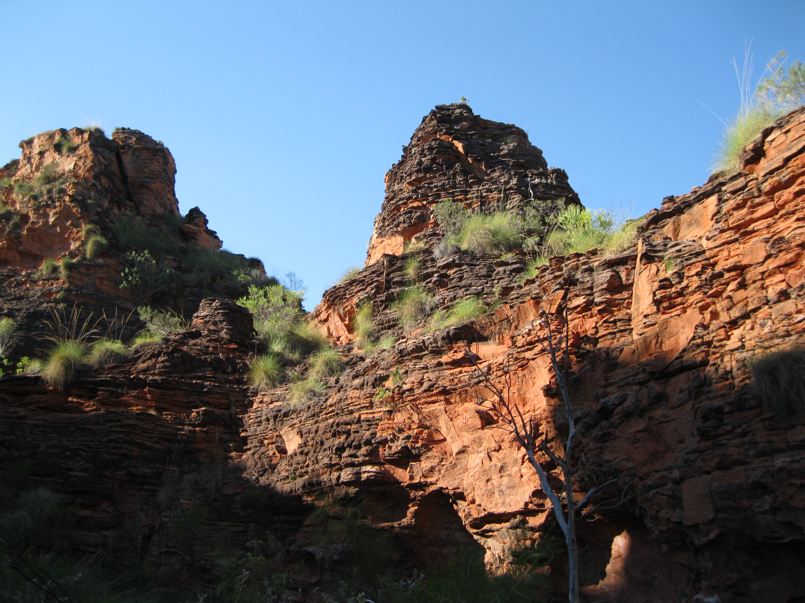
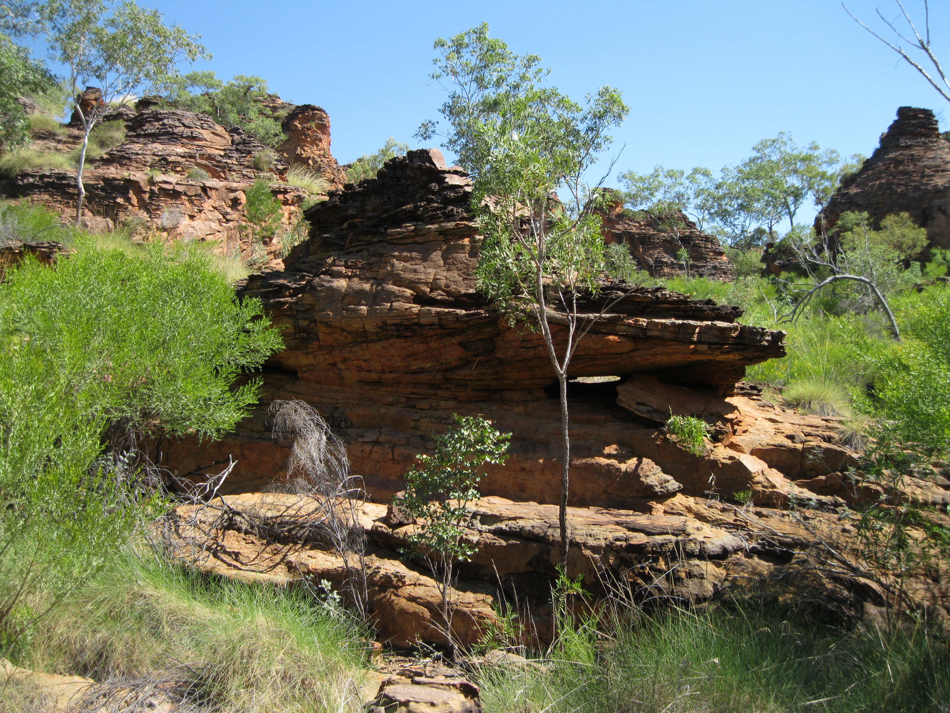
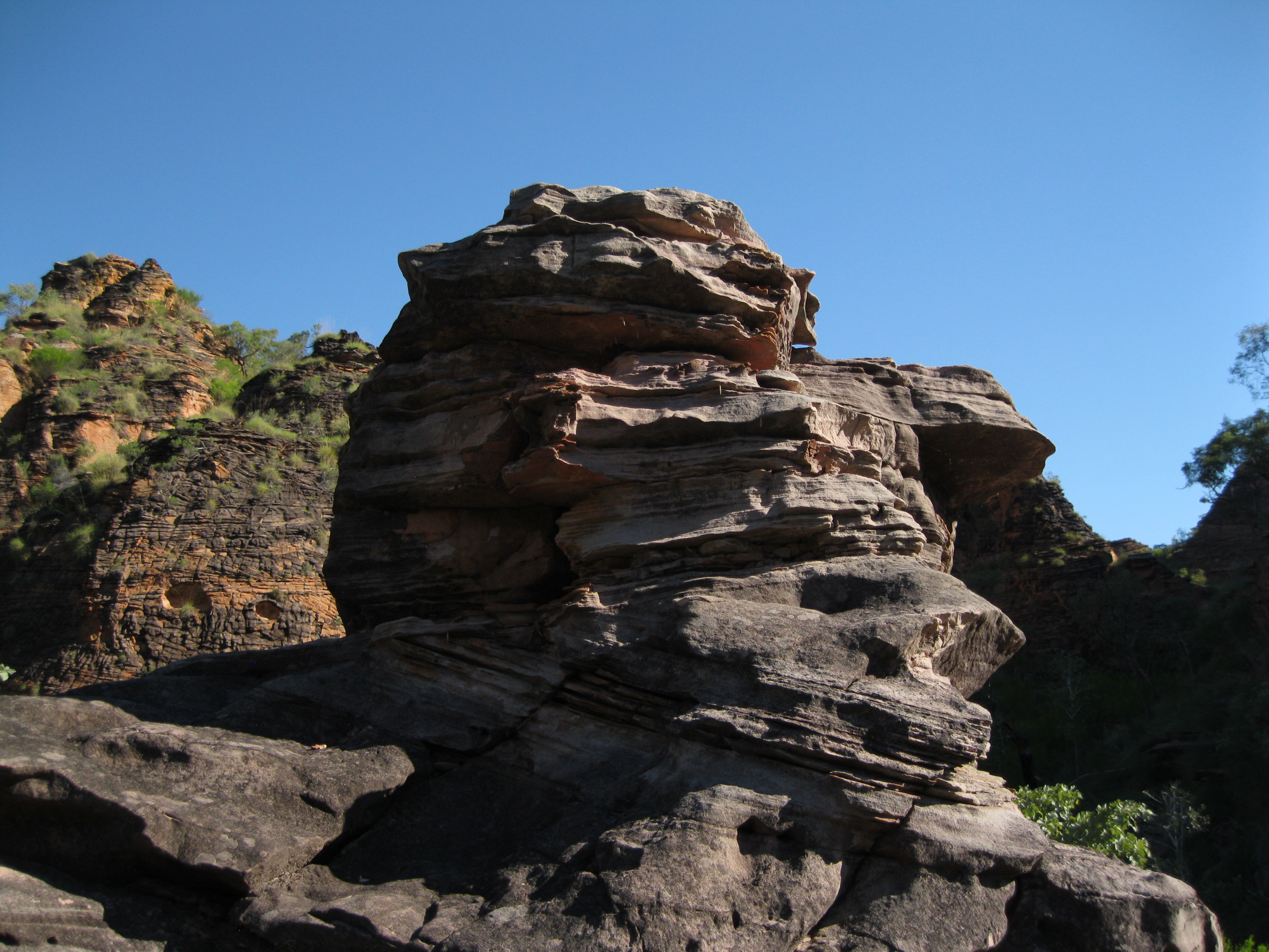
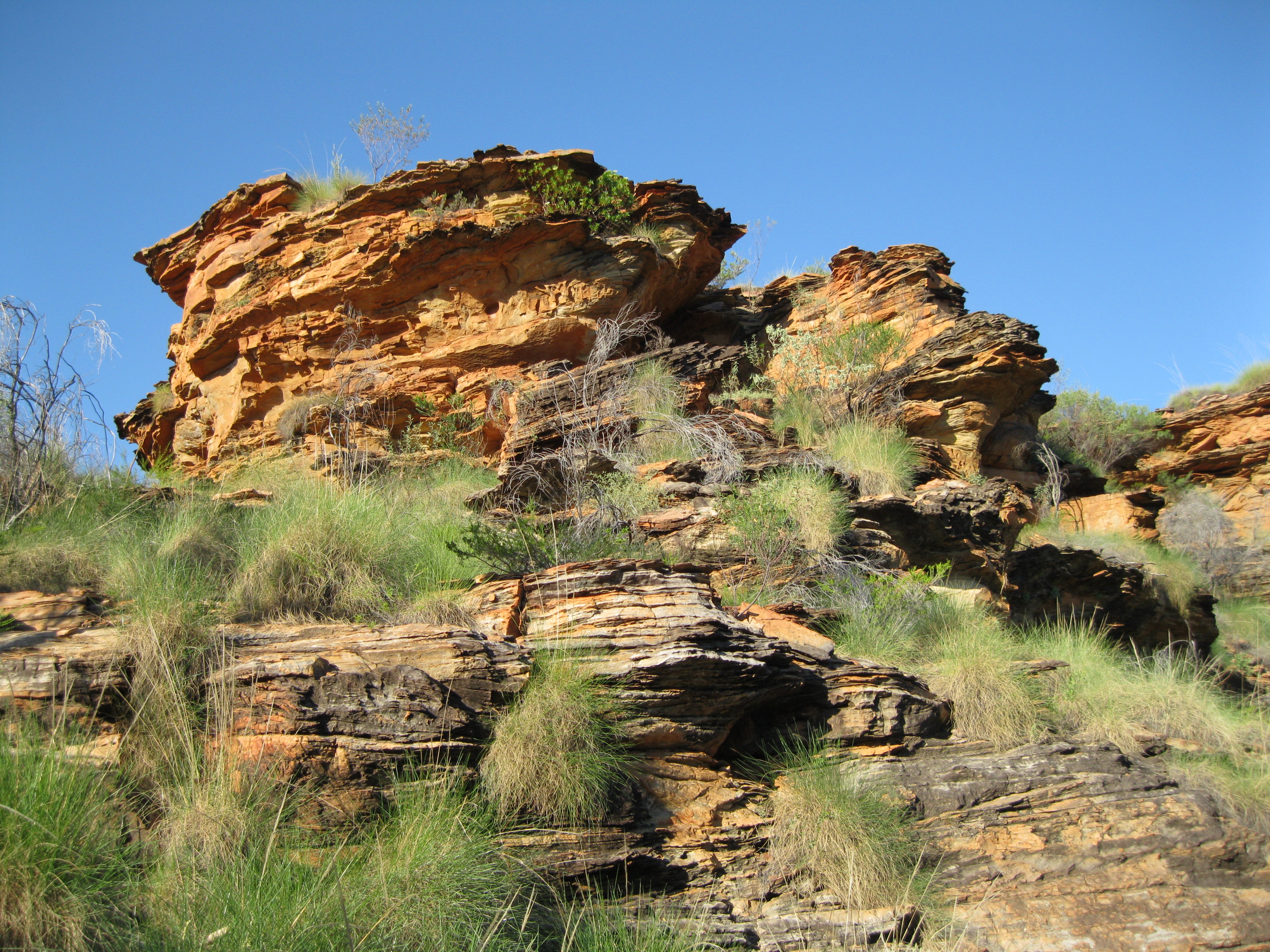
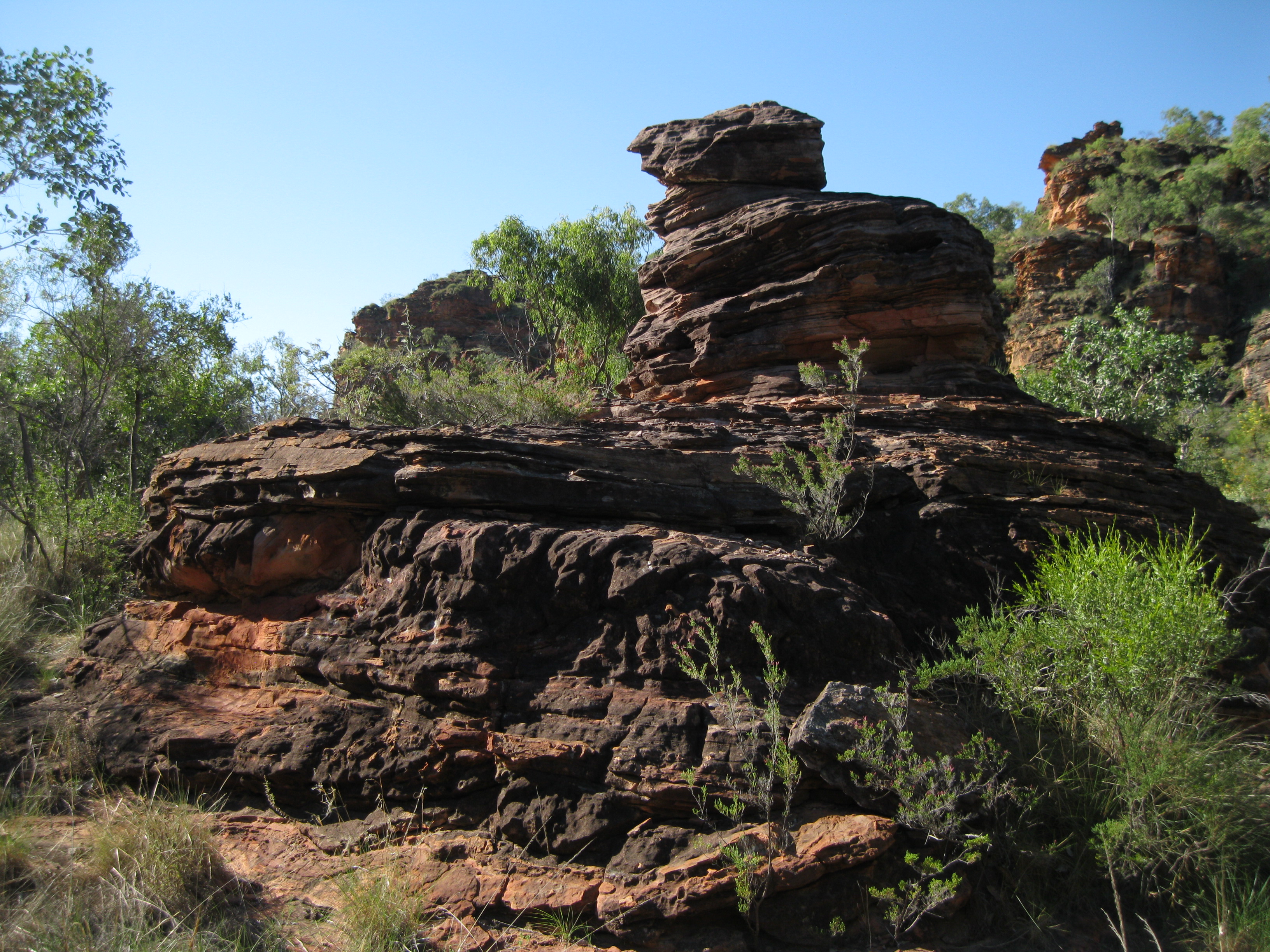
The landscape consists mainly of sandstone which was formed during the late Devonian period about 360 million years ago. More specifically the rocks are quartz sandstone and conglomerate with dolomitic sandstone, dolomite, mudstone and siltstone. During the Devonian period wind and water eroded the highlands in the proximity of present day Lake Argyle. Sand was blown towards the Hidden Valley and created dunes up to 30 metres high. Deposits accumulated to 100 metres and the today this sand is the layered sandstone you see in the park.
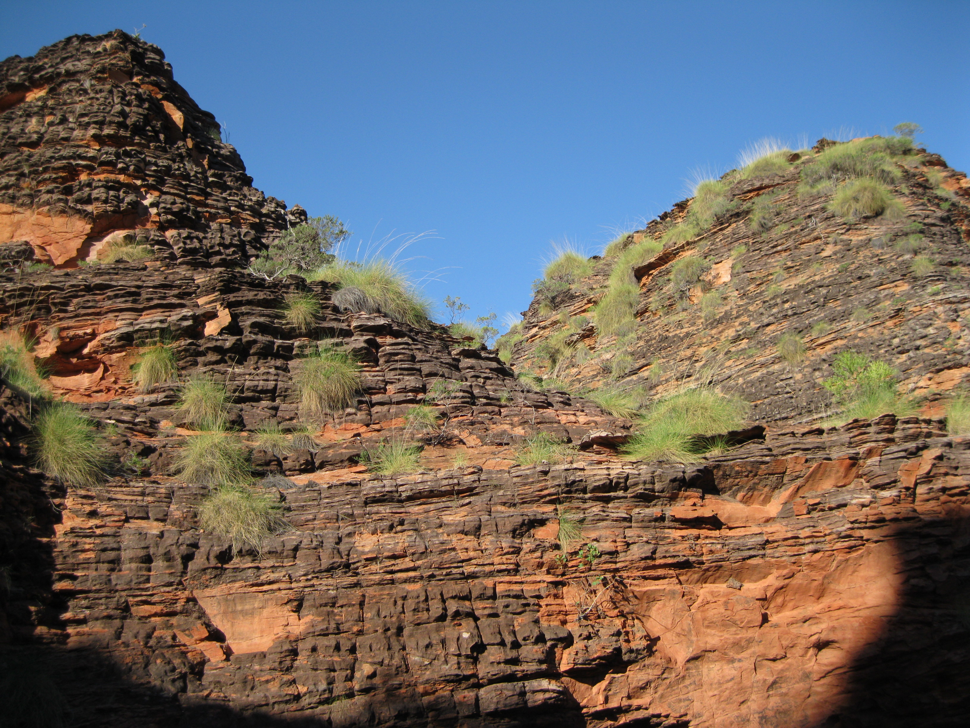
The valleys, gorges and chasms were carved out by torrential rains and during the last 250 million years erosion by wind and water has uncovered this amazing landscape. During this time Australia was subject to massive climate changes and drifted away after the break-up of the supercontinent known as Gondwana. For much of this time the continent was covered by rainforest and was ruled by dinosaurs.

As a result of deep weathering and tropical climate 50-70 million years ago, laterite formed a hard cap. This deep weathering weakened the sandstone, made it friable by dissolving the silica cement that would bind the grains together. The weight of the overlying rocks would hold the grains in place and when removed the sandstone was easily eroded and the rounded tops reflect this lack of internal strength. The water flow over the surface was concentrated by any further weakness or irregularities in the rocks, such as cracks and joints, and quickly eroded the narrow channels that separate the sandstone towers.
Cross-bedding is clearly visible in the sandstone which is evidence of the passage of dunes within the bed of the rivers. The direction of the flow of the rivers can be determined by the shape of the dunes. Cross-bedded sandstone was also formed from windblown sand dunes.
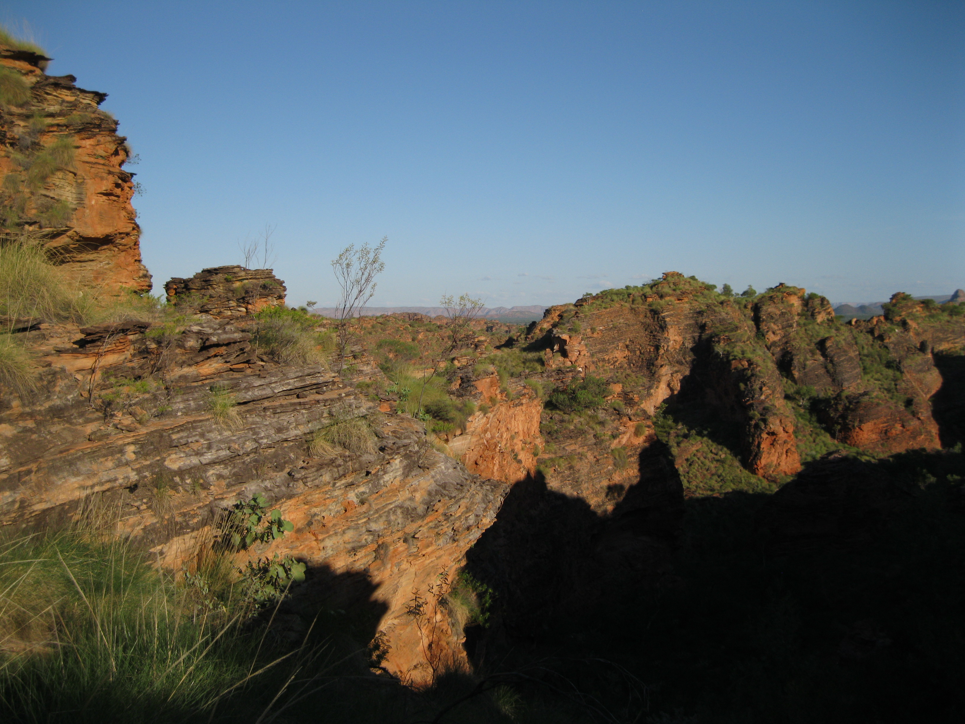
The beehived shaped landforms were created by erosion and uplift during the past 20 million years. The sandstone is fragile but is protected by a thin layer of black-grey algae and lichen.
History: Cattle Stations and the Ord River Irrigation Scheme
There is a rich history of cattle stations and pastoral leases in the area. Ivanhoe Station and Carlton Hills were both established by the brothers Patrick and Michael Durack in 1893. The following year the family sold Carlton Hill to concentrate on Ivanhoe Station. By 1895 they the Durack family constructed the homestead Argyle Downs as the centre of Durack Holdings.
During the 1950’s the Government of Western Australia requisitioned big areas of Ivanhoe Station and Carlton Hills due to the development of the Ord River Irrigation Scheme
Today both Ivanhoe Station and Carlton Hills are owned by the Consolidated Pastoral Company which owns 20 cattles stations across Australia, including a couple in Indonesia as well. The two stations are a big part of the company growing more 15,000-20,000 steers and heifers yearly.
Kununurra is a young town and was established in 1961 to service the Ord River Irrigation Scheme. This scheme was a process of several stages during the 20th century and the completion of the Ord River Dam and the creation of Lake Argyle in 1971, which is Australia’s largest artificial lake by volume, was a part of it. Establishing the dam and the lake was vital to make the agricultural industry successful in this fertile land in order to capture the rain water for the farmers. You can read more about this in our article on Lake Argyle.
The tropical agricultural crops grown in the Ord River Irrigation Area have changed over the year and tourism and mining have become more important to the local economy of the Kununurra region.
Wildlife
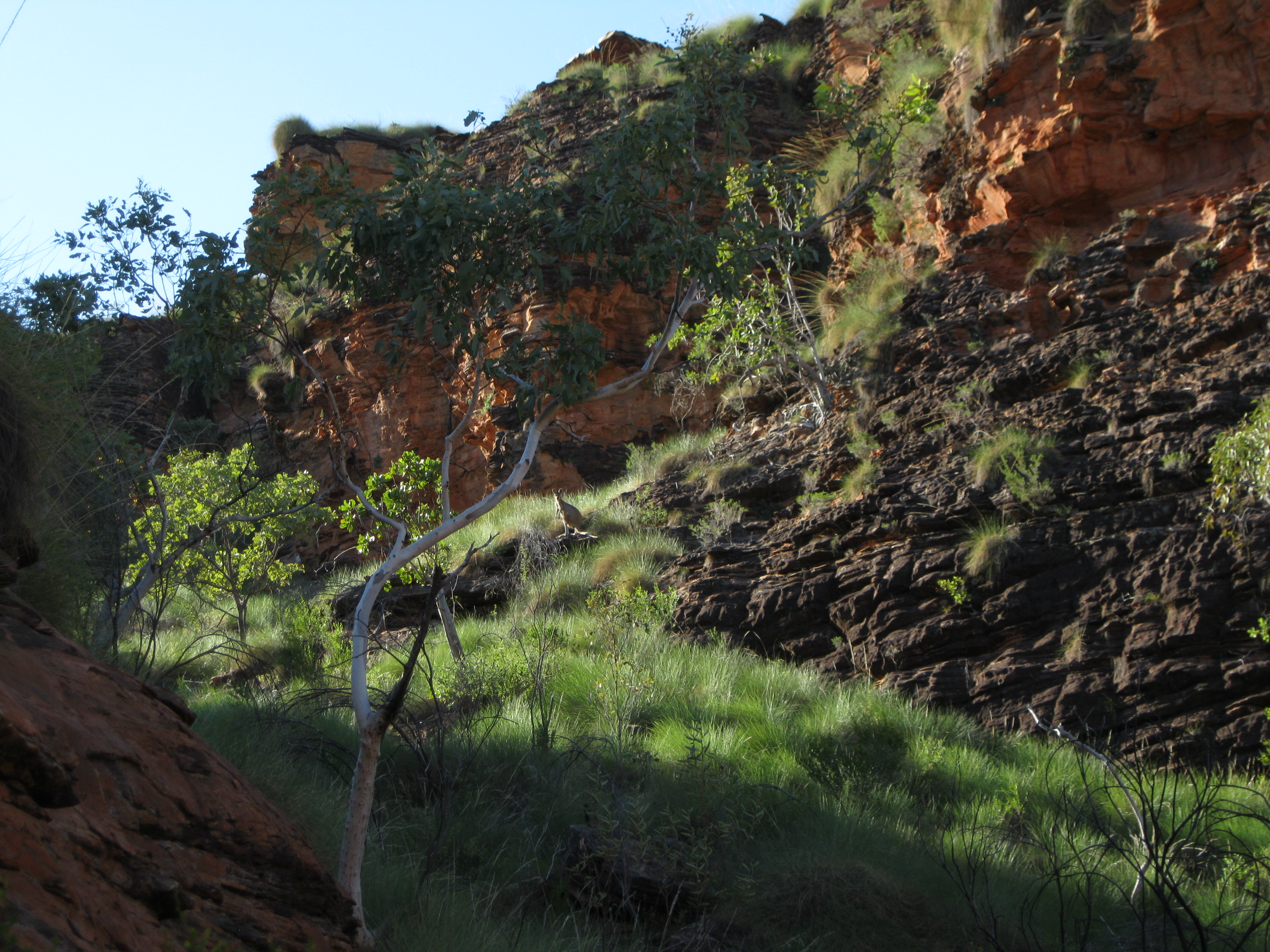
The rugged landscape has diversity of habitat which the animals have adapted to. The animals found in the park are uncommon to the surrounding plains. The short-eared rock wallaby is often seen around the steep slopes in the gorges. The hills kangaroo and the plains kangaroo are mostly inhabits the foothills and the valley floors. All these marsupials find shade from the heat during the day in overhangs.
Solar-heated reptiles such as the black-headed python, the monitors and the dragon lizards avoid the sun and come out during night or in the early hours of the morning.
The birdlife is prolific in the park. The permanent water pools provide water for the birds and other animals. The blossoms and insects on the pants such as grevilleas, acacias and eucalypts attract honeyeaters. The seeds of the grasses draw in the pigeons, doves and finches.
Vegetation
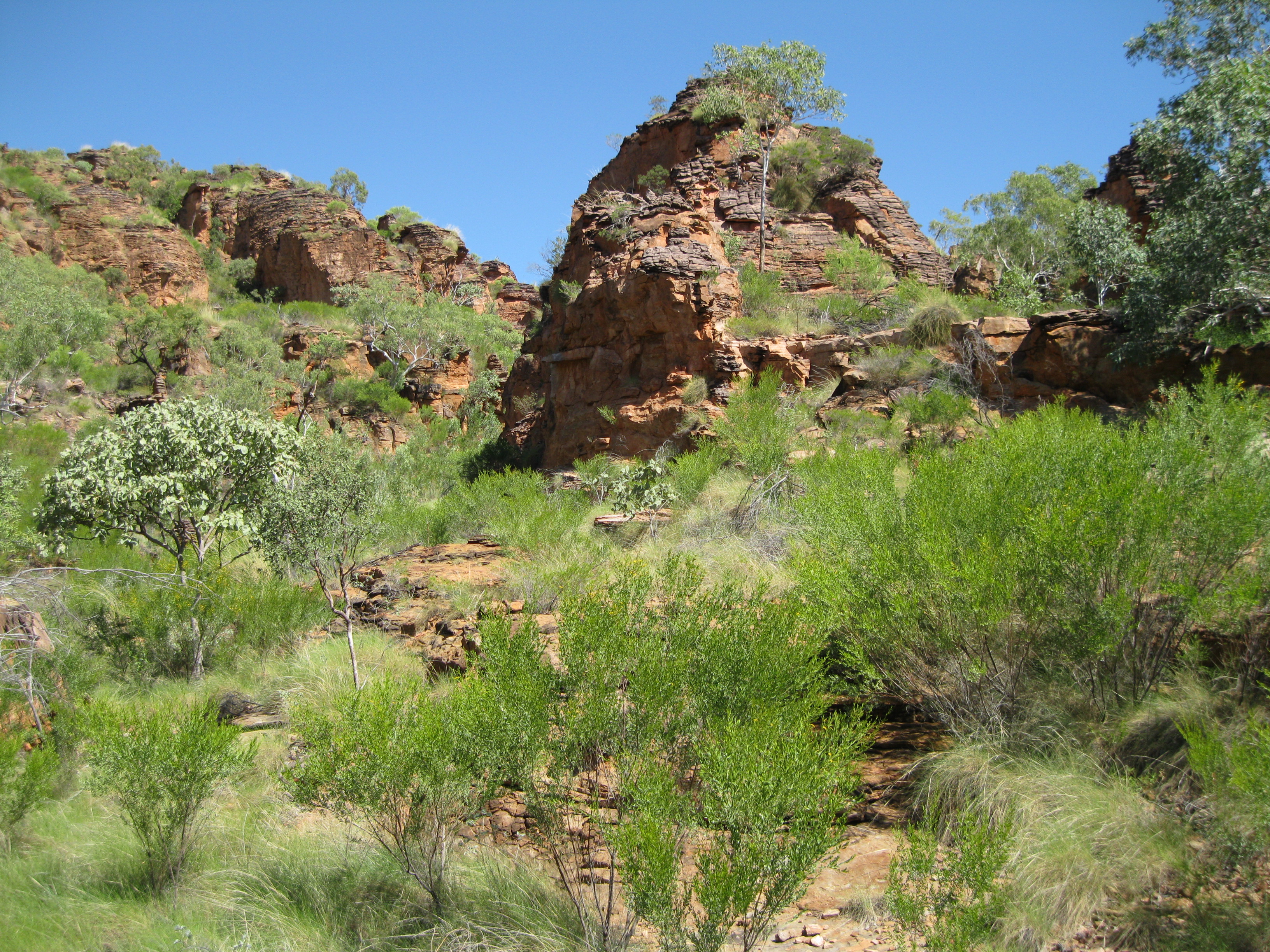
Grasses are the predominant plant in the area. Spinifex grow on the sandstone and cane grass is found in the valley floors and plains. It grows a lot during the wet season from April to December, sets seed and dies off during the dry season from May to November.
Figs and vines are found in the shelter from the sun in narrow gorges and chasms. They get moisture from the rocks. The kapok bush has adapted to the life on the rocky slopes by losing the leaves during dry season to keep moisture.
Trees like the stunted roughleaf range gum can be seen in the ranges while the much taller woolybutt is found in the valley among the cane grass.
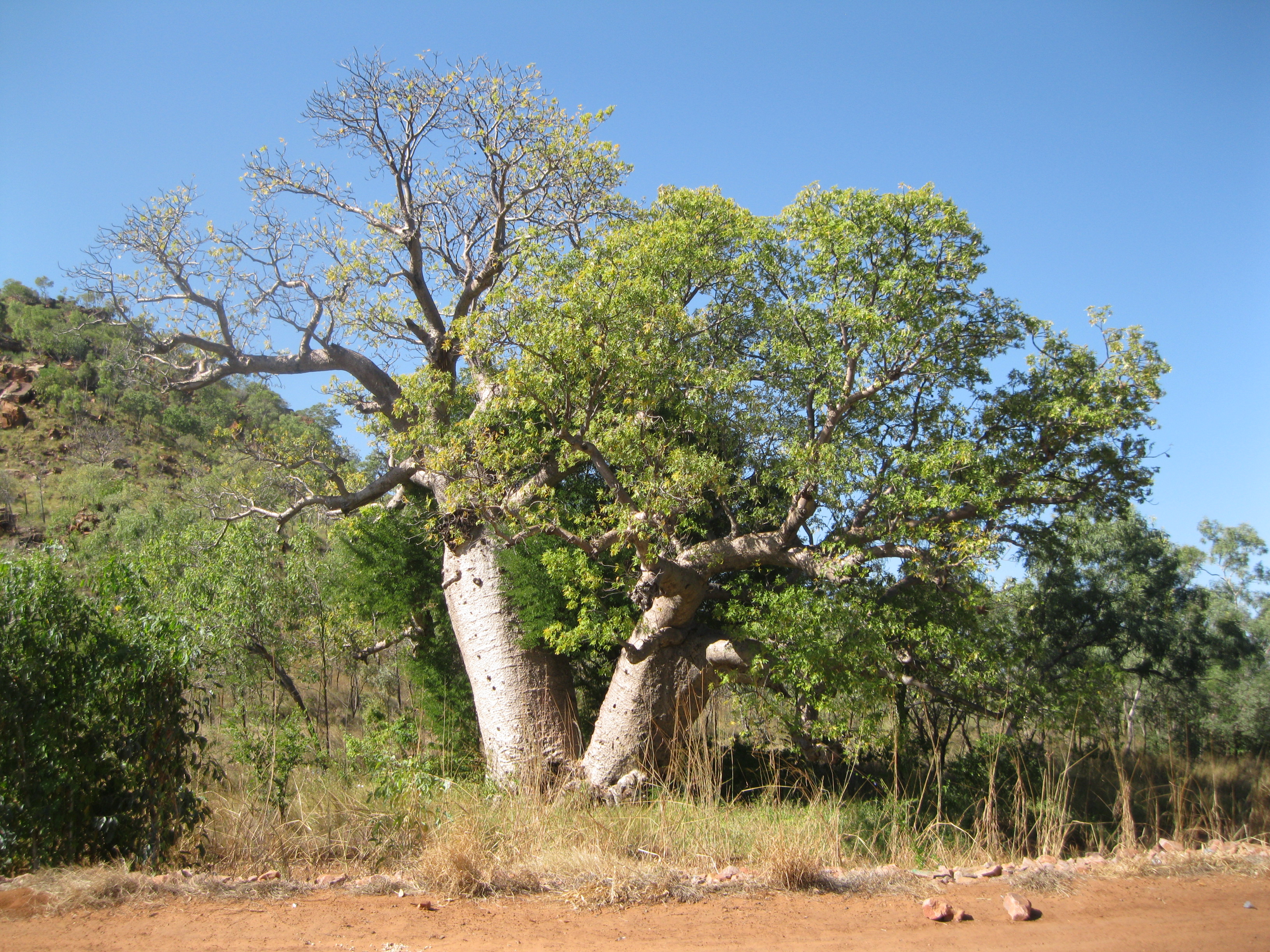
The really fascinating boab tree is also found in the park. In Australia this amazing tree is only found in the Kimberley and Northern Territory. Some of the trees are more than 1,500 making them the oldest life form in Australia.
If you do the Looking at Plants Trail you will see and learn more about the different trees of the park.
Visiting Mirima National Park
Mirima National Park is a really underrated park but it is absolutely awesome. It’s not that big and the walks available can be done in one day. If you really want to take your time to explore you can spend a couple of days as well.
The hikes are amazing as they will guide you around the scenery and close to it. They are not strenuous at all with the exception of the Lookout hike which is steep at the end but you will be walking up a flight of stairs for the most part, so it is really straight forward and easy.
Mirima National Park is not crowded at all which is so nice, so you will most likely have the whole park to yourself. At the beginning of all trails there are signs showing where in the park you are located. They also have descriptions of all the trails and how to get there. It’s all very self-explanatory and easy so you can do it by yourself.
There’s a road leading to a car park from Kununurra going up the Hidden Valley Road. Coming from the city you have to drive down Barringtonia Avenue and turn left when you get to the sign pointing to Mirima National Park which leads you to the Hidden Valley Road. If you drive to the car park you can commence hiking from here.

But the coolest option is walking to the park from the city as you will see more. It’s a short walk which will only take you about 15-20 minutes.
There are four walks you can do in Mirima National Park. If you walk from the city also head down to Barringtonia Avenue and turn left on to the Hidden Valley Road where you see the sign pointing down towards the park. On the way you will pass a little interesting colourful graveyard.
Continue on and you will encounter a trail sign and the track leading down the first trail called the Gerliwany-gerring Banan Trail. It’s a level trail all the way through on a sandy surface. After about 30-40 metres on the trail, the path split into two, but it is sign posted that the trail leads to the right which is where you should go. You can actually also turn left and do that trail too, which is unnamed and that is highly recommended as well.
The Unnamed Trail
The unnamed trail to the left is amazing as it will guide you through some spectacular landscape close to the rock walls. At one point after about 100 metres you will get to a massive a beautiful boab tree to you left. There is an opening into the bush and rock formations via a wash. There is no trail, but you can easily do some bushwhacking and take a walk in here to check it out.
This will be a tad strenuous to some as you have to negotiate through some bush, spinifex, small trees and so on, but it is highly recommended that you do so as the further you get in and up the wash, the more spectacular the views will be. Both looking up, but also back down to where you came from. Just remember to be careful about where you step and wear some sturdy hiking boots as well which will be good in this uneven terrain. The scenery here is really cool as you can clearly imagine how the water will run through this area during the wet season.
After you have finished exploring and have taken your photos of the amazing rock formations, you should continue down back to the trail again. You can walk a bit further down the trail and explore and then return to the beginning. This way you get to see the landscape from two different angles which is always good.
The Gerliwany-gerring Banan Trail
When you have returned to the beginning of the unnamed trail, you should turn right and do the hike on the Gerliwany-gerring Banan Trail. Here you will have absolutely awesome scenery to both the left and the right of massive rock walls. Also here you can go in to the bush, not on major expeditions but it will put you closer to the landscape and you will be able to take better photos. The trail is on a level surface and is not strenuous at all.
Once you get to the end of the track you will get close to the car park and the Demboong Banan Trail is just too the left. This is the coolest track in the park. Before commencing on this trail you could walk down to the car park to check out the boards which will give you some information about the park.
The Demboong Banan Trail
The Demboong Banan Trail does have some steps but it is not strenuous at all. Here you get a bit deeper into the park and you will be surrounded by stunning rock walls. When you get to about the middle of the track you can go bushwhacking a bit and see the formation a bit more up close.
Again mind your step when you do this. You may just surprise a couple of kangaroos, wallaroos or wallabies as they tend to hang out here. You will probably get a bit of shock when they suddenly jump away from the bushes when you get too close. They will just jump up the rocky slopes as they will be scared. You will see some cool insects and plants up here.

When you are finished exploring this area, return to the track and walk down to the end. Here you will see a sign saying “end of track”. Walk around here a bit and take some shots. You will also have a great view from where you can see beyond the valley.
This is a really great opportunity to do some bushwhacking. If you continue upwards to the right you will get some great views into a cool section of the park. It is recommended that you walk all the way to the top. It’s through bush so it’s very important that you wear a pair of decent hiking boots and that you mind your step. Depending on how much time you spend on taking photos and how fast you are, it will take you about 15-20 minutes to get to the top. It’s not too difficult, but you do have to negotiate through a fair bit of bush.
When you get to the top you will have an awesome view of the valley and the surrounding mountains beyond Mirima National Park. So cool. Here you will have a 360 degree view, so you will also have a great view of the park in the other direction.
Stay up here for a bit and then continue down to where you came from. Going down you get killer views yet again. Try to walk down in a slightly different direction than the one you came from and view chances. Always remember to look back once in a while to the point where you originated from and this will give you great vistas.
When you have returned to the trail, walk back to the trailhead and continue down to the car park. Again, on the way back on the same track you will get the view from a different angle which is awesome. Depending on the where the sun is located in the sky it can also make a big different to the quality of your photos. Certain angles are better than other. This also varies to which part of the day you’re hiking.
The Looking at Plants Trail
At the end of the car park the Looking at Plants Trail begins. This is a nice little loop trail taking you around in yet another area of beautiful rock scenery. Its focus is on the plant life. Selected trees of different species are fronted with signs describing the tree and its purpose. This is a great way to better understand the impressive plants life of the park. This trail has a metal grill base on which you will walk and is level all the way. Very easy to walk.
Among interesting plants are the Ironwood which is resistant to termites due to its very hard wood. The kapok tree is a good fire starter and the inner bark was used by the Aboriginal people to make string belts or baby carriage straps. The woolybutt can grow to 20 metres (65.6 ft) as an unbranched trunk and when the young stems are hollowed out by termites they make good didgeridoos. Also the Stringbark which can grow up to 18 metres (59 ft) can be used as a didgeridoo when hollowed out. Furthermore the stringy bark can be used by the Aboriginals for shelters or as canvas for painting. They also used the wood for spears, axe handles, fighting sticks and as a digging tool.
The Derbe-gerring Banan Trail
As an extension of the Looking at Plants Trail you can continue on the Derbe-gerring Banan Trail which will take you up to an awesome lookout point where you will have an amazing vista of the park. You can start on this trail when you are half way through the Looking at Plants Trail as it will extend onto the Derbe-gerring Banan Trail here. You have to return on this trail the same way as you came from so you will end back on the Looking at Plants Trail and you can complete the rest of this trail on you way back to the car park at the end.
The end of the Derbe-gerring Banan Trail is pretty steep and you will be going up a flight of stairs. It is not that strenuous though. At the top there are three different vista points, giving you stunning views. If you arrive at around sundown you will have an amazing view of the sunset as well. After sunset it will be recommended returning to down shortly thereafter as will be dark pretty fast. Unless you have a torch with you.