Beautiful Rock Formations and Prestine Gorges
Boodjamulla National Park is a fantastic nature preserve that will amaze you with it’s picturesque scenery
The park, formerly known as Lawn Hill National Park, is located in the north western part of Queensland bordering Northern Territory and just south of the Gulf of Carpentaria. It was established as a national park in 1985.
It is a really amazing national park with beautiful gorges and towering red rocks. You can easily spend 2-3 days here as there is a lot to see and do.
There are three campsites in the area, one at the park itself and one at Adel’s Grove which is 11 km (6.9 miles) up the road from the park. The latter is a great spot. The facilities are good and they have a nice reception and bar/restaurant area as well. The reception and restaurant the only place where you will have mobile and internet service. The third site is 3.5 km south of the Riversleigh Fossil Site and is called the Miyumba Camping Area.
Geology: Formation of the Gorges
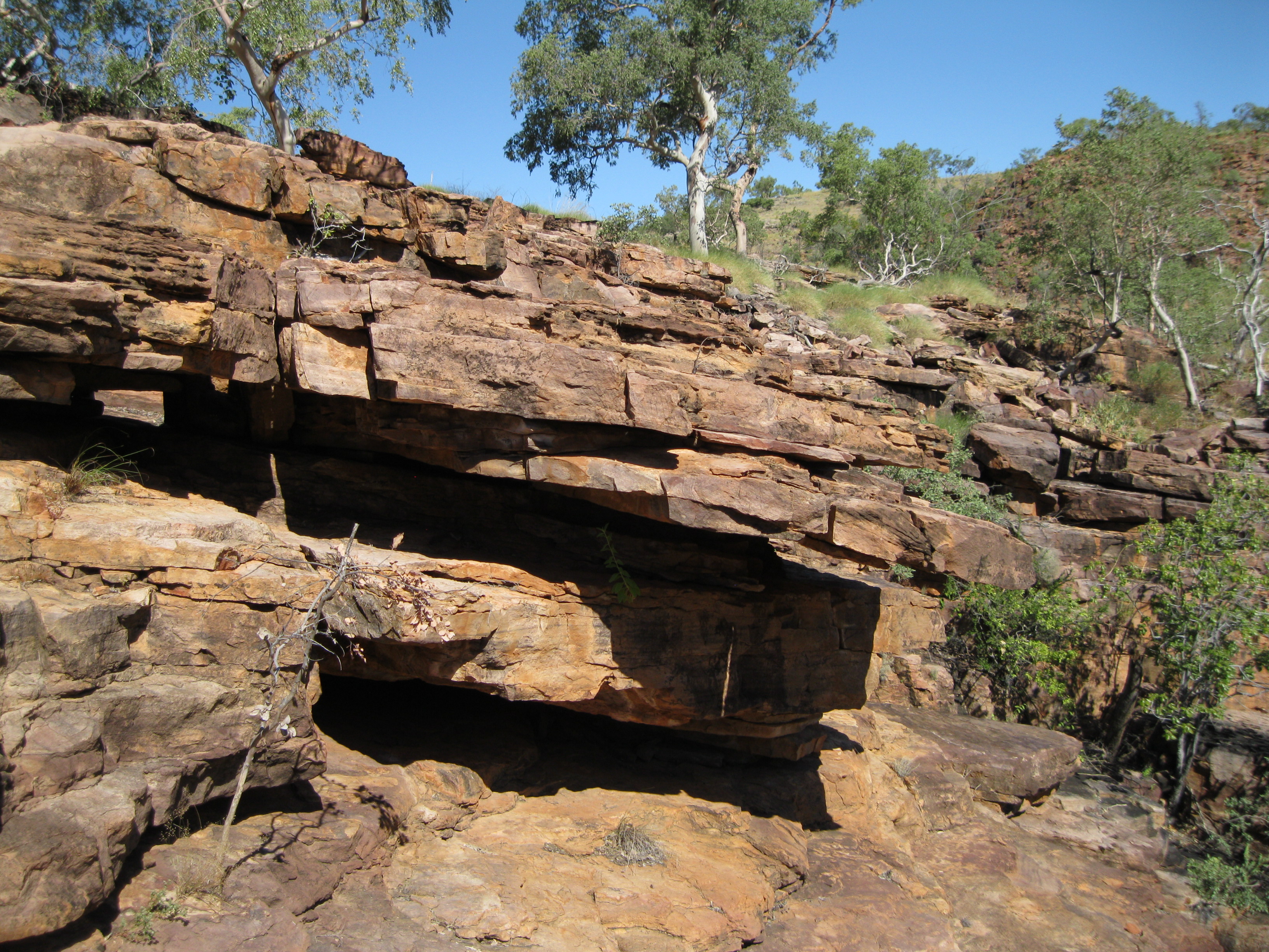
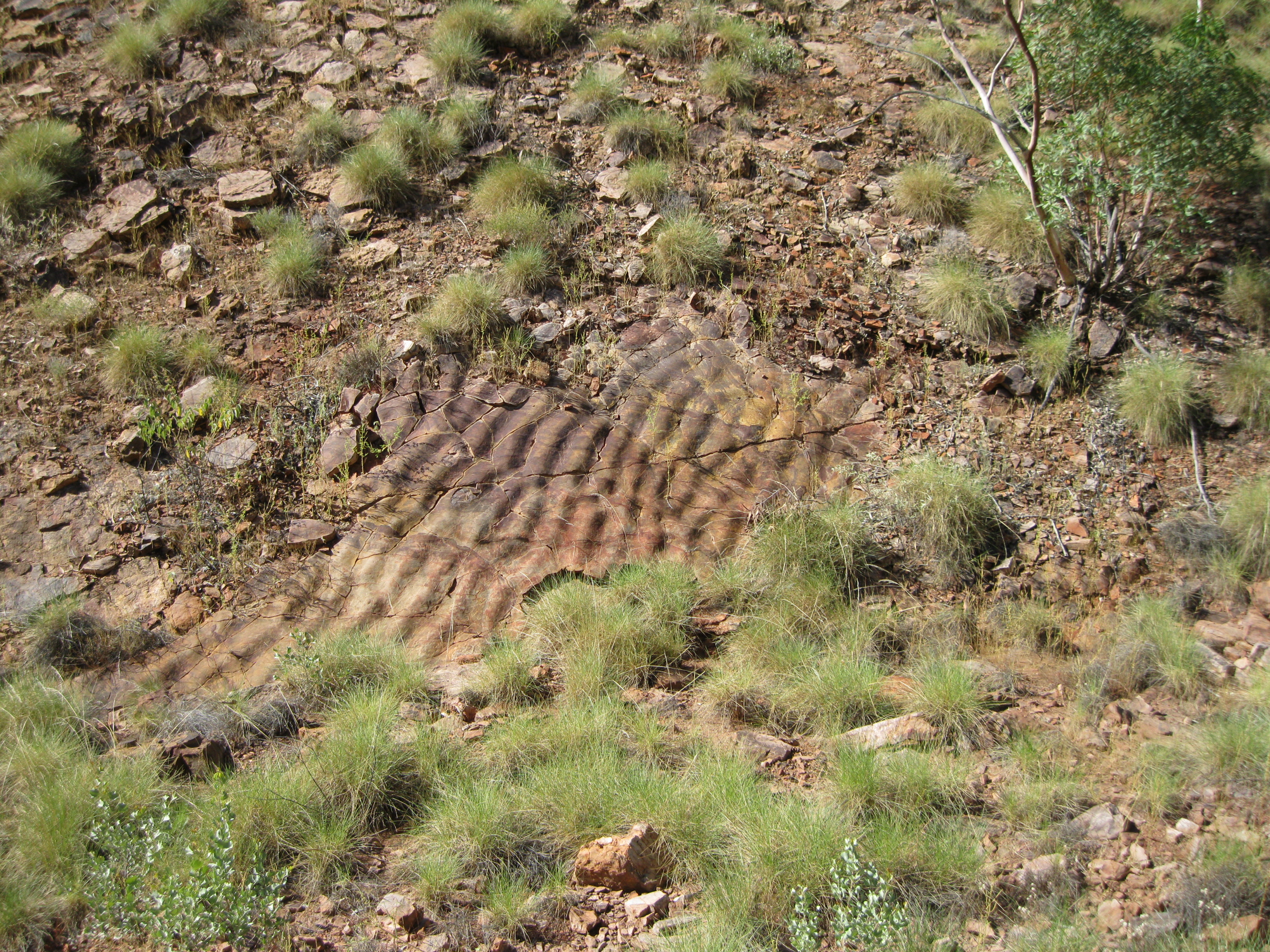
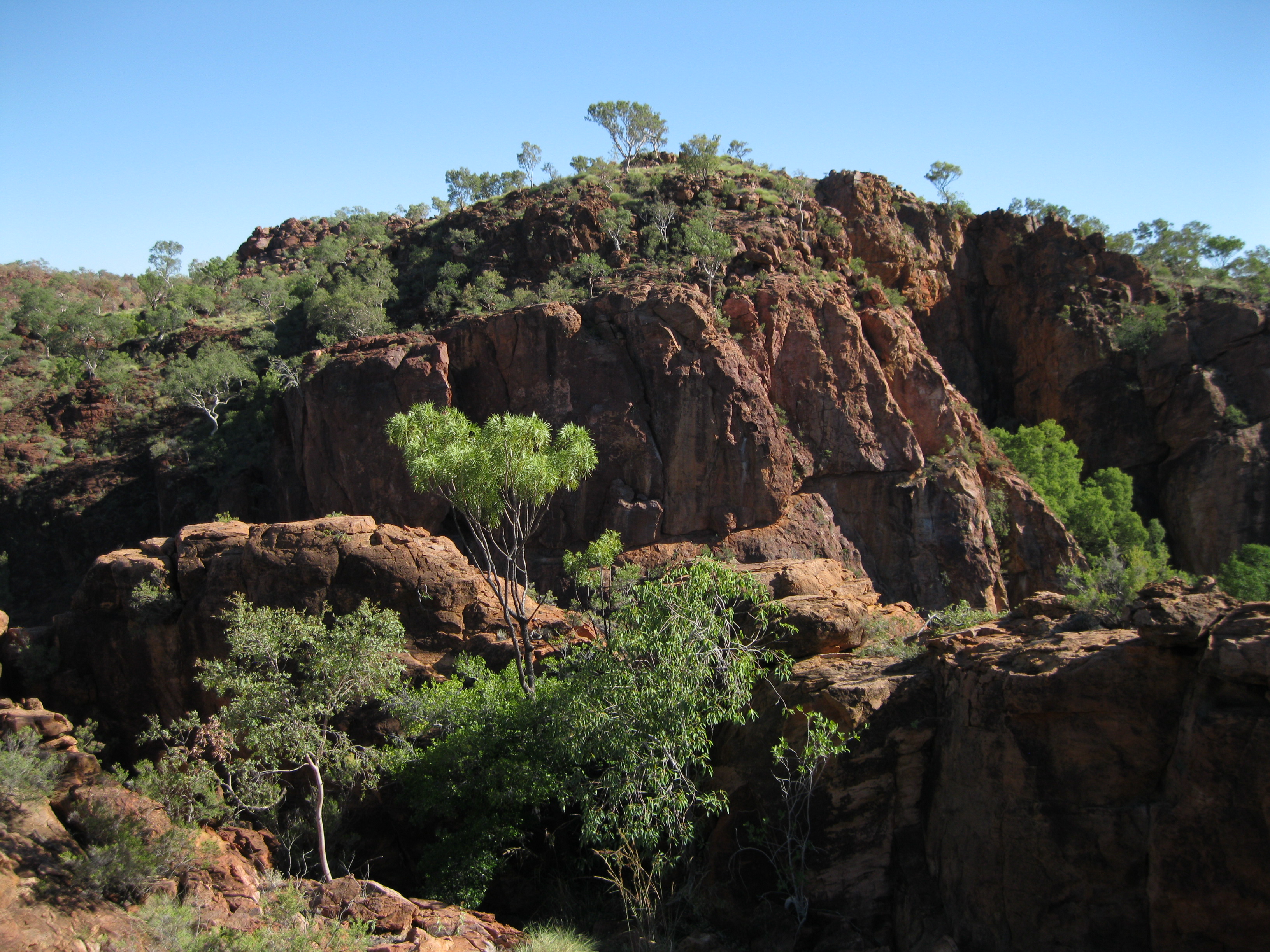
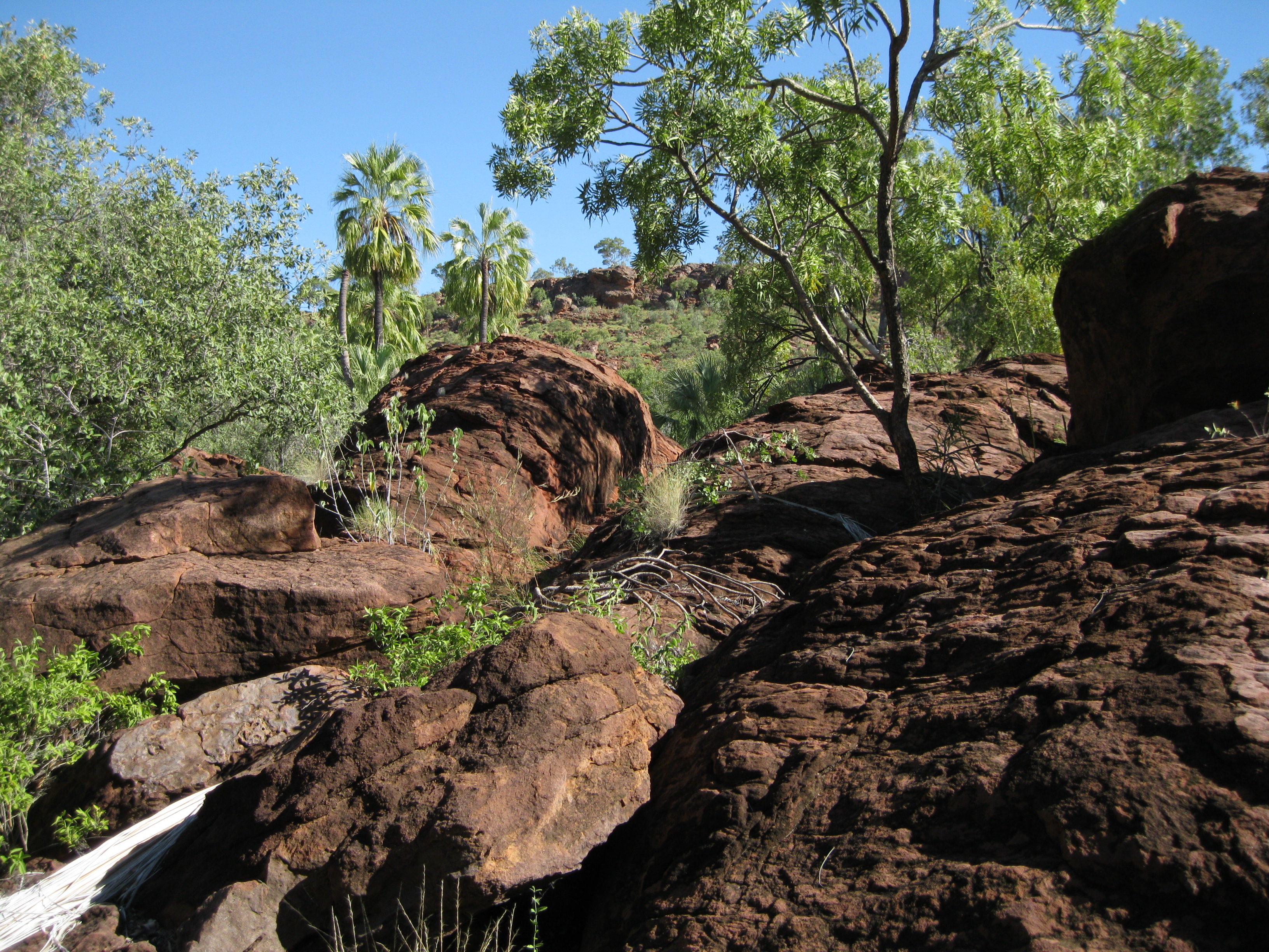
The landscape was shaped by rain and spring-fed creek waters. About 1,560 million year ago the red sandstone known as Constance Sandstone, seen in the eastern part of main Lawn Hill Gorge along the Constance Range, was sandstone deposits in a shallow sea. Ripples are still found today on rocks as evidence of these bygone Proterozoic times. The lifeforms were bacteria and algal-like organisms known as stromatolites.
Around 600-1,400 million years ago the seabed was uplifted which lead to a retreating sea. Resistant rocks such as the Constance Sandstone were warped upwards. For millions of years the less resistant rocks were eroded away by wind and water leaving the hard sandstone seen today in the Constance Range.
In Cambrian times, about 530-600 million years ago, another shallow sea appeared up against the old sandstone hills from the south and west. Sediments rich on lime and silica, and remains of sponges of trilobites had accumulated from layers of sandstone. Trilobites were primitive marine animals with hard shells which are extinct today. At the time fish had not yet evolved. Furthermore grey limestones containing silica occurred in upper parts of the Lawn Hill Gorge.
About 470 million years ago the seabed was again uplifted and the sea retreated once more. This exposed layers of limestone, sandstone and dolomite as new ranges which have eroded away over time. Over millions of years the sandstone and limestone had gradually been eroded away. The Constance Range was eroded towards the west by the headwaters of Gulf streams. Lawn Hill Creek and other stream were at a higher level and carved through the sandstone and limestone to form the gorges.
In the Riverleigh area pale grey limestones were deposited about 15-25 million years ago during the Tertiary era on top of older Cambrian limestones. The younger limestone was deposited in small rainforest lakes and flourished in the climate. This area has become renowned for the many fossils of vertebrate animals.
Geology: The Tufa Rock Formations
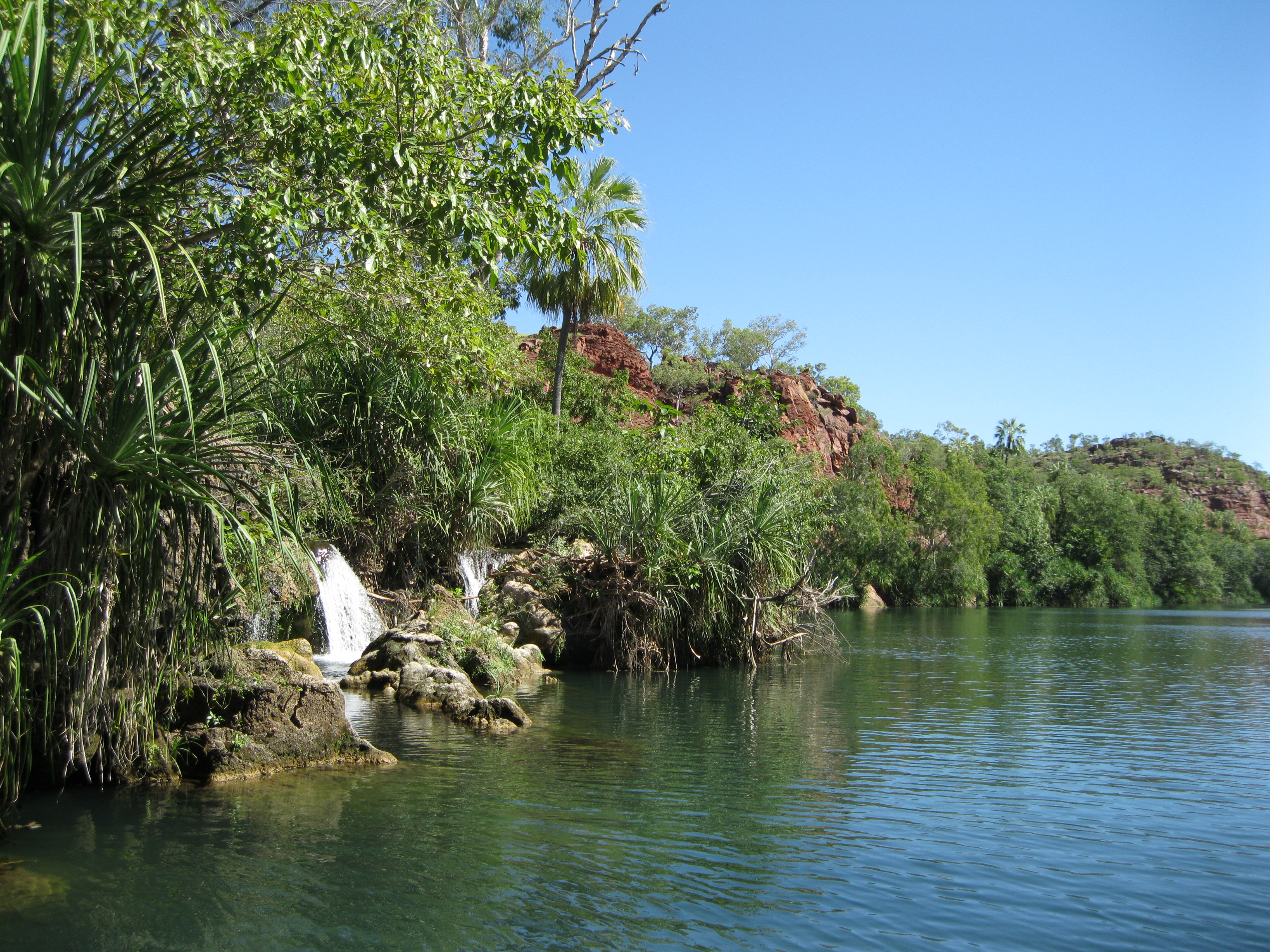
One of the most impressive deposits of tufa rock in Australia is found in the park. Indarri Falls between the Middle Gorge and the Lower Gorge and the Cascades are two of the main features. Tufa rock is a porous, spongy rock of calcium carbonate. A thick crust of tufa is also preserved along the walls of the Middle Gorge just above water level. It represents a period when the water level in the Middle Gorge was higher.
In the creek, as water flows over obstructions such as rocks debris, gas is given off and a skin of solid calcite is deposited on the obstruction surface. The calcite forms a porous brittle rock which is tufa. It accumulates over time and form fragile deposits. Exposed tufa remains dormant until they are covered by water and the process starts over again.
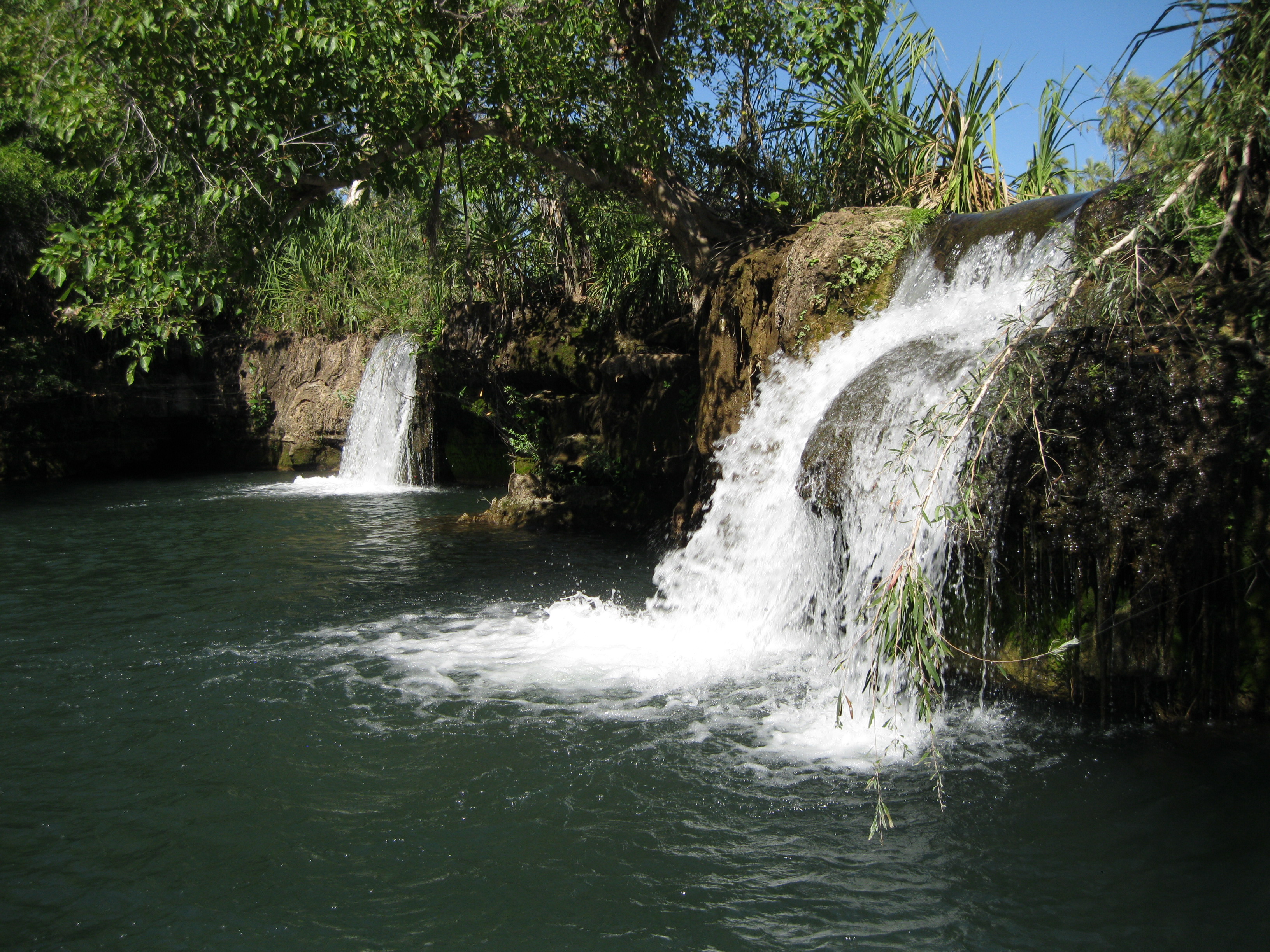
Indarri Falls is a natural tufa barrier. It was built up over many thousands of years from the bedrock floor. The falls have a height of 1.5 metres but during flooding, the increased river reduces the height. The wall extends for a least 11 metres below the surface on the downstream side. Large submerged tufa blocks are found below the surface which probably are pieces of the dam walls which have broken off during flooding. The blocks have been cemented in place. Spillways from the dam contain a range of tiny lifeforms such as algae, mosses and aquatic insect larvae.
The Water of Lawn Hill Creek
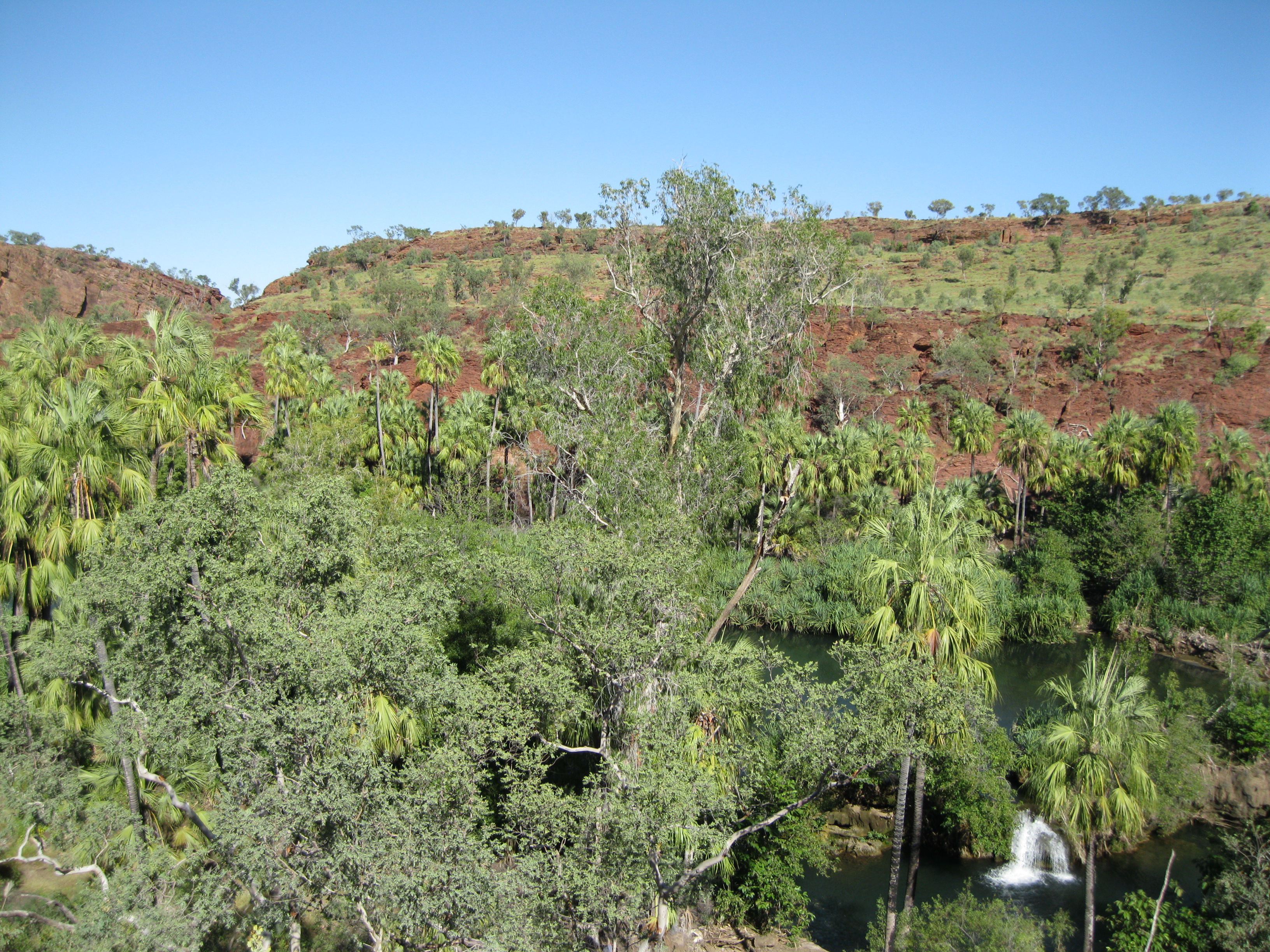
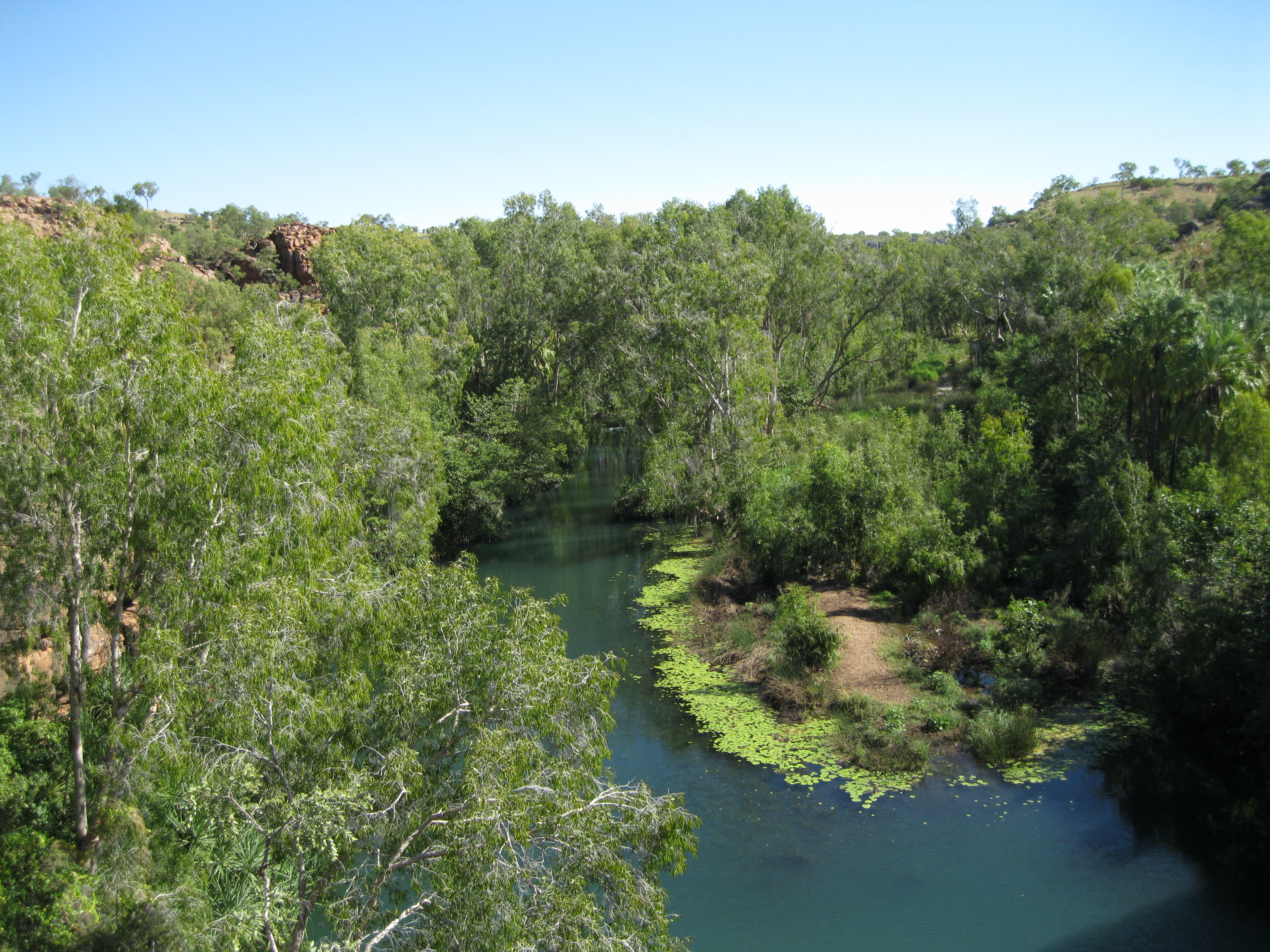
The water not only comes from rain but also from underground springs in the limestone of the Upper Gorge. The springs arise from underground water in the Georgina Basin to the south west. Therefore even with the long dry season the creek flows all year round.
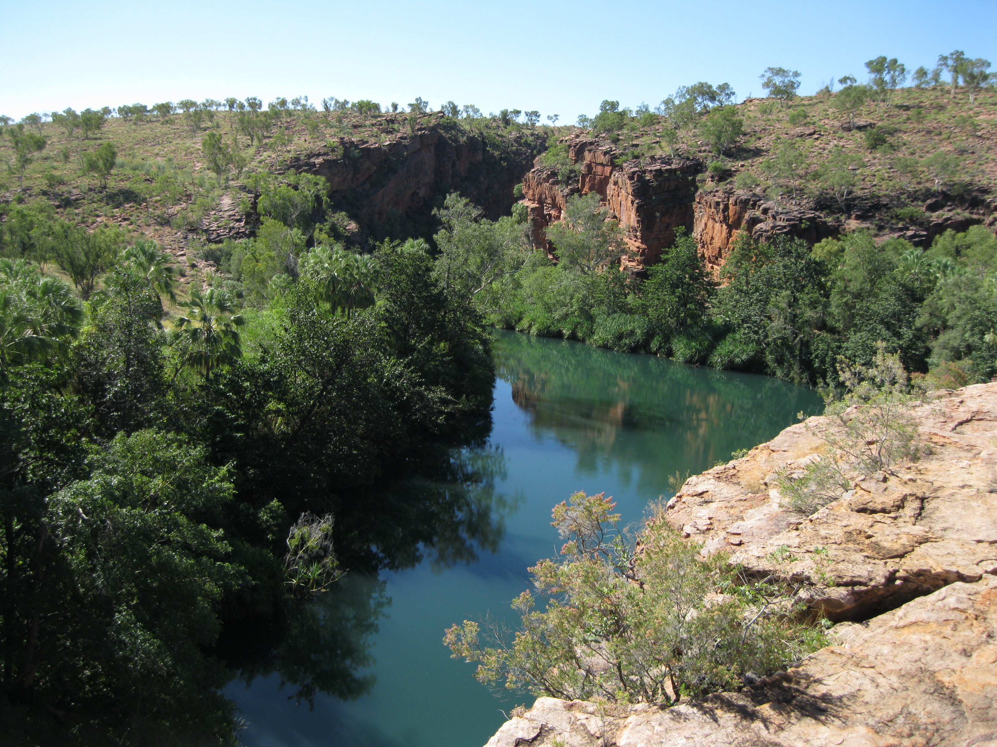
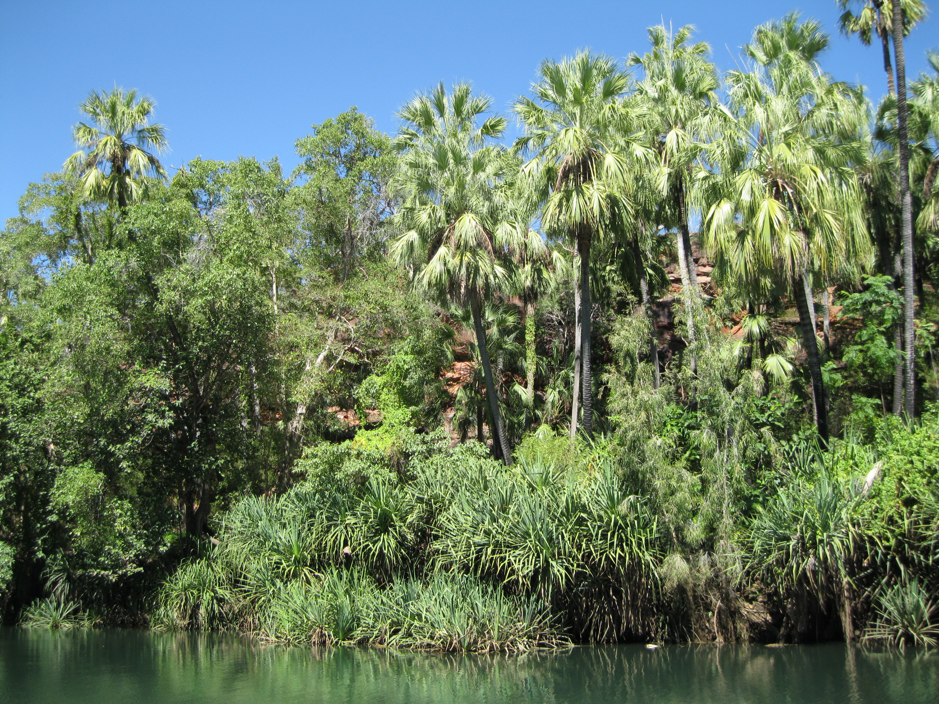
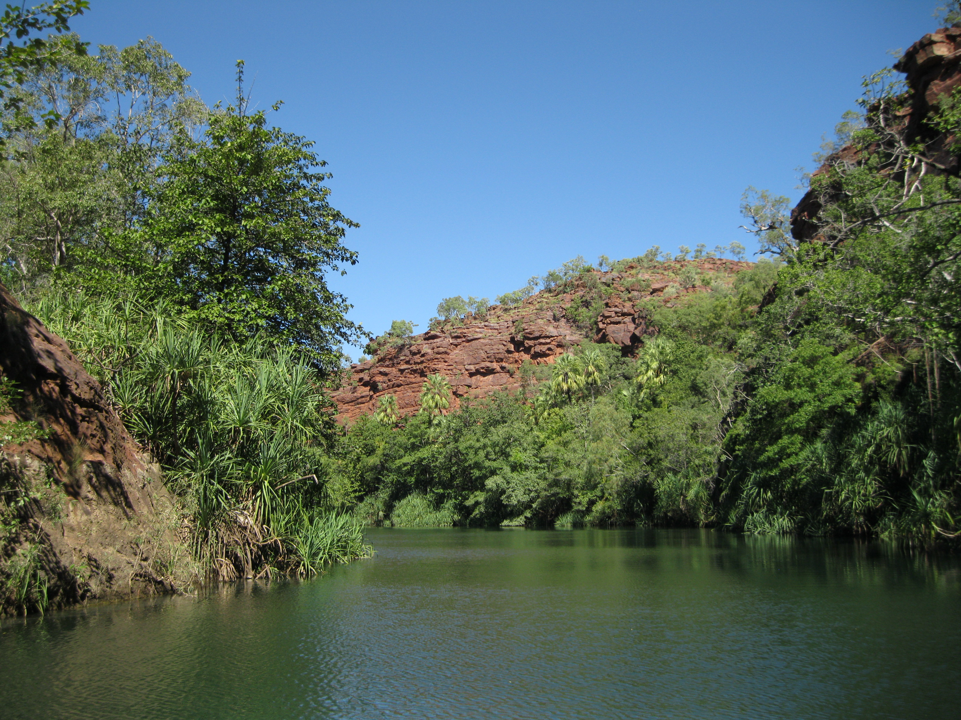
Wet riverine forest are present on the edges of the creek. Here you will see a lot of livstona palm trees, also known as cabbage palms. Furthermore also paperbarks, pandanus palms, Leichhardt trees and cluster figs are located in this area.
Water lilies give shelter to more than 20 species of freshwater fish. Turtles and file snakes are found among the ferns, sedges and bulrushes along the edges of the creek. Freshwater crocodiles are also a part of the habitat in the creek.
History: The Cattle Men
In the 1860’s the pastoral pioneers such as Page, Mytton and Cooper brought their first cattle to the Lawn Creek Area. Many grazers left the area shortly after due to an outbreak of Gulf fever which was a type of typhoid. In the 1870’s Frank Hann acquired numerous leases which would be the beginning of South Esk Holdings that later became Lawn Hill Riversleigh Pastoral Holding Company. In total Hann accumulated 9,000 square km (3,475 square miles) of land.
Frank Hann and his brother William were born in Wiltshire, England. The Hann family immigrated to the Western Port area in Victoria in 1851 and in 1862 Frank Hann and his family moved to the Burdekin River district in northern Queensland. The Hann Family and Richard Daintree took up several holdings along the Clarke River which is a tributary of the Burdekin River. The Hann brothers grew up handling cattle and when their father passed away in 1864, they took over the family’s share of their properties. By 1875 they had done well enough to stock the Lawn Hill Station with wild cattle and for the following 20 years they would supply goldfields in Queensland and Northern Territory with cattle.
In 1881 Frank Hann was a guide on a survey for a proposed transcontinental railway in northern Queensland which goes to show that he was an important and well respected businessman in the area. Furthermore he also found deposits of silver and lead in the Lawn Hill area but this was not put into commercial operation until 100 years later.
Due to a financial downturn in 1895, Frank Hann decided to leave Lawn Hill Station and continue his operations in the northern part of Western Australia.
Until 1984 Lawn Hill Station was one of Queensland’s largest cattle properties. Sebastião Ferreira Maia acquired the station in 1976. He had arrived in Sydney the year before from Brazil and was known as the cattle king. In 1984 he donated 122 square km to the state under the condition that it was used for the public’s benefit. In 1992 another 1,350 square km was given to the state to extend the park. That same year, the Riversleigh and Musselbrook sections were amalgamated into the park.
Riversleigh Fossil Site
At Riversleigh in the southern part of the park, the Australian Fossil Mammal Sites are located. This is a 100 square km (38.6 square miles) area of fossils of mammals, birds and reptiles of the Oligocene ages, 23 million to 33.9 million years ago, and Miocene age, 5.3 million to 23 million years ago.
The amazing thing about the fossils at Riversleigh is, that they have been found in freshwater limestone, have not been compressed and therefore have kept their their dimensional structure. The fossils weren’t discovered before 1901 and the first exploration survey wasn’t conducted until 1963.
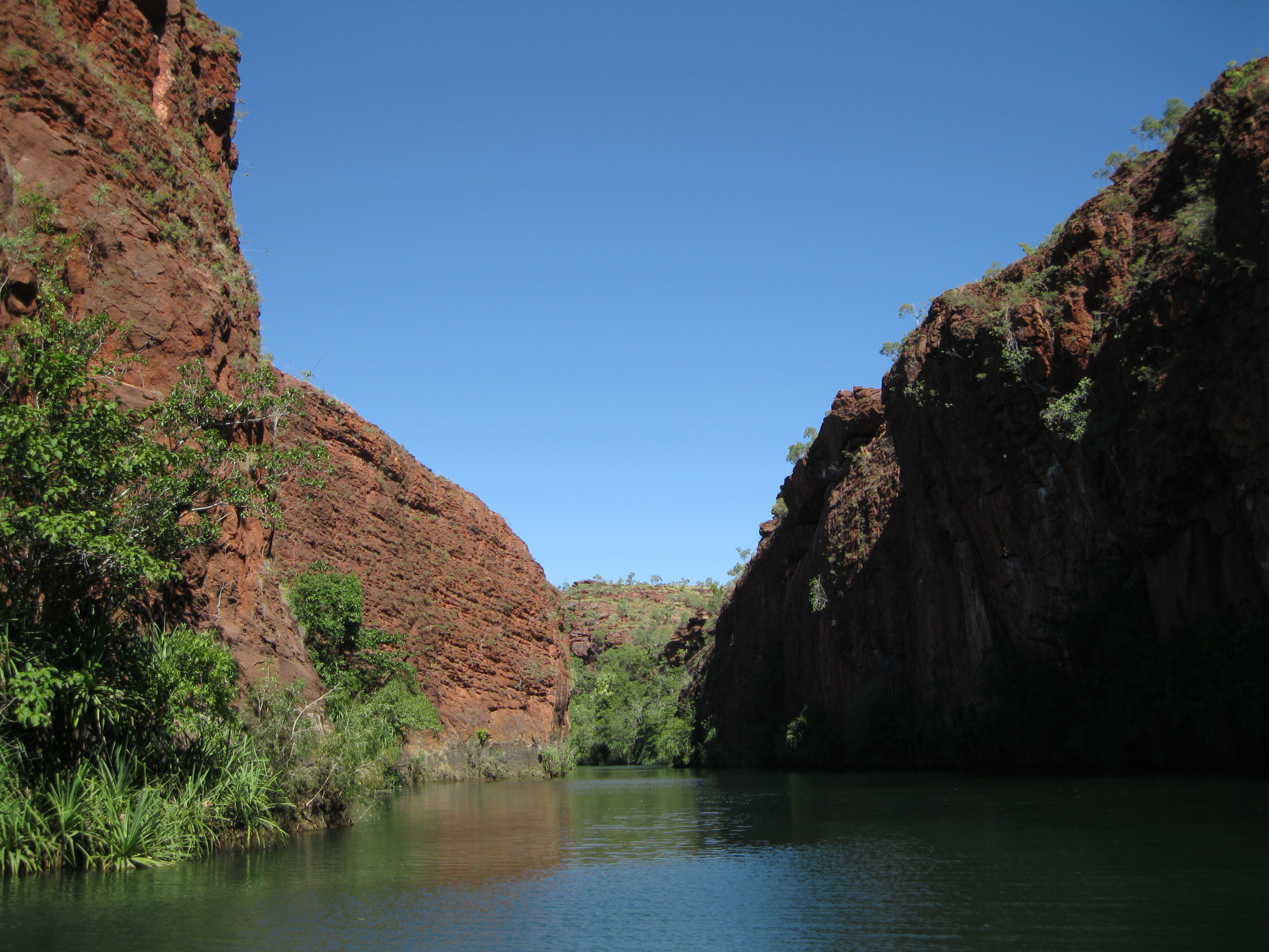
Cruise Through the Lower Gorge
There are several cool things you can do in the park. A great option is going on the Lawn Hill Gorge cruise. It has a duration of one hour and with commentary through the Lower Gorge of Lawn Hill. You will learn about the geology and history of the park on the tour while you will have amazing views of the gorge and the surrounding rock walls. You may also be able to spot some archer fish and cat fish in the gorge as well.
Take it all in. The scenery will slowly change as you get further into the gorge. Initially the gorge opening is a bit up stream. As soon as you get inside the gorge you will have amazing views of the towering red sandstone walls surrounding.
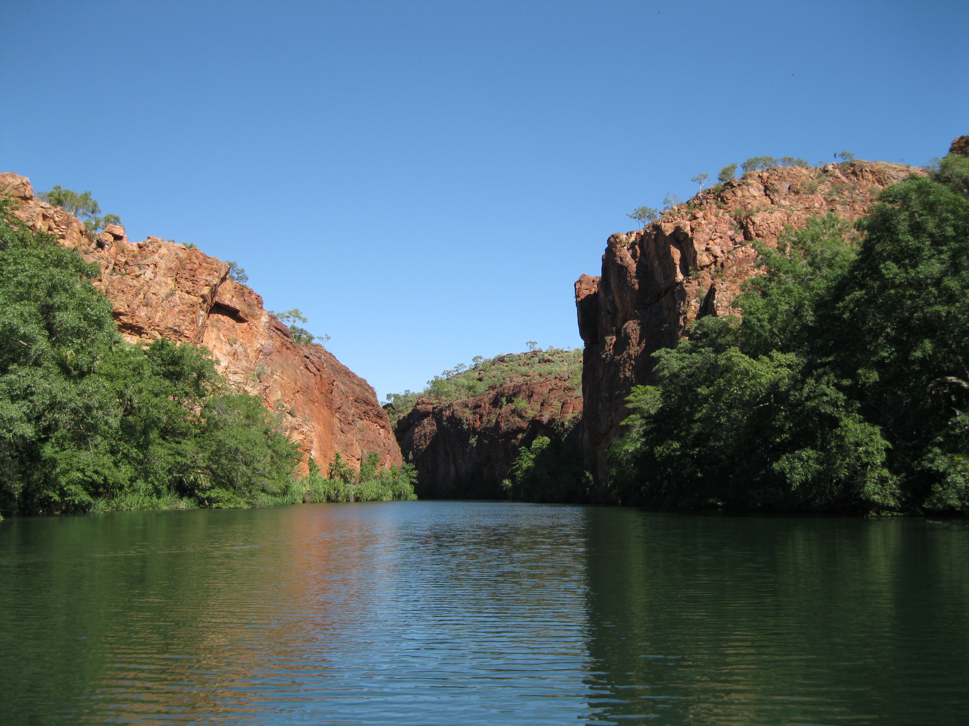
At the end of the Lower Gorge you will get to Indarri Falls which is small but a series of cascades that are quite beautiful. You will get plenty of opportunities to take some great shots here. The further you get towards Indarri Falls, the more Livistona Palm trees will appear which fits in awesomely with the red rocks and the falls. At the falls you will see the tufa rock formations which really stand out in comparison to the red sandstone.
It’s a slow cruise on a small boat that takes nine passengers, so you have the opportunity to sit back and chill, take photos of the amazing scenery and ask the skipper all sorts of questions on the way. The gorge is not too crowded either. This is the only cruise boat so the only other things you’ll see besides wildlife would be people in canoes. So there are plenty of opportunities to take photos without any obstructions.

When you get to Indarri Falls you will sail around the area for a bit and return down the same route on the Lower Gorge as you came from. You will not access the Middle Gorge on this cruise.
Canoeing Through the Lower Gorge and the Middle Gorge
Exploring the Lower Gorge and the Middle Gorge by canoe is an option as well. As you won’t access the Middle Gorge on the cruise it could be cool to check it out by canoe. The creek is 6 metres deep on average but deepest point goes all the way down to 27 metres. The red sandstone towers up to 70 metres above creek level. The canoe hire is located at the end of the Rainbow Serpent track.
A return trip from canoe hire area up to Indarri Falls is 3 km. At the falls you can either have a swim and return or walk 60 metres along the track to the Middle Gorge and continue further upstream towards the Upper Gorge which is about 1.3 km away. You just have to be two people as you have to carry the canoe from the Lower Gorge to the Middle Gorge. You cannot paddle much further than the Upper Gorge lookout as the creek dwindles into a series of channels and rapids with pandanus palms. After you have explored this area you should return the way you came from.
Hiking Through the Beautiful Scenery
There are several really great hikes you can do around Boodjamulla National Park. The park management has split them into different categories which are easy, moderate and difficult. This certainly depends on your level of fitness because the walks that are rate difficult are not really that strenuous if you are in good shape. These trails are elevated and steep at times but not particularly difficult. Bear in mind that especially around mid-day it can get really hot so remember to bring a lot of water, snacks such as granola bars, sun screen and a hat.
The hikes are split into two different geographical areas. The eastern walks and the western walks. All eastern walks start near the canoe hiring area at the end of the Rainbow Serpent track. There are four different walks in this area.
The Island Stack trail is a 4 km (2.5 miles) walk through creek vegetation leading to a steep climb at the stack. This continues with a 1.7 km (1 mile) walk along the table top. The Cascades walk follows the Island Stack track and leads to the Cascades where you will find amazing tufa rocks. This is a 2 km (1.25 miles) hike.
The Wild Dog Dreaming track is a 4.5 km (2.8 miles) hike through a partial shaded area leading to a place of Aboriginal rock art of the Waanyi people. The last walk is the Constance Range track. Here you will be going 4 km up to get to the hilltop of the Constance Range. If you are going during the afternoon, remember your torch as it will get dark early.
The western walks start from the track along the Lawn Hill Creek. There three hikes which are the Duwadarri Lookout, Indarri Falls and the Upper Gorge trails.
Exploring the Lower Gorge: Duwadarri Lookout and Indarri Falls
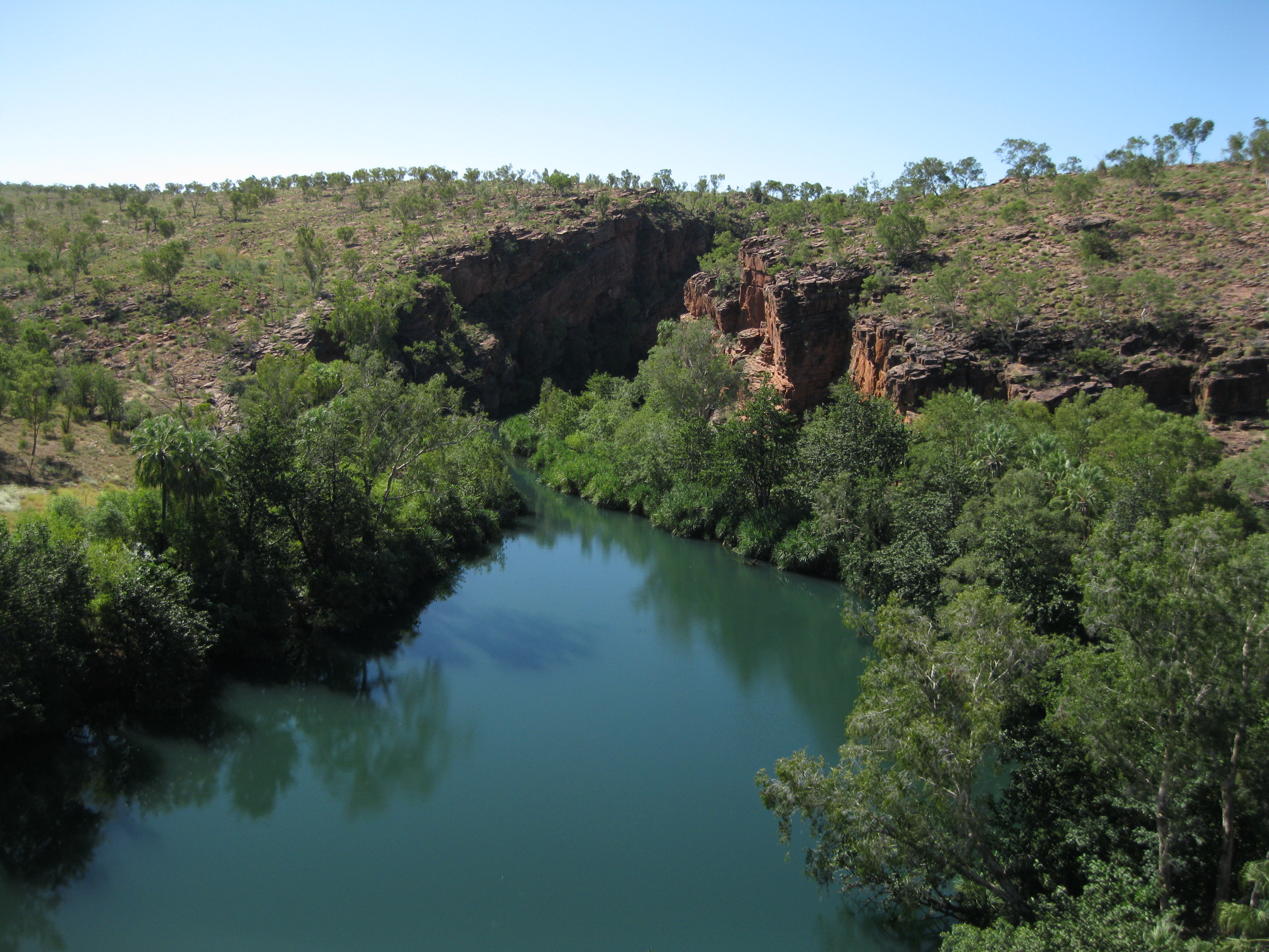
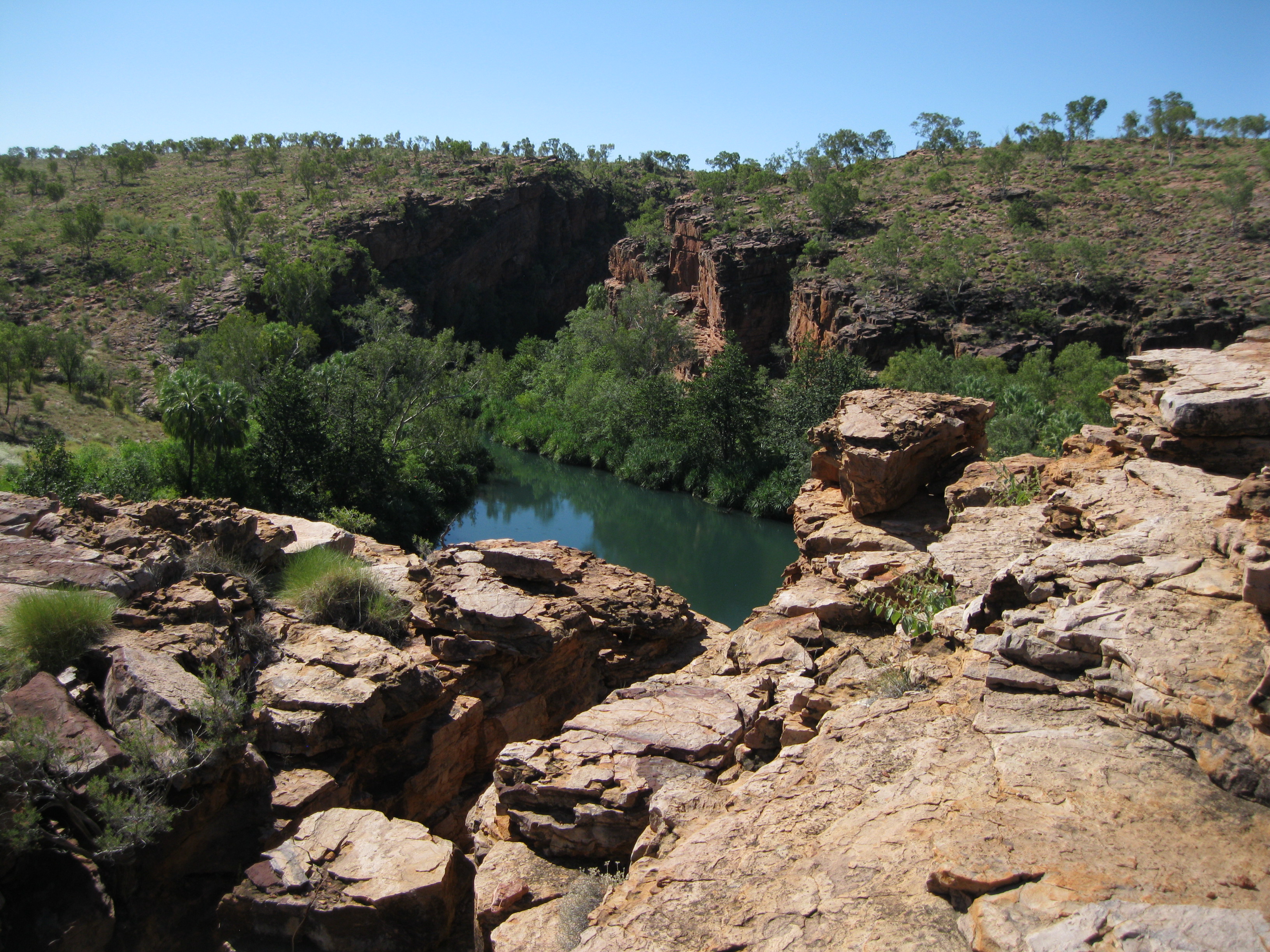
A really great walk is going down the trail towards Duwadarri Lookout which is a short 600 m (0.4 miles) trail. Going up to the lookout is on a pretty steep trail. It’s not too long and not that difficult. It’s definitely well worth it because when you get to the top you will have an awesome view of the Lower Gorge, the massive rocks walls just opposite and the surrounding area.
There are different vantage points from up there. If you go a bit further down closer to the edge you will get a different view to the one you a have at the very top. Going down is a tad harder than going up due to the steepness of the trail. It’s not for too far and not too difficult though. Just mind your step.
You can continue down to Indarri Falls from there. There are two trails. You can continue from the top of Duwadarri Lookout which is a loop of 3.8 km (2.4 miles) or you can walk down the ridge of the lookout and continue along the escarpment to the falls. The latter is on a pretty level trail with a tad elevation. On the way you will see some great bush and rock formations such as a pretty neat escarpment.
When you get down to the falls you will have a view of it from a different angle than you get on the cruise. You will be standing directly opposite the falls and you can take some great photos. You can do a bit of bushwhacking to the left and get some alternate views and shots of the gorge and the beautiful rock walls as the backdrop. Spend a bit of time here and take it all in as it’s a fantastic view. Note the tufa formations on the falls which are very different to the surrounding red sandstone rocks of the gorge. Cool stuff.
The Upper Gorge Trail: The Amazing Middle Gorge and Upper Gorge
A really cool hike you could do as well is the Upper Gorge Trail which is about 7 km (4.4 miles) in total. This is highly recommended as it will take you to a vantage point of the Upper Gorge and the Middle Gorge. There are a couple of different routes going up there but a good option is taking one route up and the other one down.

One route takes you through open land of bush and rock formations. It’s elevated but not too hard as the trail is pretty good. The biggest challenge is really the heat. Especially is you are walking around during midday the sun will be roasting down on you and there is no shelter on the way up. So again, do remember to put on a lot of sunscreen and bring loads of water.
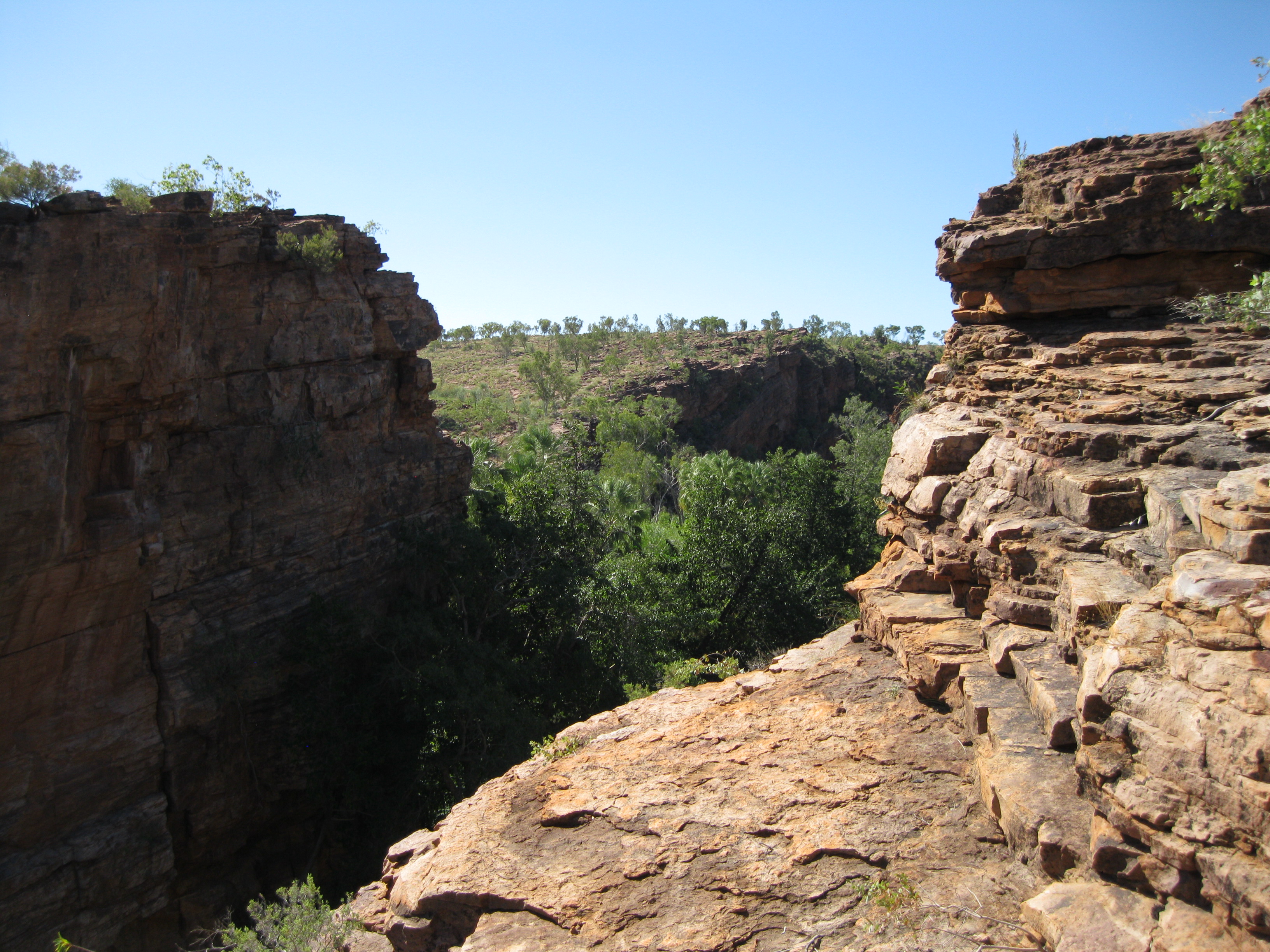
Once you get towards the top you will be met by a view of the Upper Gorge and the Middle Gorge. The vantage point is actually pretty big. So the closer you get to the edge, the clearer the view of the gorge will be. So you can get all sorts of cool pictures of the fronting rocks and the Lower Gorge slightly coming into view. Really cool if you are into taking abstract nature photos.
You can walk a bit up and down the rocks and there will be some stunning views. When you get to the very edge you can view both sides of the gorge which is quite impressive. There’s a massive steep rock wall between the two which is quite a sight. To the left you will have the view of gorge which has carved its way through the steep rock walls, and on the other side a wider gorge surrounded by more sloped rock walls and more vegetation. An absolutely stunning view on both sides. Have a walk around and take it all in. You can easily spend about half an hour up there strolling around.
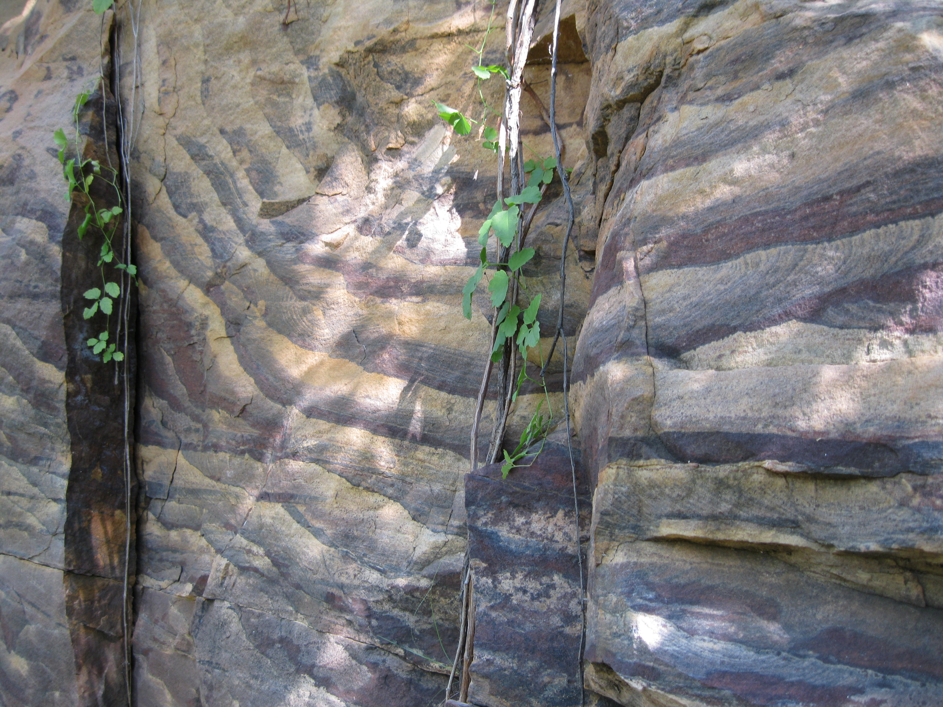
On your way back you can access the other trail which is only about five minutes from the vantage point. It takes you through a valley down to the banks of the Middle Gorge. When getting down to the gorge you will be approached by a steep rock wall and savannah bush with Livistona Palm Trees. You will see some amazing banded rocks down there.
Continue along the gorge on the trail. Here it’s quite nice in the shade most of the way which is just what you need after a long hike where you’ve really been exposed to the sun. Continuing along you will pass through some awesome rock secery and vegetation. As you walk along the bank you will have great views of the Middle Gorge on the way.
Eventually you will get to Indarri Falls and the Lower Gorge. From there you can continue on the trail leading away from the falls back towards the car park. Before going all the way down to the carpark you should go for a swim in the creek. You can do it from the spot where you went on the cruise or in that area. There are a couple of paths down to the creek where you can have a dip. It is so cool. You will have an amazing view of the Lower Gorge and it’s an awesome end to a busy hiking day where all you want to do it cool down.