Denali National Park & Preserve is the most visited national park in Alaska. The scenery is absolutely stunning and some of the most beautiful you will ever see.
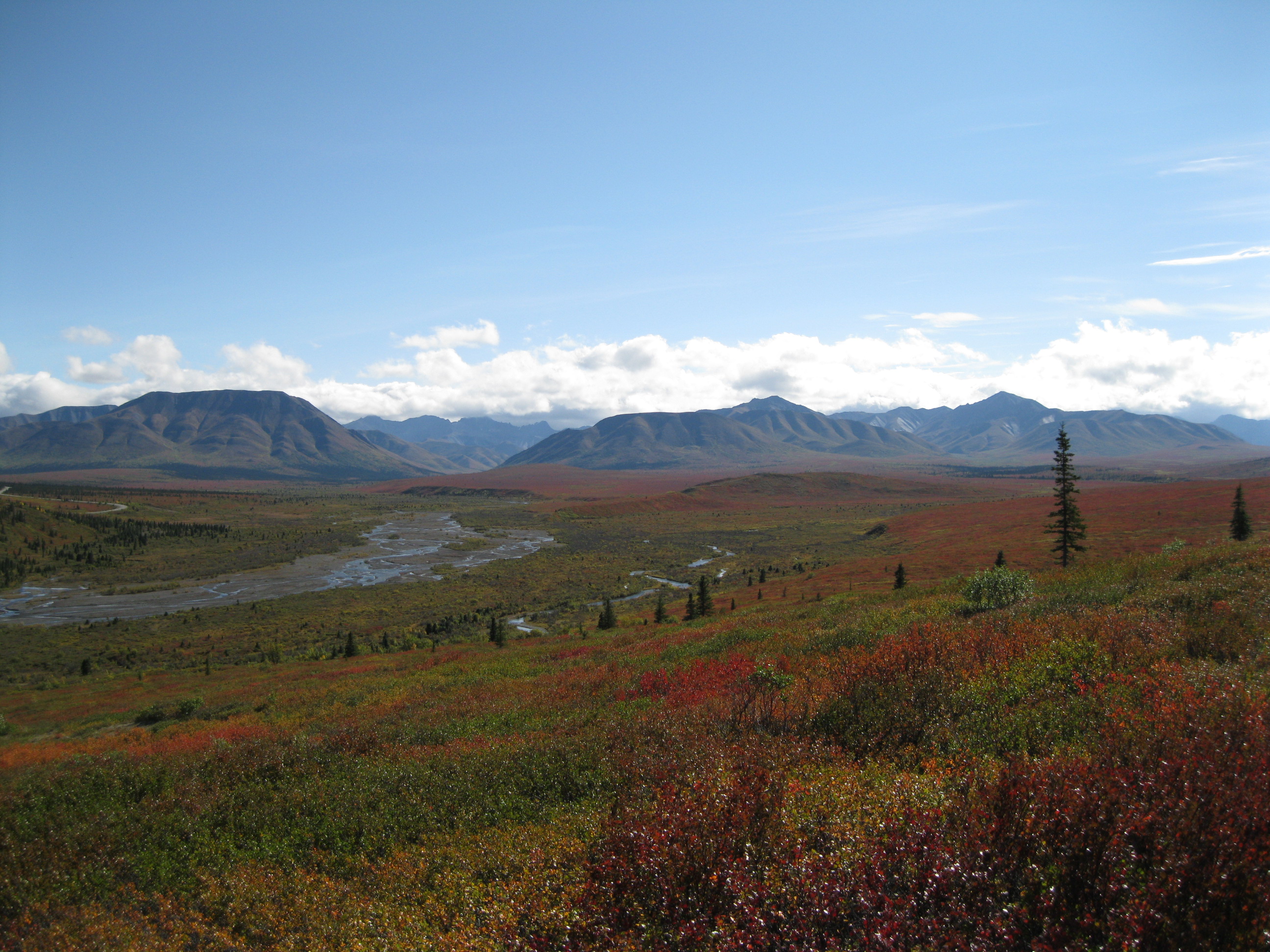
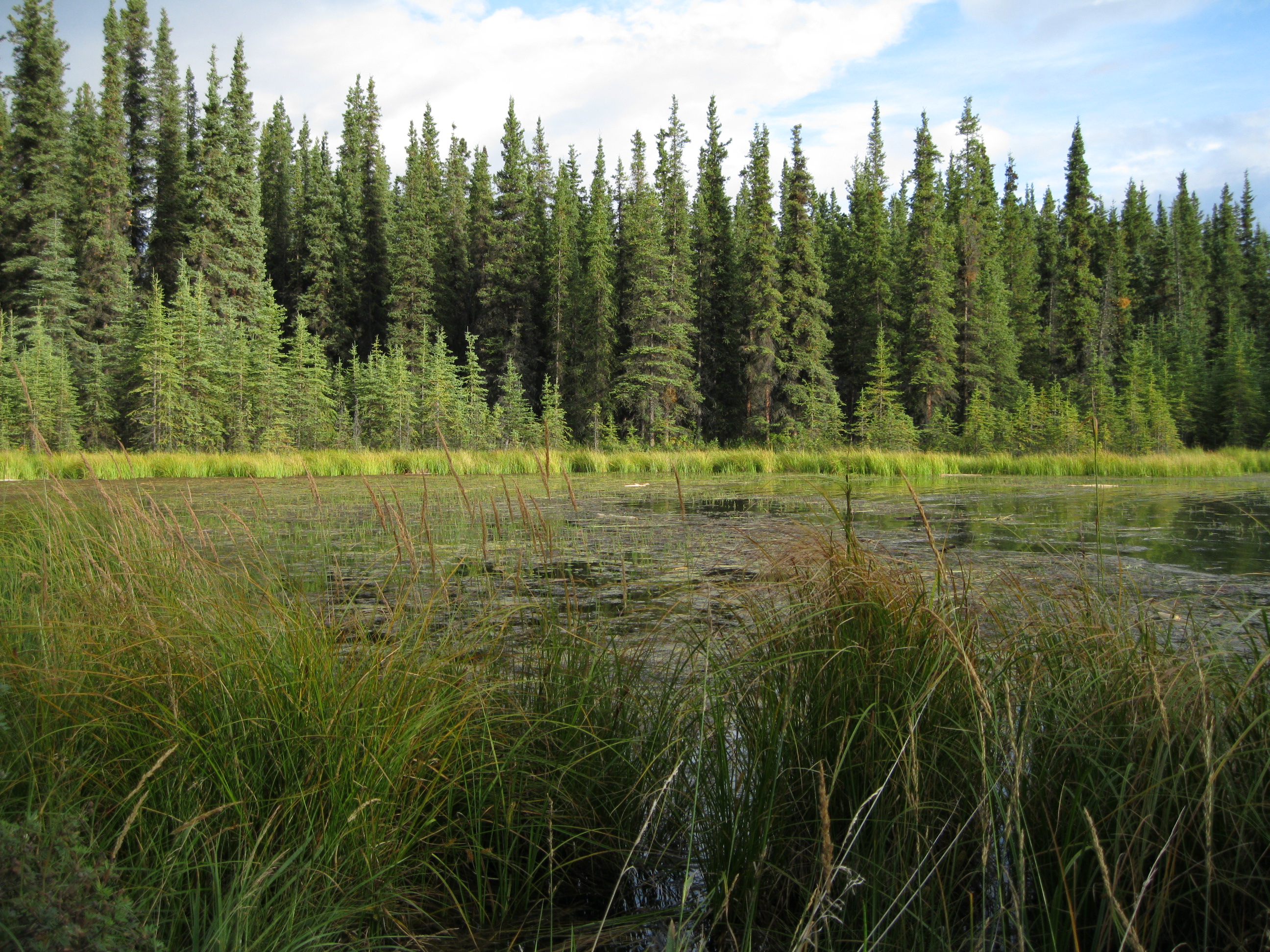
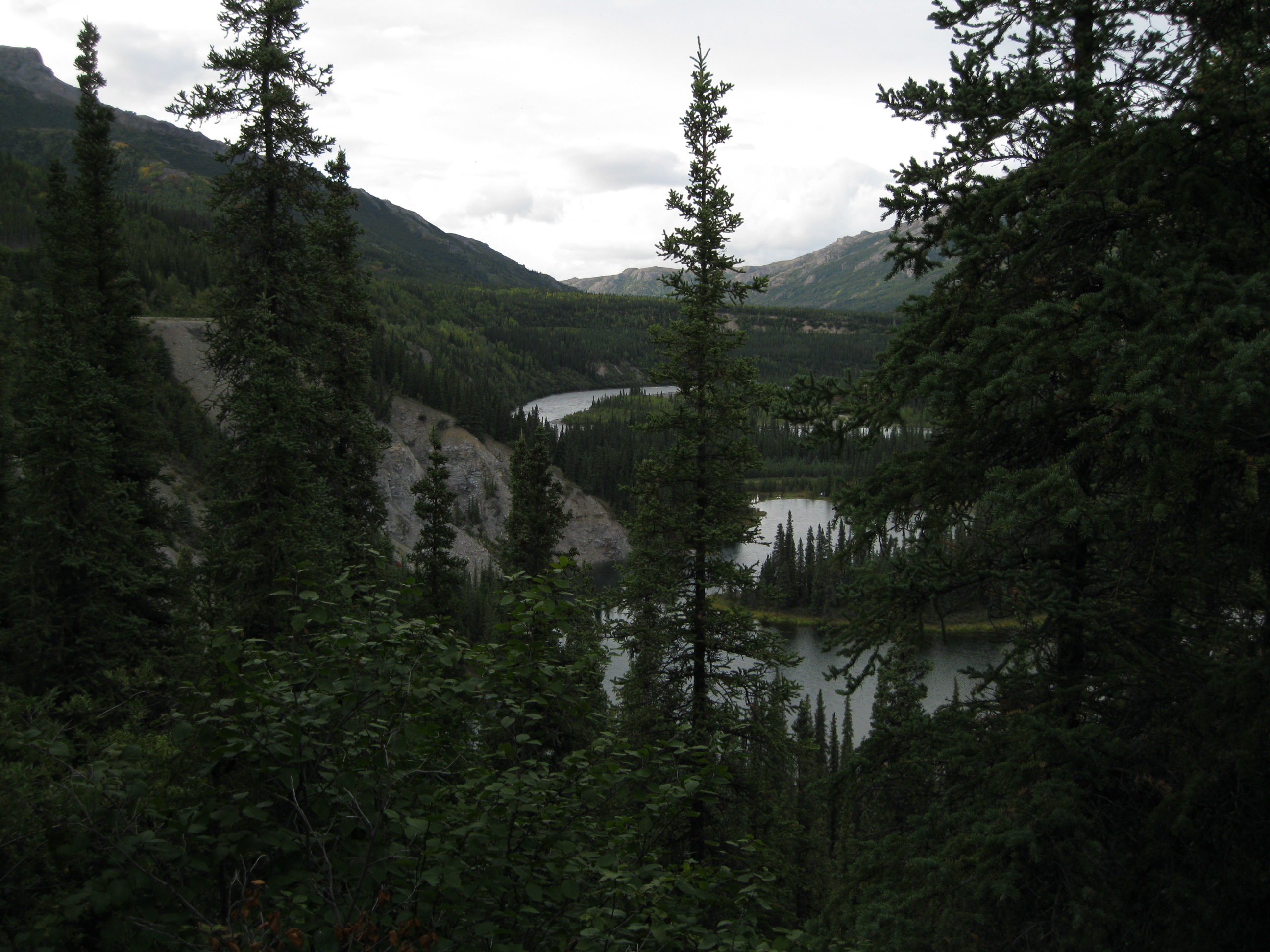
The park is located in Interior Alaska which covers a big chunk of the state and is mostly wilderness. A great and fascinating aspect about the park is that the wilderness is very much intact and untouched. The park mostly consists of forest which includes boreal forest, tundra, glaciers and rock. All the mountainous scenery is a part of the Alaska Range and the park is based in the central part of the range.
Mind you that the national park is called Denali National Park & Preserve and the highest mountain in the park and North America is simply called Denali. Initially the park was called Mount McKinley National Park but was was renamed Denali National Park & Preserve in 1980. The mountain Denali was called Mount McKinley until August 2015 where is was renamed as well.
A way of going to Denali National Park & Preserve would be by car or on an organised tour from Anchorage. The park is huge but if you go from Anchorage up the Alaska Highway (also called the George Parks Highway) to the entrance it’s about 383 kilometres (238 miles). You also have the option of going by the Alaska Railroad. The park is about 193 km (120 miles) south of Fairbanks. Mind you there is only one road entrance to the park. It is open for private vehicles for about 23.8 kilometres (14.8 miles) to the Savage River Bridge. If you want to continue beyond this point you will have to join the public shuttle and tour bus. The shuttle bus runs every half hour.
Denali is the highest peak in North America at 6,190 metres (20,156 ft) above sea level and in the Athabascan language Denali means “the high one”. If you consider the distance from base to peak which is 5,500 metres (18,000 ft) it is in that sense the highest mountain in the world.
The former name Mount McKinley was given by a gold prospector called William Dickey in 1896, named after a presidential candidate at the time called William McKinley who had nothing to do with Alaska or Denali. He would become the United States president the following year. When Dickey returned to the lower 48 he wrote an article about his adventures in Alaska and suggested that the highest peak in Alaska should be named after William McKinley and the name stuck. This was the official name from 1917 to 2015. A lot of Alaskans referred to the peak as Denali anyway and but as mentioned earlier the name was finally officially changed in August 2015.
Denali is granitic pluton lifted by tectonic pressure from the subduction of the Pacific Plate beneath the North American plate which created the Denali fault system. The sedimentary rock above and around the mountain was removed by erosion. A pluton is a body of intrusive igneous rock which is crystallised from magma slowly cooling below the surface of the Earth. Granit is hard rock that doesn’t easily erode which is the reason for the height of the mountain. There is a lot of tectonic activity in the area with more than 600 earthquakes a year. Most of them are too small to be felt. The Denali fault is more than 1,160 km (720 miles) long.
There are four areas of rocks that run in east-west bands through the park. The oldest is located in the north and the youngest in the south. The areas consists of different terranes. A terrane is a geological term for a crustal block or fragment which is normally bounded by faults, has been broken off one tectonic plate and is added onto another plate.
The oldest rocks is a part of the Yukon-Tanana terrane which are ocean sediments, deposited between 400 million and 1 billion years ago. The rocks have arisen from folding and faulting of the rocks and what is known as metamorphism which is a transformation of rock from one form to another. This resulted in rocks like schist, quartzite, phyllite, slate, marble and limestone.
The next oldest rocks are of the Farewell terrane which are from the Paleozonic era and are between 250 and 500 million years old. These sediments were deposited in a variety of marine environments from deep ocean basins to continental shelfs. The latter is the shallow underwater landmass extending from a continent. There is a big presence of marine fossils which are evidence that it was a tropical area about 380 million years ago.
The third oldest area was deposited during the Mesozoic era which was 66 to 252 million years ago, also known as the age of reptiles. This area is a part of the Pingston, McKinley and Chulitna terranes. This includes rock such as marble, chert, limestone, shale and sandstone with intrusions of igneous rocks like gabbro, diabase and diorite.
The youngest rocks are from the Cretaceous period which were formed about 100 million years ago which includes the Kahlitna terrane. These were rocks deposit in a marine environment during the early stages of the creation of the mountains. It includes volcanic rock such as basalt and rhyolite. This can be seen at Polychrome Pass.
The first humans came to present day Denali National Park & Preserve about 12,000 years ago for hunting. The Athabascans came thereafter and established villages in the warmer areas close to the river for fishing. But due to the lack of salmon runs the interest in the area by the natives was limited. The first white man to spot Denali was English Captain George Vancouver while sailing in Cook Inlet in 1794. After he reported about his sighting other explorer, adventurers and surveyors followed.
One of the first white men to explore the Denali region was naturalist and hunter Charles Sheldon who went on two expeditions in 1906 and 1907-08. The second expedition was for an entire year to observe sheep but he was also fascinated by the other wildlife of the region. This time he was accompanied by guide Harry Karstens with two other men. They built a cabin at the Toklat River and here Sheldon and Karstens talked about how a great national park the area would be and how people would enjoy it.
Sheldon suggested that the area should be a national park and wildlife preserve, started lobbying and used his influence to gather support for this cause. He told fellow members of the Boone and Crockett Club, which included founders George Bird Grinnell and former president Theodore Roosevelt, that without protecting the area, the wildlife would be slaughtered by trophy hunters. Furthermore sheep were being killed to feed gold miners in the area. Sheldon also knew that the railroad was coming which would result in more killings of sheep to feed the staff. Sheldon and members of the Boone and Crockett Club campaigned through the halls of the Capitol in Washington, DC to make the area a national park. It was mainly due to Sheldon’s efforts that this became a reality in 1917 and Sheldon personally delivered the bill to President Woodrow Wilson for signing. To his disappointment it was initially called Mount McKinley National Park.
The first trying to make an ascent of Denali were four miners called Billy Taylor, Pete Anderson, Charley McGonagall and Tom Lloyd who went on the endeavour in 1909. It was known as the Sourdough Expedition named after the yeasty mixture they brought along to make bread.
The driving force behind the expedition was Tom Lloyd, a Welshman who was a former sheriff in Utah. He came to Alaska during the Klondike Gold Rush as had settled down in Kantishna Hills. Lloyd had claimed to the owner of the Fairbanks Hotel Washington Saloon, Bill McPhee, that he and several of pioneers which he knew could climb the summit. McPhee made a mock of Lloyd’s attentions saying he was too old and overweight and McPhee ended up offering Lloyd 500 USD to anyone who would climb Mount McKinley, as it was known at the time. Two other businessmen offered to put up 500 USD each as well which Lloyd accepted and the expedition was on.
Initially it was a group of seven but it was quickly reduced to four. They set off from Fairbanks on horses, a mule and a team of dogs. They had never climbed a mountain before but were optimistic as they thought they could easily do it after having survived Alaskan winters before. They spend a couple of months setting up several camps, reached Muldrow Glacier of Denali in March which Anderson and McGonagall nicknamed Wall Street Glacier due to the high walls on each side.
By 3 April 1910, Taylor, Anderson and McGonagall set out for the summit from the camp at 3,300 metres (11,000 ft) with a spruce flag pole which they hoped would be visible at the mining camps in Kantishna evidencing and displaying their ascent. Lloyd didn’t join and returned to Willows Camp. It is believed that he suffered from altitude sickness. McGonagall stopped half way up but Taylor and Anderson continued to the top of the north peak of Denali. This is 260 metres (850 ft) lower than the true summit which is the south peak. Therefore they were never credited for being the first to climb the summit of the highest mountain in North America. But well done especially considering their lack of experience. Furthermore the north peak is actually considered being a more challenging climb than the south peak.
Hudson Stuck and his party of three climbers were the first to ascent the summit in 1913. The group consisted of Stuck who was an amateur mountaineer, a missionary and an Episcopal archdeacon, co-leader of expedition Harry Karstens, an experienced outdoorsman, Robert Tatum, a theology student, and Walter Harper, a half Athabascan and half white, whom Stuck had hired due to his skills as a trapper, dog driver, guide, interpreter and other abilities.
The Party left from Nenana on 17 March 1913 with two sleds pulled by fourteen dogs. They used route descriptions used by previous parties and ascended at Muldrow Glacier. After a challenging climb they reached Denali Pass which is the saddle between the north and south peaks. This is only 640 metres (2,100 ft) below the summit. The final hundred metres were the toughest of the climb due to the low oxygen level and extreme cold. Walter Harper was the first to stand on the summit of Mount Denali and was shortly followed by the rest of the group. Harry Karstens was latter appointed the first superintendent of Denali National Park where he served in this position from 1921 until he retired in 1928.
Doubts were raised shortly after the Sourdough Expedition was completed doubts started to flourish due to the lack of evidence of their efforts. People found it hard to believe that four people without any mountaineering experience could do this. But they were cleared of any accusation when Hudson Stuck confirmed that he had seen their spruce flag pole on the way up and acknowledged their efforts.
Due to the remoteness and the lack of infrastructure the amount of visitors were few between 1917 and the early 1970s. Roads were developed and improved throughout Harry Karstens’ tenture though. It wasn’t until 1923 that facilities were established to accommodate visitors which was called Savage Camp from where people to hike and ride horses. Visitors would arrive by trains at the McKinley Park Station Depot and were picked up by touring cars and busses which would take them out to Savage Camp, 19 km (12 miles) up the road.
During the five years prior to 1972 the yearly number of tourists were around 15,000 in average. When the Anchorage-Fairbanks highway was completed in 1972 the amount of visitors quickly increased to around 140,000 a year. The national park rangers raised concerns with regard to the increased activity. They were of the opinion that it could have a bad influence on the wildlife. The noise would scare the animals away and more visitors would also increase the possibilities of encounters with dangerous animals. Furthermore the single dirt road that goes through the park would not be wide enough for the additional traffic.

The solution to the issue was the introduction of shuttle bus system. All private vehicles must be parked at the entrance and to get into the park you have to join the shuttle. Visitors are allowed to drive their own vehicles as far as Savage River Bridge about 24 km (15 miles). That first stretch is paved while the 120 km (75 miles) beyond here is a dirt road.
The public shuttle and tour bus can be taken from the Denali National Park Visitor Center. There are several tours but going on the green “camper” shuttle bus tour is highly recommended. During summer it can get full pretty fast so booking it in advance is advised. On this tour you will see a lot of beautiful scenery and will most likely get the possibility of watching wildlife like bears, Dall sheep, caribou, wolves and so on. It is encouraged on the tour that if you see wildlife you should call it out to the driver and he will stop for the passenger to have a view.
Mind you that it is not a guided tour. Some wildlife may be close to the bus and some may be far away. Therefore a pair of binoculars or a camera with a great zoom lens would be good to bring along. Having a seat by the window is a good option. You can easily move the windows down for taking photos which is pretty cool. Even though you may have a spot at the window please show some consideration for the passengers who do not have a window seat. People on these tours are really friendly and helpful so it should be all good.
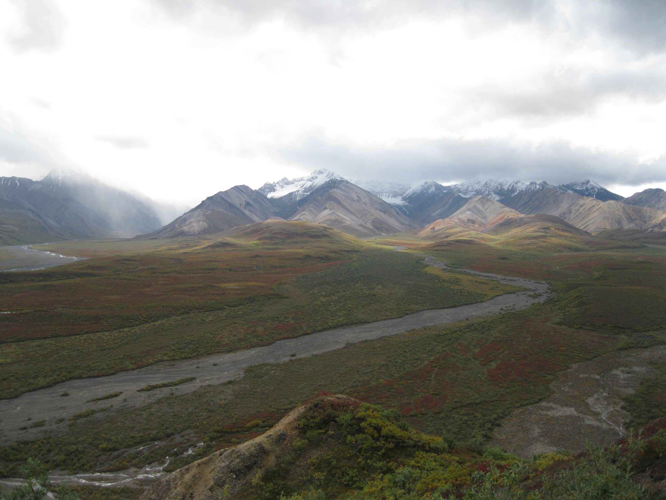
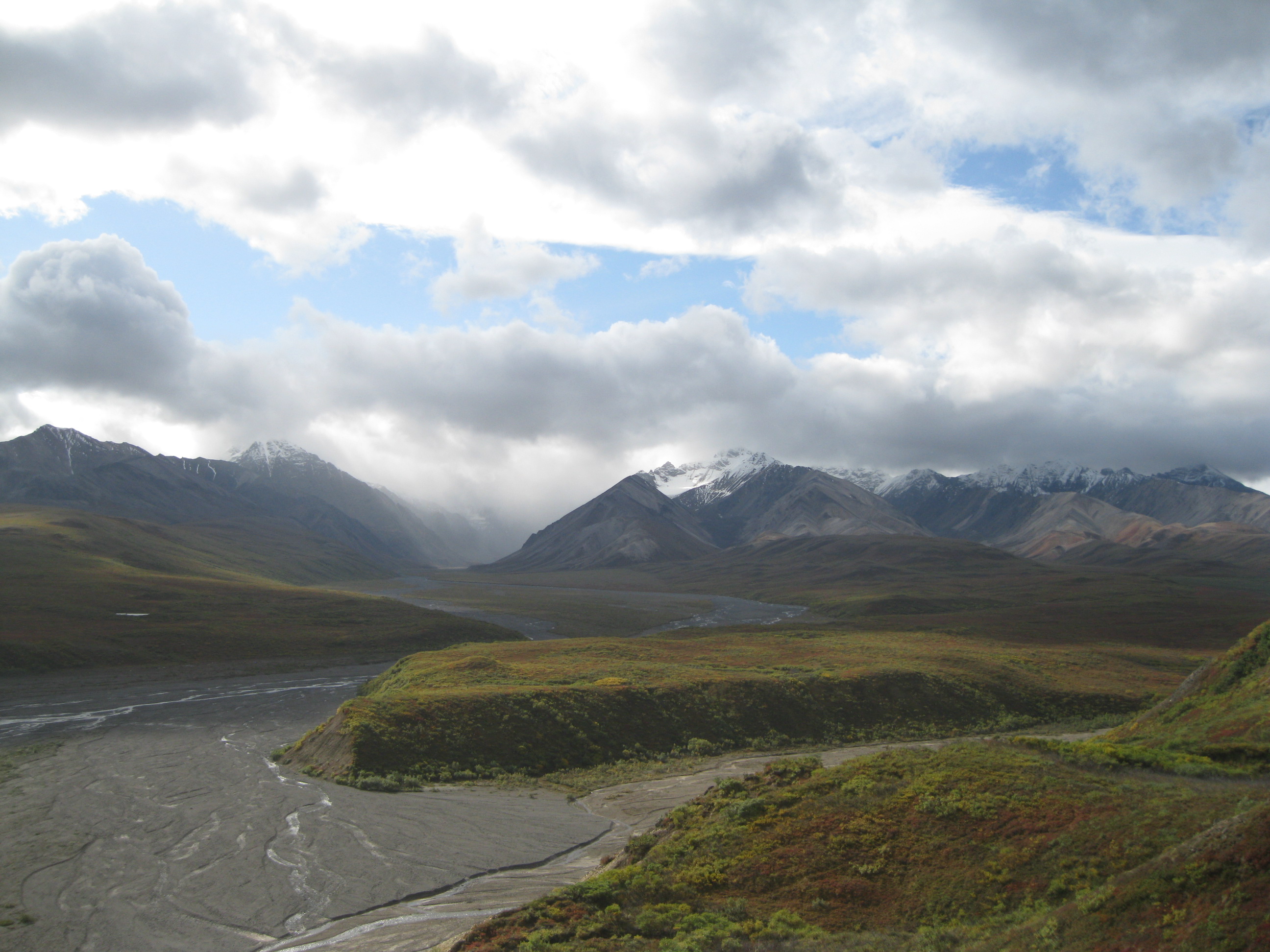
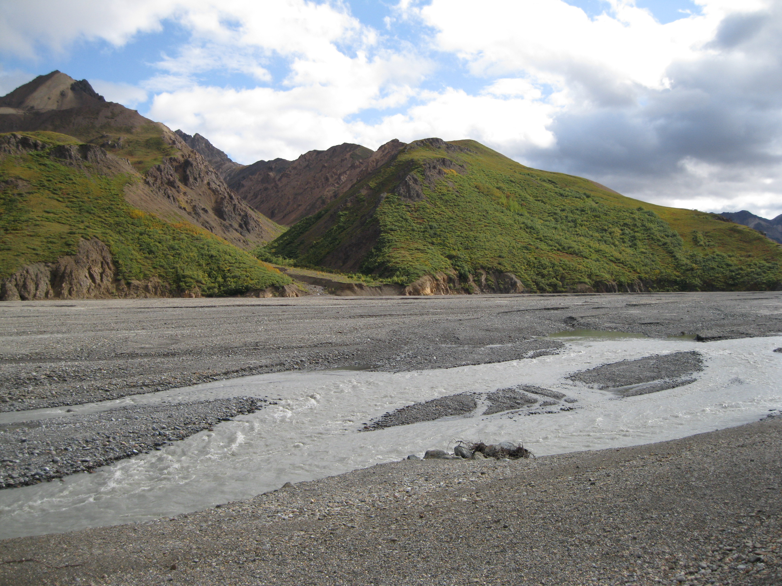
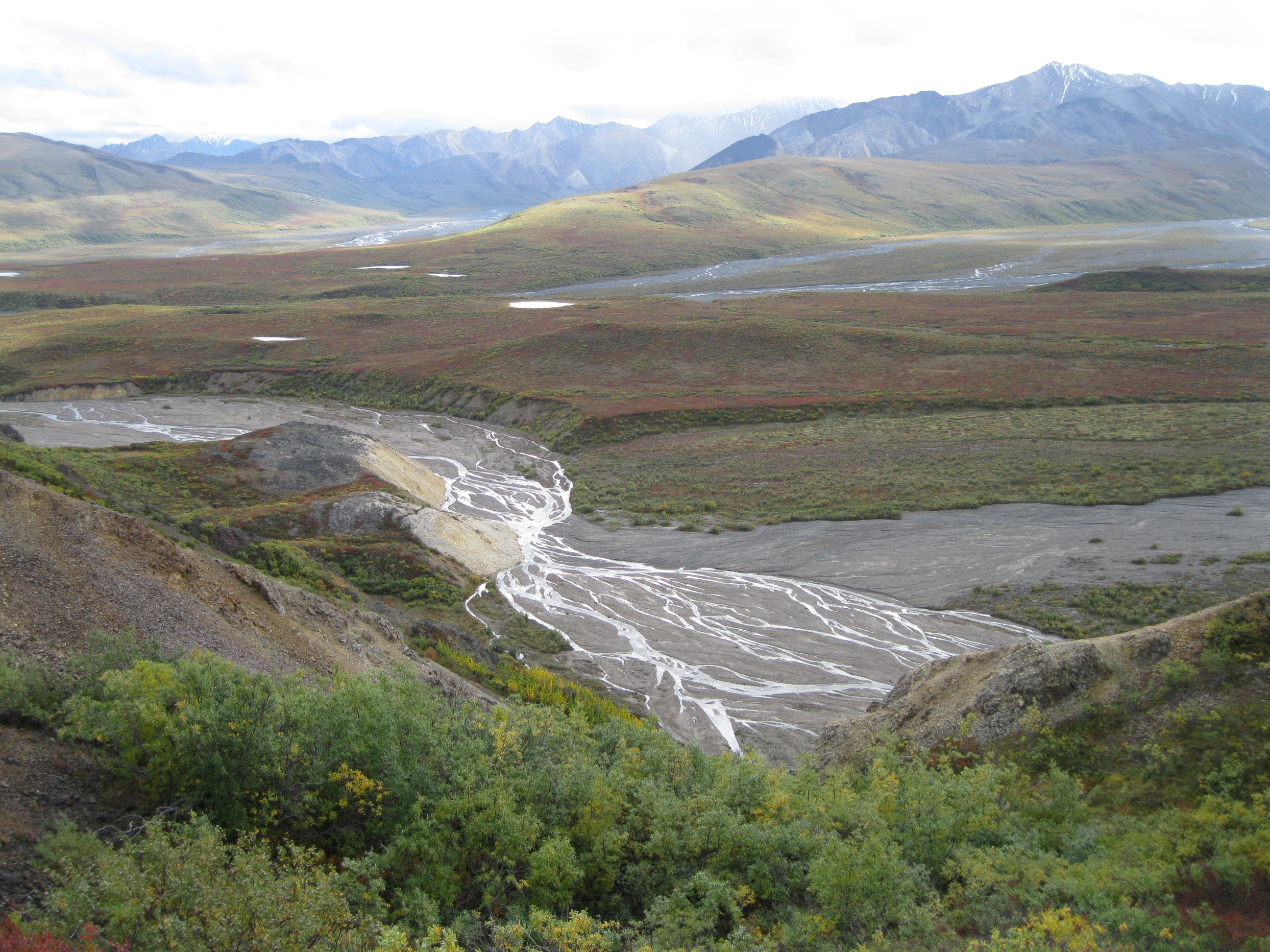
There are several shuttle bus tours but going from the Denali Visitor Center to Eielson Visitor Center and back is recommended. It is four hour tour each way so it will be a full day excursion. It will return on the same road as it is only one road going into this vast park. On the tour there will be several stops lasting approximately 15-20 minutes – at Polychrome Pass, Teklanika River and Toklat River where you will have stunning views of the park. You can get off, take pictures and if you want to stay a bit longer you can and hike off trail if you fancy that. Then return to the same spot and catch the next tour bus either further on or just back to the Visitors Center. At Eielson Visitor Center they have the vantage point of Mount Denali. Mind you, many times it will be foggy so you are lucky if you get a view of Denali.
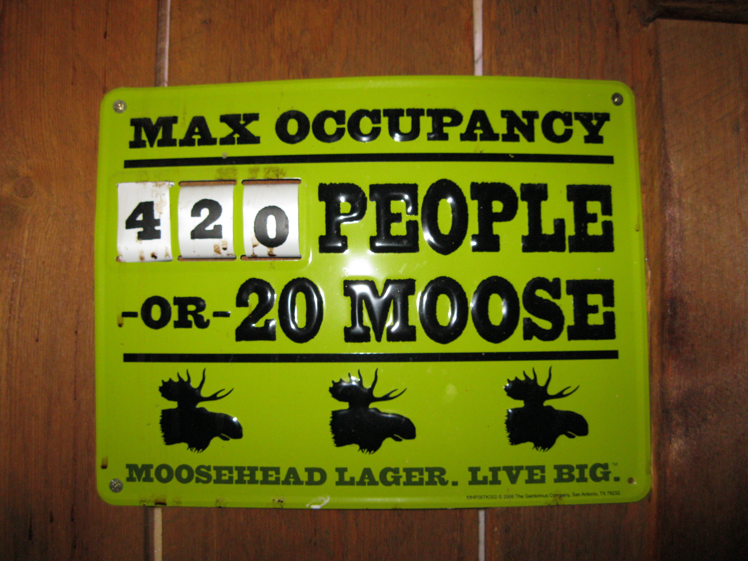
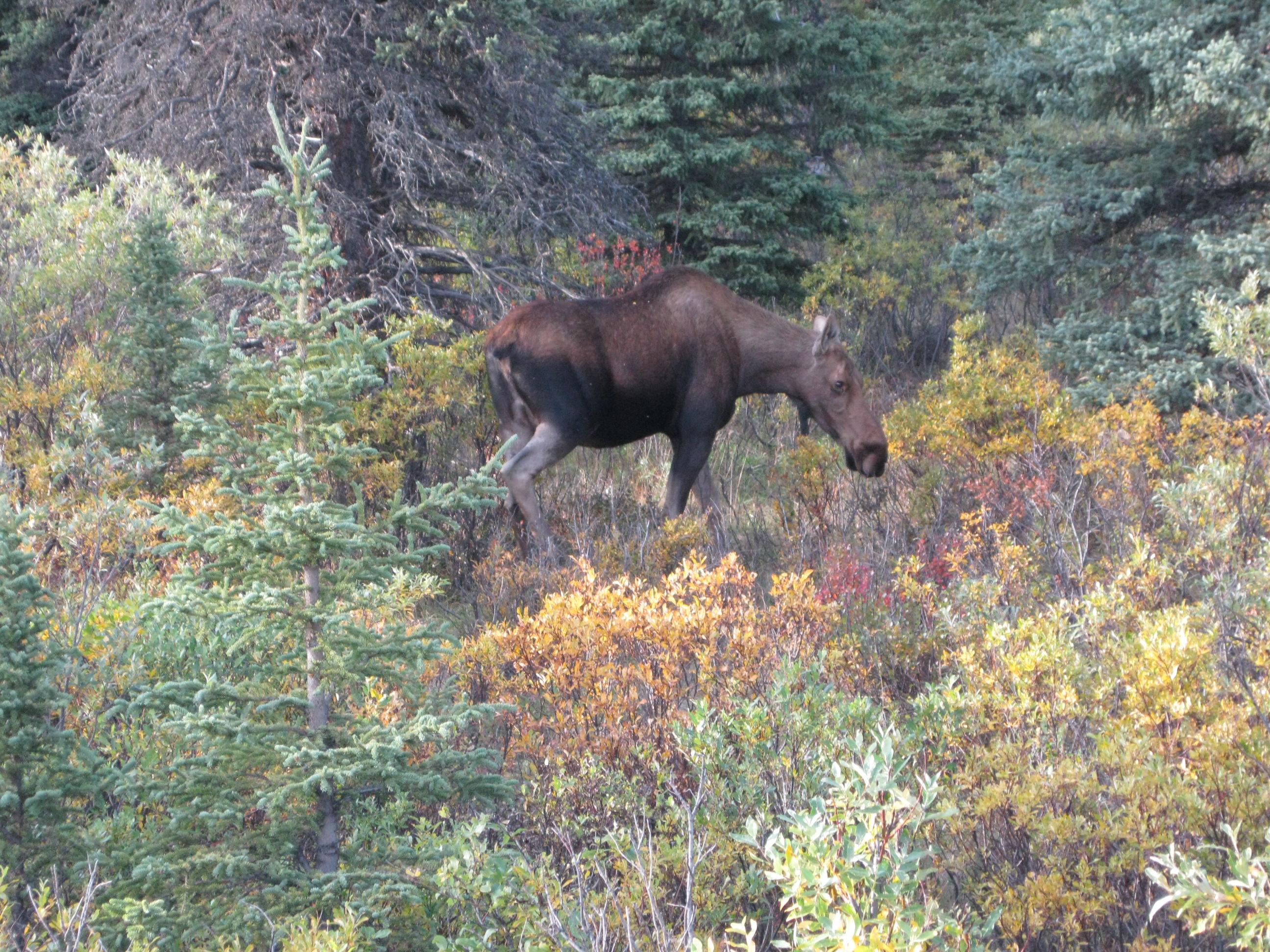
From the Visitor Center to the entrance to Savage River is a stretch of 22 km (14 miles) which is moose habitat. The moose is the biggest animal in the park and a mature bull can weigh up to 680 kg (1,500 lbs). During spring they have their calves and they have one or two. It is one of the fastest growing animals in the world. At birth it weighs around 14 kg (30 lbs) and in a year it can weight 270 kg (600 lbs). During September and October it will be the rutting ground for bulls challenging each other over harems of cows. The moose is a dangerous animal. Both cows and bulls will charge if you get too close. If that happens, run away immediately. Unlike beers they will not continue hunting you down after you have left their personal space.
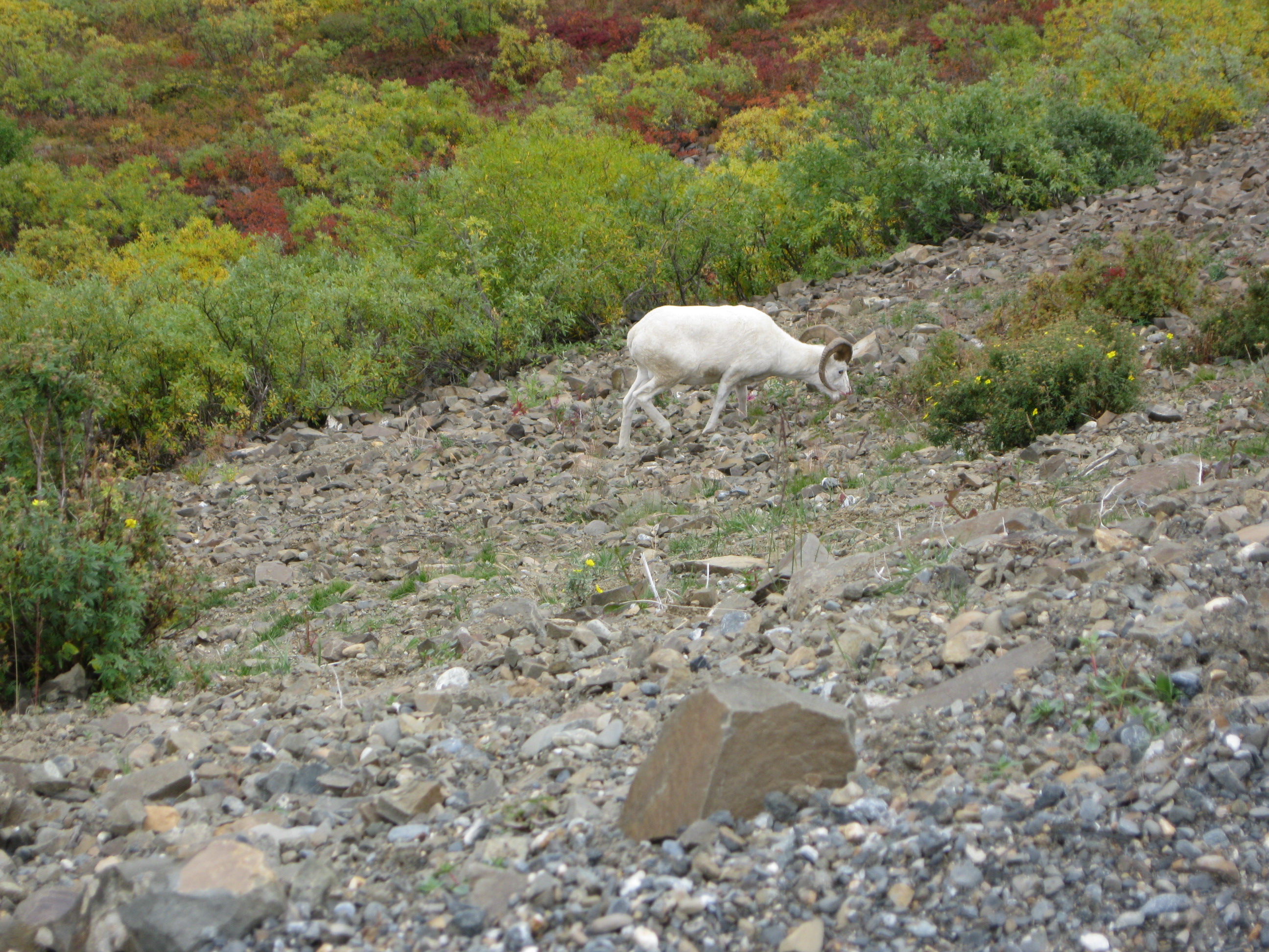
Beyond Savage River you will pass the mountain called Primrose Ridge. Here you may be able to see Dall sheep on the slopes along steep cliffs where they will be safe from predators. Within a few days of birth the lambs will match their mother’s ability in climbing. The lambs will play games and head-butt which help them develop the strength, agility and coordination. Rams can also be found which will also have head-butting contests and the winners will determine which will get to do most of the mating during the fall rutting season.
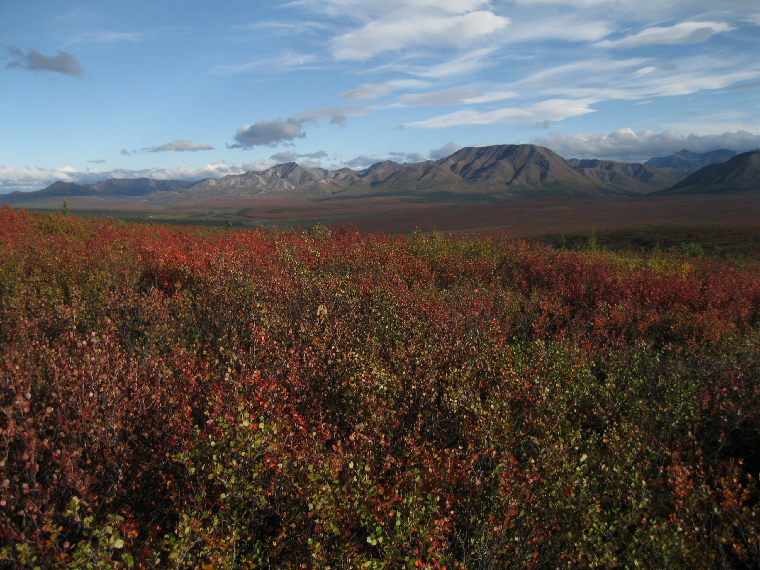
Further into the park at Sable Pass you will be above the treeline surrounded by tundra. The elevation here is 1,188 metres (3,900 ft). The strong winds at this altitude are too harsh on the trees. The tundra can survive as the temperature at ground level is a tad higher and it’s less windy. There are a lot of grizzly bears in this area, therefore off road hiking is not allowed. Grizzlies would prefer to eat large animals such as caribou, moose and Dall sheep but they are rarely successful at hunting these down. They will most likely eat rodents or vegetation instead.
Grizzly cubs are born in January and February during the mother’s hibernation. It gives birth to between one and four cubs weighing around 200 g (1 lb) each. Sable Pass is one of the best areas in the world to watch grizzly families. It’s estimated to be about 200-300 grizzlies here. When the young are about 2½ years old they get their independence and at this time they will weigh around 45-67 kg (100-150 lbs). The mother then breeds again and gives birth the following winter once more.
Grizzly bears are dangerous and if they are provoked they will charge. They normally stay clear of humans as they are shy. There are very few attacks and encounters. If you feel threatened by a grizzly you should never run away as it will hunt you down. If you are in a group you should stay closely together to make you look bigger, make a lot of noise and walk backwards. If you are by yourself, you should also make yourself look bigger by stretching your arms out above your head, make a lot of noise and walk backwards. Remember to carry a bear spray if you are out hiking in bear country.

The shuttle bus will stop at one of the highlights which is Polychrome Pass. Here you will have a spectacular view of the Alaska Range, tundra and Polychrome cliffs which are volcanic rock. In this area you may be able to see wolves. They are normally in small packs or alone. In a pack it is only the alpha male and the alpha female that breeds. Their pups are born during spring and can consist of about 5-10. The other members of the pack help feeding the young.
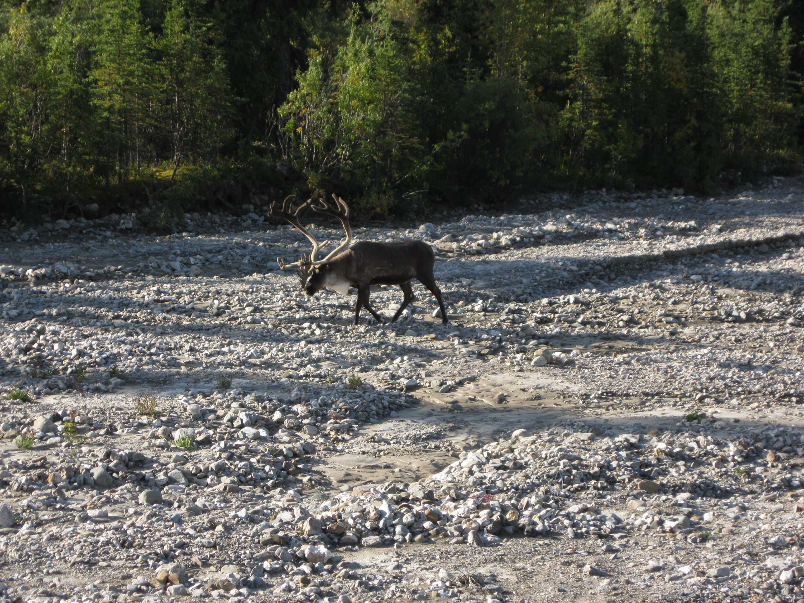
The Caribou is the most social of the big animals in the park. In spring there are herds of several hundred which are mostly seen in the Highway Pass area. They are constantly on the move and if they stayed to long in the same areas they would kill off the fragile tundra environment. Their antlers are made of bone and are shed every years, the same happens to the antlers of the moose. Unlike the horns of sheep which are never shed. The horns consist of the same material as human fingernails which is keratin. The bulls fight for the harems in September which normally happens between Highway Pass and Wonder Lake. After the rutting season the antlers fall off.
At Stoney Hill Overlook where you will have a stunning look of Denali if it’s a bright day. Thereafter the tour will continue to Eielson Vistor Center. Here there will be facilities such as toilets and drinking water. There are also rangers who will be able to answer any questions you may have with regard to hiking and so on. There is actually a shuttle bus which continues beyond this point to Wonder Lake which is another 32 km (20 miles). On a cloudless day Denali will be visible all the way and you will have some beautiful scenery of the mountains and maybe also wildlife. The park road ends at Kantishna which is 8 km (5 miles) beyond the turn out for the Wonder Lake campsite. Kantishna is an abandoned mining site.
Campground and backcountry registration have to be done at the Wilderness Access Center which is located in the same area as the Visitor Center. Mind you, if you are going on an organised tour this will already have been take care of for you. There are seven public roadside campgrounds. A couple of them are small and have no water supply such as Igloo Creek and Sanctuary River.
Going white water rafting on the Nenana River is highly recommended if you are into a bit of adventure. It is great fun and not really that scary. Obviously this depends on the level of rafting you chose. A great operator for this experience is the Denali Outdoor Center and the level they have on their half day Nenana raft is not too strenuous. Great fun. On this particular tour you will experience 37 km (23 miles) of scenic wilderness and great rapids. On the tour the rafting guide will give you all sorts of information about the river and its surrounding area. You will be active too by paddling based on his instructions. You will be wearing life vest and a dry suit so you won’t fell cold at any stage even if you do fall into the river which is very unlikely as you will sit firmly on the draft.
Not too far from the Nenana River just at Park Road you can do a hike around Horseshoe Lake via the Horseshoe Lake Trail. This is a nice like walk which is not too strenuous and you will get some scenic views of the woods and lake. To the overlook it’s 0.3 km (0.2 miles) and to the end of the trail it’s 1.2 km (0.8 miles).

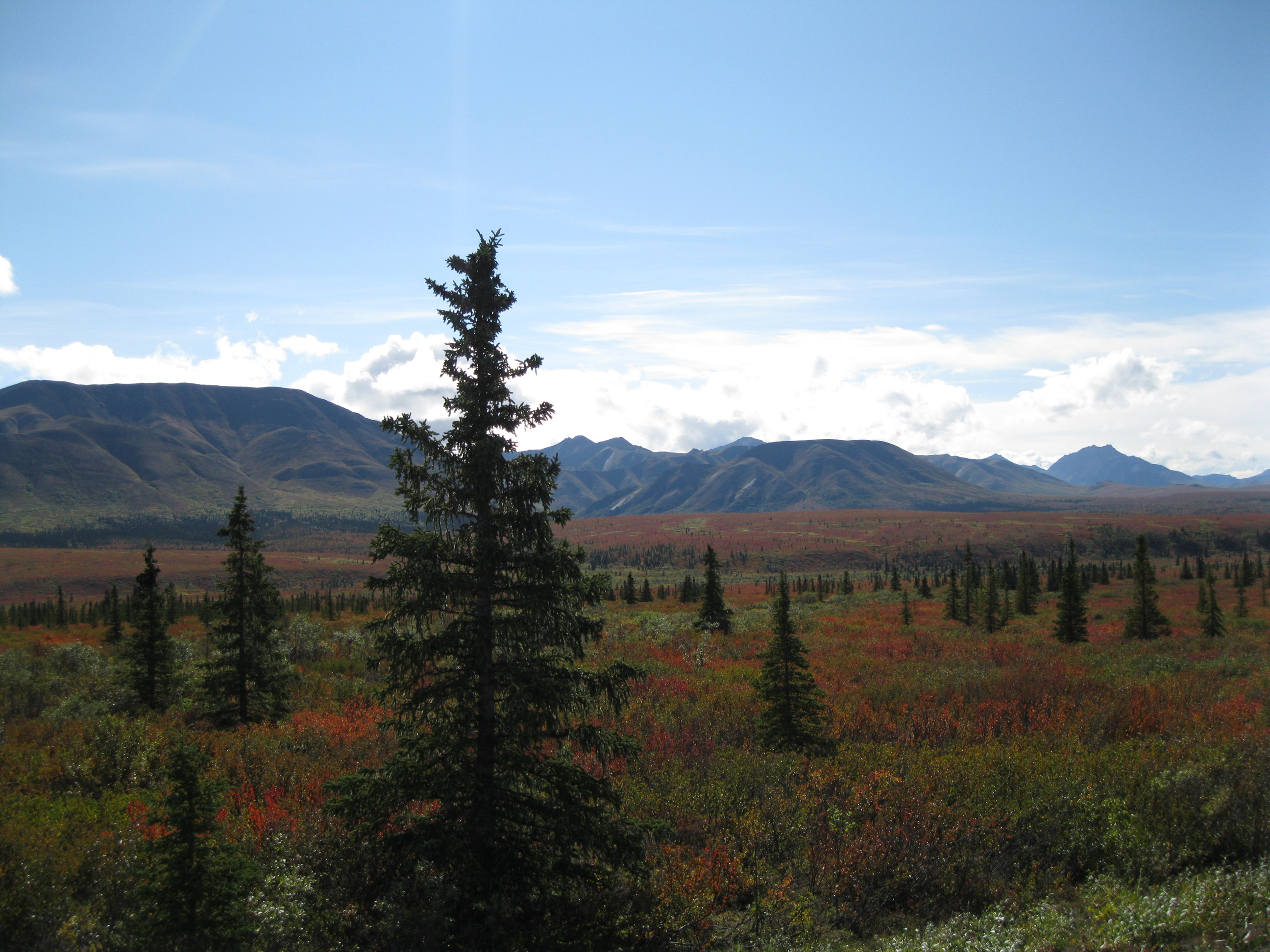
There are several of options for hikes you can do but Denali is different to other National Parks in the United States as they don’t really have that many organised trails. There are some trails but they are mainly centered around the Denali Visitor Center. You can also go off trail and do some bush whacking and just follow the natural terrain. In Denali it’s fairly easy to go where there’s alder scrub vegetation. Follow the ridge line as hiking in vegetation can be difficult. If you do so be a bit careful. Be sure you know where you are going, that you are fit enough and have enough water and snacks for the walk. If you do a hike to the top of one of the many mountains you will get breathtaking views of the Alaska Range. Depending on the time of year it will obviously have a different look, so for instance if you go during Autumn you will have changing colours of the leaves and a great place to view this is at the Thorofare Ridge.
Other places which are good for day hike are Savage River, Primrose Ridge, Polychrome Pass, Highway Pass, the Eielson area and Wonder Lake. Bear in mind that if you do an overnight trip into the backcountry you will need a permit.

Panorama Pizza Pub is a very nice and cosy little place located at Mile 224 George Parks Highway just outside Denali National Park itself right next to the campsite at Carlo Creek. Here you can get good craft beer and great pizzas which are made with local fresh ingredients and the dough contains Oosik Amber Ale. Furthermore they have different events at the place which is not very big. Local bands can turn up and play right in the middle of the restaurant among all the guest which is so cool. This is a great way to experience an evening out in Alaska.
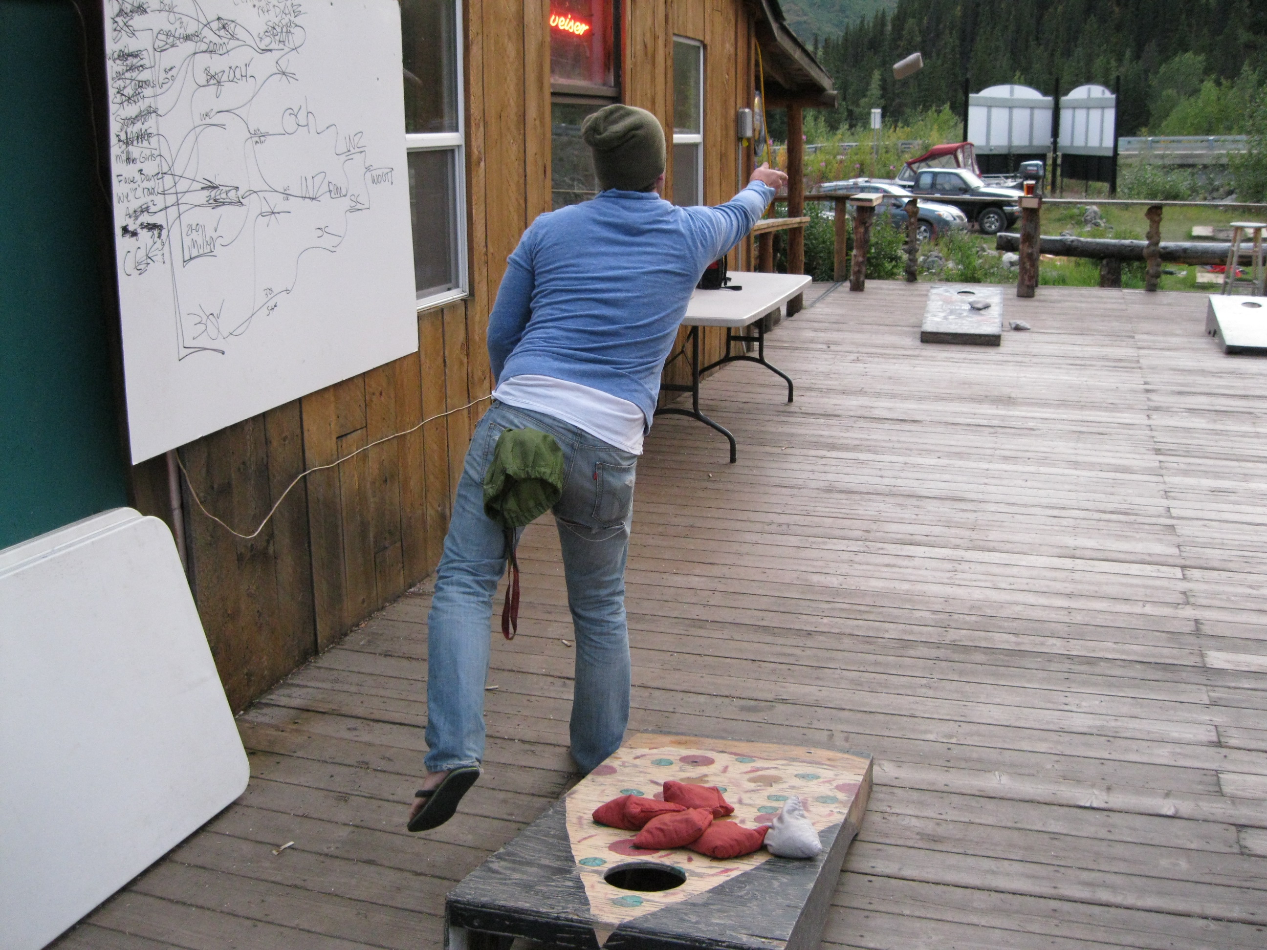
You can also go outside with your beer and play the fantastic game of Cornhole with your mates. This is great fun. Cornhole is played with two sets of bags and two platforms. There are four bags in total. You can play a team of two against each other or just individually one on one, it’s really up to you what you fancy. Each platform is 0.61 m X 1.22 m (2 ft X 4 ft) with a 15.24 cm (6 inch) hole centered 22.86 cm (9 inches) from the top. Each platform should be angled with the top surface 30.48 cm (12 inches) above the ground and the bottom part 7.62 to 10.16 cm (3-4 inches) above the ground. The two platforms are placed about 10 m (33 ft) away from each other. Each person/team throws four bags a round, if a bag remains on the board the score is one point, if it goes through the hole it’s 3 points. This is a killer game!