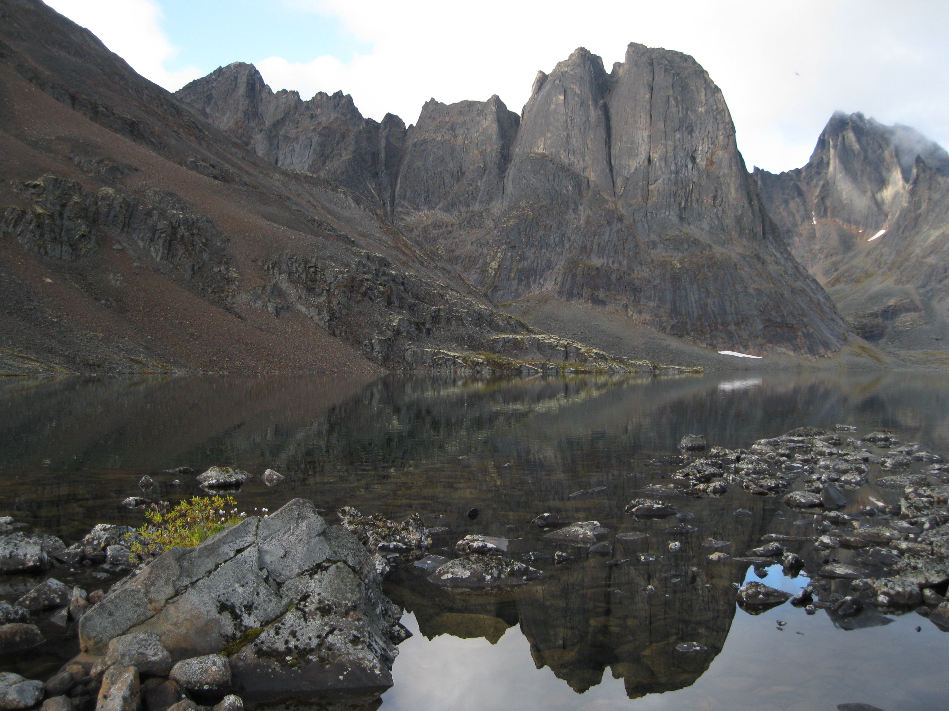
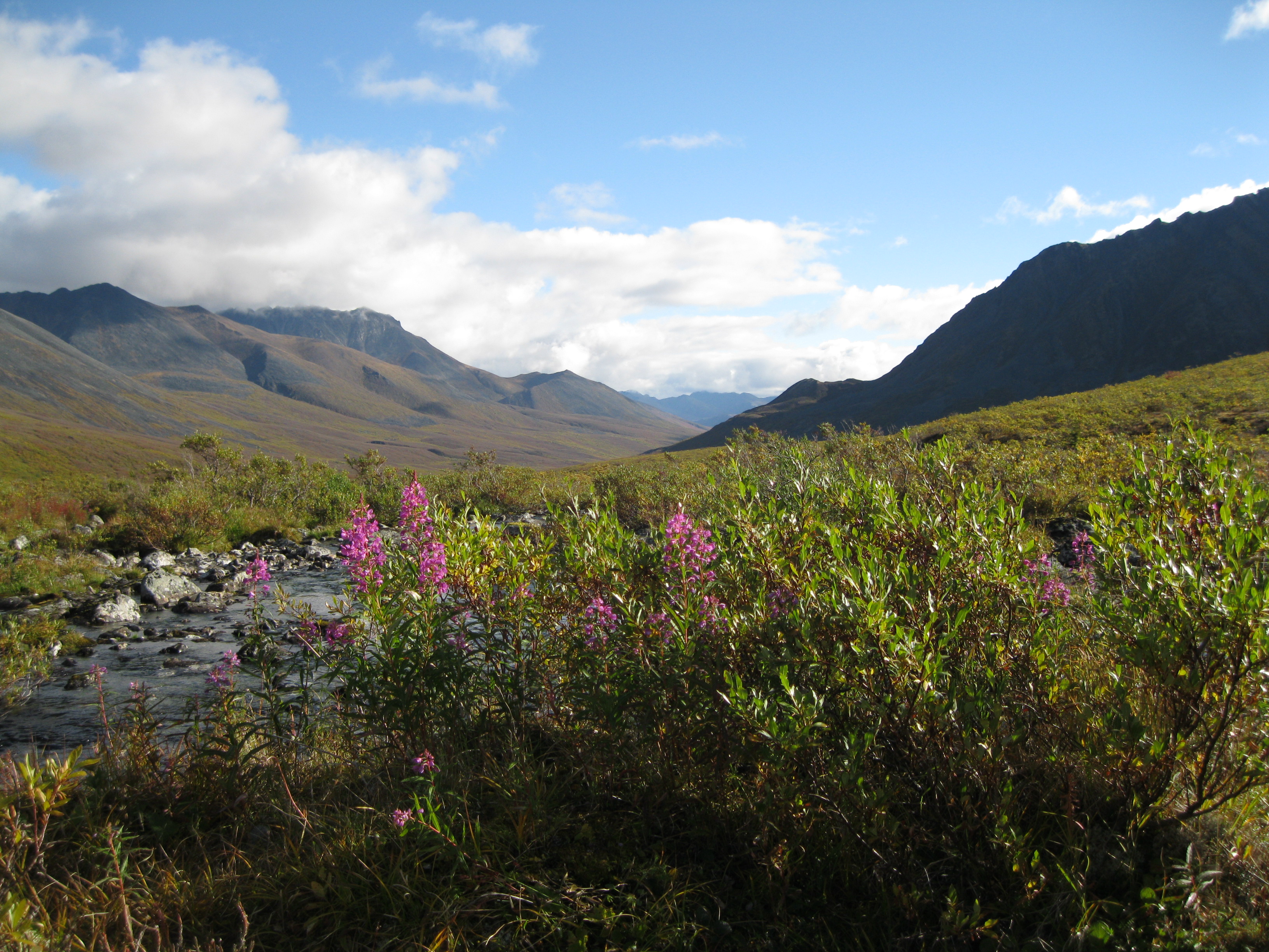
Stunning Rugged Scenery
Tombstone Territorial Park is an absolutely amazing nature preserve in the Yukon and one of the best kept secrets of the northern part of North America
The park was established in 1999, created as a result of the land claim agreements to protect this beautiful area for all time. It is a natural splendour of towering glacially carved granite peaks, beautiful valleys and lakes that will blow your mind. The park is 2,200 km2 (849.4 square miles) in size and is based in the Ogilvie Mountains which is a sub-range of the Yukon Ranges.
Geology: Formation of the Breathtaking Landscape
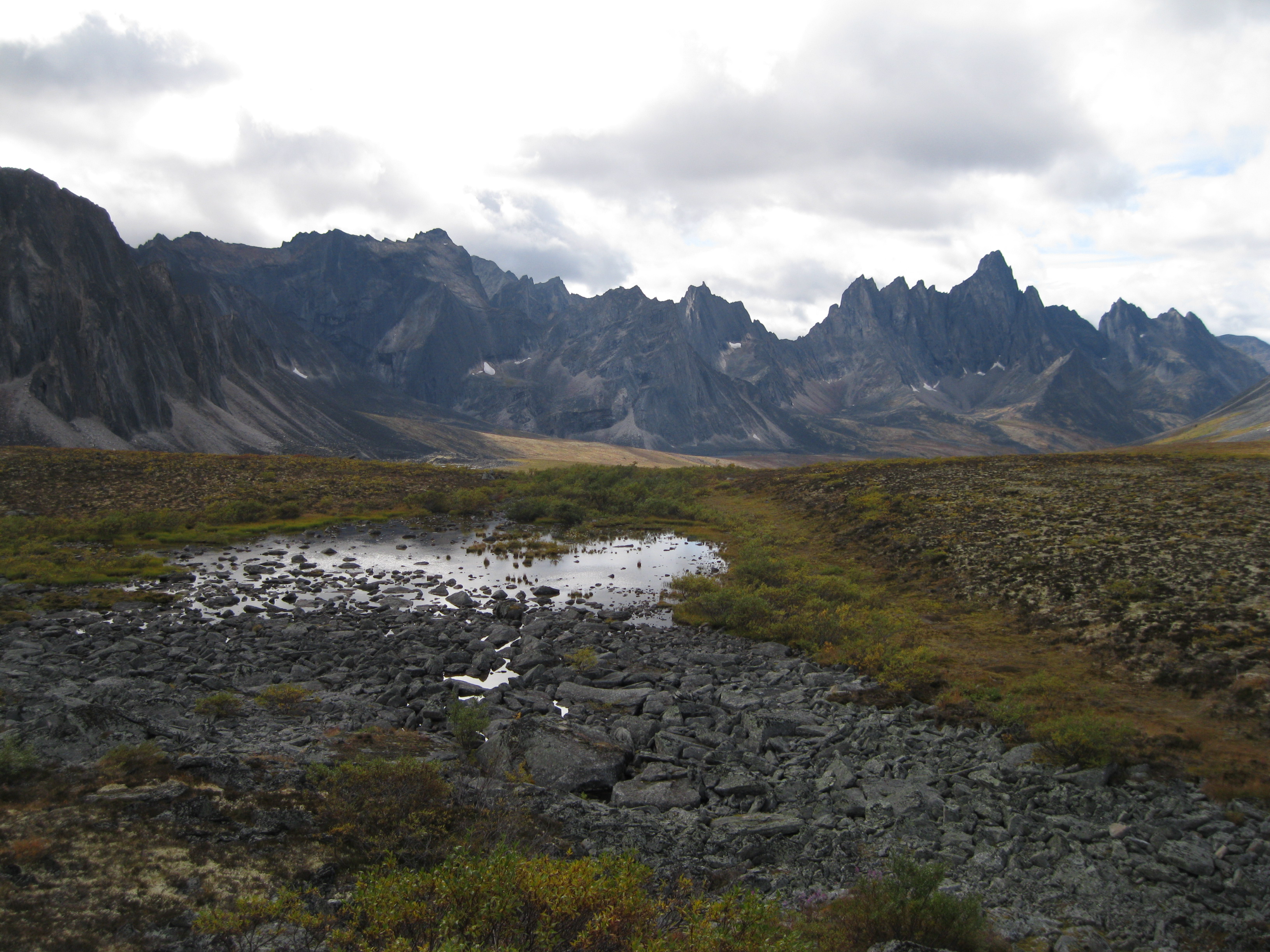
Both sedimentary and igneous rocks are found in Tombstone Territorial Park. The sedimentary rocks include sandstone, limestone, shale, chert and quartzite that were deposited at the western edge of a continent between 300 and 800 million years ago. Dark magma forced its way through these sedimentary layers and later light magma rose beneath what is now the Tombstone Range 92 million years ago. The then newly formed syenite rock cooled off and the softer layers around it were eroded away by wind and rain.
During the most recent glaciation, a glacier flowed down the North Klondike River Valley. The broad gravel flat of the river contains boulders from the terminal moraine of the glacier.
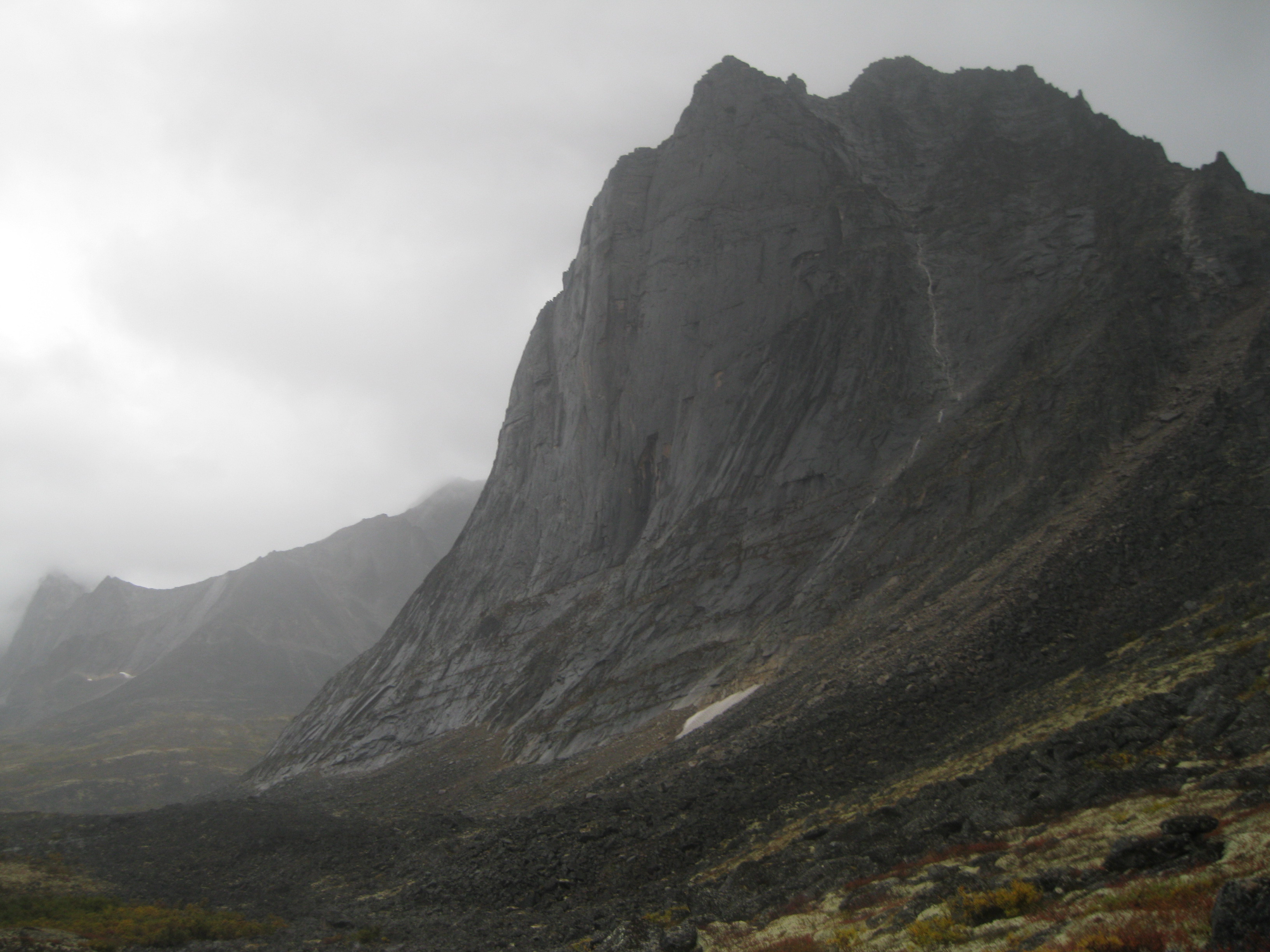
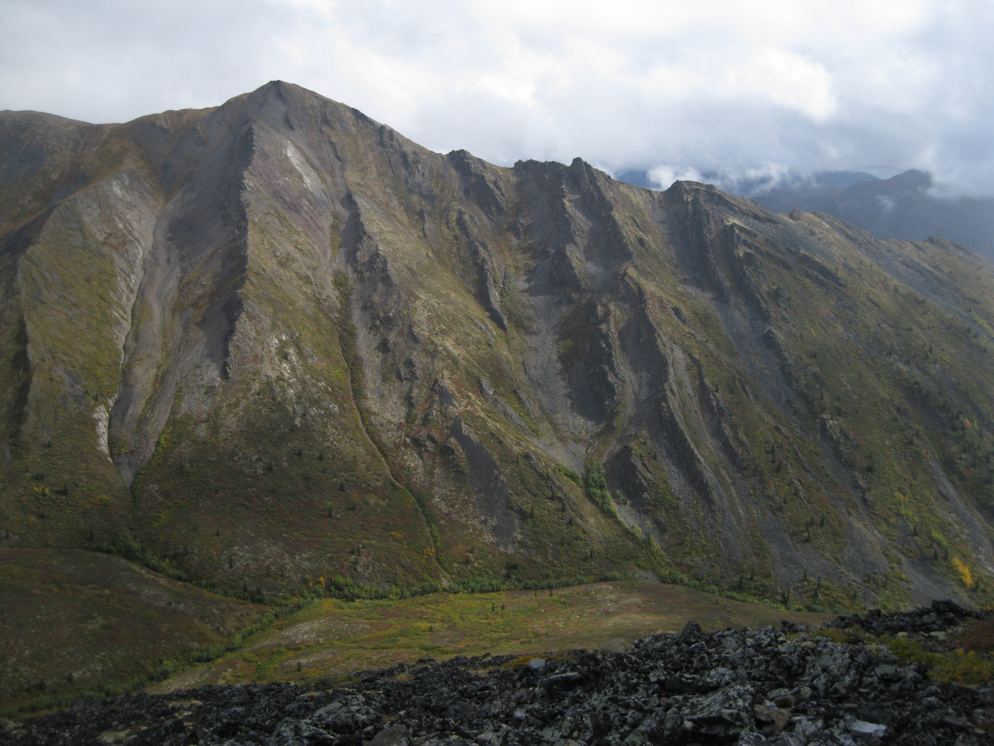
The park is bisected into belts of granitic and syenitic intrusions known as the Cretaceous Tombstone Suite. This belt goes from Fairbanks, Alaska to Ross River, Yukon and beyond. These intrusions created the massive vertical peaks which the park is known for.
The belt is responsible for the high mineral potential in the area and deposits related to the intrusion has resulted in massive mineral exploration over the past 100 years.
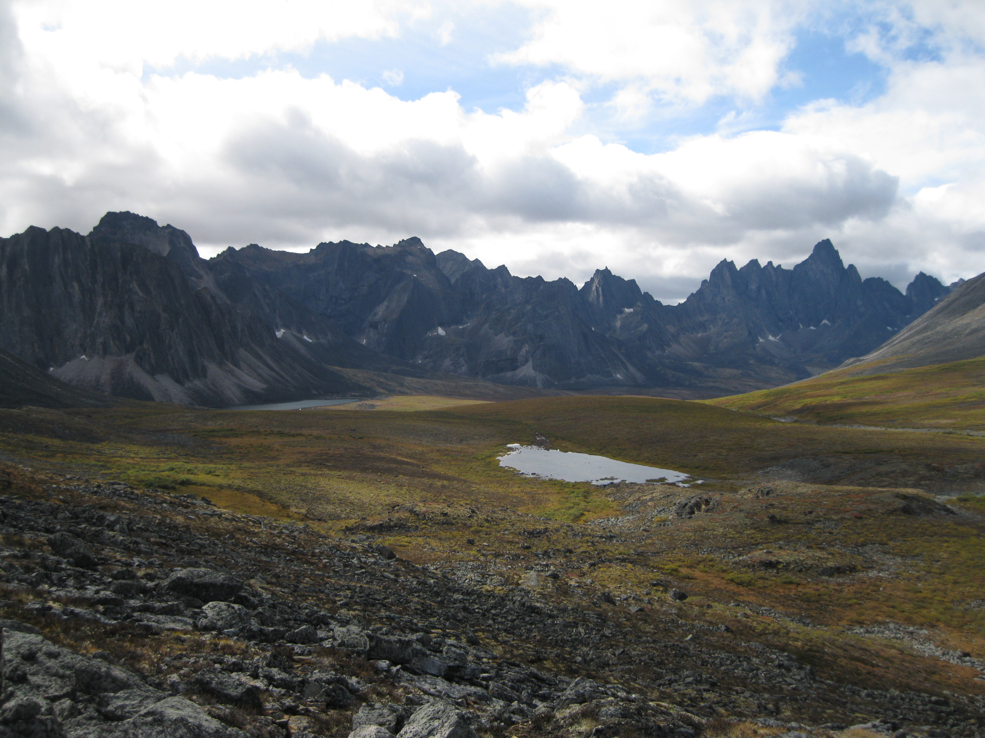
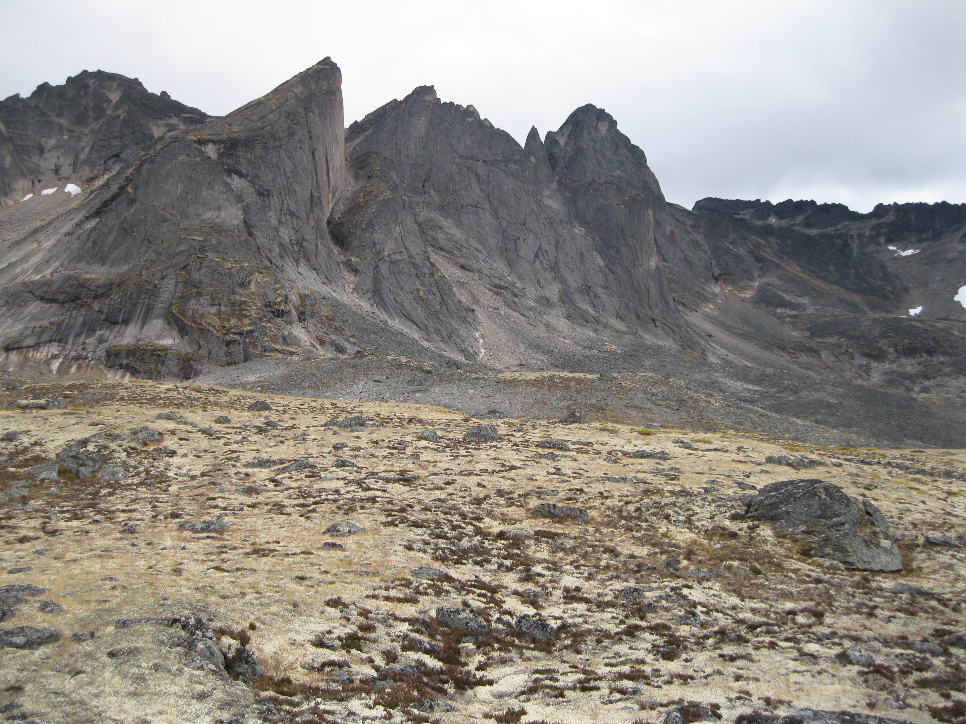
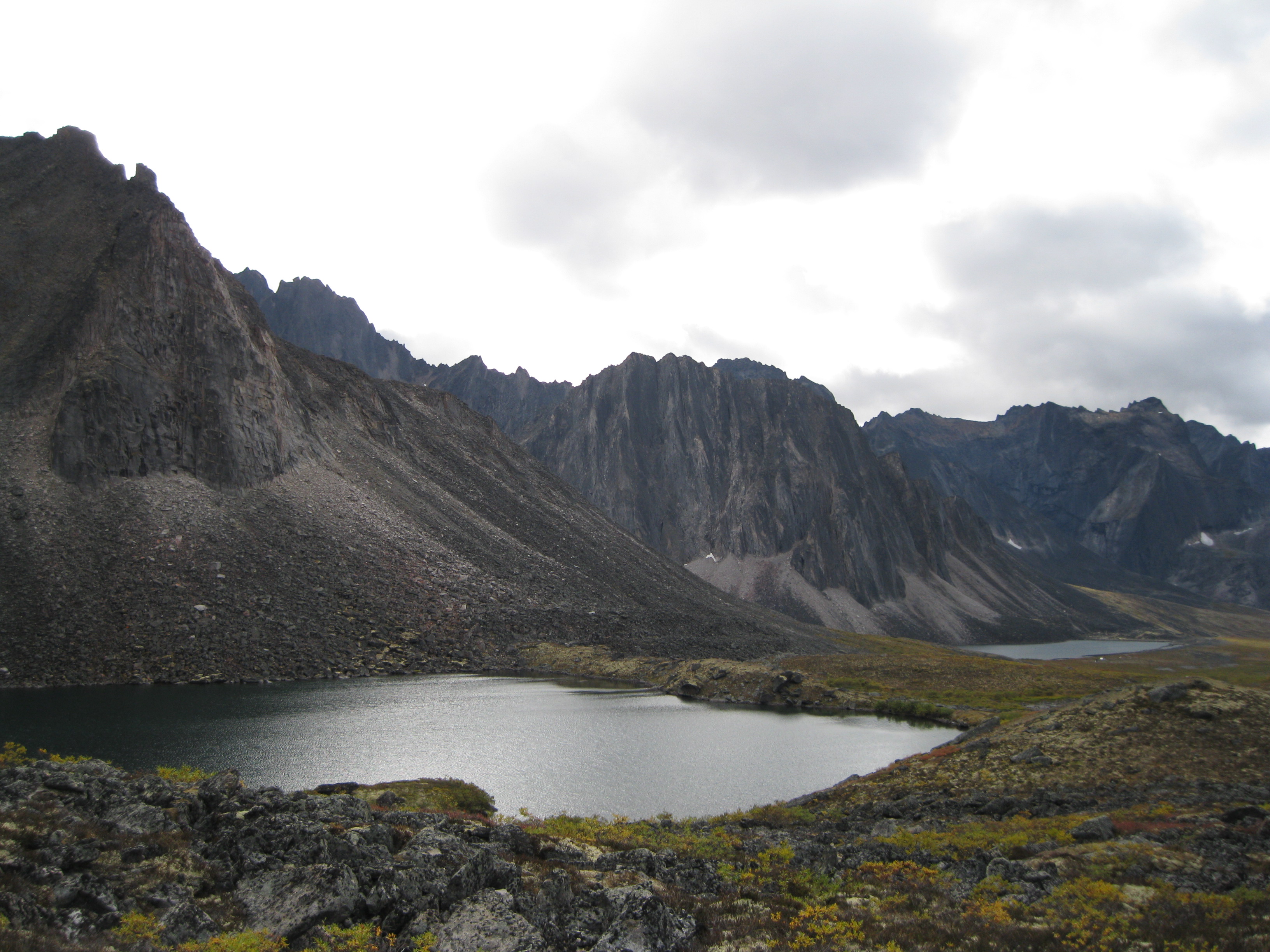
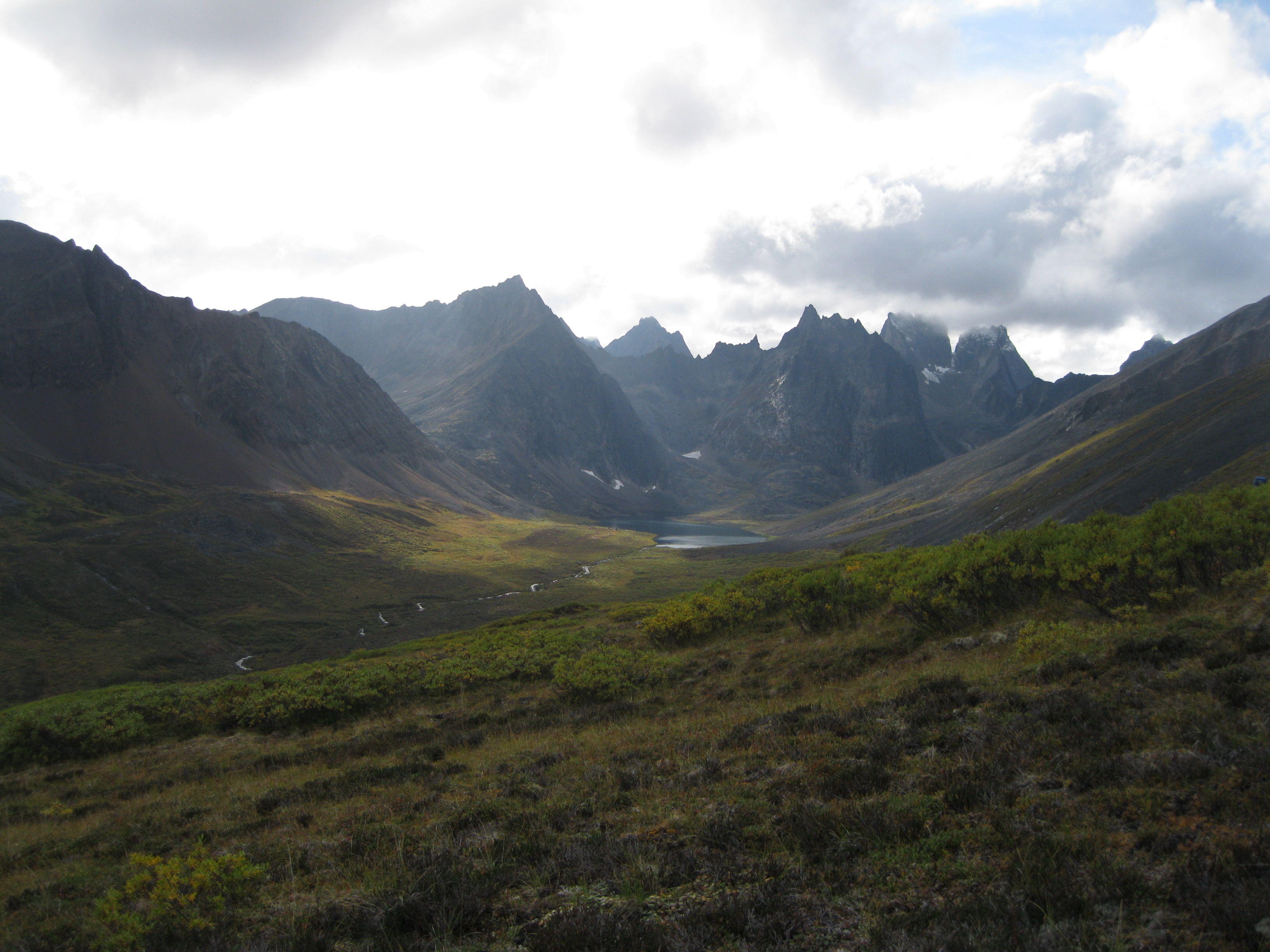
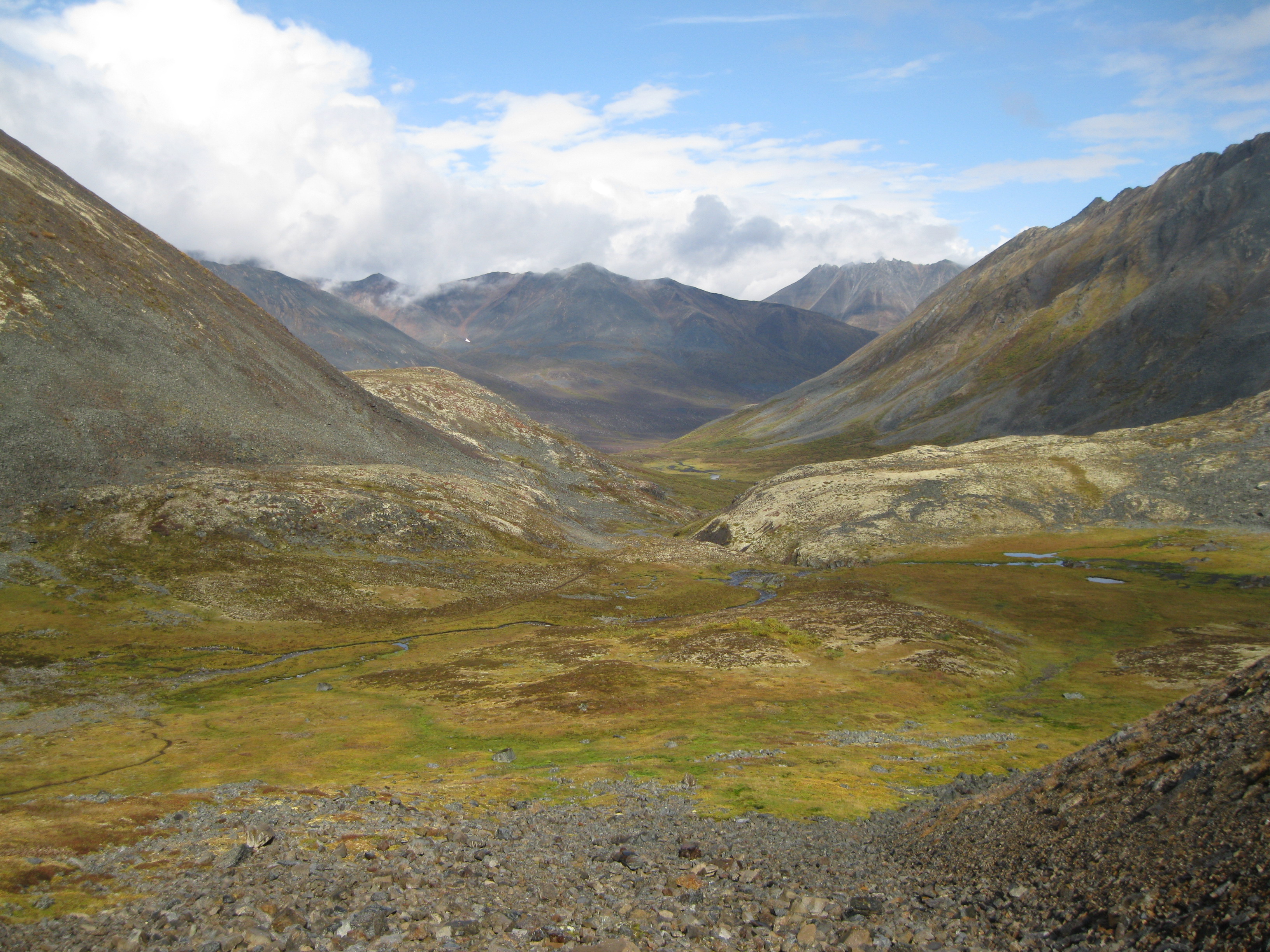
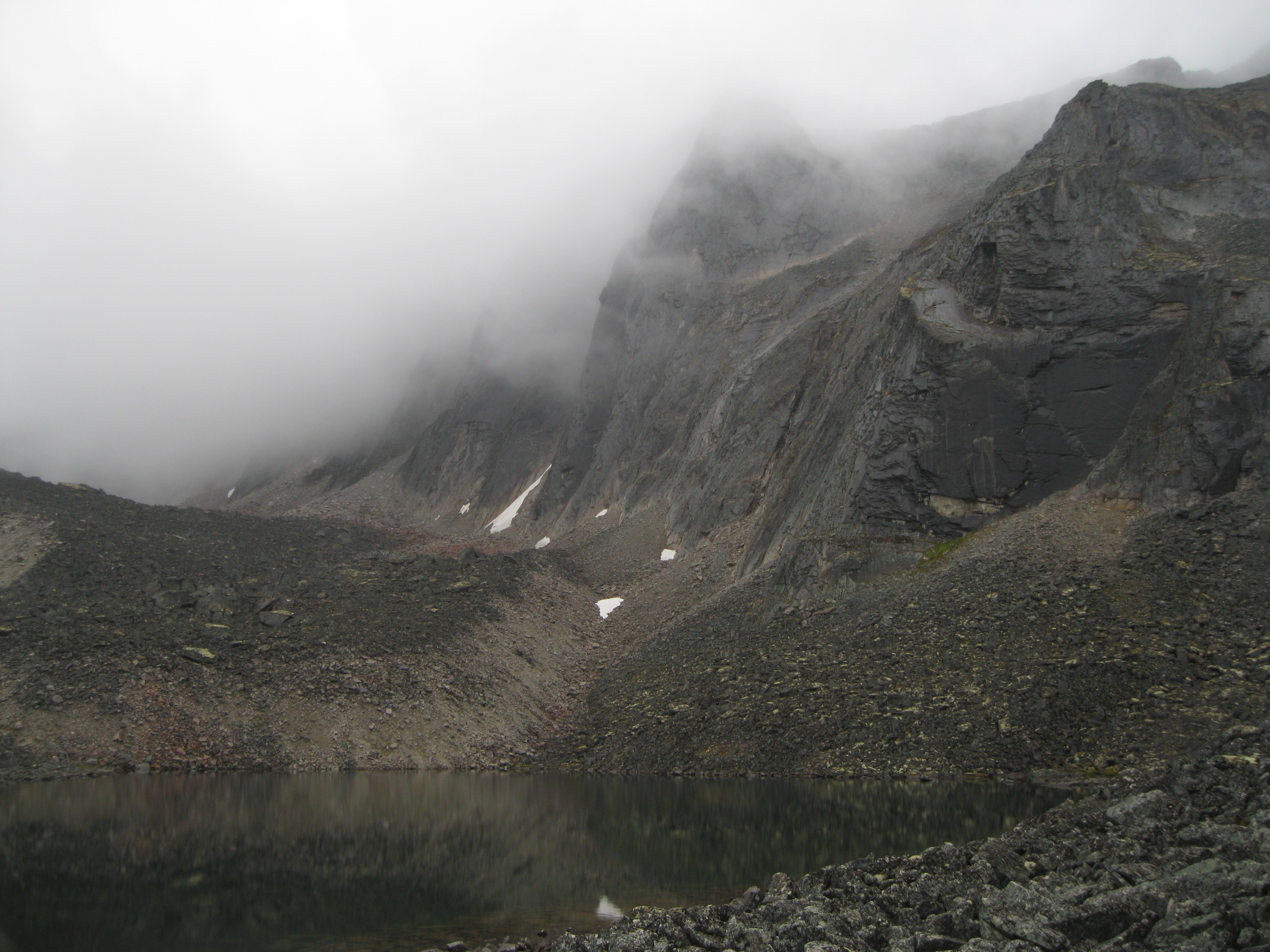
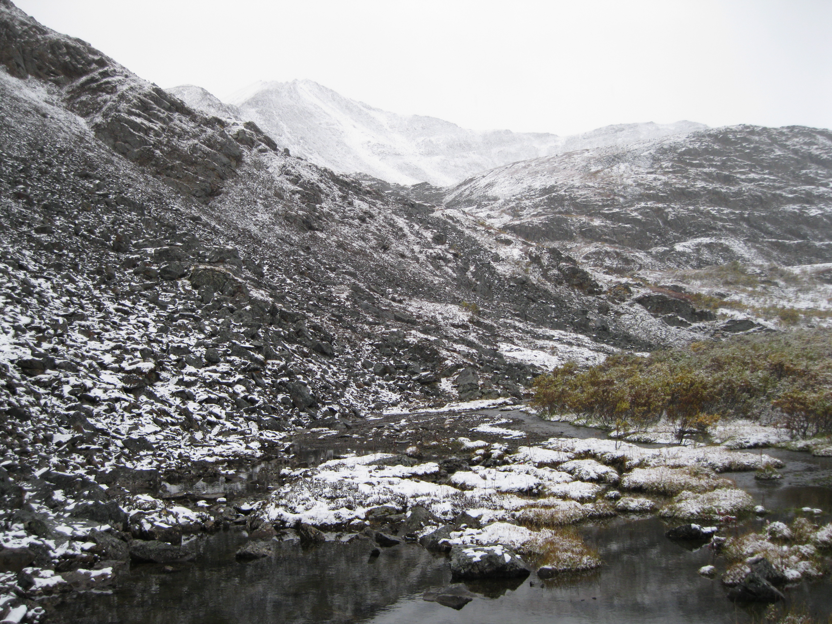
The area is significant in several ways. The spectacular features of the Tombstone and Cloudy ranges are a result of multiple alpine glaciations which have left behind tarns, moraines and cirques which are unprecedented anywhere else in Canada.
At the south end of the park the boreal forests follow the river valleys and the slopes are covered with tundra among amazing rock formations and peaks. At the north end the landscape is more arctic as it’s treeless, covered by tundra in a landscape dominated by permafrost.
The continental divide cuts the park into two watersheds. In the south the Klondike and Chandindu rivers feed the Yukon River watershed which flows into the Bering Sea. In the north the Hart and Blackstone rivers and its many creeks are a part of the Mackenzie watershed which flows into the Arctic Ocean.
The Wildlife & the Plant Life
The northern part of the park features tundra ecosystems similar to the low Artic which is typically appear several hundred kilometres further north.
There are different permafrost features throughout the park. Pingos are conical mounds with a core of ice that are formed by water freezing in a contained space that makes the ground expand upwards. They take decades to centuries to form, last about 1,000 years and can be up to 65 metres (213 ft) tall. Frost mounds or palsas are peaty ice-cored mounds that are only a few metres tall. They are typically found in bog areas.
Patterned ground or polygons are formed by cracks in the underlying frozen ground. Ice wedging breaks the ground surface into honeycomb patterns. Solifluction is a wavelike landform as a result of downslope movements of saturated earth and vegetation. Thermokarst is a depression of thawing of ground ice. Both thermokarst ponds and lakes are found as large as Chapman Lake.
There is a great variety of lifeforms in the park. There are Beringian plants, other plant species and insects which are found nowhere else on the planet. Beringia is a loosely defined area around the Bering Strait, the Chukchi Sea and the Bering Sea. You will also be able to find a lot of wild berries such as cranberries and crowberries which are quite tasty.
Caribou, mouse, Dall sheep, grizzly and black bears, wolves, marmots and more than 148 species of birds have been spotted in the park. Bears are pretty rare, but you have to be bear aware and bringing bear spray for your own protection is highly recommended.
History: The Natives
Humans have been present in the park for at least 8,000 years and the area has been an important cultural and hunting site among the native people. The presence of raw materials for stone tools and the vast amount of caribou and fish was attractive. The open tundra landscape made it easy to spot wildlife. In recent times Indian tribes such as the Han and the Tukudh have roamed the region

There are more than 78 archaeological sites that tell the stories of look-out sites and camps for hunters. Abandoned tent frames and graves are also present. You can have a look at these sites but please respect the historical and cultural significance and leave it untouched.
History: The Yukon Ditch
In the early 1900s water was the natural resource of interest in Tombstone. The Yukon Gold Company constructed the Yukon Ditch over a period of three years which was a system of pipes, flumes and trenches.
The materials used were local spruce, redwood from California and steel from Pittsburgh and Germany. It would transport water from the Little Twelve Mile and Tombstone Rivers to the Klondike Goldfields and by 1909 it was delivering 250,000 litres per minute almost 160 km (99.4 miles) away.
The water diverted from the rivers to the ditch also powered a hydro-electric plant producing more than 1,200 kilowatts of electricity a day. It’s been described as a 20th century technological marvel and has been compared to the Panama Canal. The operation of the ditch terminated in 1933.
Today a scar of the ditch is visible running down hill on the north side of the valley 9 km (5.6 miles) from Dawson City on the Klondike Highway. Most of the ditch is overgrown by vegetation and some was burnt during a forest fire in 1999. The main powerhouse on the Little Twelve Mile River can be accessed by a 20 minute helicopter ride from Dawson City.
The Dempster Highway
If you drive from Dawson City to the park you have to head towards the Dempster Highway which is 40 km (25 miles) away. You will have to go via the North Klondike Road for about 40 minutes then turn left onto the unpaved Dempster Highway for about another hour until you get to the Interpretive Centre in Tombstone Territorial Park which is about 74 km (46 miles) from the highway.
The Dempster Highway started as a winter road in the 1950s but by 1958 they started an all-season construction that was completed in 1979. The decision was made by the Canadian government when oil and gas exploration was booming on the McPherson Delta and the town of Inuvik in the Northwest Territories was being built. This is the only Canadian highway that crosses the Arctic Circle. When you get towards Tombstone Territorial Park it provides great views of nature and the surrounding wildlife.
The road has a gravel based surface. It was graded and gravel was put on followed by a layer of calcium chloride which keeps the dirt down and makes it packed. The action of vehicles driving across it binds it together. The highway sits upon a gravel strip which is between 1.2 metres (3.1 ft) to 2.4 metres (7.1 ft) thick. This insulates the permafrost in the soil underneath. Without this layer the permafrost would thaw and the road would sink into the ground. It’s well maintained as there are highway camps along the road. The length of the highway is 736 km (457 miles) and has a lot of beautiful scenery along the way. The part of the Dempster Highway that goes through Tombstone Territorial Park is from kilometre 50 to 120.
If you are going from or via Dawson City on to Dempster Highway it’s recommended to check out the road conditions at the Dawson City Visitor Centre. You have to be a careful when driving on the highway so a few precautions may ensure a safe trip.
There are a couple of things you should bear in mind when driving on the gravel road. When vehicles approach you, reduce the speed to minimise the dust. Avoid skidding and sliding by eliminating sudden braking and steering movement. Use the pullover bays provided when stopping along the highway.
Heading to the Park
A great time of year to visit the park is during the late summer like in August as the autumn colours are beginning to come out. Absolutely beautiful. It won’t be too cold at this time with temperatures probably around 5-15 degrees Celsius (41-59 degrees Fahrenheit).
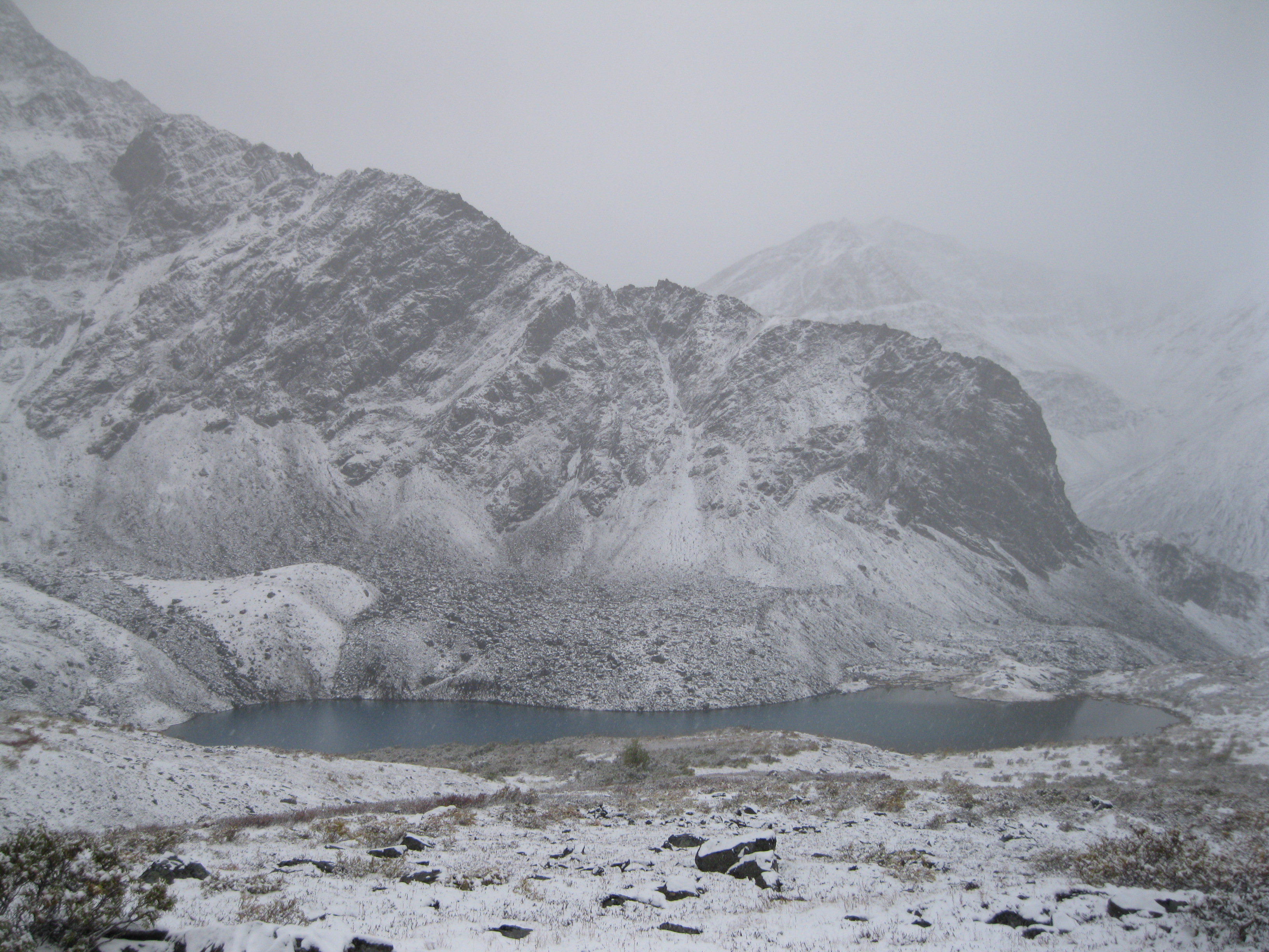
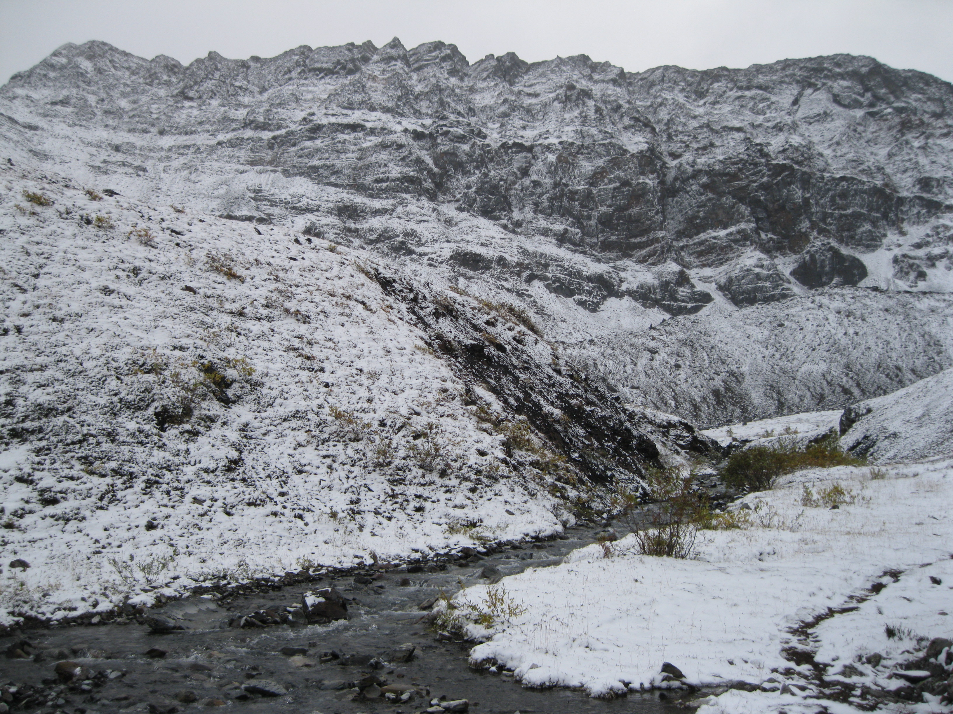
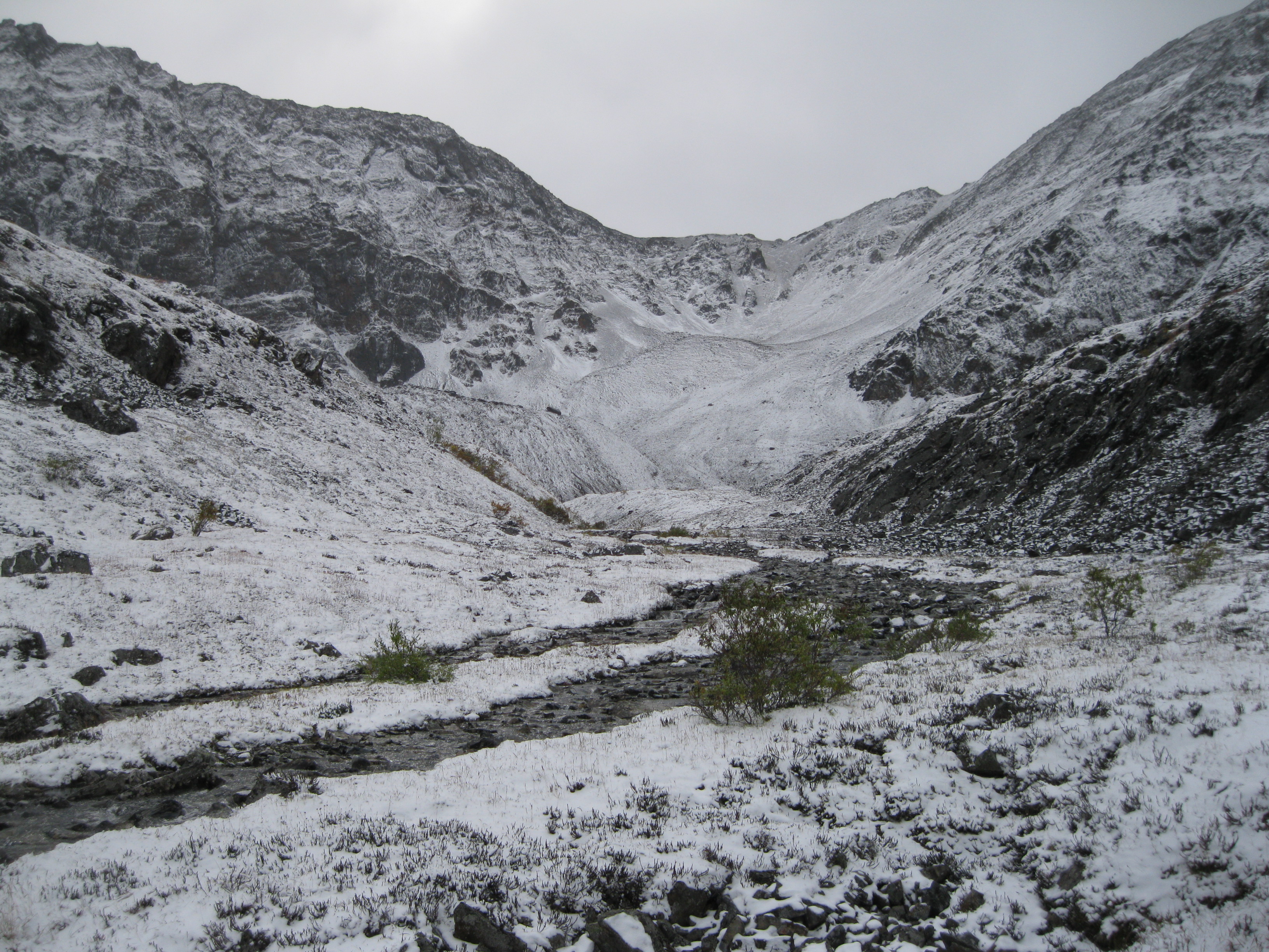
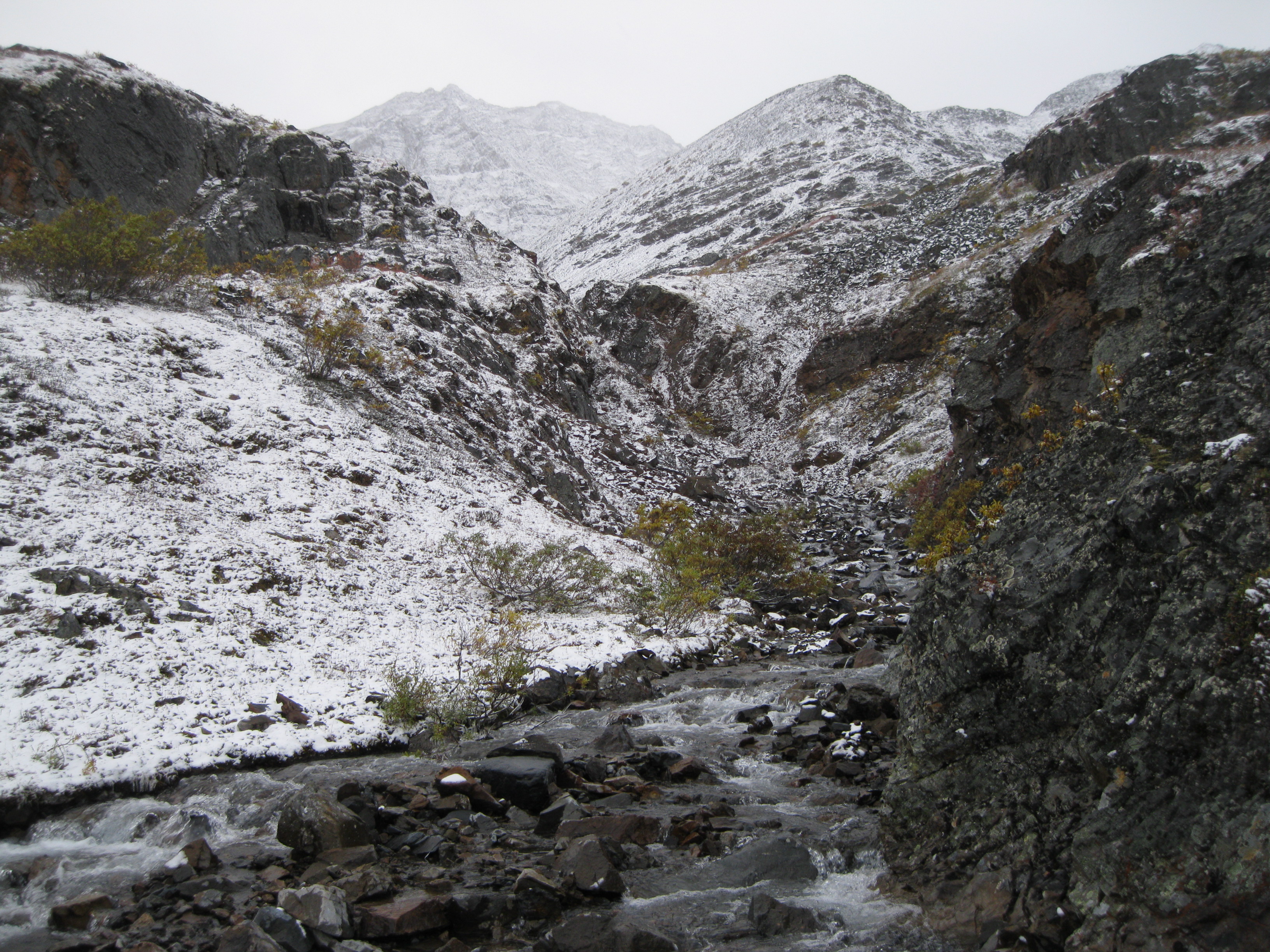
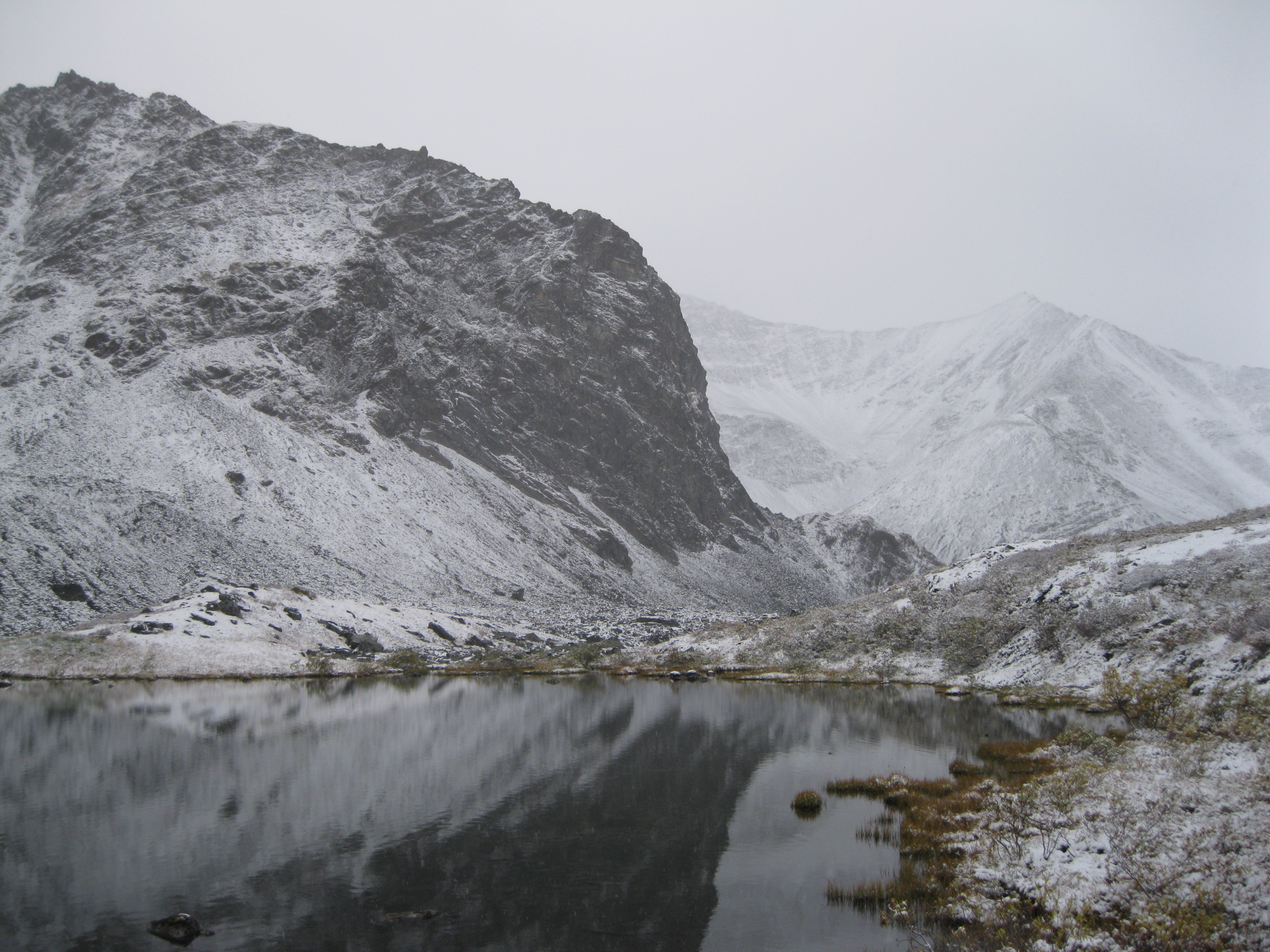
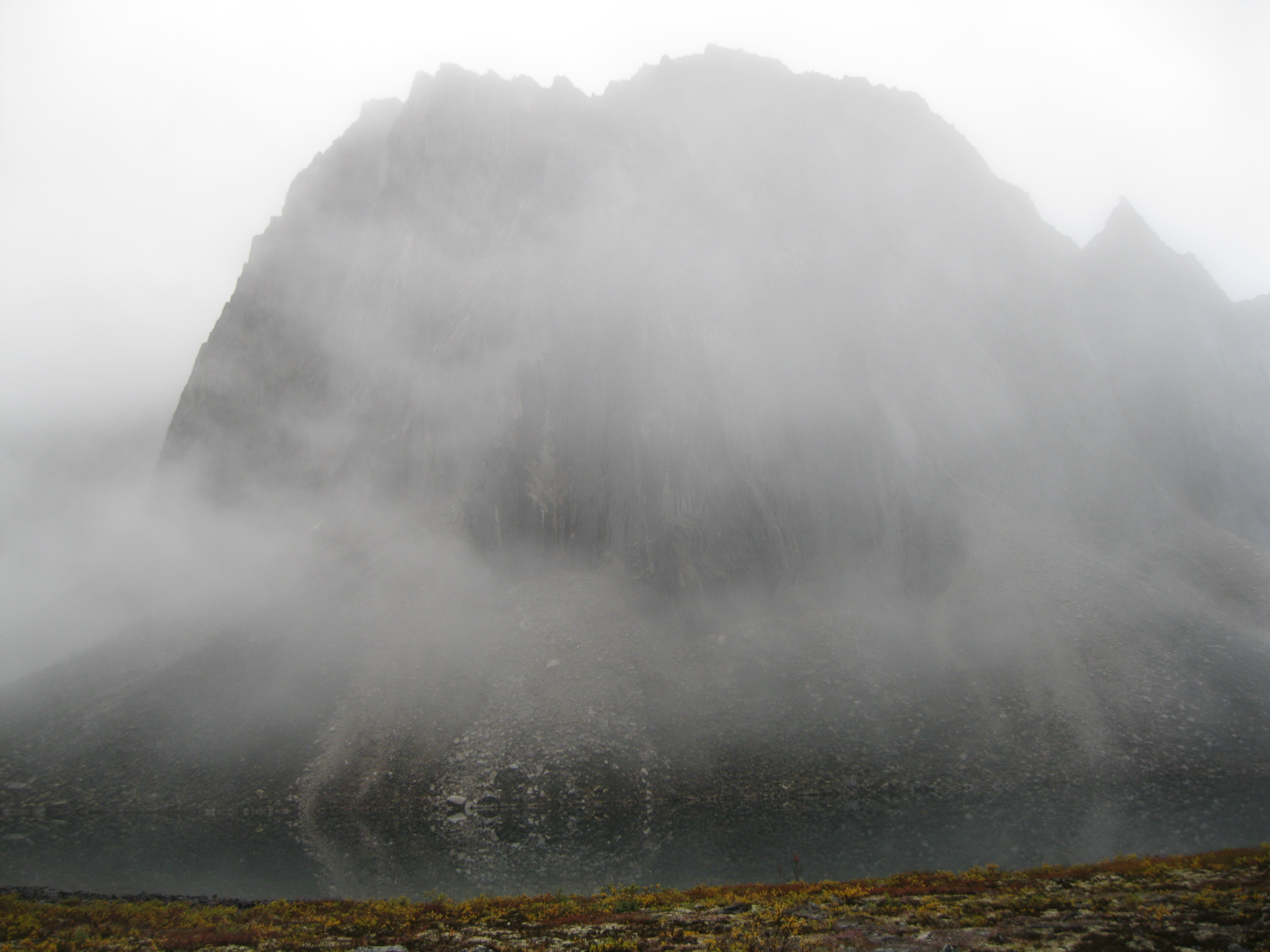
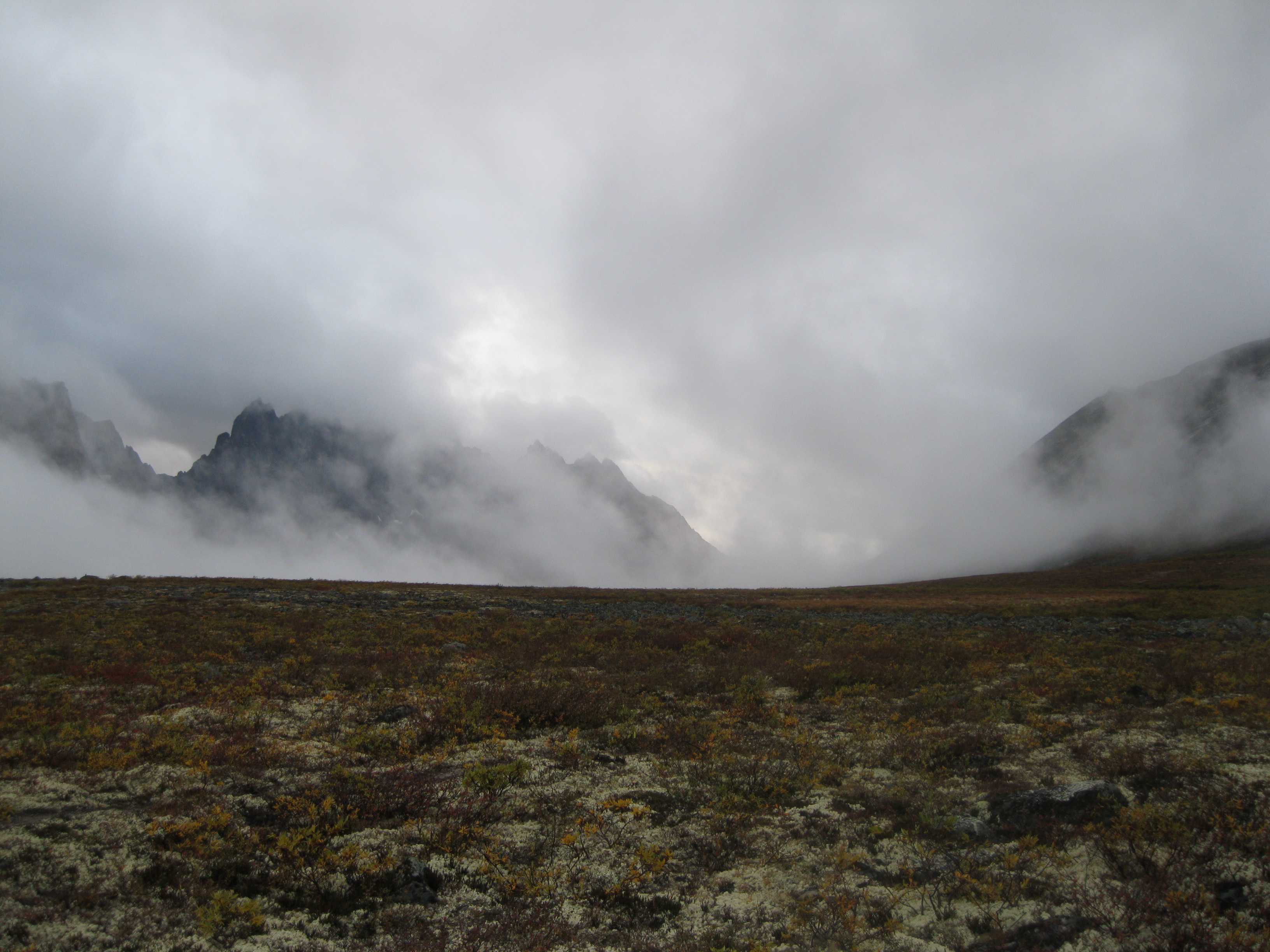
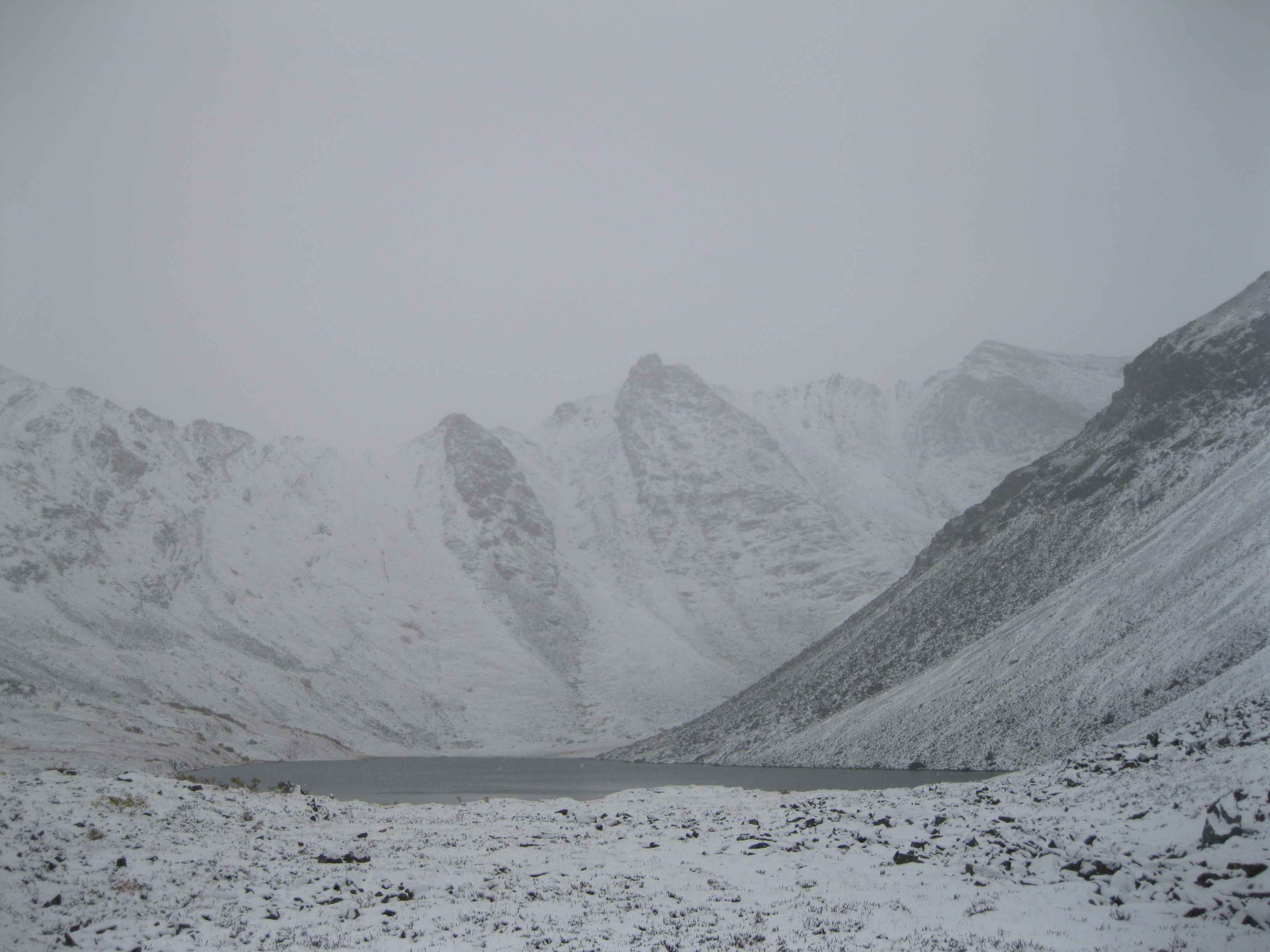
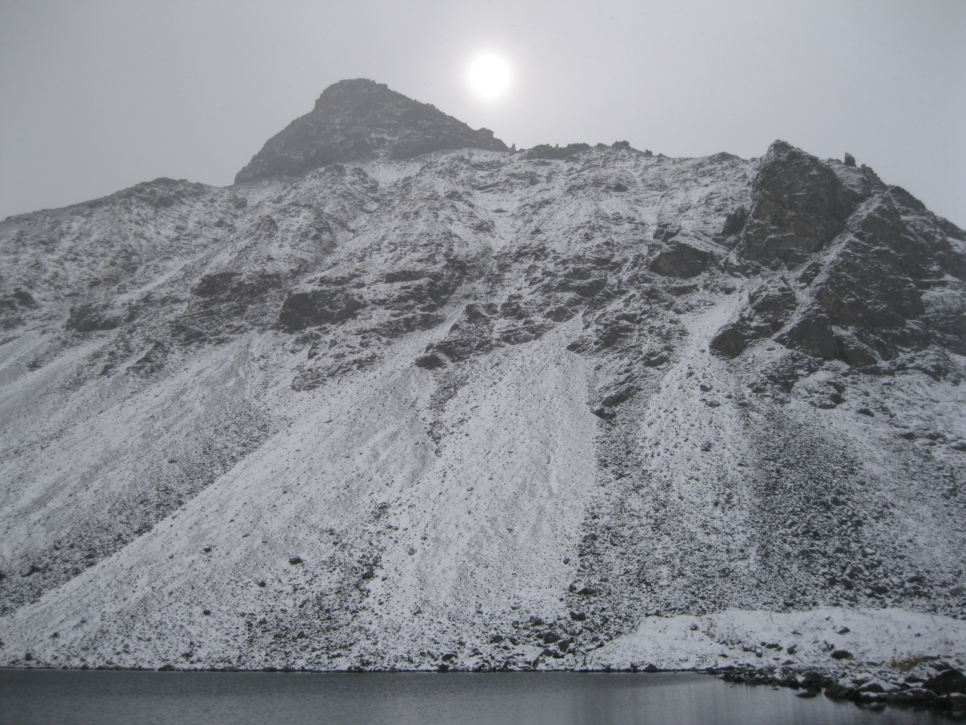
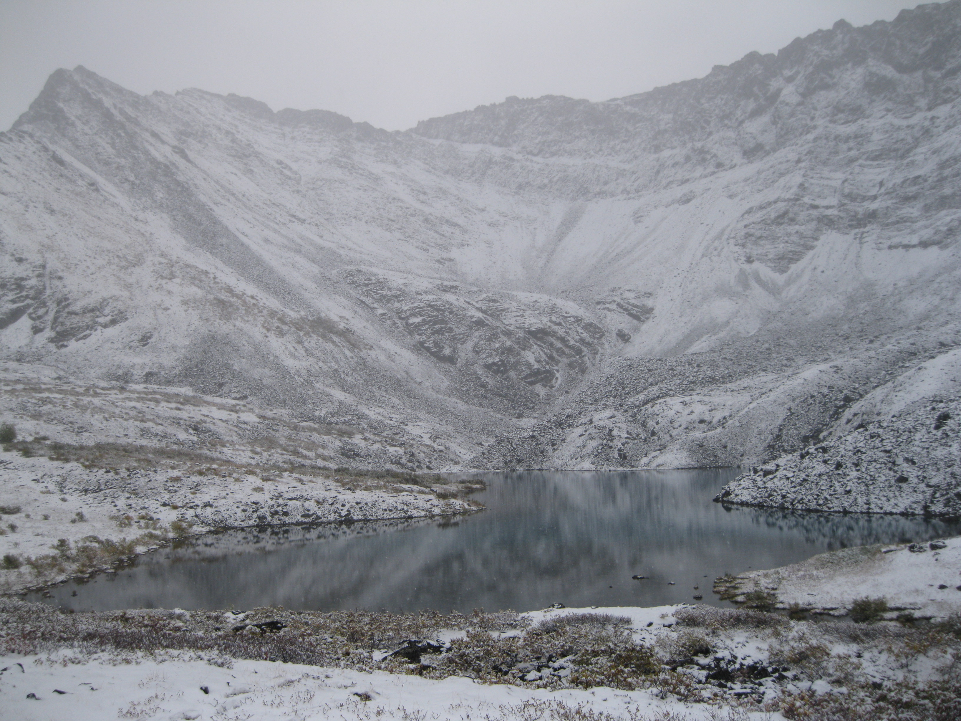
When going to Tombstone Territorial Park you never know what the weather is going to be like. It can be sunshine, rain or snow, obviously also depending on what time of year you are visiting. In any case see the glass as half full. Even though sunshine is better than rain, you may be able to get some awesome shots of the ranges in the mist. Snow is definitely better for hiking than rain and snow will create a different stunning view of the park.
Before heading into the backcountry you can camp at the Tombstone Mountain Campground at Charcoal Creek which is a nice spot. Camping tables with benches are available and you can have a campfire which is not allowed in the backcountry.
Before Camping – The Tombstone Interpretive Centre
The best way to experience the park is by backpacking all the way through. There are easier options, such as flying in to certain sections by helicopter, but if you really want to experience the real deal and have all the great views, backpacking is the way to go. First you have to check in at the Tombstone Interpretive Centre.
You may camp for free anywhere in the backcountry of the park. The only places where you have to get permits are at the Grizzly Lake, Divide Lake and Talus Lake campgrounds where facilities are available.
If you are travelling with an organised group all the permits will have been taken care of for you. In case you are travelling by yourself these permits can be purchased online at Yukon Parks, at the Dawson park office or at the Tombstone Interpretive Centre. At the latter you can get information on hiking in the backcountry and updates on wildlife activity. This is also where you will get your backcountry orientation in connection with your visit. The centre opens in mid-May to 31 May for the weekends and from 1 June until September it is open daily.
Furthermore you can get the most up to date park information and programming schedules as they may have some interesting events such as presentations, workshops or entertainment. You will find different displays where you can learn about different aspects of the park such as the history, geology, geography, wildlife and the partnership between the natives, Yukon Parks and the territorial government.
There are a number of different ways of exploring the park. Several trailheads are available where you can do short days hikes if you fancy that and by backpacking trips through the Grizzly Lake Trail.
Packing Tips for the Big Hikes
When you go on long backpacking trips into the backcountry you have to carry everything yourself and what you bring in you bring back. This includes your rubbish. You only leave footprints and your waste in the outhouses. Travel as light as possible. People tend to over-pack on toiletries and under-pack on clothes.
If you are hiking as a group of people for 4-9 days or so, everybody is going to stink as there are no facilities for washing. But really, it actually won’t be that bad. You’ll be surprised. You can’t take a shower or wash properly and if you are a guy don’t worry about shaving. Therefore don’t bring your shaving cream, shampoo, soap or deodorant. If you feel you have to bring any of these items, bring as little as possible as it will take up space and will add to the weight. If you do make sure it’s biodegradable. But really all you need to bring is a toothbrush and toothpaste.
As for clothes, don’t bring too much, but bring enough. What exactly does that mean? Bring a pair of undies for each day, about 4 pair of sweat absorbent hiking socks, two sweat absorbent tops, two pair of pants, a beanie, gloves, rain clothes, a pair on thermals or long undies and several layers. This is plenty. If you are struggling with the weight, the pair of pair of pants you are wearing should be enough and you may not need undies for each day.
This is based on going for 9 days. Bear in mind, the amount of layers depend of how easily cold you get. If you are going during summer/late summer and you tend not to get too cold, it would be recommended to bring four layers. Don’t bring any cotton, but only synthetic clothes. Don’t bring any shorts either.
Hiking poles are absolutely essential. They are very helpful when you are carrying a heavy backpack especially when going uphill or downhill. It is very important in a place like Tombstone Territorial Park as you will be crossing loads of slippery boulders. The poles are a great support to keep your balance and to distribute the weight around as well.
A good pair of hiking boots with ankle support are very important part of your equipment and a pair of light shoes such as sneakers to wear around the camping areas. Another necessity is to make sure that your backpack is strapped on correctly when you start hiking. This is essential because it can make a big difference on the strain on your body especially after you have walked for several hours. If it’s not placed right it will hurt in your shoulders and back big time after a long day.
If you are with a tour group make sure you discuss this with the tour leader before you heading off and take their advice as they will know what to do. Basically the bottom strap should be placed above your hips and rest on the hips so the weight does not strain on your shoulders.
Remember bring snacks to have along the way such as lollies or granola bars as it will boost your energy. Also bear in mind that you have to drink plenty of water as well even though it may be a bit chilly and you don’t necessarily feel like drinking water.
The Campsites
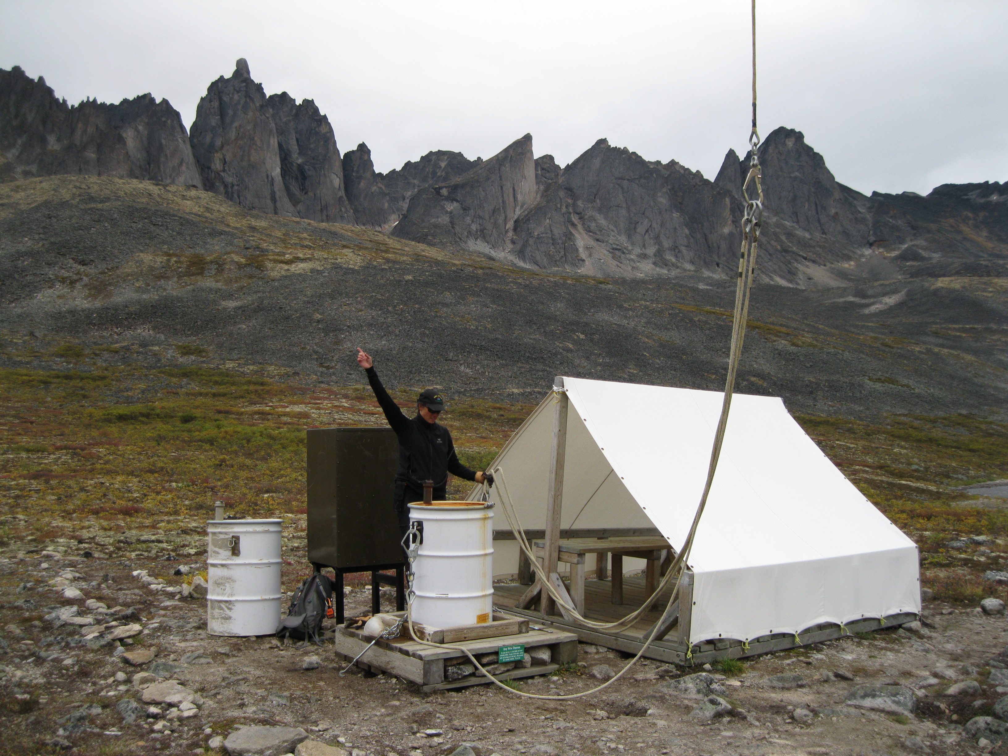
The campsites are really basic. They have shelters which are basically a tarp covering a wooden table on a wooden floor and that’s pretty much it. At the Interpretive Centre you will be given a bear proof barrels for your food, meaning that they are sealed off so bears cannot smell the content. They are simply referred to as bear barrels and you have to carry in your backpack as well. You can use them as chairs at the campsites as there won’t be chairs. Not having a chair and a proper backrest can be a bit hard during the evenings but you will learn to deal with it.
At Grizzly Lake there are two shelters but at Divide Lake and Talus Lake there is only one. You will find paths at the campsites made of some sort of plastic material so it’s not too slippery or muddy. It’s a kind of a mud grill which is known as a duckboard. Pretty useful as it can tend to be a bit muddy at the campsites.
Several sleeping platforms/tent pads are available on which you can place your tent. Remember if it is raining that you place the tent in an angle to avoid getting drenched at the bottom of the tent. At Grizzly Lake the platforms are made of plastic like a grill which is good as the rain can run through. At Divide Lake and Talus Lake the platforms are wooden.
Hiking in Tombstone Territorial Park
The hikes in Tombstone Territorial Park can be categorised as intermediate. It’s not too difficult walking around in general, but as mentioned previously the hardest part is not so much the weight of the backpack itself, it’s more the strain on your shoulders, especially after you have hiked around for about five hours in a day.
Some areas can be a bit challenging like when you are crossing large boulder fields where you have to negotiate through massive potentially slippery boulders. There are some marked trails but a lot aren’t. So be careful. Just remember that you are responsible for your own safety. The park is a remote area and the weather can change drastically. Respect your fellow travellers and people you meet along the way.
Going with an organised group or going with a group of friends are good options. If doing the latter it would be recommended that some of you have camping and backpacking experience.
A great itinerary is going to Grizzly Lake via the Grizzly Lake Trail. Then onwards to Divide Lake and Talus Lake and return to the same trailhead by camping at Axeman Creek. More details will follow in descriptions below.
From the Grizzly Lake Trailhead to Grizzly Lake
The distance from the Grizzly Lake Trailhead to Grizzly Lake is about 11 km (6.8 miles). The Grizzly Lake Trail starts with no mentionable elevation where you will be walking through forest following the Cairns Creek. This is a nice way of easing you into the day. After a while very steep elevation will occur. You will be heading uphill for about 800 metres (2,625 ft) and you’ll enter an area covered with shrubs. The trail is really well marked, isn’t too rocky and steps have been constructed at really steep sections to assist you.
The further you elevate on the trail the better the views. The scenery consists of rolling hills, bushes and trees. The hike uphill is not too strenuous but do take your time as it’s the elevation will start to pick up fast. Also bear in mind that you do have a long day a head with a heavy backpack strapped on your shoulders. The further you get up on the hill you will start to encounter some rocky talus slopes and it will get a bit steep and challenging. You will be at a point where the trail heads out of the forest and you won’t see any forest for the remainder of the whole hiking tour.
Around half way as you will be on top of a ridge and at a fantastic view point where you’ll have a view of Grizzly Valley and the first look at Mount Monolith. This is a great spot for a snack and a breather. You will have some great views from up here. It may be raining to one side of the ridge and sunshine to the other side. Who knows, but it will be awesome! You still have a bit to go until you are on top of the hill, so head on. It’s a bit of a climb but you will have great scenery all the way and when you get to the top the vistas will be even more impressive. You will continue along the ridge with beautiful views all around you.
The view of Grizzly Valley and the different mountain peaks are stunning. There is a bit diversity at this point. If could be all misty to one side, blue skies to the other and maybe you will just spot a rainbow. This is a great spot for lunch, a backrest and a chill. There are plenty of opportunities to take great photos up here.
As you continue onwards from this point it will alternately go uphill and downhill. The hike is not too bad, just take your time. Notice the beautiful vegetation as you head on. Along the way you will be walking through boulder fields and beautiful meadows with amazing views of stunning rock formations and mountain peaks. A lot of peaks don’t have any names, so you can be creative and make up your own.
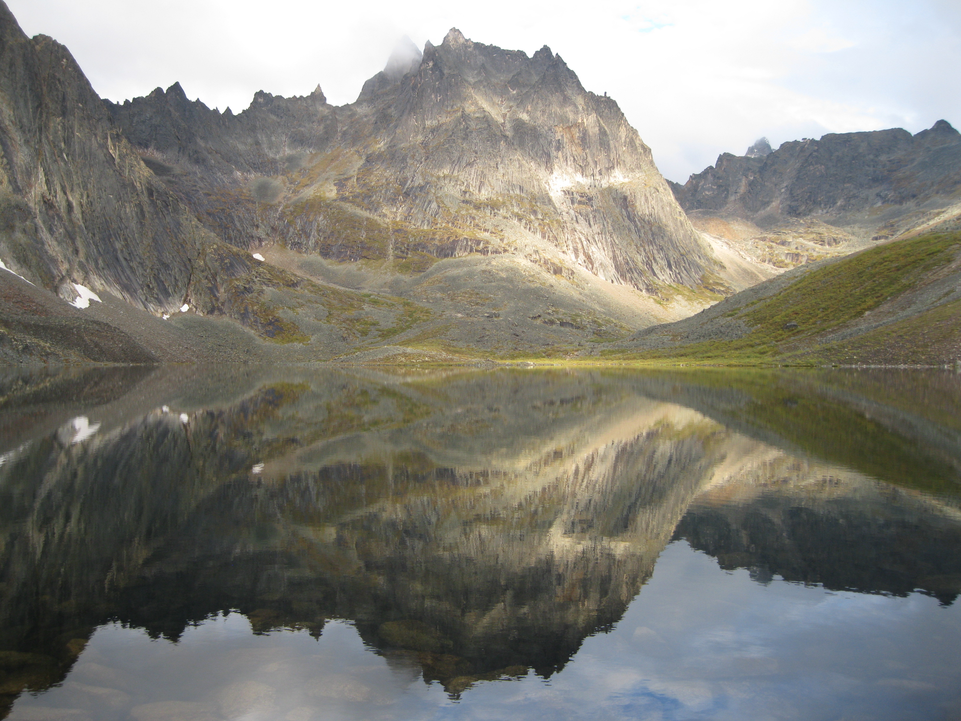
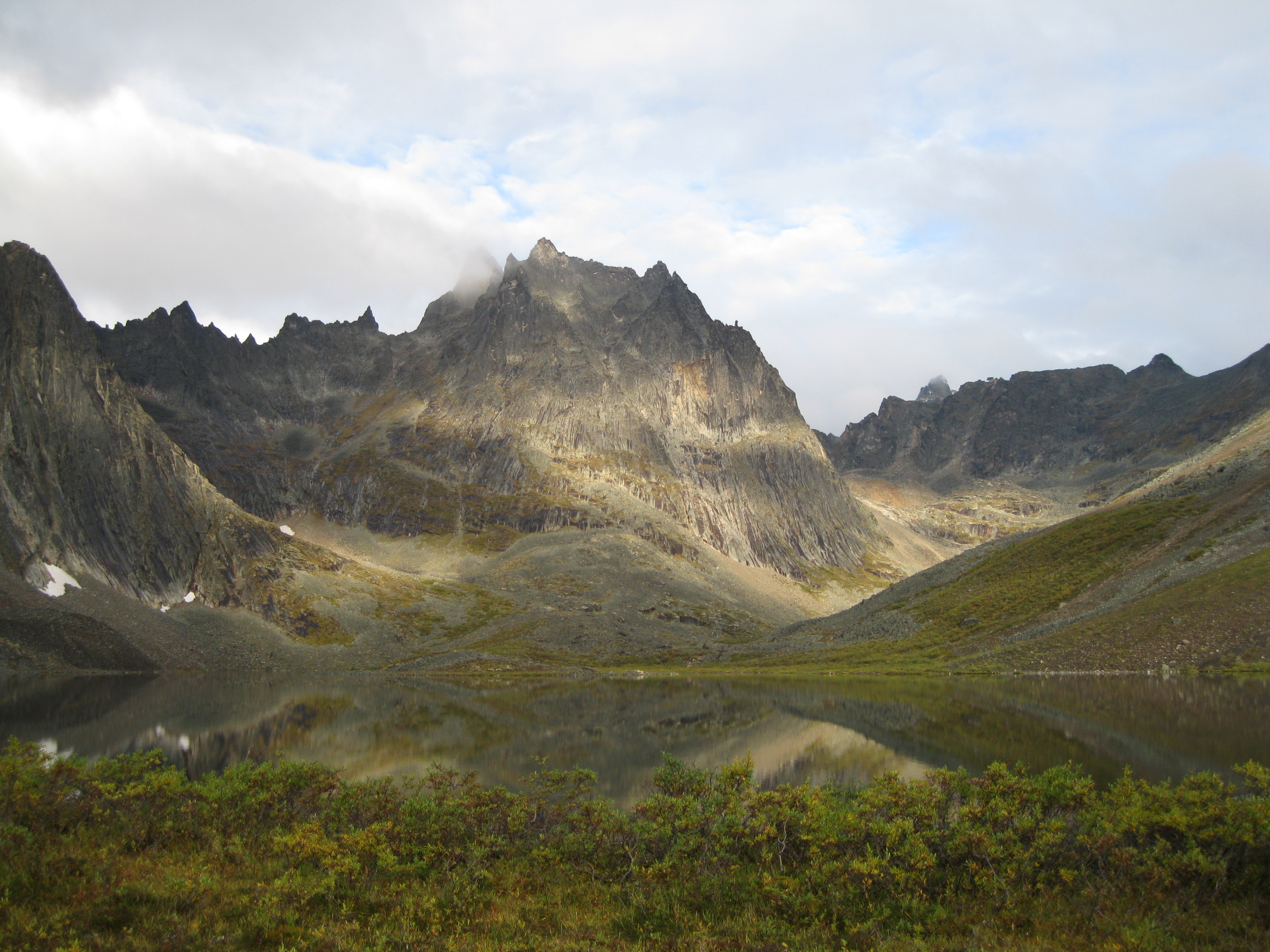
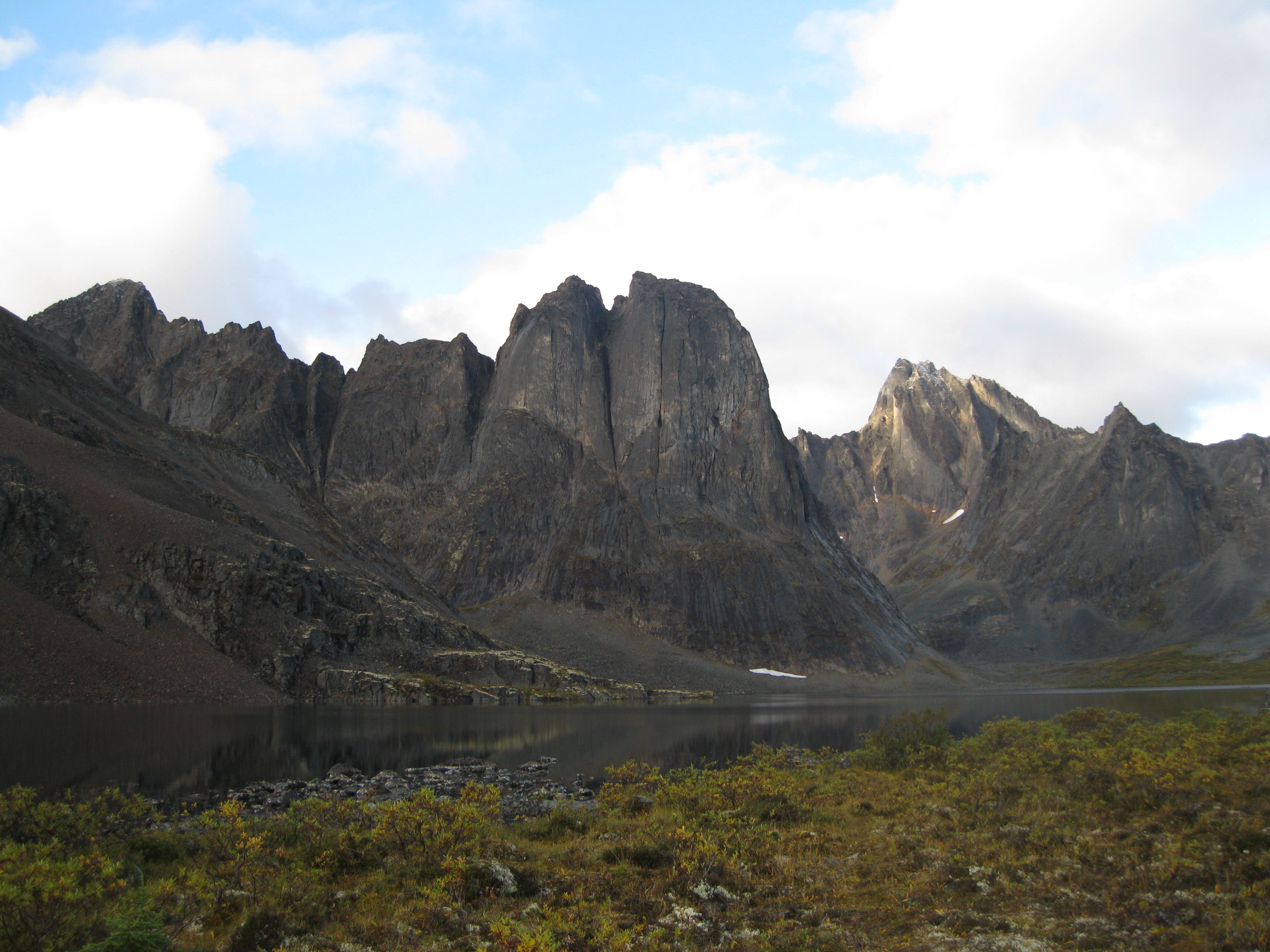
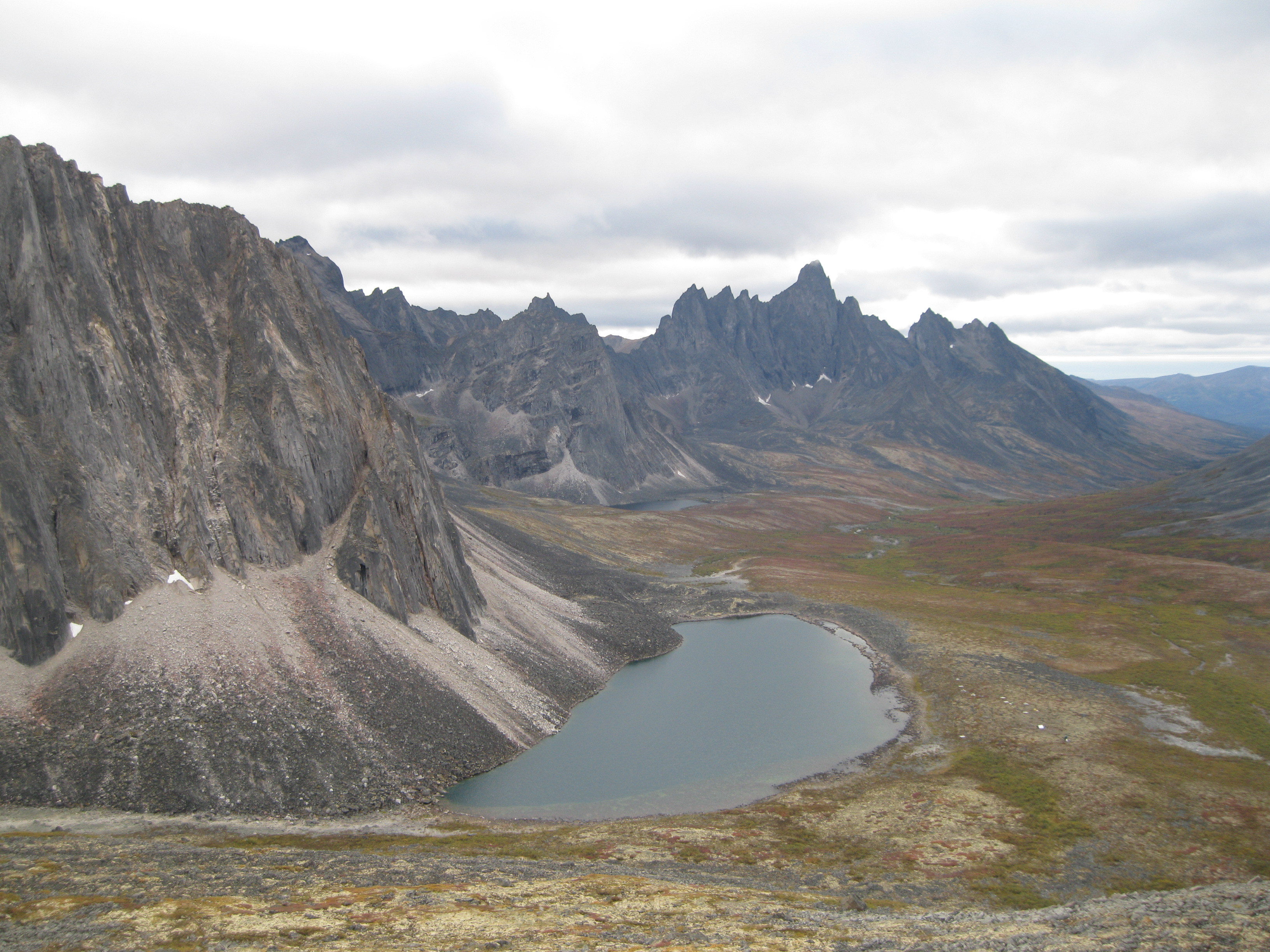
Then you will get to the point where you will have your first glimpse of the beautiful Grizzly Lake with Mount Monolith as the backdrop. Absolutely stunning. Take you time to enjoy the view and take some photos. Bear in mind that even though it looks like you are close to Grizzly Lake, you are not. You have a fair way to go. This is the time where you have to dig in deep. Because you have already walked for several hours, you are beginning to get a bit tired mainly due to the strain on your shoulders and you have to cross some major challenging boulder fields as well.

You will be continuing downhill and you the view of Grizzly Lake will get closer. Take your time to take some photos along the way. Remember to look back to where you came from as that is a awesome view as well. You will be going down rocky talus slopes and there are several massive boulder fields on the way. This is where the hiking poles really become handy when crossing the boulders.
As you get into the valley look back away from Grizzly Lake check out the stunning view and head on. The last little challenge before reaching the destination is crossing a small creek and then you will be at the Grizzly Lake campsite.
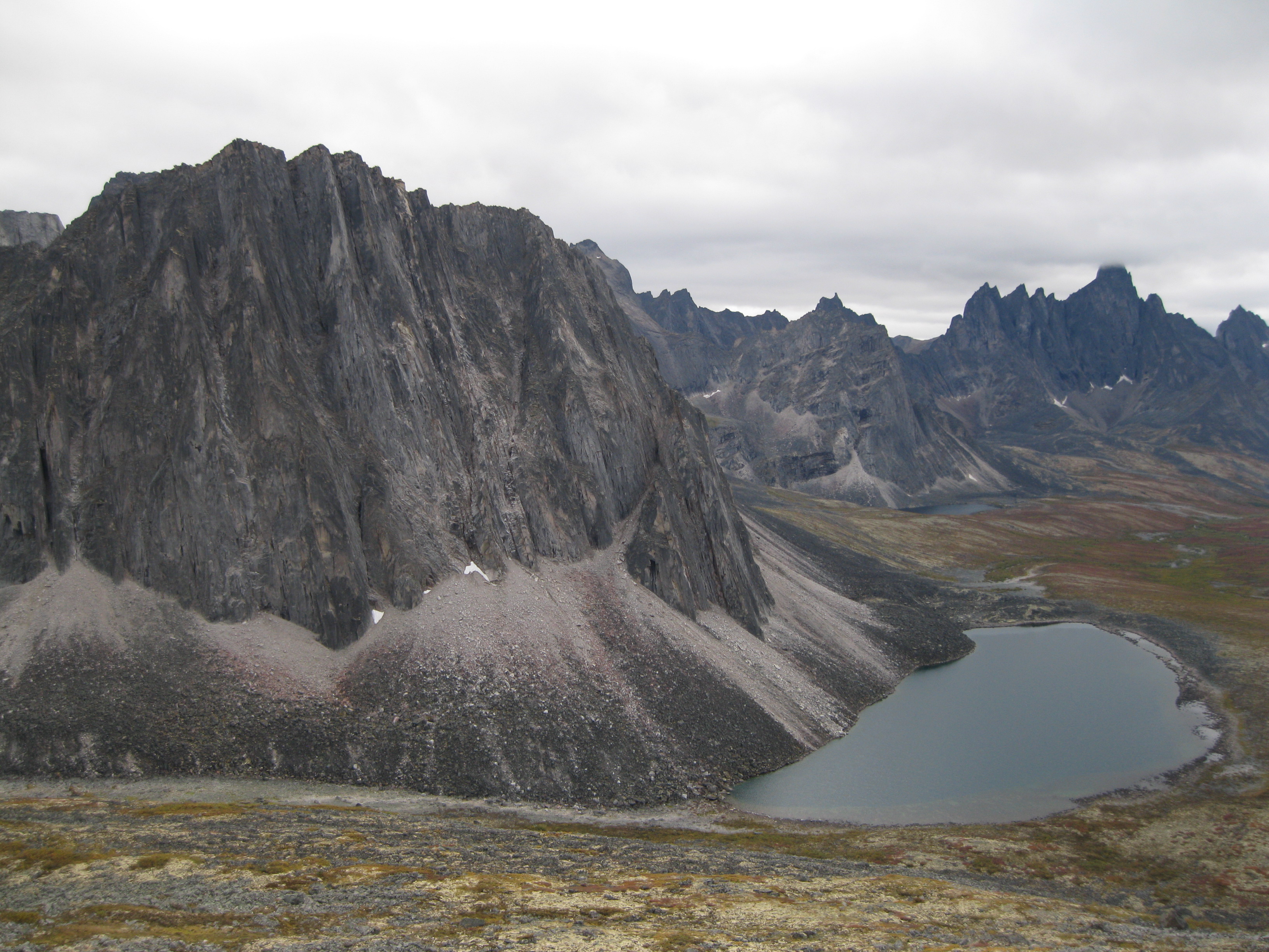
Grizzly Lake
Once you’ve reached the campsite at Grizzly Lake you will have the amazing view of Mount Monolith as the backdrop. This makes it all worth the long strenuous walk. Set up your tent, slip into your more comfortable shoes and walk down to the shelters and prepare your dinner. As this is a popular campsite there are two shelters which are based close to the lake.
From here it is just a short walk down to the shore where you can take some cool pictures of the lake and Mount Monolith. Jump between the rocks to get further into the lake. Hopefully the water will be still so you’ll have the perfect reflection of the mountain in the lake which will be the perfect photo opportunity. Another great shot is of Mount Monolith, the lake and the rocky shores in the foreground. It could also be a picture with the shrubs in the foreground instead of the rocks. You can mess around with the lighting and the colour of the sky or clouds and so on. Walk around the shore and play around with different motifs. Great fun.
The atmosphere at the shelters is really cool where you will most likely meet other travellers spending the night. There won’t many people so you don’t get the feeling of the place being too crowded. There is a maximum capacity at the site which is great.
There are plenty of cheeky ground squirrels at the campsite. They are so used to humans that they will be all over the place, especially at the cooking shelter but they can also be around your tents. The latter is not a bit issue though. They are a bit of a pain around the cooking area so just be aware as they may suddenly be sneaking around your food. They like the salt from your sweaty gear. Therefore keep as much of your equipment in your tent or behind the vestibule of the tent. They can actually chew a hole in you backpack.
There are three outhouses, bear lockers and a barrel for so-called grey water at the site. Grey water is “used water” such as the water you have used to brush your teeth. It is very important that you use these barrels to dispose your spit after brushing your teeth as the smell from the tooth paste attracts the bears.
If you walk down to the beginning of the campsite in the opposite direction of the shelter you will have a magnificent view of the valley which is also a fantastic photo opportunity. If you continue a bit down towards the creek you crossed earlier you can get a shot of the lake and Mount Monolith from a different angle which is cool.
The following morning the view of surroundings may just be different due to a change in weather. You may just have a different awesome lighting on the mountain peaks or the perfect reflection in the lake. Have a stroll around the lake and the campsite and check out the views. If you approach the mountains to the left of the campsite you will have great views of the peaks as well. There are loads of opportunities to enjoy this stellar location.
Grizzly Lake to Divide Lake
The distance from Grizzly Lake to Divide Lake is 6 km (3.7 miles). Initially you have to cross the same creek as you crossed when you arrived at Grizzly Lake. You will have a great view of the valley as you head on towards Glissade Pass which will the big challenge of the day. When you cross the creek take you time to enjoy the view of Mount Monolith and take some shots of the creek with Mount Monolith as the backdrop or the creek against the valley. You will probably have to do a bit of rock jumping to get a cross the creek. It really depends on the level of the creek but it shouldn’t be too deep.

As you’ve crossed the creek you will get to the foot of the ascent of Glissade Pass which is not too far from the campground. You will start climbing the pass which has an elevation of about 300 metres (984 feet) over a distance of 1 km (0.6 miles). It’s a pretty steep slope and depending on your fitness and the weather it can be pretty strenuous, but if you are in pretty good shape it’s not too bad. If you are going as a group just focus on following the person in front of you, don’t think too much on how far you have walked, how far you have left.
Do remember to check out the view of Grizzly Lake and Mount Monolith as you will have fantastic views of the lake at the mountain peaks fronted by the rocky talus landscape. There will be plenty of photo opportunities. To the other side you will have a great vista of Grizzly Valley as well. Awesome. The further you get up the hill the more spectacular the views will be so do take you time to take it all in.
When you get to the top of the pass, the view of Grizzly Valley, Grizzly Lake and Mount Monolith on one side will be amazing. On the other side you are looking down a small valley where Glissade Pass continues with the North Klondike River Valley at the very end to where you are heading. Absolutely spectacular.
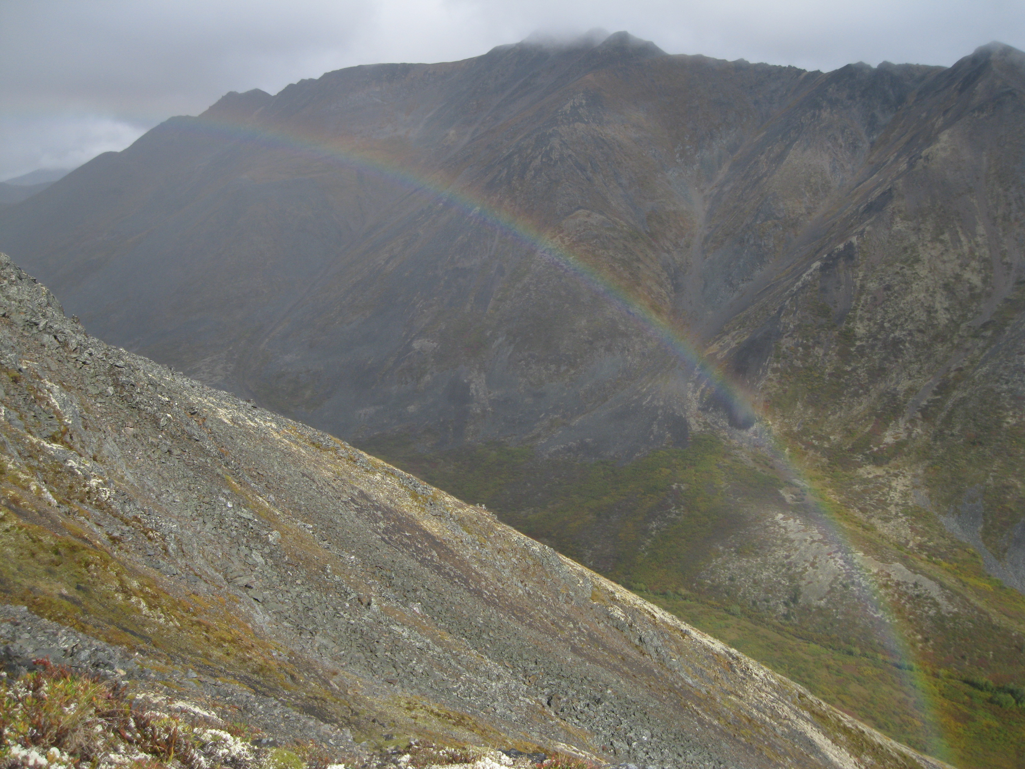
You will be surrounded by impressive rocky peaks and a rocky talus terrain ahead of you. Have a bit of a breather while you are on top of the ridge and take you time to check out the view and take some shots. This does really depend on the weather conditions, as the weather can change rapidly in this terrain so you may be hiking in mist and rain or snow, then suddenly the sun will come out and you will be approached by blue skies and it will suddenly get a bit hot. It will be windy over the ridge in any case

Walking down on the other side down into the small valley towards the North Klondike River Valley can be easier than going up the pass. It depends on the condition of the surface on which you are walking. If it’s been raining and there are several plus degrees Celsius, it will be a bit muddy which is good as you can easily slide down the hill among the loose rocks. Be a bit careful but it is not too difficult.
As you head down you will have amazing views of the valley and remember to have a stop once in a while take a couple of shots and look but up at the hill to the ridge where you came from. You will see an amazing rocky talus landscape. There are sections where you definitely should not slide down as you get further down the hill, so you will have to negotiate yourself down among the many loose rocks. Looking around you and back up the hill you will have a stunning scenery of rock walls around you.
When you get to the bottom you will be in a beautiful grassy meadow among creeks and mountain peaks. Look back at where you came from. You will feel very good about what you have just accomplished. If you have left Grizzly Lake early in the morning, this could be a good place for a break and lunch. Fantastic spot. Have a chill a stroll around the area where you can take amazing shots of the creek and the surrounding mountain peaks.
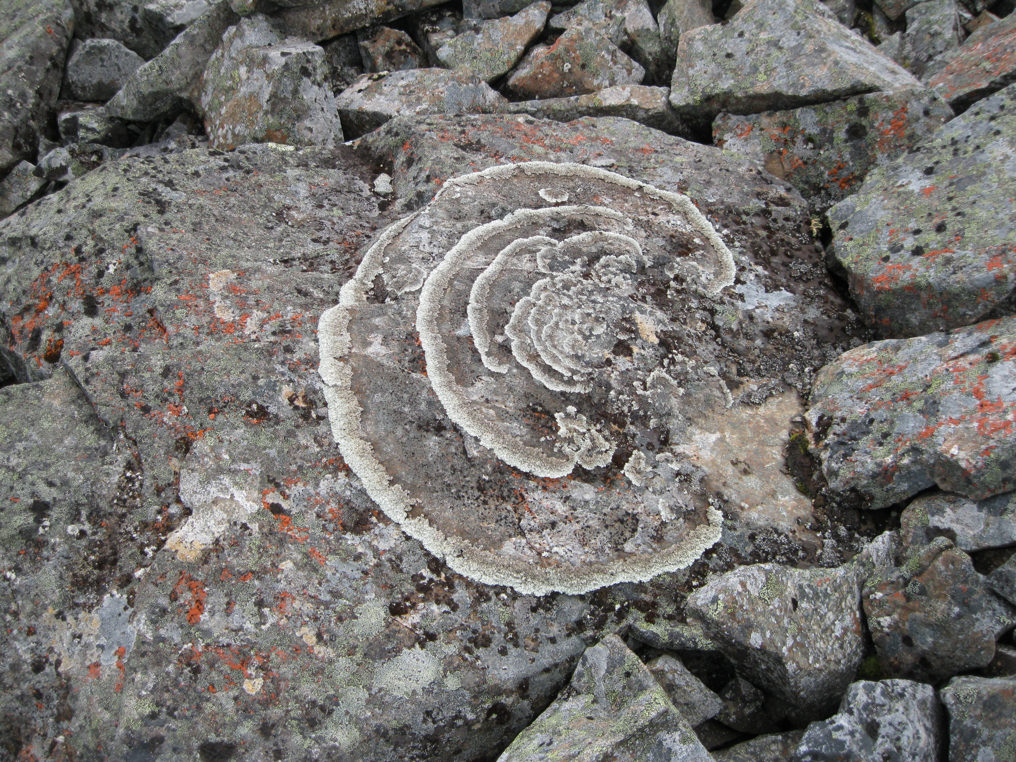
Afterwards continue onwards down the valley following the small creek. You also have to cross boulders on the way. The trail is for the most part elevated above the creek which will give you some very neat views of the creek and an ever changing scenery of peaks along the way. You plenty of opportunities to get great photos on the trail. Take you time to check out some of the art work of nature on some of the boulders which are the awesome displays of lichens. You will notice several of these if you have a good look around.
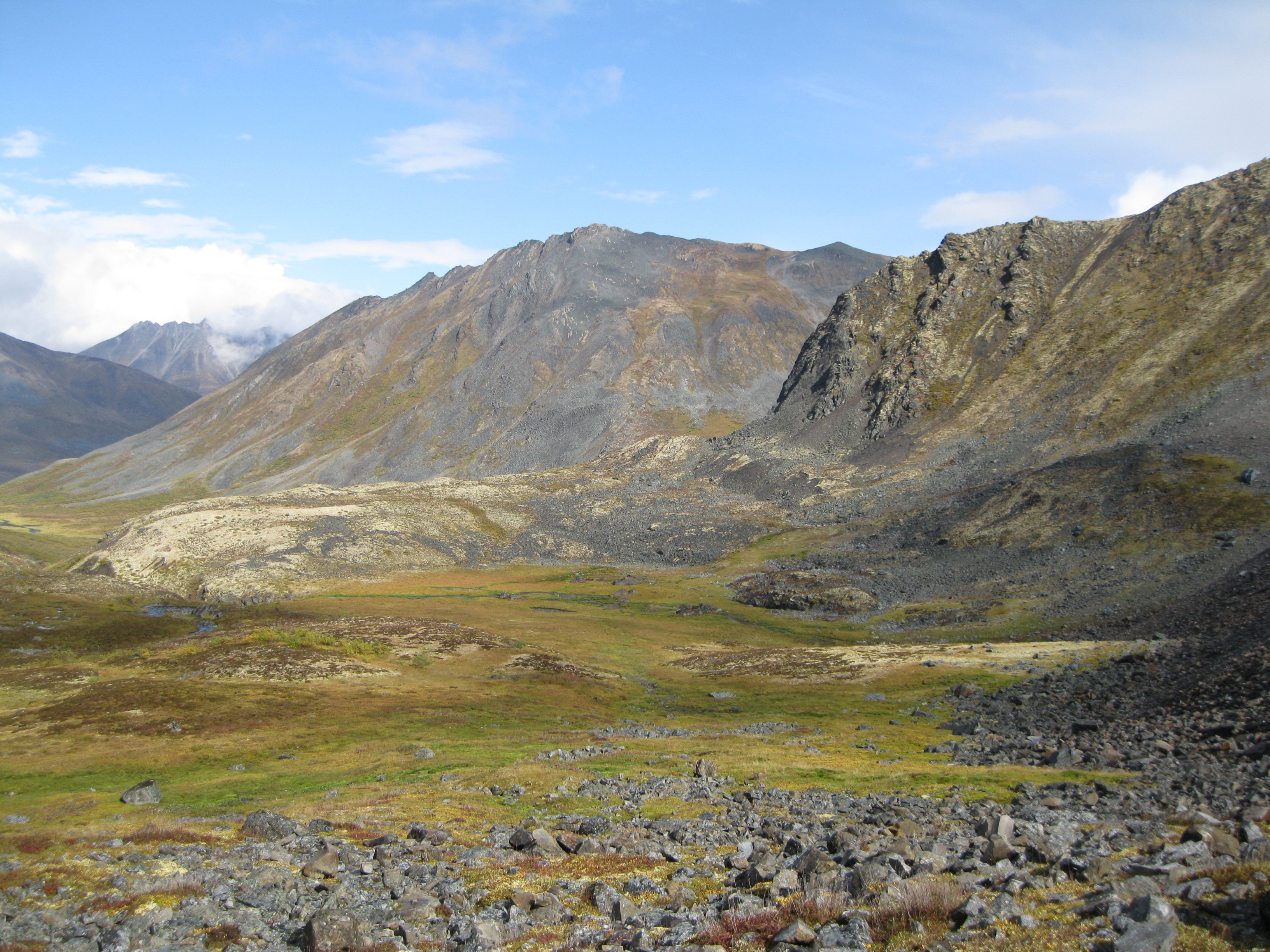
At one point you will be heading downhill through a bouldery areas closer to the creek which will lead into North Klondike River Valley and out of Glissade Pass. As you enter the North Klondike River Valley you are exposed to absolutely beautiful scenery of a valley of mountain peaks, vegetation, ponds and rocky talus both to your left and right. Take your time to take in this spectacular landscape.
You will be turning left towards Divide Lake. From here it’s only about 2 km (1.25 miles) down towards Divide Lake down the well-marked trail through some boulders here and there. At one point you view the peak of the backside of Mount Monolith and you will be getting closer to the lake. Look back down through the valley as well to where you came from.
Divide Lake
When you arrive at Divide Lake you will have a breathtaking view of the lake and the backside of Mount Monolith. You can take all sorts of photos of the peaks the lake from many different angles as you approach the campsite. You will be crossing a creek where you’ll have great photo opportunity to take a shot of the creek against the valley which you came from. The peaks here have no names, so again, be creative and make up your own names.
At the campsite there’s one shelter, bear lockers, a barrel for grey water, an outhouse and ten wooden tent pads/platforms. Set up camp and check out the view. The tent pads are located just a little bit uphill from the shelter. It’s always a good idea so set up your tent first thing so you get that out of the ways and you can have you gear tugged away from potential rain. It’s not a crowded site so one shelter is normally enough space. If there are other people at the site you can always agree on taking turns on when you are preparing dinner. People are always friendly and helpful in the backcountry so it’s not an issue.
After dinner you can take some amazing shots of the valley which you just came from and you may just be lucky that you will have blooming flowers which can perfectly front your image. Walk down closer to and around the lake and you can take some awesome shots from many different angles. If you head down to the area of the creek you may be able to a perfect shot of the mountain peaks reflected in the lake. Make your way further to the other side of the shelter and down towards the lake. Here you can get a great shot of the lake and the peaks fronted by shrubs or lake and peaks by itself.
Head up to the camping area and walk down to the very end. You can get some great shots from this area as well as it’s elevated. The views are a tad different of Mount Monolith fronted by a mound with shrubs and to the other side you will have another great view of picturesque mountain peaks. There are plenty of opportunities for great shots and killer vistas. The following morning you may want to go through the same routine of picture taking as the weather may have changed. So it may just be a completely different view.
Divide Lake to Talus Lake
Some people stay overnight at Divide Lake and do a day hike to Talus Lake the following day leaving their heavy backpack behind at the. Some hike to Talus Lake with their backpack and camp there. The latter is a good idea if you want to do some further hikes around the area.
The distance between Divide Lake and Talus Lake is 6 km (3.7 miles). You will be continuing down the North Klondike River Valley and as you head up to a more elevated section your view of Mount Monolith will change. More of its amazing peaks will come into view fronted by a stunning alpine cirque. Breathtaking scenery. You may have a beautiful blue sky with clouds making their way through the majestic peaks. Very cool. Remember to look a back through the valley to where the days hike originated from which is just awesome as well.
As you head on through North Klondike River Valley you will pass a small lake which will be a great motif against the Couldy Mountain Range. You will continue onwards on the left side of this lake. Have a look back at the part of Mount Monolith which you came from and you will see the peaks and the cirque from a different angle. Amazing view. All the way on your hike Mount Monolith will be to your left and you will experience the immense beauty of this massive mountain.
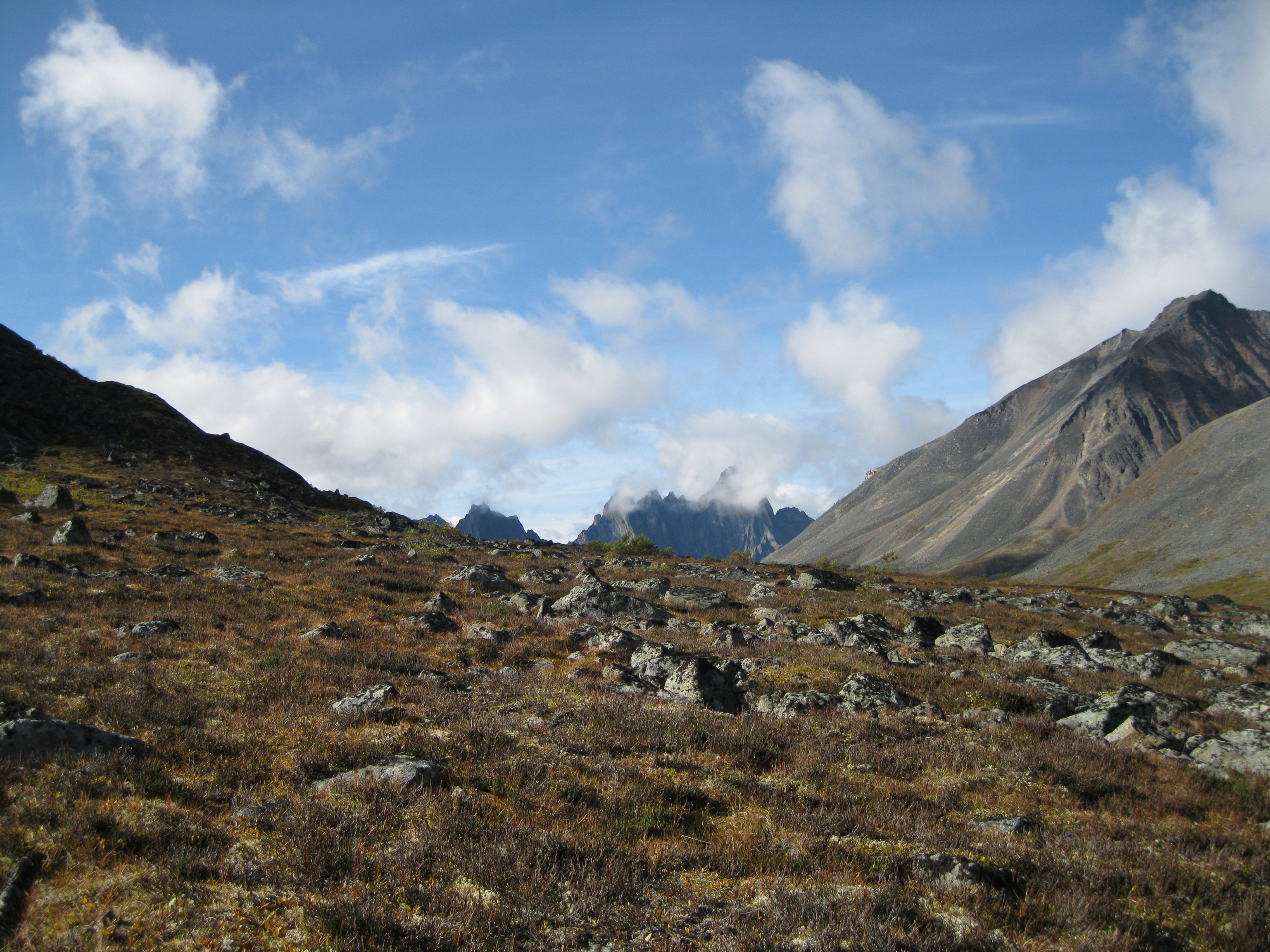
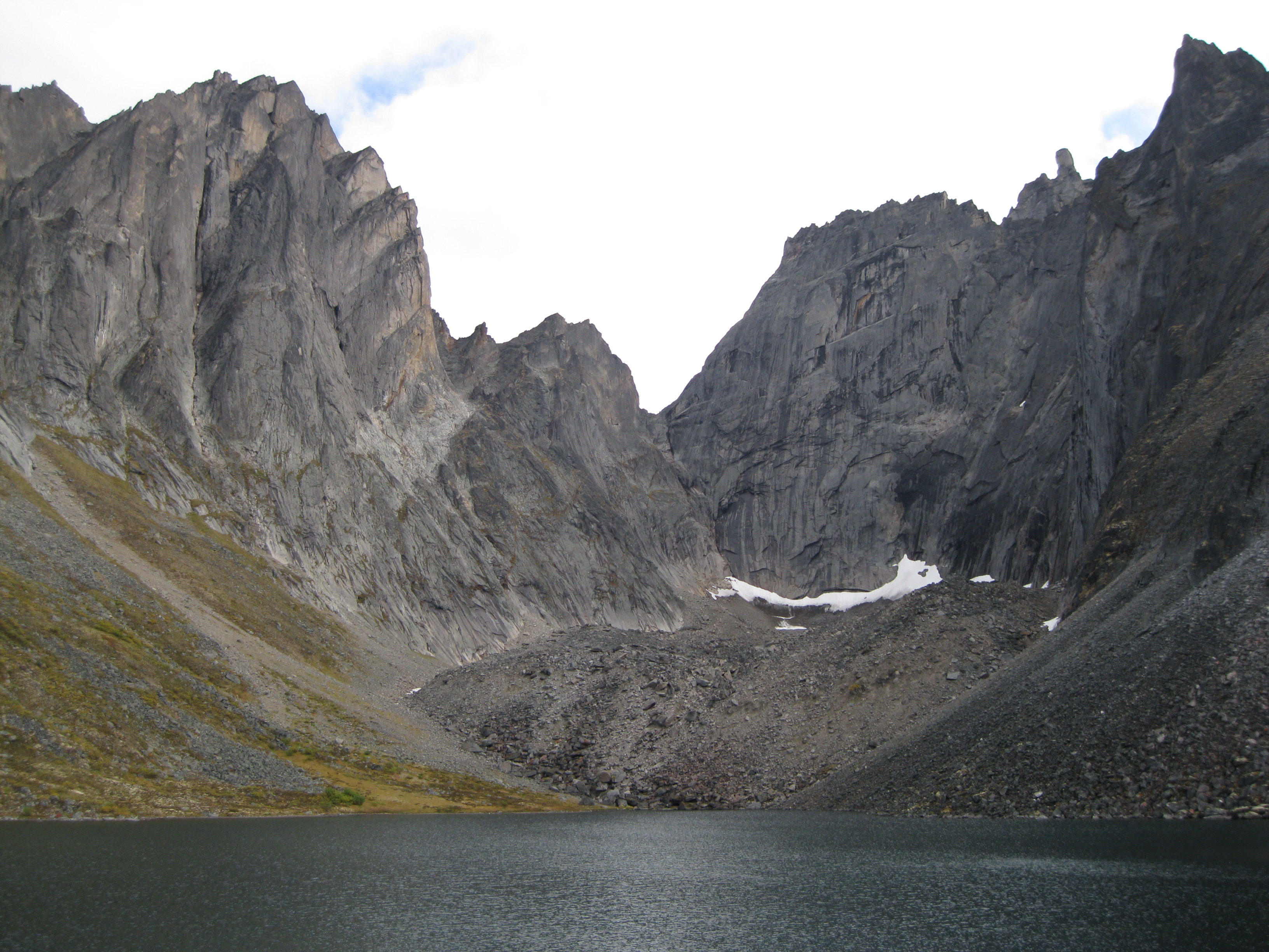
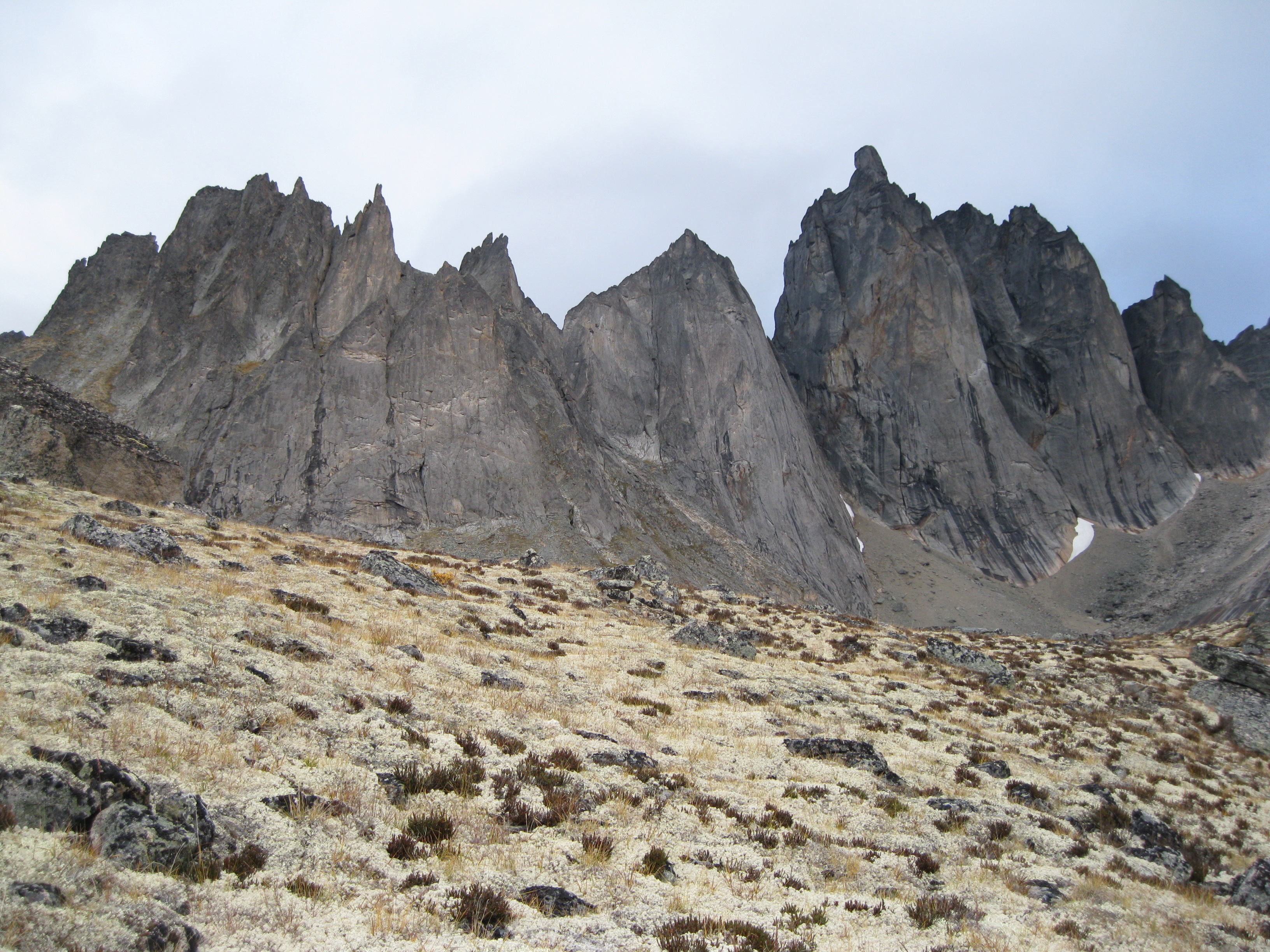
After you have walked beyond the lake have a look back at the beautiful scenery of the lake against the valley. As you continue onwards you will get your first glimpse of the rugged peaks of the Tombstone Range. Yet another great photo opportunity. You encounter a bit of elevation as the trail enters Tombstone Pass. You will get an awesome and perfect view of the Tombstone Range and you first look at Tombstone Mountain. On your way through the pass you have the opportunity to climb up towards the walls of Mount Monolith to check out two magnificent unnamed cirque lakes.

At the first lake you not only have a beautiful view of the lake but also of a marvellous cirque fronted by a massive moraine. You can take some great shots of the lake and talus landscape against the Tombstone Range landscape in the background in the other direction which is an awesome photo. There are plenty of opportunities. Maybe you will have the motif of the lake, the talus scenery, a small puddle, the Cloudy Range and the Tombstone Range as the backdrop. This could also be the perfect lunch spot as well which will allow you time to check out the scenery. Maybe you will some amazing lichen patterns on the bounders as well. Check out the fantastic view of the Cloudy Range looking away from the lake.
As you head down from the first cirque lake you will have another small lake in the valley in front of Talus Lake. A killer view of the two lakes with the Tombstone Range in the background. Yet another opportunity for a great shot. Another awesome view is along the line of Mount Monolith with Talus Lake and the Tombstone Range as the backdrop.
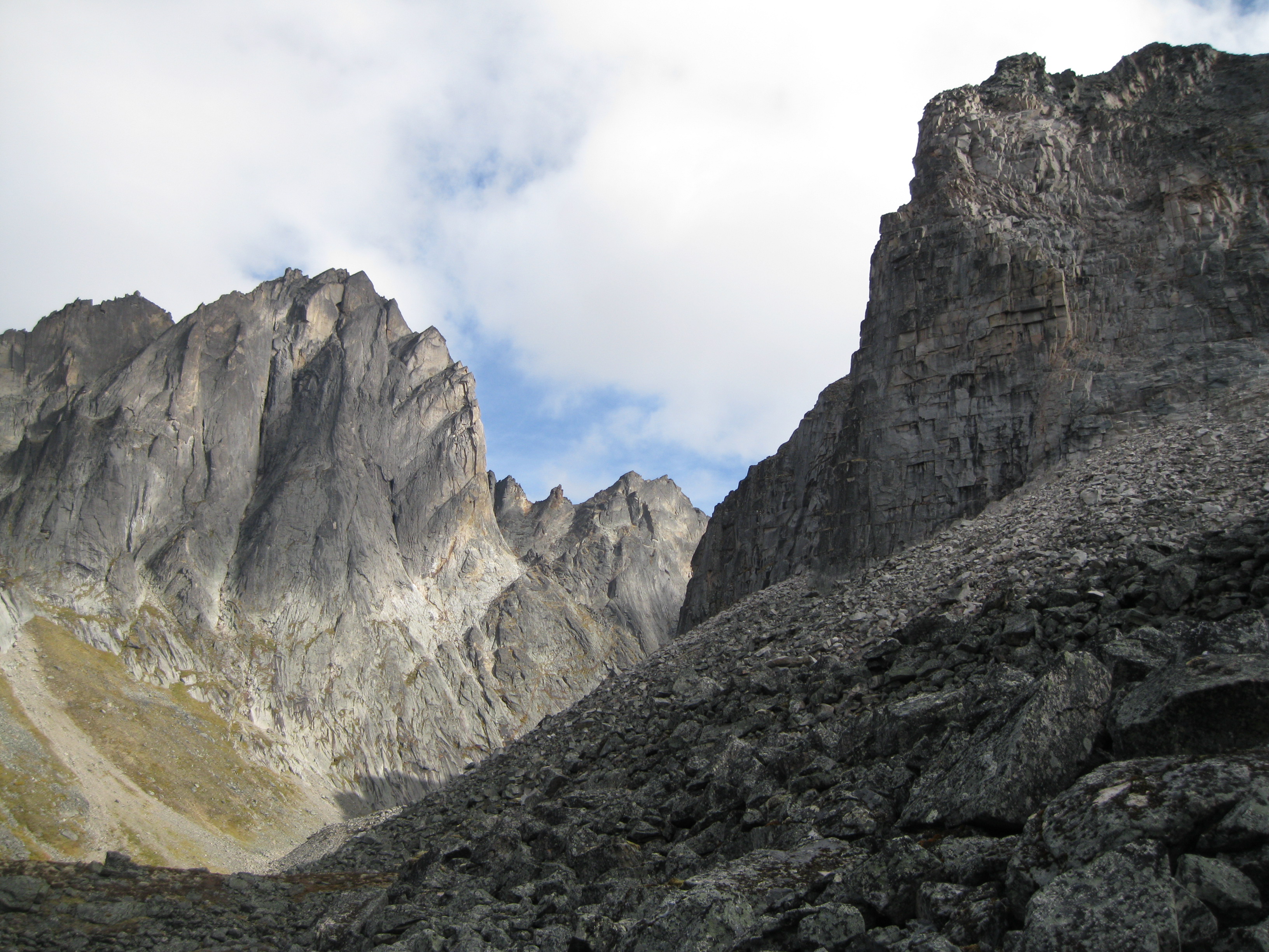
Coming up as you walk further down the lake along the walls of Mount Monolith is the next unnamed cirque lake. When you climb the hill to get to the lake you are approached by a beautiful view of massive granite peaks. Upon arrival at top of the hill you will be amazed by the stunning alpine cirque and lake. You can get a killer shot of the lake and Talus Lake and the Tombstone Range in the background. A photo of a lake with the cirque is compulsory. You can also get a shot just of the cirque depending on where you are standing on the hill. Absolutely awesome.
There is also a small island in the lake which is a cool feature. Depending on the season and what the weather conditions have been, there may just be a pond at the edge of the hill, in the direction away from the lake, which is just perfect for a shot against the Tombstone Range. Really cool. As you head off the hill make sure you take images of the scenery ahead but also look back to lake and the magnificent peaks, the massive boulders along the rock walls of Mount Monolith and so on. The views on the way down are fantastic. The landscape towards the Cloudy Range, there may just be stream coming down from the lake which is a perfect shot against the Tombstone and Cloudy Ranges. You will have many opportunities to enjoy this awesome day out in the wilderness.
From here it’s a short stroll before you will be at Talus Lake. If you have left Divide Lake early in the morning you should be at Talus Lake in the early afternoon.
Talus Lake
The campsite is pretty close to the lake. There is a shelter and an outhouse, ten wooden tent pads, bear lockers and a barrel for grey water. Here you have great views of the Cloudy Range, the Tombstone Range and the backside of Mount Monolith which is completely different to the view at Divide Lake. The views from the campsite are absolutely fantastic. As was the case at Divide Lake there is only one shelter at his site, so it can be a bit cramped if there are other visitors but you will sort it out between you. Having more people in the shelter can be an advantage if it is cold. This is also an opportunity we meet other fellow travellers and share your experiences and travel stories.
Do your best to stay on the paths of the campsites as the tundra is very sensitive. If too many people step on the tundra, it will be damaged and it will take many years before it’s recuperated.
You may be lucky to experience the visit of a ranger from Yukon Parks. Park services will fly in by helicopter once in a while to get the waste from the outhouses and to change the barrel for the grey water. The ranger may have hiked in and serviced this other sites on the way. The helicopter will drop off empty containers that are attached to a wire. The ranger will attach the container from the outhouse and the grey water barrel to the wire and the helicopter will fly out of the park to dispose it. The ranger will install the container and barrel and wait for the helicopter to return for a pick up. This is cool for you as a traveller because you will see how the rangers work and you can have a chat and ask questions about their work. It’s all about the experience.
If you use Talus Lake as the basecamp you can do all sorts of day hikes. You can climb hill up to the backside of Mount Monolith or you could take a hike down the Tombstone River Valley.
Climbing the Hill up to Mount Monolith
It is highly recommend that you climb the hill to the left of the lake towards Mount Monolith. This hike is one of the highlights of the whole tour. Heading up here you will be bush whacking and walking through tundra as there is no marked trail. The tundra is actually really beautiful so it is actually worth a shot up close. Climbing this hill is a tad strenuous but not too bad. You will be walking through tundra and the boulders are not difficult to navigate through as you will can use them to climb upwards.
The great thing about doing this hike from Talus Lake is that you don’t have to carry your heavy backpack as leave the gear you don’t need at the camp. Depending on your walking style it can actually be easier climbing without your hiking poles. They seem to be a lot more helpful when you have a heavy load on your back.
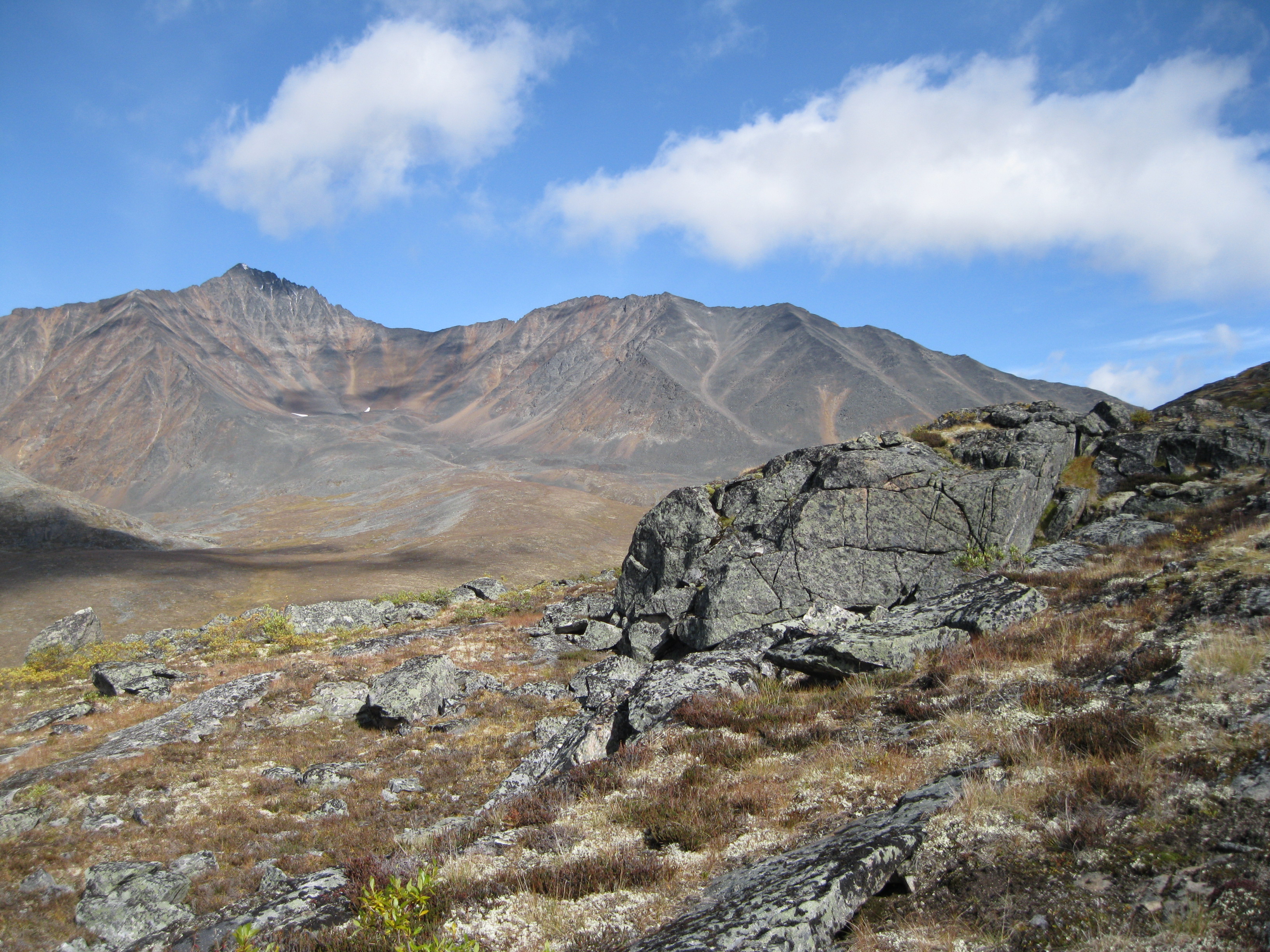
As you head up you will have the fantastic granite peaks of Mount Monolith in front of you. When you turn around and look down you will see Talus Lake, the campsite, the Tombstone Range and the Tombstone River Valley. The campsite will be smaller and smaller they further you get up. The view of landscape you are entering and the scenery looking down at Talus Lake gets more and more amazing the further you ascend. When you get to the top you will be approached by towering peaks which are so impressive up close. Scenery that is not visible from Talus Lake.
At the very top you will find a huge rock which you should climb on to. It almost looks as if it has been place for you to climb and enjoy the view from. You will have a breathtaking view of Talus Lake, the Tombstone Range, the Cloudy Range and the valley. If you turn around, the backside of Mount Monolith will come into view which is awesome. Absolute natural splendour at its best. Make sure you take loads of photos up here and that you get your own photo taken against the scenery. Take your time and enjoy the view. The campsite looks very small from up here and are small dots on the ground.
Heading down the hill back to the campsite and easier and faster than going up. All the way down you will have the immense view of Talus Lake, the Tombstone Range, the Tombstone River Valley and the Cloudy Range. It doesn’t get any better.
Exploring Tombstone River Valley and Tombstone Mountain
While you are based at Talus Lake you can also do a day trip further up the Tombstone River Valley towards Tombstone. You will be heading down the valley with the Tombstone Range to your left. You follow the peak that faces Talus Lake. You will get to a point where you’ve surpassed the peak and will ascend the hill to the left. On way up there’s a great view of the aforementioned peak from the side and as you carry on a bit further you will get the first glimpse of an unnamed lake.
You will walk a bit more to get to the lake. Meanwhile you can enjoy the peaks which you are heading toward and the scenery into the valley. This section can be a bit strenuous especially if you are experiencing rain as you will be crossing a small creek and negotiating through boulders to get to the lake. It is definitely worth it. At the lake you will find a bit of abandoned equipment from the gold rush. Incredible how you can still find trace of this era in these really remote and “untouched” areas. Spend some time to check out the lake and the surrounding peaks.
As you continue onwards along the mountain wall you will be crossing more boulders and head bit downhill. After a bit of negotiating through rocks, you will be heading down to another unnamed lake. The view is fantastic as you approach the lake with the Tombstone River Valley ahead of you and the Tombstone Range to the left. As you make your way down to the lake remember to look about at where you came from as it is a great sight and so is the view of the lake. Take your time to absorb the scenery.
Meander down beyond the lake towards Tombstone Mountain and check out the view of this magnificent peak. Let’s hope you it’s not raining and misty so you will have a perfect view. You can also head up the range at different sections and check out the scenery up close. This can be quite strenuous if it’s raining as you will most likely have sections where you will be negotiating through slippery boulders. On the way you may just find a perfect rock shelter where you can have lunch, have a chill and then you could make your way back to Talus Lake
As you return to the camp at Talus Lake you will have a great view of the valley as you will head off the hill and down into the valley itself. You can take awesome pictures in both directions of the valley, the Tombstone Range, the Cloudy Range, creeks, shrubs, tundra and boulders. Maybe you will find a massive boulder in the middle of the valley which is just a perfect shot against the mountains or the valley. Be creative and you will find the perfect abstract motif.

Note the beautiful colours down through the valley. This obviously depends on when you are visiting the park, but you may have a mixture of white, yellow, red and green vegetation. If it’s raining or misty you can play around with this feature as well when taking your photos. Awesome stuff.
Returning to the Trailhead
If you are returning to the trailhead from Talus Lake you can go via Mount Frank Rae, camp up there which is going to be without facilities or you can spend the night at Divide Lake once more. If you stay at Divide Lake you will continue through the North Klondike River Valley to get to Glissade Pass the following morning. Heading back through the same trail, you will experience the landscape from the opposite direction to when you arrived. As the weather changes rapidly in mountains you may just see the scenery in the snow instead of blue skies or rain. It is highly recommended that you either stay at Axeman Lakes or Grizzly Lake when returning.
Axeman Creek and Axeman Lakes
You should definitely stay at or at least make a side trip to Axeman Creek and the Axeman Lakes. It is highly recommended as it is very beautiful.
As mentioned earlier you can camp at the Axeman Lakes. It depends on your itinerary but bear in mind that this is a spot without facilities. As you head down the North Klondike River Valley and you turn right into Glissade Pass, you will get to a point where you cross the small valley of Glissade Pass, mosey your way ahead and cross Axeman Creek. You will ascend the hill through shrubs and a bit of a rough terrain. It’s a bit of a climb but not too difficult or strenuous. Just go at an easy pace. Remember to enjoy the scenery and look down to where you came from as the view of Glissade Pass is awesome.
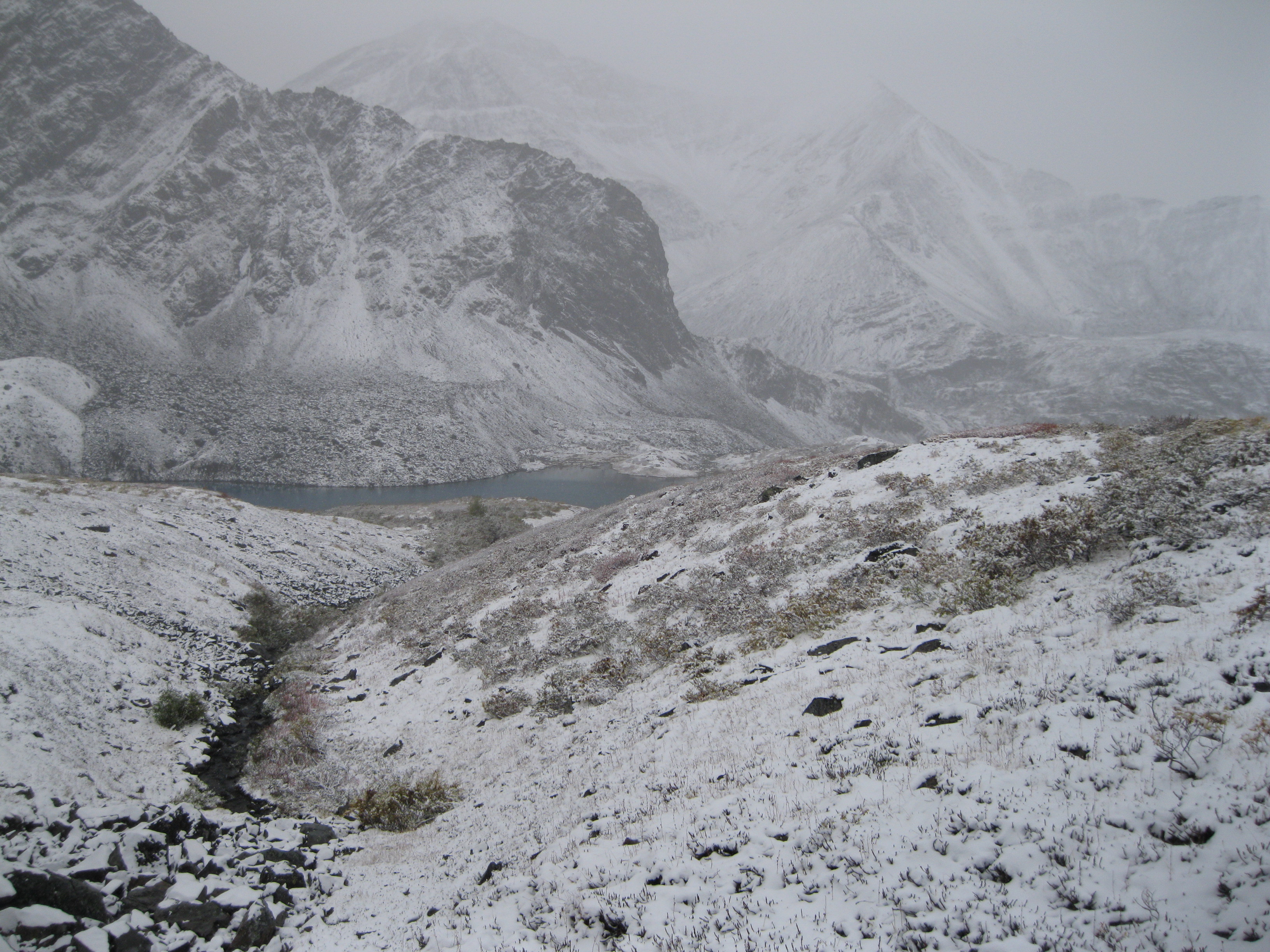
When you arrive at the top you will have the stunning view of the lower lake. An absolutely picturesque lake surrounded by beautiful mountain peaks. Check the view of Glissade Pass as well. View the lake from a distances, take your time to it all in, take your photos and then head up to the upper lake which is not too far away. It’s is so peaceful and beautiful up here.
As you get to the upper lake, you will be approached by yet another stunning lake with beautiful peaks as the backdrop. You will have a view of both lakes are the same time from this point. This is great spot for lunch, so have a chill and explore the lake and take some photos. You can get some cool shots of the lake up close, from a distance, from many different angles and the surrounding hills and peaks. It is also a neat shot of lake down towards Glissade Pass.
After you have explored the upper lake, you should stroll down the hill towards the lower lake. As you approach the lake you will have an amazing view of the lake with its surrounding peaks and the mountains of Glissade Pass as the backdrop. An amazing photo opportunity. Look back to where you came from as the view of the boulders and peaks is amazing. There is a small stream leading towards the bottom lake which is a great shot against the lake, all the peaks and Glissade Pass. You will have some great views of the lake on the way down and when you get right to the shore of the lake as well. As you are standing at the lake, look to your left towards the peak and you will see a beautiful cirque in the rock wall.
Again, check out the view back up to where you came from. The view of the lake against Glissade Pass which is stunning as well and yet another photo opportunity, especially with the reflection of the peak of the lake in the lake against the scenery of Glissade Pass. As you head off the hill look back at the lake as this view is quite something as well. When you get to the edge of the hill you will be blown away with the vista of the valley of Glissade Pass and the creek running through. Absolutely stunning views on the way down of the scenery of Glissade Pass and through Axeman Creek.
Returning to the Trailhead Continued
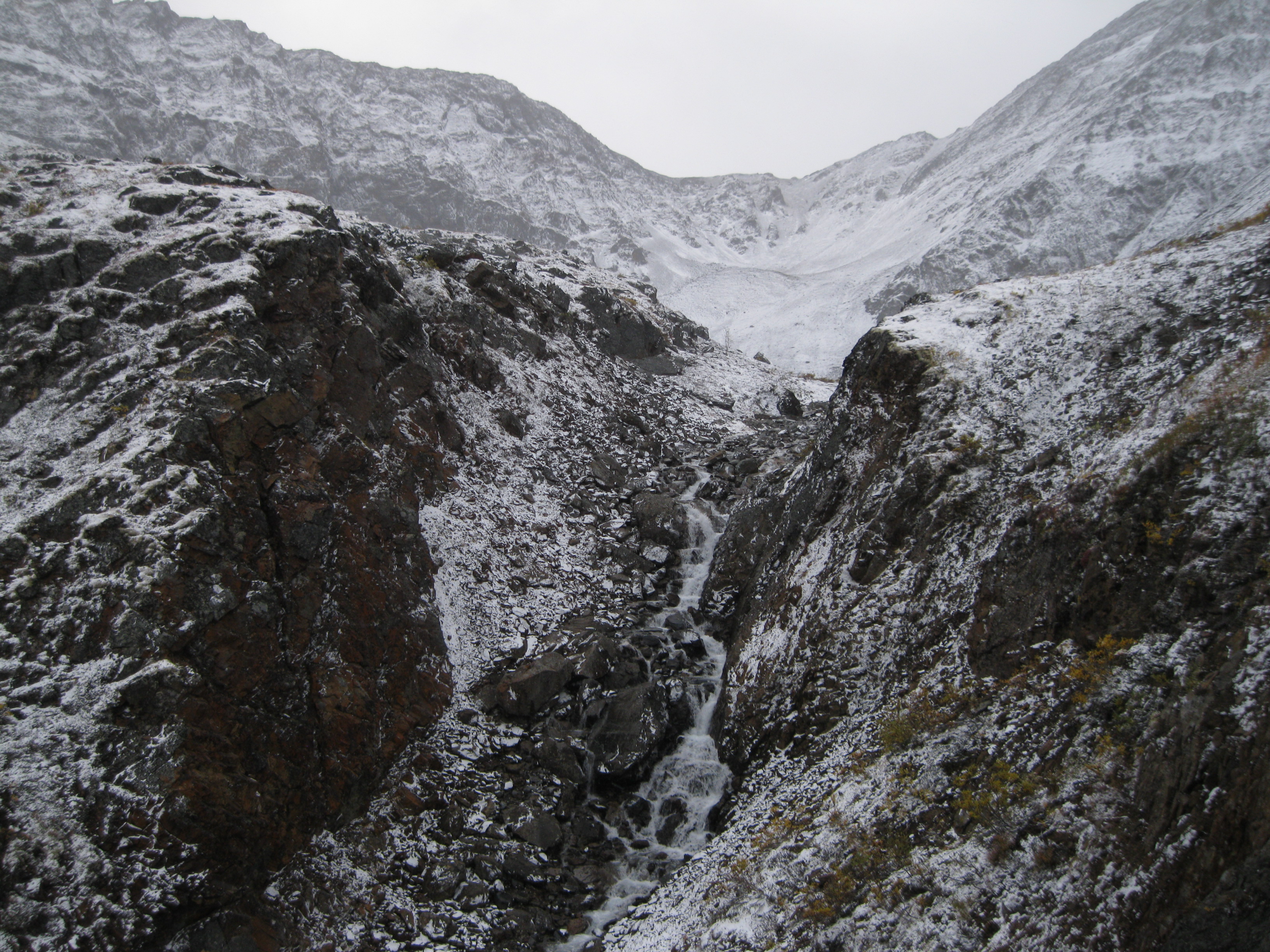
Returning to Glissade Pass from Axeman Creek you will get some awesome views which you didn’t have when you first crossed the pass upon arrival as you are approaching it from a different area, so that is an additional bonus you get from checking out the lakes. You will see breathtaking creeks, streams and small waterfalls heading down this way through the pass. Some of creeks can be a bit wide, depending on the season, so they will have to do a bit of rock jumping to get across but it is not too challenging.
As you head down towards the big climb at the bottom of the pass to return to Grizzly Lake, have a look back down the small valley of the pass and then get ready for the ascent. Depending on the weather conditions, this can be a tough climb especially if it’s during snow as it will be windy. If you are ascending as a group just concentrate on climbing. Don’t look up or down too much, just look at the person ahead of you and keep going at a steady pace. All of a sudden you will be at the top of the ridge and you just have to head down on the other side towards Grizzly Lake which is easier. If it’s during snow but a bit careful as there may be pockets you can’t see. As long as you concentrate on the descent it should be all good.
As you are off the hill, cross the creek at Grizzly Lake and head towards the campsite where you should camp for the night. As mentioned earlier, the advantage about camping at Grizzly Lake again a couple of days later, as with Divide Lake, is that the weather may have changed. In that case you will get a completely different view of the surrounding mountain peaks. It could be in sunshine, in rain covered with mist or covered in snow.
The following day you have to do the big full day hike back to the trailhead. You will get all the awesome views in the opposite direction different to the ones you had when you arrived on the first day. It can be a tough day if you have been out hiking for 9 days. Once you are back at the trailhead you will have such a fantastic feeling of accomplishment for doing such an amazing trip.
Before continueing on you travels you can spend another night at the Tombstone Mountain Campground at Charcoal Creek. The Interpretive Centre is within walking distance. Who knows, they may just have some entertainment or an event for the locals and the tourist when you are there.