Purnululu National Park also known as the Bungle Bungles is definitely one of the most amazing scenic areas in the world. It’s located in the Kimberly region of Western Australia, includes the Bungle Bungle Range, and has rock formations like nothing you will ever see, which are the most outstanding example of cone karst sandstone around. It is a rocky outpost of the Kimberley and beyond here there is only one line of hills before it becomes desert land to the south. The name Purnululu means sandstone in the language of the Aboriginal Kija people. It’s a bit uncertain where the name Bungle Bungle comes from but it is believed to be either a corruption of an Aboriginal name for the area or a misspelling of the word “bundle” from the Bundle grass which is found in the region.
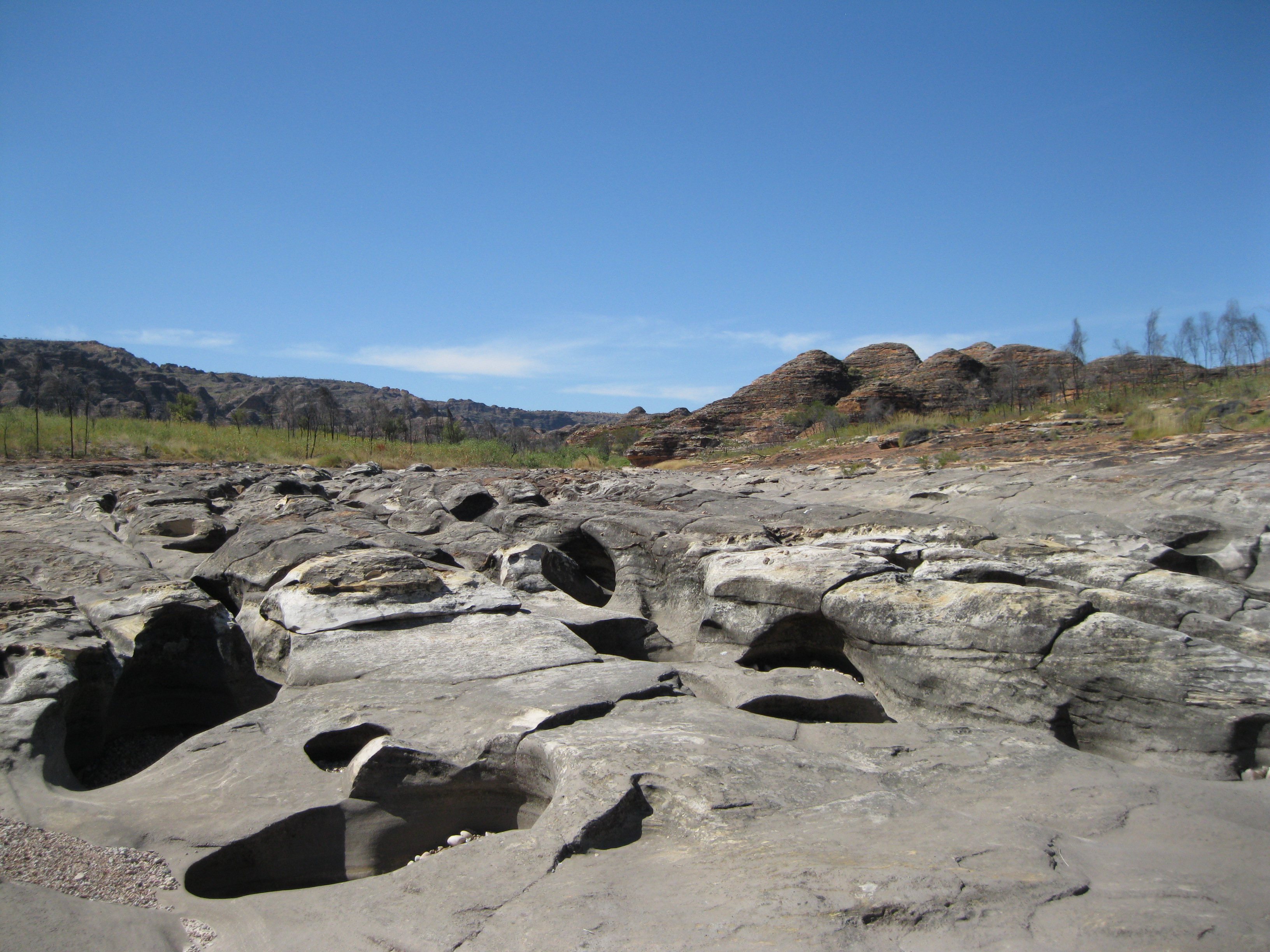
The area is mostly known for the amazing domes which look a bit like tiger striped beehives but in other areas of the park you will also find different types of rocks and scenery like at Echidna Chasm. The Bungle Bungles weren’t discovered by the white fella before 1983 and before then hardly anyone knew about the place. It wasn’t declared a national park before 1987, which is unbelievable when you think about how beautiful it is.
As with all other national parks and nature reserves please remember to treat the area with respect. All Aboriginal artefacts are protected and so are all plants, animals and geological formations. Therefore please stay on the tracks and do not climb any rocks and be respectful to the cultural significance which it has for the Aboriginal people.

Purnululu National Park is located 304 km (189 miles) south of the Outback town Kununurra and 160 km (99 miles) from Halls Creeks by road. There are several ways of getting to the Bungle Bungles. An option could be to fly into Kununurra. You could stay here for about three days, spend one day in town, one day going to Lake Argyle and Ord River and one day exploring the Bungle Bungles. You can fly from Kununurra out to the Bungle Bungles and on the way you will see some beautiful scenery such as Lake Argyle, Argyle Diamond Mine, the Carr Boyd Range and the Bungle Bungle Range upon arrival. Very stunning. This way you will get the scenic flight included as opposed to booking one when you are already at the park. Booking such a flight will be expensive. Mind you, it will not be the exact same flight. Another option of getting to the park could be by joining a tour going through the Kimberley region which will include this area. This way you will most likely have more time to explore the Bungle Bungles, depending on the itinerary of course.
You could also hire a car in Kununurra and drive to Purnululu National Park which will give you even more freedom to explore. Just be aware that some of the roads are pretty rough as they are dirt roads. Towards the end of the visitor season the roads will also be deteriorated which will make your journey times a bit longer than usual. If you come from the Great Northern Highway and enter at the Spring Creek Track to go further towards the park, you will be driving on a 4WD track which is often badly corrugated with hazardous sharp corners and blind rises. Early in the visitor season there may be some creek crossings. The track is open for high clearance 4WDs and off-road trailers. If you are driving by yourself remember that you have to pay the entrance fee at the Visitor Centre. There are no fuel, food or mechanical supplies available in the park. The nearest place to get supplies is in Warmun which is 63 km (39 miles) away. Therefore make sure you have sufficient supplies and fuel for more than 200 km (124 miles). If you are camping it is advised to book up front. There is a privately run campsite at Mabel Downs called Bungle Bungle Caravan Park and two public campgrounds which are Kurrajong to the north and Walardi to the south. Mabel Downs Station is cattle station just outside Purnululu National Park but it has also engaged in tourism and serve campers.
The Aboriginal people have lived in the area for more than 20,000 years. Their lifestyle was challenged soon after Alexander Forrest, who was an explorer, surveyor and politician, led the first colonial expedition into the Kimberley in 1879. They were searching for natural resources and areas for grazing stock. In 1885 the first gold rush in Western Australia was sparked as gold was found at Old Halls Creek. This attracted more than 15,000 people. The gold rush was short-lived, lasted less than three months and Halls Creek became a trading centre for cattle stations, Aboriginals and miners. The area has cultural significance to the Aboriginal people and certain areas are off limits for visitors unless you are going with an Aboriginal guide through the Elders.
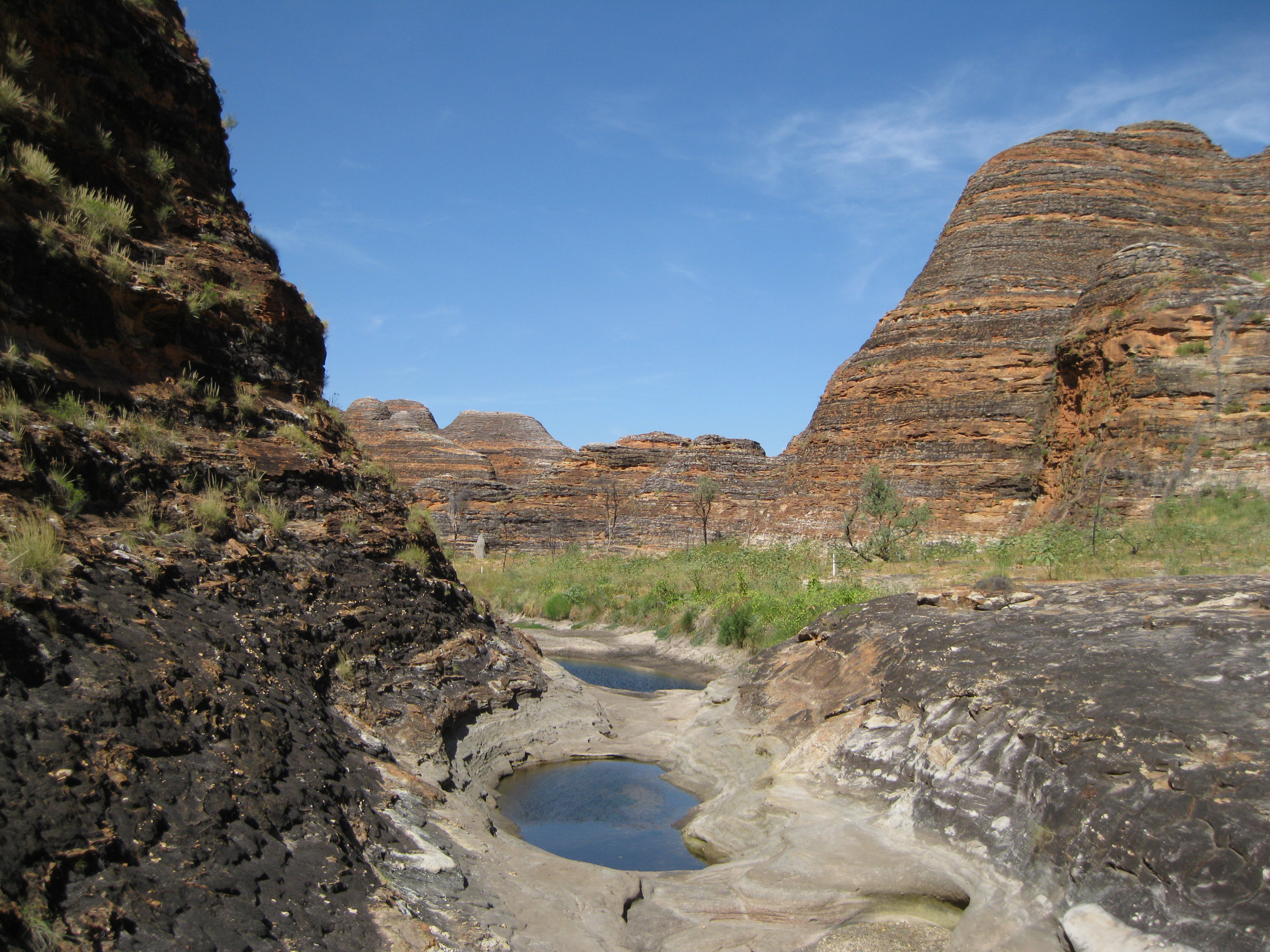
The landscape of Purnululu National Park is absolutely stunning and out of this world. Hiking through the many different gorges is a delight. You will be met breath-taking vistas in all areas of the park. The southern part of the range is made by sediments which are much finer and was developed slower by moving rivers into an inland Sea. The northern part of the range contains boulders found within conglomerate which are well rounded as they were tumbled by wild rivers before being deposited.
Erosion of huge mountain ranges deposited sand and gravel in the Ord Basin creating the sandstone formations around 360 million years ago. Older rock laid down hundreds of millions years earlier lies underneath. At this time Australia was a part of the great southern landmass Gondwana and Purnululu was close to the South Pole. 250 million years ago massive amounts of sediments lied on top of the sandstone. A period of mountain building occurred when underlying rock was tilted and uplifted.
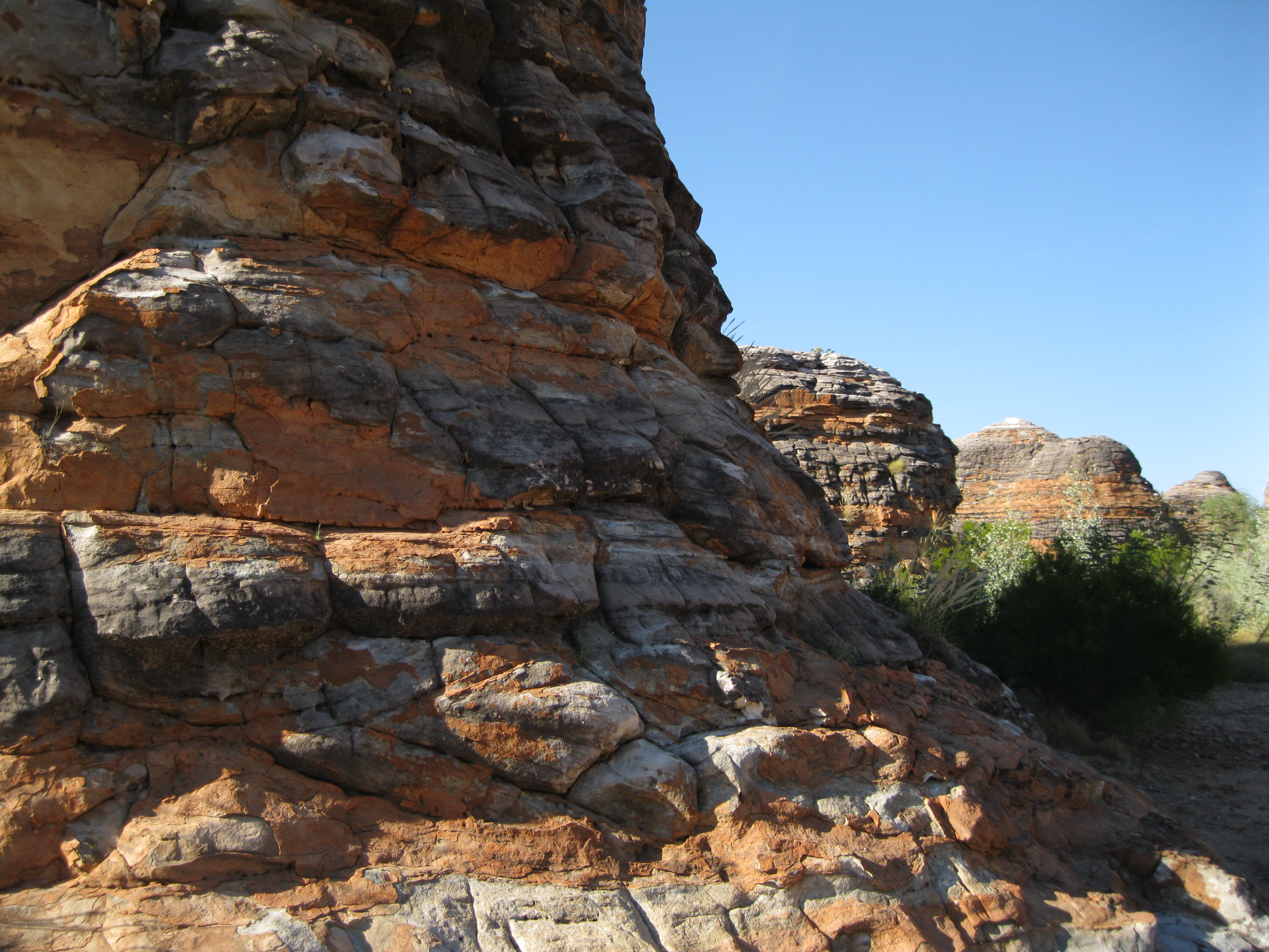
Laterite formed a hard cap on the surface 50 to 70 million years ago. The weathering weakened the sandstone and made it crumble and dissolved the silica cement which binds the sand grains together. The weight of the overlying rocks would still hold the sand grains in place, but when this is removed, the sandstones are easily eroded and the rounded tops indicates this lack of internal strength. The flow of water over the surface was concentrated by any further weakness or irregularities in the rock, such as cracks or joints, eroded the narrow channels that separate the domes.
20 million years ago the sea level fell and the landmass rose by more than 300 metres causing massive erosion which removed most of the rock and the underlying rock had been eroded away too. The erosion of the overlaying rock caused a huge release of pressure which led to jointing and faulting in the sandstone. Water and wind caused erosion of sandstone along the line of weakness being the joints and faults. For the past 20 million years the stunning domes, gorges and chasms have been carved out by creeks, rivers and weathering.
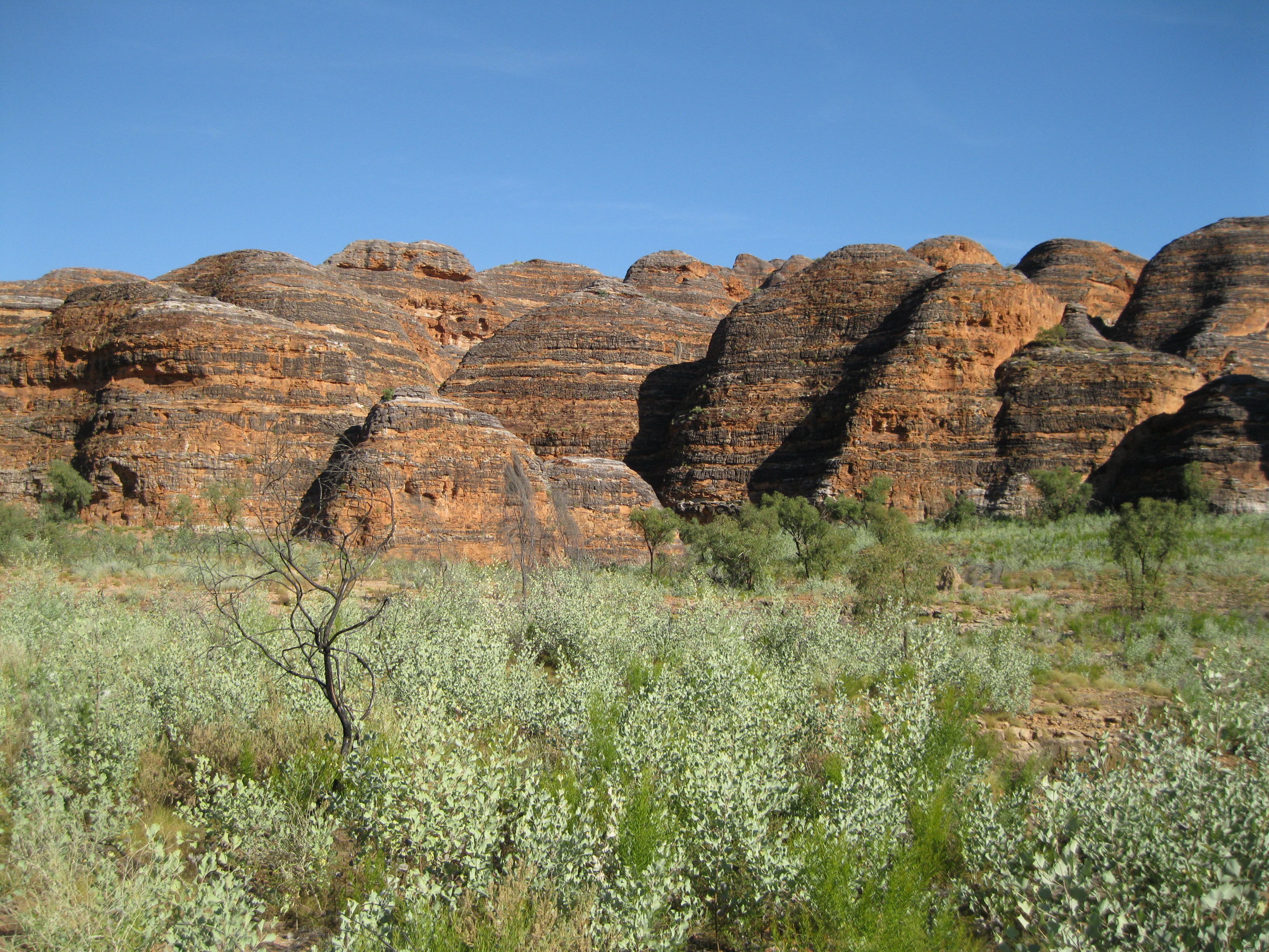
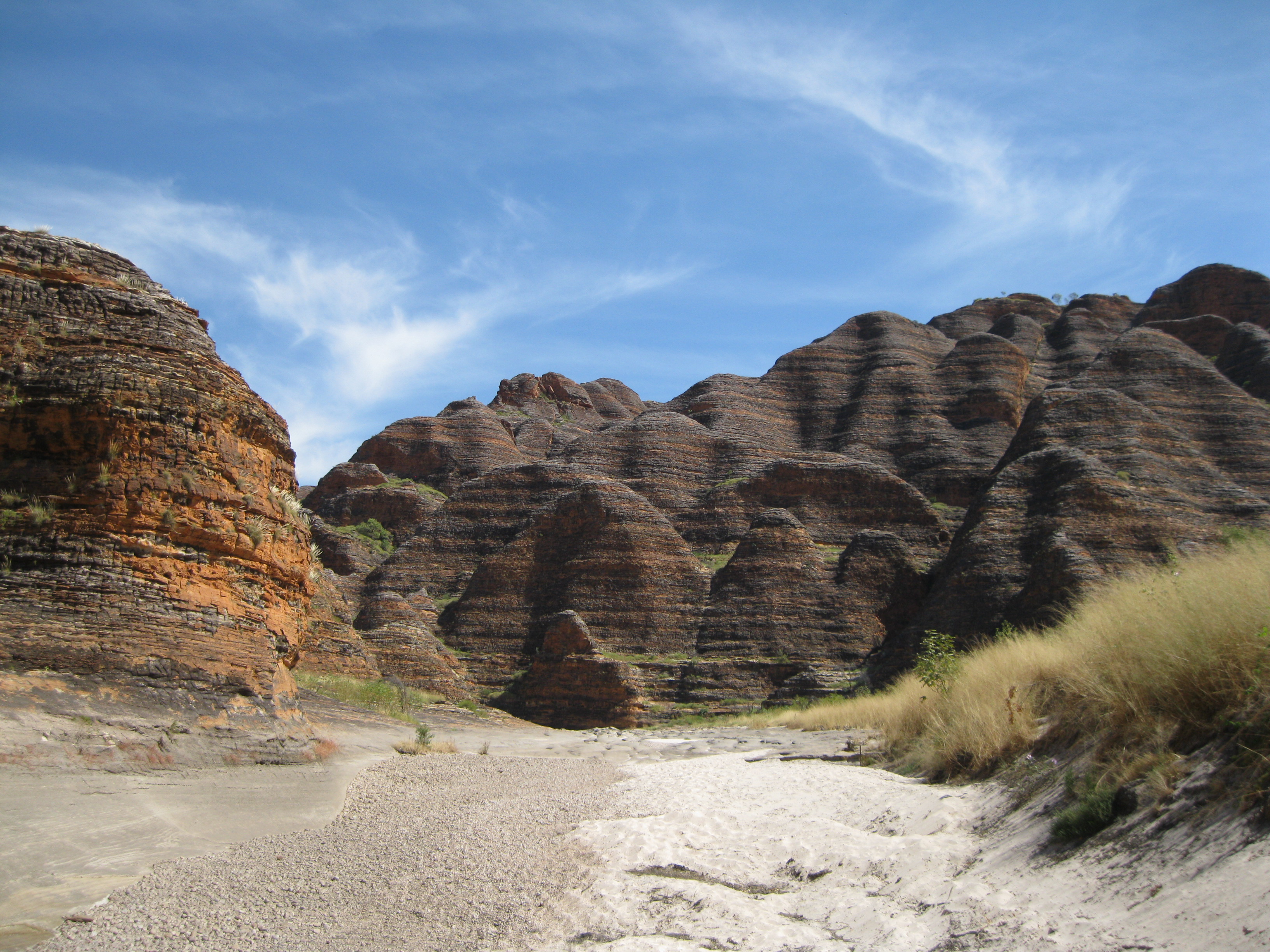
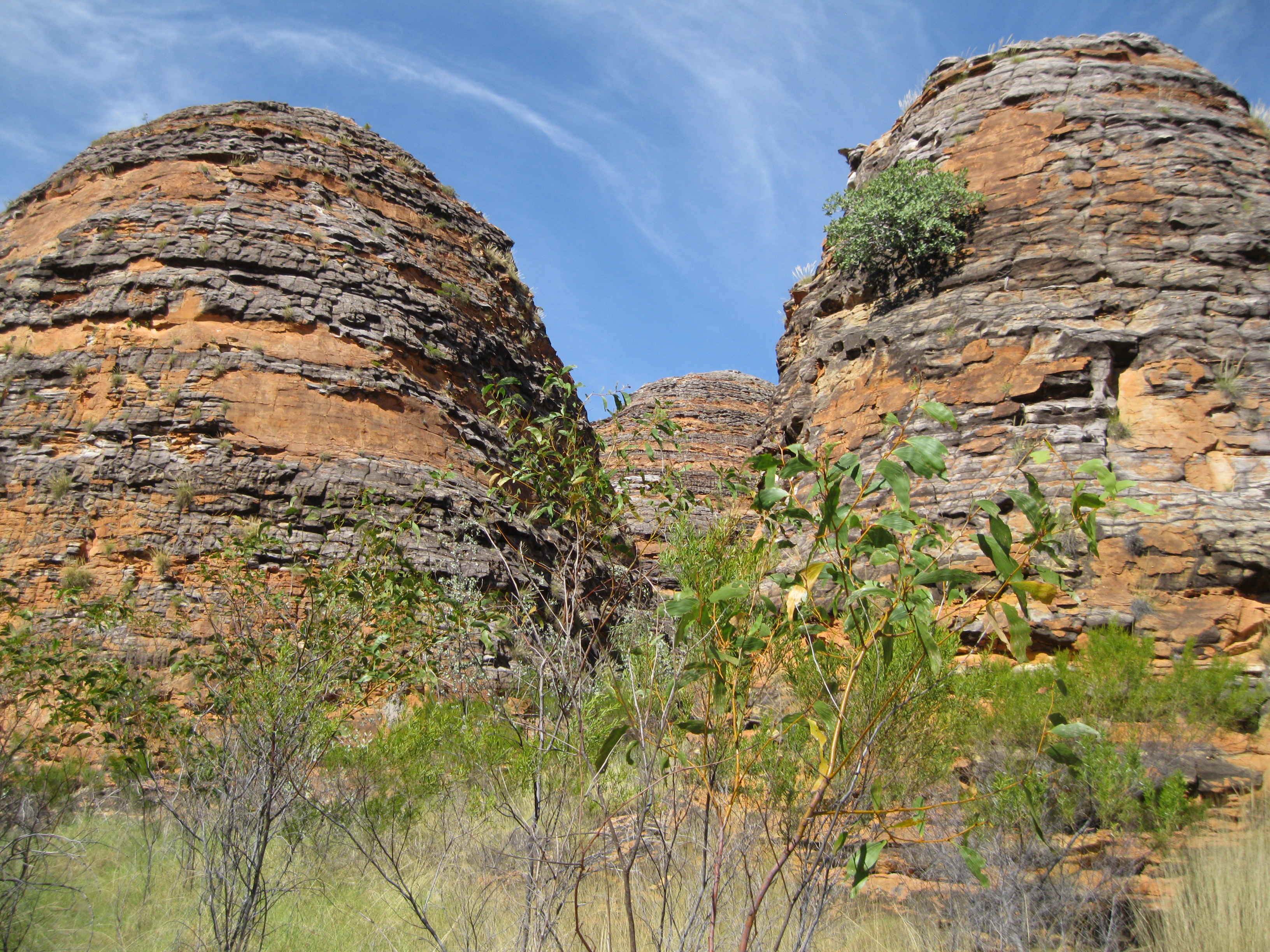
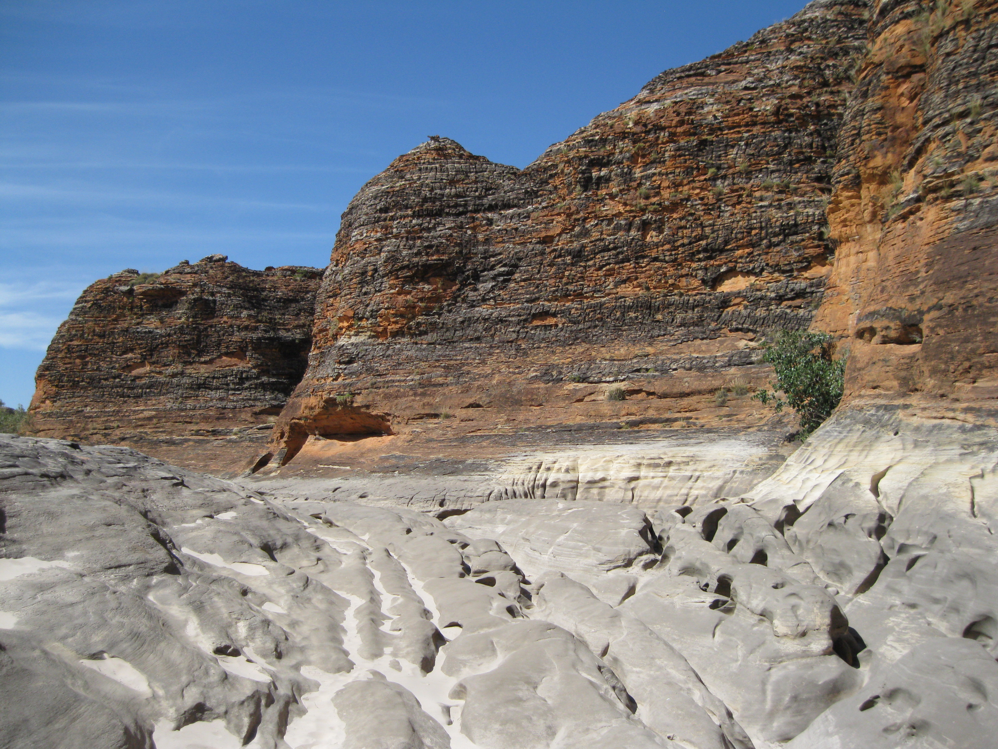
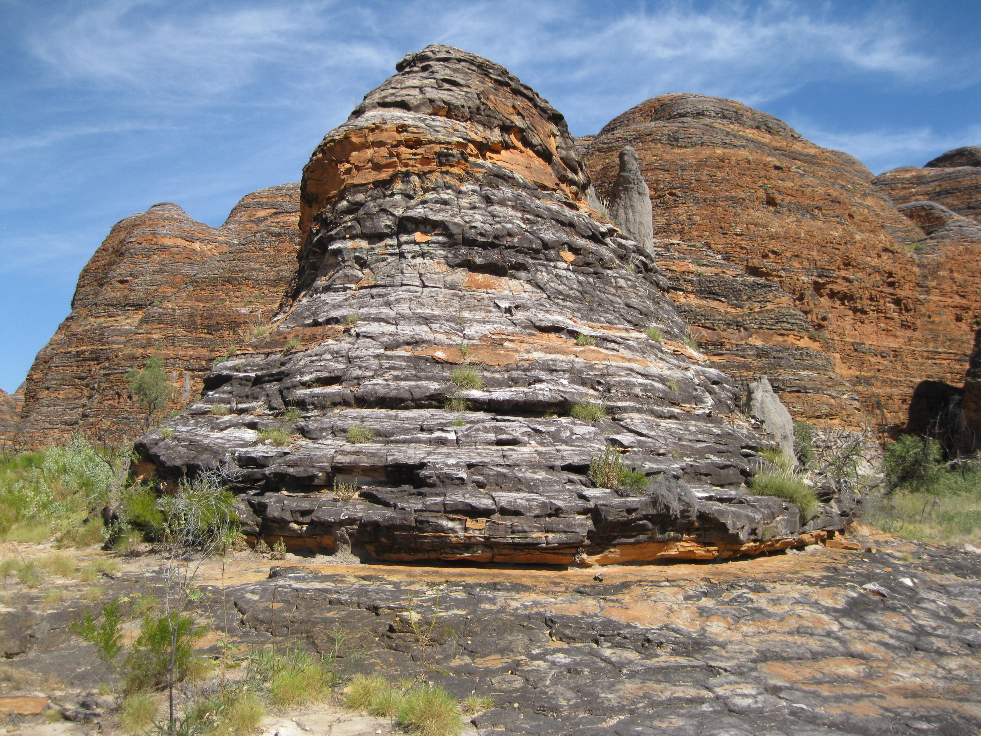
The Bungle Bungle Range reaches up to 578 metres about sea level and stand up to 200-300 metres about woodlands and grass-cover plains among towering cliffs. Furthermore the range is cut deep by gullies with the tiger striped beehive domes in the southern part of the range. It consists of quartz sandstone, conglomerate and some siltstone.
The orange and grey bands of the domes are a result of presence or absence of cyanobacteria. The dark bands indicate the presence of the bacteria which grows on a layer of sandstone where moisture accumulates as this layer of rock allows water to seep through with relative ease. The orange bands are where the bacteria has been absent which are oxidised iron compounds that have dried out too quickly for the bacteria to grow as water cannot seep through that easily. There outer coatings help to protect the lower parts of the domes from erosion.
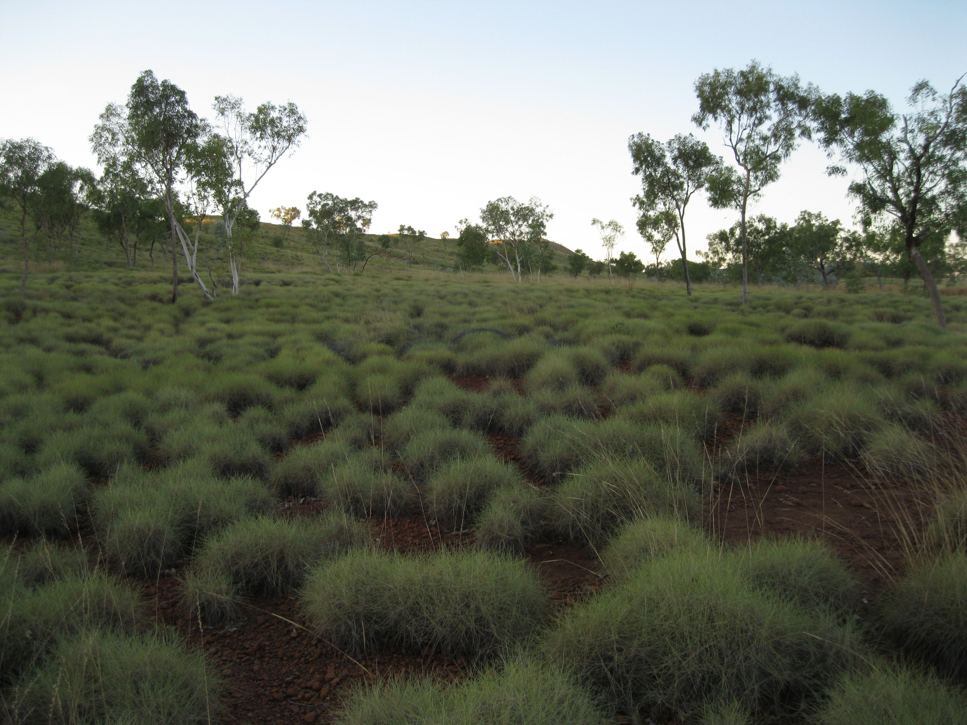
There are more than 600 plant species in the park. The most common trees are the bloodwood and snappy gums. There are more than 13 species of spinifex which is more than anywhere else in Australia. The spinifex is a common plant in the Outback and is very spiky. So if you do get close to the plant be a bit careful as the spikes can stick to your skin and can be a bit difficult to get out. There are more than 149 birds, 85 reptiles, 32 native mammal and 12 frog species. The birds include honeyeaters, doves, wood swallows and finches. A white-quilled pigeon can also be found. Being on the divide between the two different worlds of the rocky land and the desert it is the home to many native species at the northern and southern edge of the range.
There are several camping options within the park, just mind you that the facilities are pretty basic. There will be drop toilets and running water. It is not recommended that you drink the water though. It can be boiled for cooking and for coffees. It is not allowed to collect firewood within the national park. Limited wood can be provided for cooking purposes but you are not allowed to bring your own as it can spread diseases that can kill native flora. Fires can be lit in fireplaces provided but not during bushfire season where fires are prohibited. No fires are allowed on hot and windy days either. If you are on a tour, the tour leader will know all this, but if you’re travelling by yourself you have to be aware of this and also remember to bring your own portable gas and cooking equipment.
The speed limits are 50 km/h (31 miles/h) on the open roads and 10 km/h (6 miles/h) in camping areas. There is no rubbish disposal in the park so bring all your rubbish with you when leaving.
Elephant Rock is a popular sight found at Gorge Road. You can have a stop here to take some photos and it’s also a great possibility to take some shots are the surrounding areas as you will have a great view of the Bungle Bungle Range and the domes.

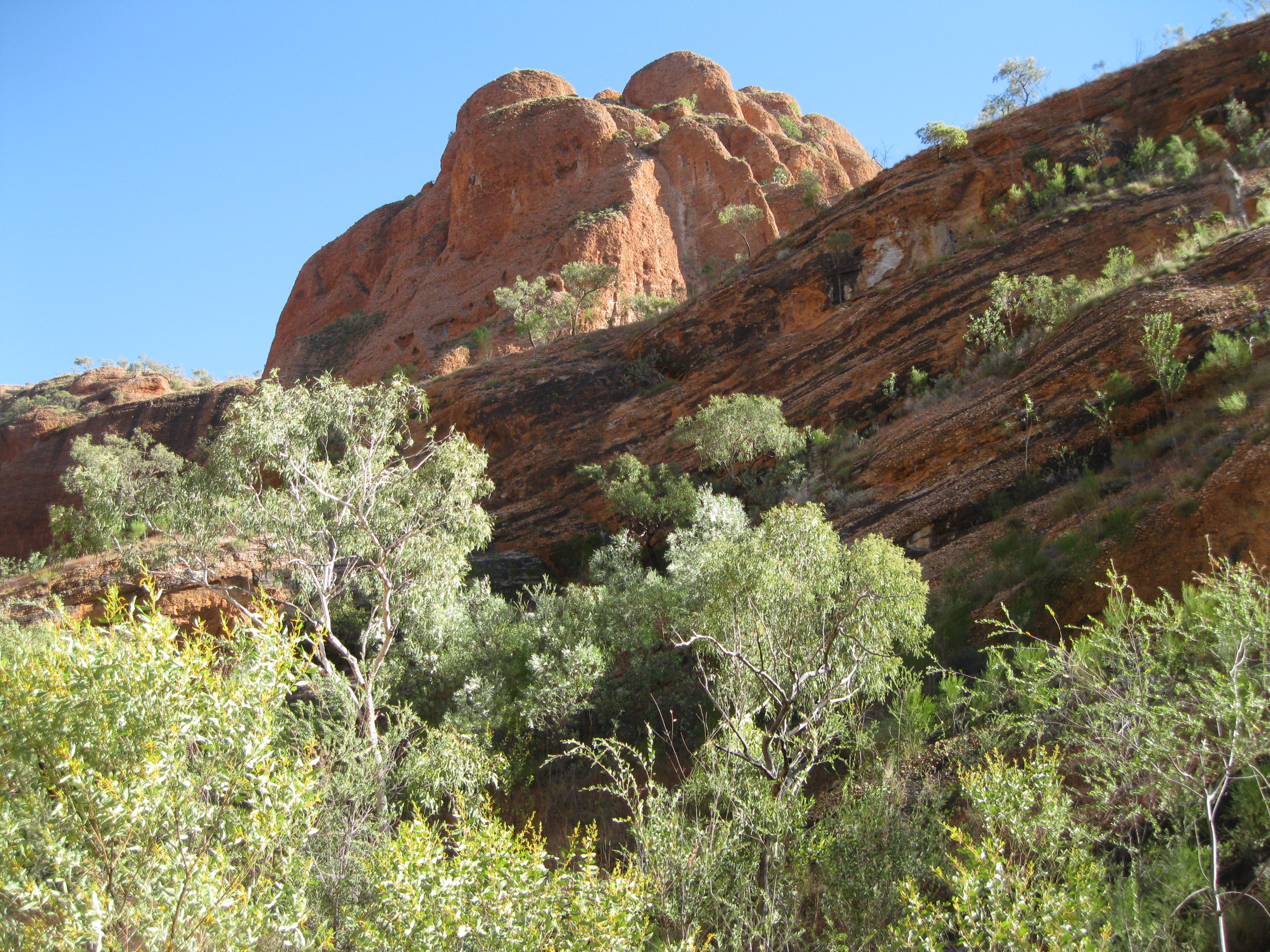
The Bungle Bungle Range is the most scenic part of the park. Here you will find all the cool hiking trails to places like Echidna Chasm, Cathedral Gorge, the Domes and so on. The distances are pretty big between the different sights. From the Visitor Centre, the distance to Echidna Chasm is 20 km (12.4 miles) and 27 km (16.8 miles) to Piccaninny (Cathedral Gorge & the Domes). If you want some information, something to drink or souvenirs, the Visitor Centre would be worth a visit. This is based just outside the national park itself in what is known as Purnululu Conservation Reserve.
The hiking trails are split up between the Northern Walks and the Southern Walks. There are different levels of walks. Some are easy strolls and some are more advanced. The trails are generally unmodified which is really cool. Therefore always wear appropriate footwear. It can be pretty hot at times, up to 40 degrees Celsius (104 degrees Fahrenheit), so bring a hat, plenty of water and apply sunblock.
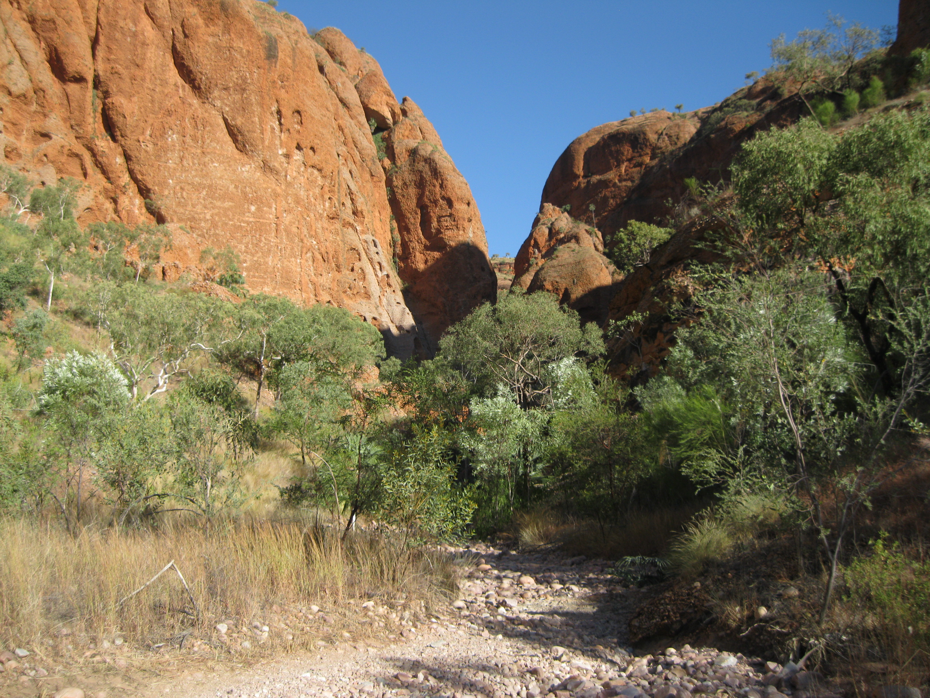
A very cool hike you can do in the Northern Walks area is to Echidna Chasm. The trail starts at the creek bed and is a 1.4 km return walk to the Chasm from the car park which will take about 45 to 60 minutes. It’s a moderate walk but it goes through rocky and uneven terrain. The temperature can rise as high as 40 degrees Celsius (104 degrees Fahrenheit) so it is recommended that you leave early in the morning or in the late afternoon as you will be exposed to a lot of sun for the first part of the walk. Going inside the Chasm is a 2 km (1.2 miles) return hike from the car park which will take about 60 to 90 mimutes. This part is more challenging as you will have to pass fallen boulders and scaling ladders. The Chasm is 180 metres deep and only metres wide. It is in deep shade the most of the time but in the late morning it’s very beautiful when the sun is directly overhead and beams of light reach the chasm floor. Shades of orange and red light up the chasm walls as well.
On the trail you will be met by towering orange rocks walls, Livistona palm trees and stunning views. As mentioned earlier, the scenery in the area is different to the tiger striped beehive domes which the Bungle Bungles are mostly known for. But it doesn’t make it less cool. Echidna Chasm was formed millions of years ago by erosion along a weak point in the sandstone called a joint or a fault. Fractures were formed by a release of pressure as overlying rock was removed by erosion. Water and wind erosion deepened the channel and further erosion over 20 million years created the chasm we see today.
High-energy streams and rivers eroded the steeply sloped highlands and carried large boulders. As the steepness of the slopes decreased the energy level of the streams and river fell and conglomerates were deposited in the walls. Some of the boulders have scratches and grooves which is evidence of erosion by ice as they were eroded out of glacial rock from the Osmond Range and deposited a few kilometres further south. Most of the rocks are sandstone deposited further from highlands by lower-energy braided rivers flowing across broad plains in open valleys. The sandstone show well-developed cross-bedding which documents the passage of dunes within the riverbeds. The direction in which the river was flowing can be seen in shape of the dunes. Cross-bedded sandstones that were formed from windblown sand dunes are also recognised.
If you look at the surrounding rock walls inside the chasm you will also see the evidence showing that it was laid down by a huge river system one layer at a time. All this started about 360 million years ago where sand and sediments eroded from huge mountains from the northwest which would eventually become the Bungle Bungle Range. The round rocks found in the walls here were transported by water millions of years ago which gave them the round and smooth features.
The orange colour of the sandstone is due to the iron content and when this is exposed to the elements it is oxidised and turns orange. If you notice areas where rocks have fallen off you will see that the cliff face left behind is white as this has not yet been oxidised. The Livistona palm trees are often found in the areas with gorges as their roots can reach the permanent seepage water. Therefore you will see them on creek beds or on cliff faces.
Among interesting wildlife here is the bowerbird which bower is quite a sight. The male builds the bower to attract the female with all sorts of stick, twigs and coloured objects such as bones and stones to give it all some “bling bling”, then he delivers a courtship dance and if successful, the mating takes place in the bower.
An amazing geological feature is the round rocks known as conglomerate which is made of pebbles and boulders embedded in a sandy mixture. Millions of years ago the pebbles were moved along in a fast flowing river until they became smooth and well-rounded. They were then fixed firmly in sand and covered by finer sediments. After millions of years of pressure and compaction the conglomerate were formed.
The most famous hiking trails are located in the Southern Walks area. Here you can do The Domes which is a very scenic short 700 m (0.4 miles) loop with amazing scenery. Here you will get to see some amazing domes up close and even termite mounds upon some of them. These are spinifex termites and the mounds provides them protected from the sun, floods, rain and is also storage for plant fibre which is what their diet consists of. There’s not much shade so just be aware that you will be exposed to the scorching sun. The trail is a bit uneven but it is not challenging and just an easy stroll. This walk will take approximately 30 minutes. The Domes are fragile being encased in thin, protective skin of orange bands of iron oxide and grey bands of cyanobacteria. The skin is deposited on the surface by water on the surface seeping through the sandstone and if it breaks of if will be eroded away.
In continuation of the Domes you can do Cathedral Gorge. It’s also a moderate walk which is a 2 km return walk and should take you about an hour to 1½ hours, really depending on how much time you allow yourself in the natural amphitheatre which is at the end of the trail. The trail is uneven and on a dry creek bed but it’s not too challenging. It’s recommended that you leave for the hike early in the morning as it will be cooler. When you arrive at the amphitheatre you will have some shade where you can chill and have a snack or lunch depending on your time of arrival. Try your singing voice. The acoustics here are pretty good, so try a song by yourself if you are brave enough or if you’re in a group assemble a little choir. On the way to and back from Cathedral Gorge you will have a view of towering rocks, domes, pebbles, potholes and honeycomb rocks. Awesome! The amphitheatre sits on a major north-west trending vertical joint line where undercutting of soft sandstone has taken place underneath a waterfall.
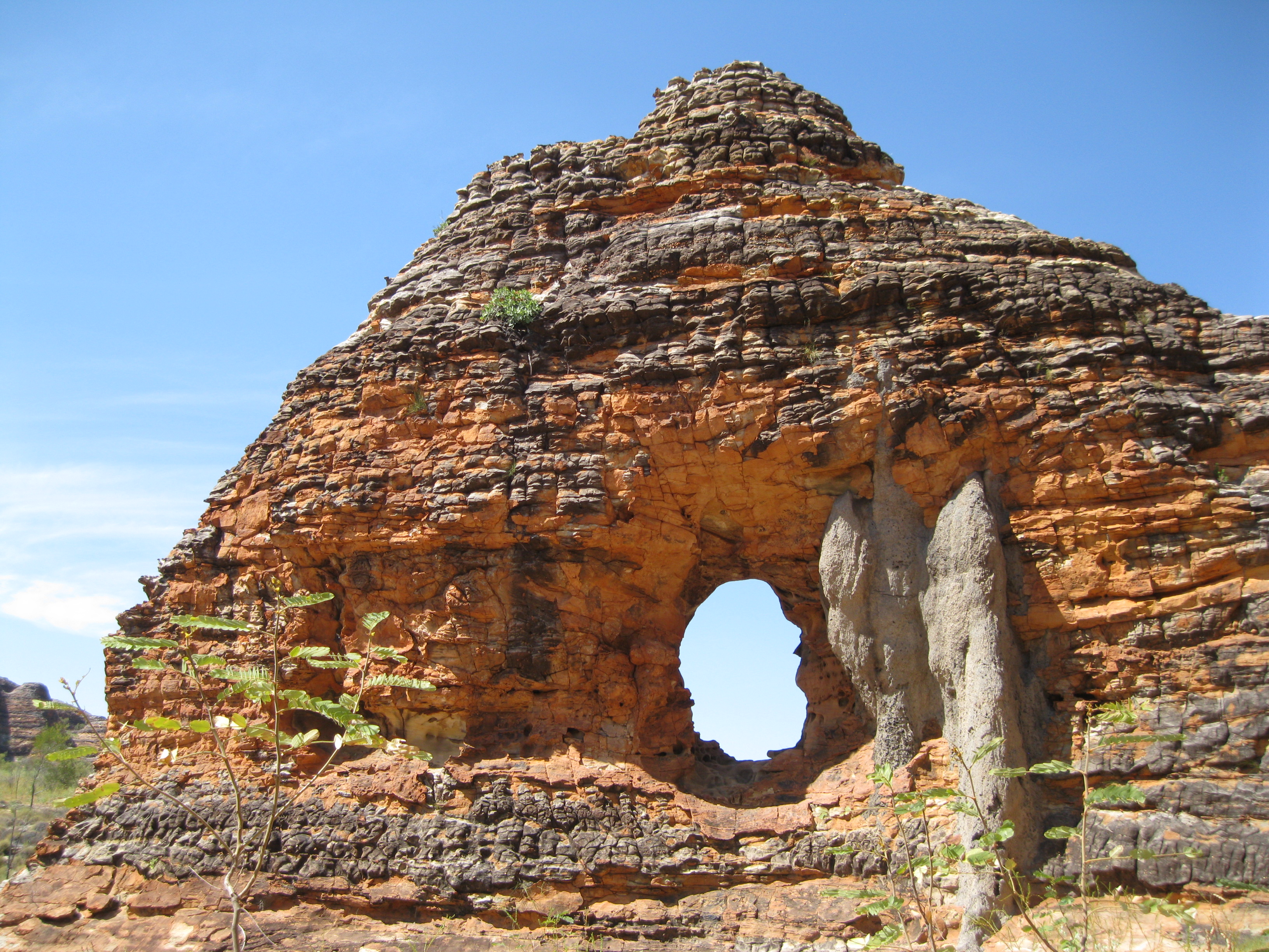
Thereafter an option could be to continue down to Piccaninny Creek Lookout. This is a 2.8 km (1.7 miles) return walk if you are only going from the car park to this spot and back. The trail leads you through uneven deeply eroded creek bed and you will be exposed to the sun. But still it’s not too challenging. At Piccaninny Creek Lookout you will have a great view of Piccaninny Creek going through spinifex hummocks towards Ord River. You can then walk back to Piccaninny Creek and continue down to The Window which is a natural hole in a sandstone rock wall which is pretty cool. Along the way you will have stunning scenery and it’s really awesome walking down Piccaninny Creek when it’s all dried out as it itself has some cool formations carved in the creek over the years. This is a 6 km (3.7 miles) return walk to the carpark.
If you are still up for a further walk you should do Whip Snake Gorge. This is a 10 km (6.2 miles) walk from the carpark which will take you further through Piccaninny Creek among uneven sand and rocks. From The Window it’s another 400 metres to Whip Snake Creek. Stay on the left bank of the creek along the uneven trail of sand and rocks and continue further until the gorge narrows. On the way to the gorge you will pass through a beautiful green area with bushes and flowers. The views along the way of the towering rock walls are amazing and the trail ends at yet a natural amphitheatre with rock figs, brittle range gum, ferns and mosses.
If you are really adventurous, doing the Piccaninny Creek Gorge hike is a possibility. This is the parks largest and most impressive gorge system with multiple fingers stretching deep in to the range. Mind you, if you do this you have to register at the Visitor Centre. Going here you will be hiking down the Piccaninny Creek trail and it is a two night 30 km return trek. It’s really remote but also magnificent. The first 7 km (4.3 miles) are relatively difficult and then it becomes even more challenging as you will be going through fallen boulders, loose rocks and the occasional pool. Furthermore it’s unmarked, with no signage or facilities. You therefore have to be prepared with respect to clothes, food and water. There’s no permanent drinking water source in the gorge, but during wet season and early dry season there may be waterholes. Black Rock Pool which is 700 m past what is known as The Elbow is the more reliable place to find water. The water from pools and waterhole has to be boiled with water purification tablets before consumed. Still please make sure you carry at least 4 litres of water per day.
Furthermore you have to be in good shape and willing to camp among the rocks. It’s a journey into the heart of the Bungle Bungles where you will experience the deeply incised gorges of Piccaninny Creek. The distances to The Elbow is 8 km (5 miles) and further 4 km (2.5 miles) to get to The Fingers which are side gorges of Piccaninny Gorge extending further into the range. Remember your safety. Don’t do the trek alone. Either go with some mates or with a group. The temperatures can be extreme to 40 degrees Celsius (104 Fahrenheit) during the day and down to 5 degrees Celsius at night during dry season. Wear proper hiking boots with good and firm ankle support. Human waste has to be buried at least 15 cm deep and 30 metres away from water sources. Do not wave at helicopters unless you are in need of emergency assistance. You also have to remember to contact the Visitor Centre when you have finished the trek before leaving the park.
If you do decide to take the scenic flight you will be able to view the largest gorge which is Deep Gorge formed after millions of years of erosion along a large joint in the sandstone. You can see where jointing and faulting in the range creates a regular pattern such as near Cathedral Gorge where the north-east and north-west trending faults have formed prominent lines of weakness which acts as natural drainage lines for water coming off the plateau. The scenic flights leave from the Bellburn Airstrip.
In Piccaninny there is an elliptical area referred to as the Piccaninny Impact Structure which a crater is 7 km wide in diameter forming a roughly circular plateau within in the sandstone domes which was caused by a huge meteorite impacting with Earth between 180 and 300 million years ago.
In the south of the range, most of the sandstone have eroded away to become sand plains but some resistant structures have survived millions of years of erosion and stand alone on the plain.

A great place to watch the sunset is at Kungkalanyi where there is a short 500 m (0.3 miles) trail which is an easy uphill stroll up to the view platform. You will have a great panoramic views of spinifex covered ridges, Bellburn Creek and the western escarpment of the Bungle Bungle Range. This could be a great culmination to a busy day. Standing here viewing the sunset with a beer in your hand, it can hardly get any better. Right next to the Bungle Bungle Range you will see a higher ridge of dark red Cambrian sandstone which is 520 million years old. In the middle distance you will see a grey limestone wall with is 525 million old, stretching from north of Kurrajong to the south towards Walardi. It was formed as a reef fringing inland sea and accumulated sediments over time. The retreat of the sea and the uplifting of the sediments later displayed the Bungle Bungle Range. If you look to the north you will see the Osmond Range out in the horizon. This is the original source of the sediments and conglomerate which the Bungle Bungle Range is made of. To the west the Halls Creek Fault and the Spring Creek Tracks can been seen and to the south beyond the plains you will see the Dixon Range and the Ord River Valley.