Wrangell-St. Elias National Park & Preserve is not only the largest national park in the United States but also in North America. The park opened in 1980, is twice the size of Denali National Park and six times as big as Yellowstone National Park. It is one of the least visited though which in a way is a shame but on the other hand that is also the charm of it, as it won’t be crowded and spoilt. The park has 9 out of the 16 tallest peaks of North America, 150 glaciers and more mountain peaks than any other location on earth. It’s known as the “Mountain Kingdom of North America” and includes the mountain ranges St. Elias, Chugach, Alaska and Wrangell. Another interesting fact is that it’s got one of the two glaciers in the world with a forest growing on it with trees calving off the edge. Until the mid-1980, Wrangell-St. Elias National Park & Preserve was an overlooked mountain wilderness.
The park is only a day’s drive or a short flight from Anchorage, it has a lot of history and is not crowded. It receives a lot fewer visitors than Denali, is just as amazing but different. It is mainly an area for active people, who want to go hiking, rafting or other outdoor activities.
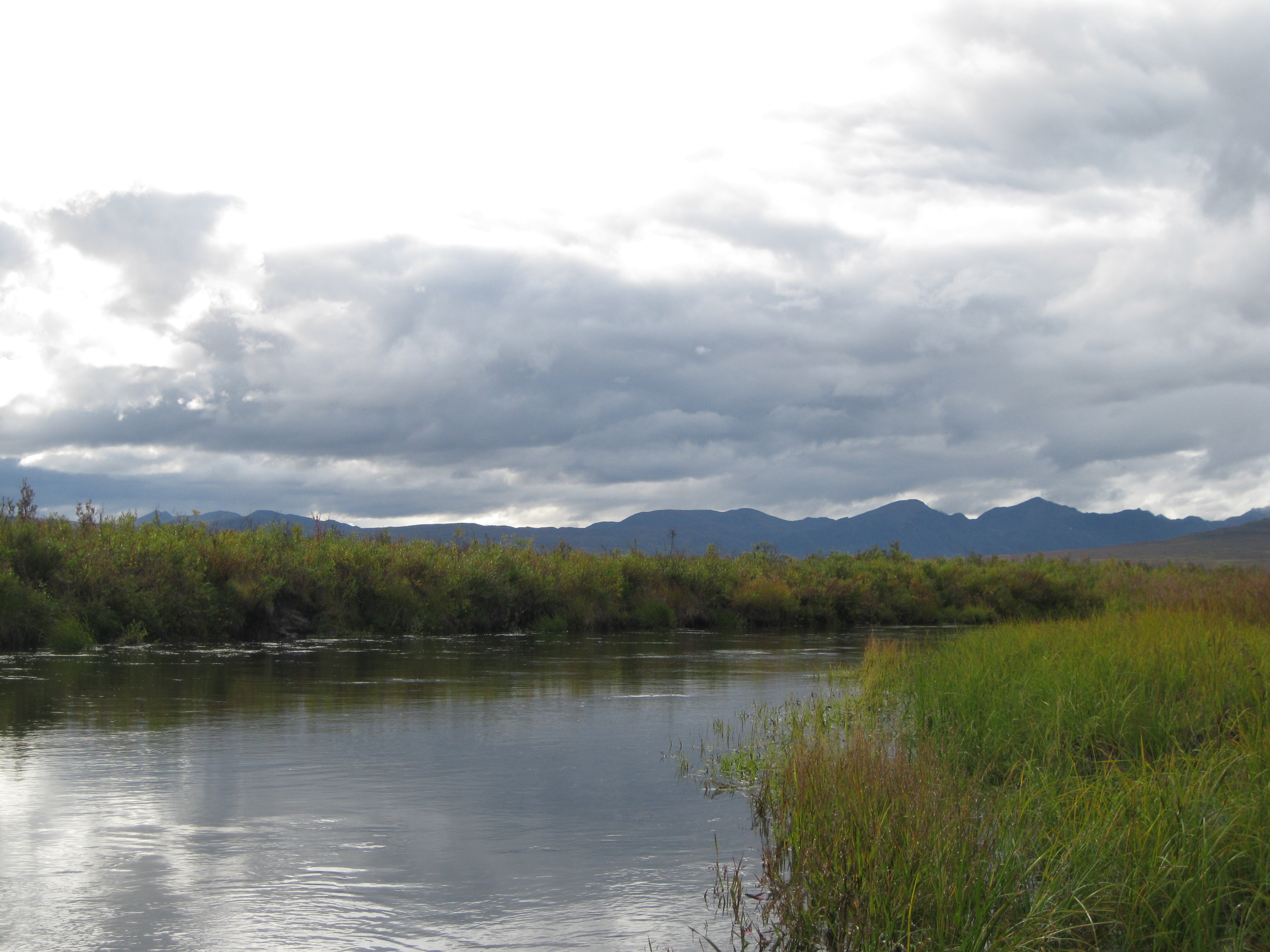
Maclaren River is located just on the edge of the national park. An option could be to go here before entering the park. You can go canoeing on the river and stay at the Maclaren Lodge overnight, which is literally the only place you can stay in the area. The river is awesome. Exploring it by canoe is a killer option. The scenery is so beautiful and the silence when you are on the river is staggering. There is nothing and no-one around. You can easily spend around three hours sailing around here. Fantastic experience.
In 1900 two prospectors named Jack Smith and Clarence Warner found a green spot in the Wrangell Mountains between Kennicott Glacier and McCarthy Creek which happened to be the richest copper deposit ever discovered. The financier families of J.P. Morgan and Guggenheim, who were collectively known as the Alaska Syndicate, bought the rights for the Kennecott Mining Company (misspelled). The name was later changed to Kennecott Copper Corp, and chipped out 1 billion pounds of copper.
To do this they had to build a railroad and a mine in the wilderness. The construction of the railroad started in 1907 and reached the area around 1911. At that time they started producing ore. In order for the company to obtain land beside the railroad tracks it had to be completed in four years. It was called the Copper River & Northwestern Railroad which was 314 km (196 miles) long and is now defunct. The railroad was built by thousands of workers who laid tracks around glaciers, across canyons and through deep snow and avalanche areas. 129 bridges were built and the total cost of the railway was 20 million USD. The most expensive bridge was the Million Dollar Bridge at a cost of 1.4 million USD

Michael Heney, who was known as a colourful character, was in charge of the construction and they started building the railway from Cordova where they also had to create a steamship company which would transport the ore from Cordova down to Tacoma, Washington. He had previously been in charge of the Yukon and White Pass Railroad in Skagway where he had earned the reputation of overcoming difficult challenges.
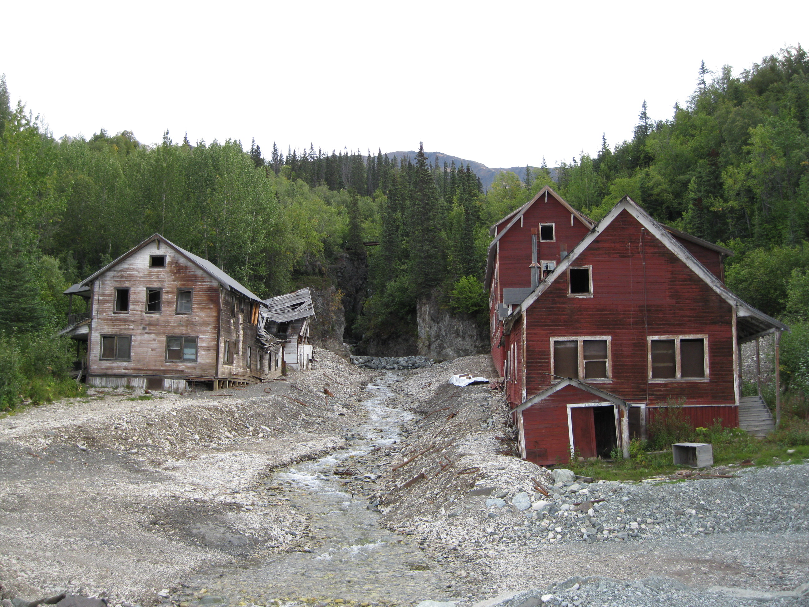
Mines, a concentration mill and the town of Kennicott were quickly established to support the extraction of the copper. Due to the growing amount of workers, Kennicott grew and became one of the most modern towns of Alaska at that time. There was a hospital, a school, a post office, stores, houses and recreation hall and at its peak the population was around 600 people. All the buildings were steam heated, had electricity and running water. This was a time where Anchorage was very small. Kennicott was a closed company town when it started developing and it had strict morals. There weren’t many jobs for single women, alcohol was forbidden and there weren’t many forms of entertainment. So if they wanted to be entertained they would have to go to McCarthy which was a support community for not only Kennicott but also the gold mining district which was 15 miles south east of Kennicott. Today old mining equipment is still located outside the storefronts of town as a tribute to the past. The mill and artefacts still stand today and it is more like a ruin with a lot of rubble lying around which is actually pretty cool. The National Park Service is slowly restoring many of the old structures. A National Park Service Visitor Center is based within the Kennecott Mill Town from where you can join a guided tour by a ranger or local guide. The mine itself is also abandoned and is located up in the hills.
When the mine closed in 1938 it had been operating for more than 26 years and had produced more than 4½ million tons of ore worth 200 million USD. At that time the Kennecott Corporation donated the bridges and the land they owned around the tracks to the US Government. 48 miles of the Copper River Highway was completed from Cordova to the Million Dollar Bridge. The roadbed from Chitina to McCarthy is now the McCarthy Road located on where the old railroad was based.
Kennicott, the town, the river and the glacier, were named after the American naturalist Robert Kennicott who worked for the Smithsonian Institution. In 1859 he identified Alaskan natural history specimens and joined a mission in 1865 to determine a telegraph line between the United States and Russia via the Bering Strait.
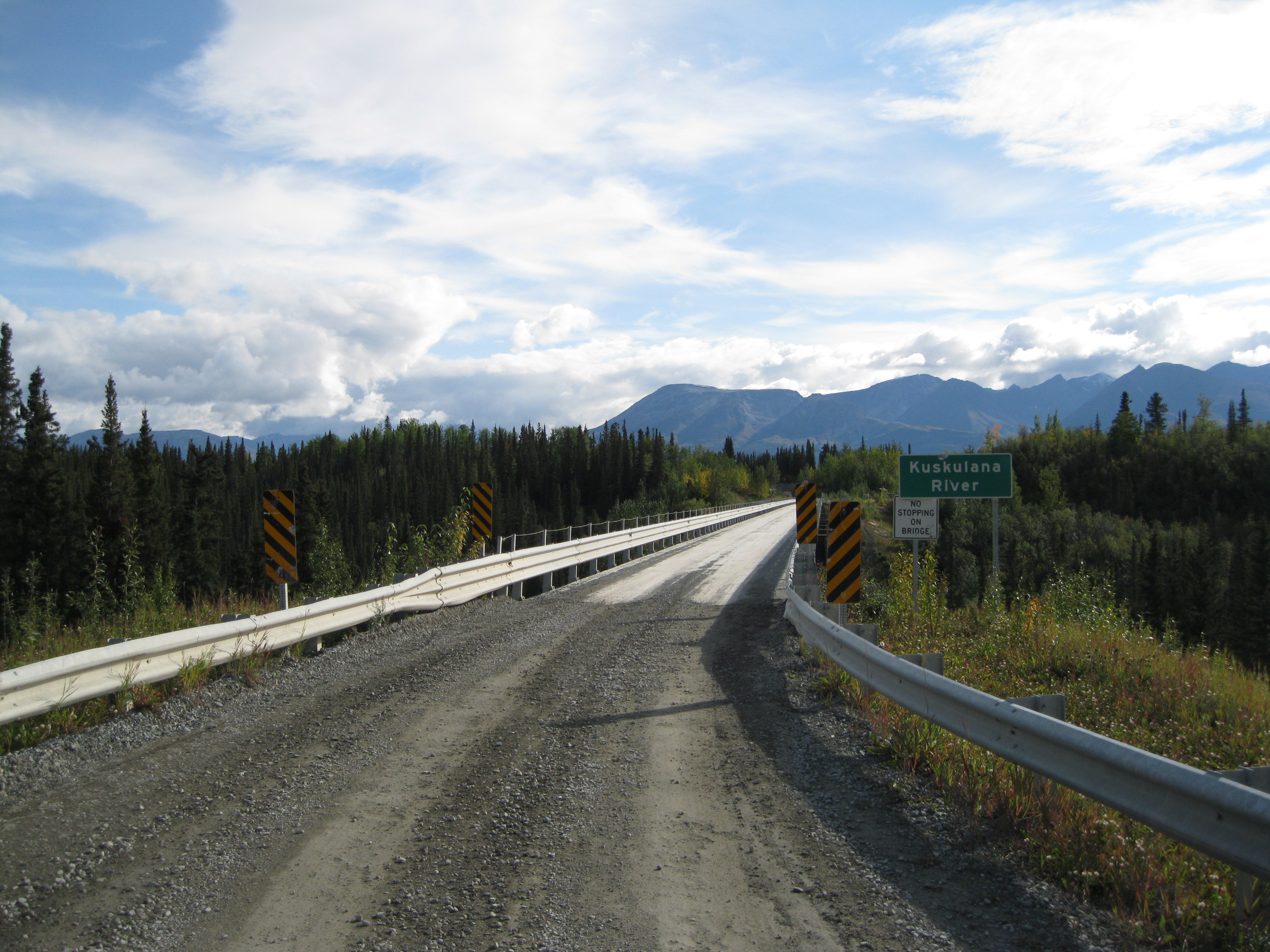
Going to McCarthy and the Kennicott area can be done via the McCarthy Road which runs from the end of the Edgerton Highway in Chitina (pronounced “Chitna”) to about 1.6 km (1 mile) outside McCarthy. The road is 96 km (60 miles) long and has a gravel surface. You have to be a little bit careful when you drive on the road as it can be a bit rough. The weather could have resulted in creating ridges and ruts in the surface. It is a narrow and winding road that still reflects its railroad past. It will take approx 3 hours to drive each way. The McCarthy Road starts as you cross the Copper River Bridge and enter Wrangell-St. Elias National Park and Preserve. After 27 km (17 miles) you will reach the Kuskulana River Bridge which is 236 metres long (775 ft) and crosses the Kuskulana River. After crossing the bridge it’s an absolutely must to stop and step out to have a look at it and the river below. You can get a pretty good view of the construction of the bridge. It was completed in 1910 during winter at -51 degrees Celsius (-60 degrees Fahrenheit). The demand was on to get a bridge built as Copper was piling up in Kennicott.
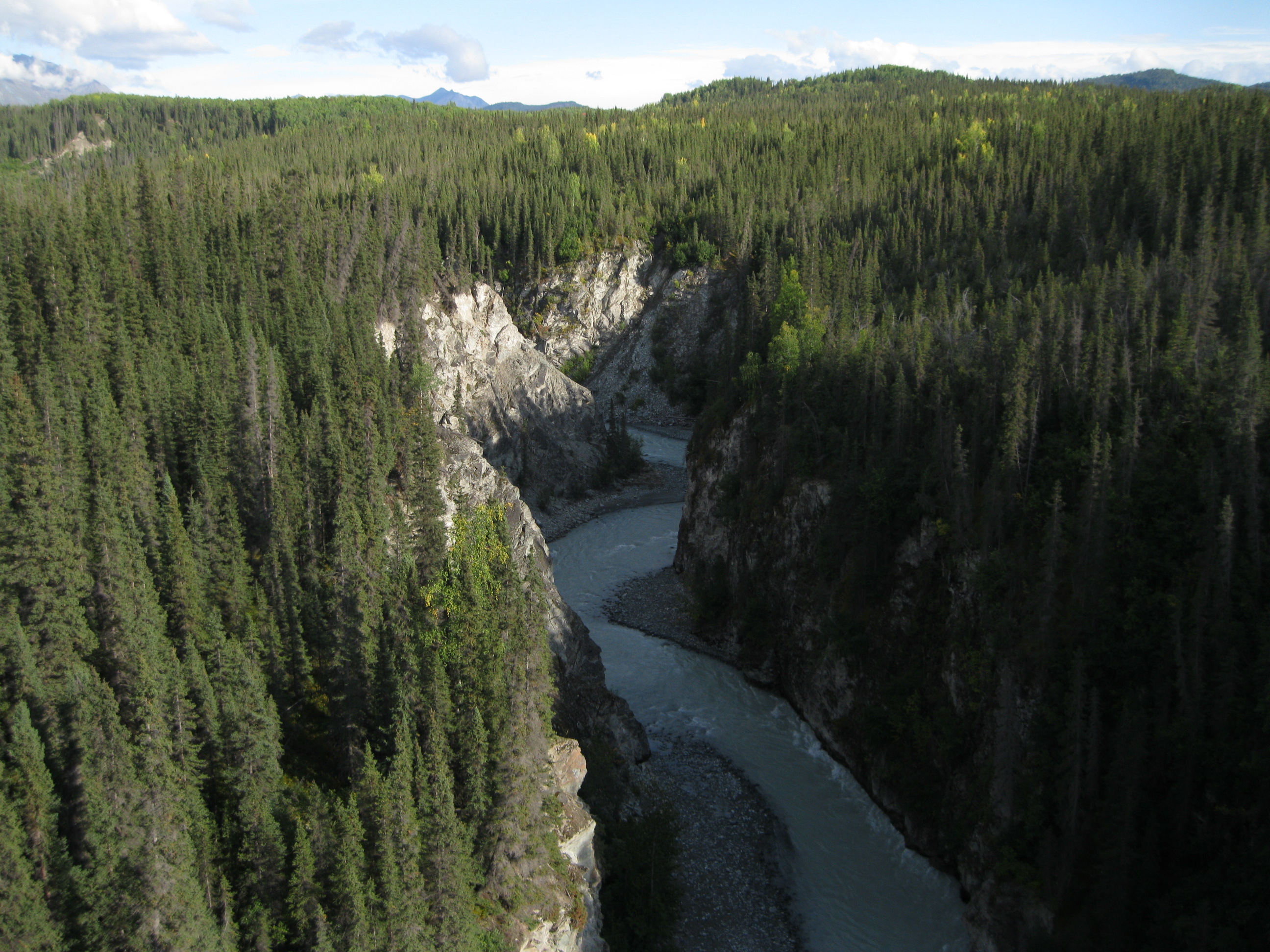
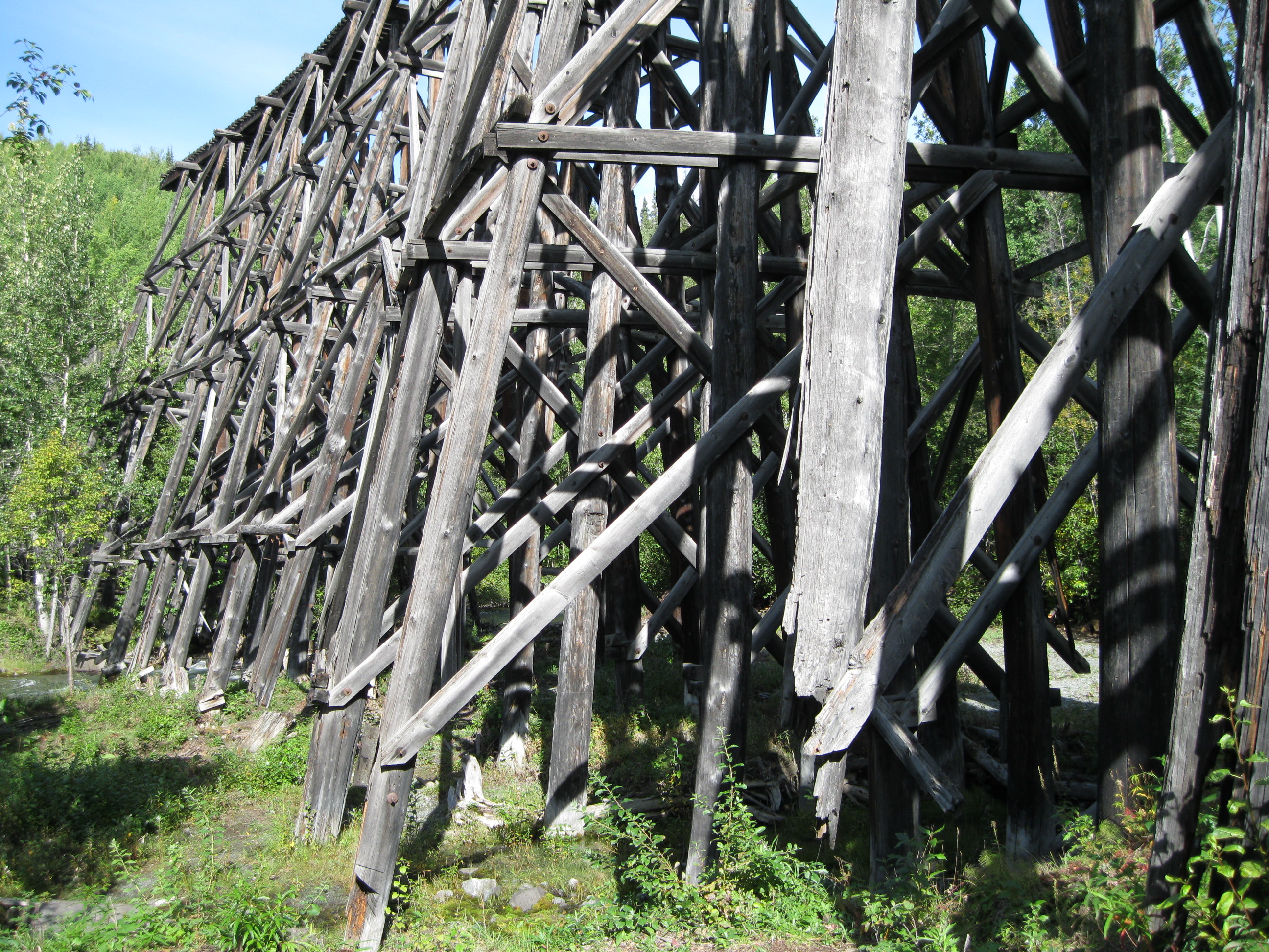
Continuing further up the road after travelling about 46 km (29 miles) you will reach the Gilahina Trestle located at the Gilahina River which is really awesome. This abandoned wooden bridge was originally 268 metres (880 ft) long and 27 metres (90 ft) tall and was a part of the Copper River & Northwestern Railroad. Due to the rugged landscape, more than 15% of the structure was built on trestles. When the rail building crews arrived at the Gilahina River the pressure was on to get the entire railway built by April 1911. The price of copper was high and there was a huge demand to get the ore to market. The crew worked around the clock through one of the harshest winters on record and managed to get 21 km (13 miles) of track between Kuskulana Bridge and the Gilahina River built in 17 days. Temperatures would drop to -55 degrees Celsius (-67 fahrenheit) and carpenters would struggle with timber that would split and crack because of the cold. It was impossible to drive pilings into the ground so to anchor them, holes had to be blasted. In spite of the terrible workings conditions the workers rose to the challenge and the Gilihana Trestle was built in 8 days in 1911. On 28 January 1911 the first train crossed to bring construction supplies to continue the work.
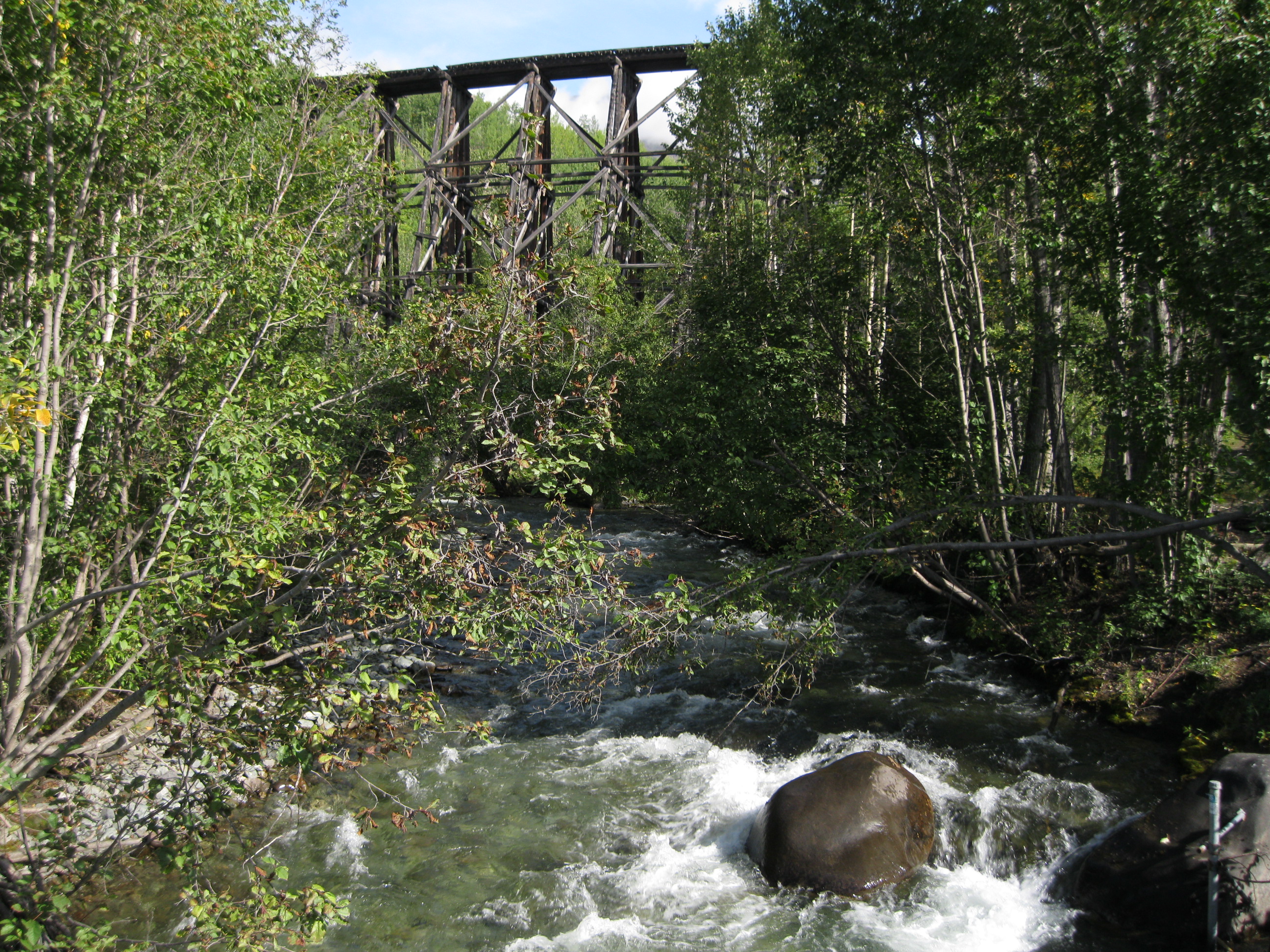
Sparks from passing trains was a huge risk so water barrels were placed along the wooden trestle to put out small fires, but in the summer of 1915 sparks started a huge fire which burnt the trestle to the ground. It was rebuilt again in 10 days by rail crew to keep the ore trains running, only 2 days longer than it took for experienced workers to construct the original during the bitter winter of 1911. Having a stop here to check out the bridge is also a must-do. You can get some really neat shots of the bridge from all sorts of angles. It’s a really impressive historic structure.
At the end of McCarthy Road you will reach a camping site at the Root Glacier Base Camp and if you want to continue onwards you have to cross a footbridge over the Kennicott River. Here you will have a fantastic view of the Kennicott Glacier. McCarthy is 0.8 km (½ mile) away and the Kennecott Mines National Historic Landmark is 8 km (5 miles) away. After crossing the footbridge there is a shuttle service going from here to both McCarthy and the Kennecott Mines. Both Kennicott and McCarthy, which are now ghost towns, are located in the heart of Wrangell-St. Elias National Park & Preserve, 300 miles east of Anchorage, in a glacier cut valley surrounded by limestone mountains. McCarthy is 7.2 km (4.5 miles) from Kennicott.
In 1906 the founding father of McCarthy, John Barrett, wisely claimed ownership to his homestead on land which the Kennecott Corporation most likely would have to travel through with their railway. It worked out better than he could have foreseen when the Kennecott Corporation leased a freight yard as the construction expanded at the Kennecott site in 1907. Barrett wasn’t the only homesteader as John Bloomquist also staked his homestead at the base of a mountain leading to Kennicott. The two gentlemen partnered several claims between the two homesteads near the glacier and soon a camp town grew as miners and labourers appeared in hope of getting a job. The Fagerburg brothers from Dan Creek and Bloomquist ran roadhouses close to the wagon trail and later the railroad station by delivering different services. Pete Johnson managed an unlicensed saloon and at the time it was a dry area but was poorly policed. This is most likely also the reason for the tales of rowdy fist fights and general lawlessness still circling today. This site was not the location of present day McCarthy. When the railroad arrived in 1911, McCarthy became a jump-off point for miners and visitors. It also became a major supply source for Dan Creek and Chititu Creek mining camps which had been active since the turn of the century. The community quickly became a trading and freighting point due to the arrival of the railroad.
The original site of McCarthy voted to change the name to Blackburn in 1912. Present day McCarthy developed due to the Shushanna Gold Rush where prospectors were forced to exit the trains on John Barrett’s property. Tent camps started to appear on his land much to his dismay. Barrett did not have a patent to his property so he followed the same route as he did with the railroad and made some of his homestead into a town site and leased lots to potential merchants, families and entrepreneurs. Merchants began gathering in McCarthy due to the convenience of the railhead, postal offices and freight and soon the businesses from Blackburn such as the Pete Johnson’s saloon moved to present day McCarthy. Johnson actually moved the entire building. Blackburn did not endure and McCarthy was up and running within a short period of time. During the second decade of the century the community blossomed due to the Dan Creek operations booming, the Shushanna Stampede and Kennecott expanding. Bootlegging was big and the train operators had created a way of warning the people of McCarthy if the law was on board when they entered town with a special whistle sequence. When the law arrived they would have great difficulty in finding any booze. When Barrett received the patent for his homestead he included the township and handed the entitlement to the land of the lots to the people who had leased them at no cost. A really admirable act by Barrett.
McCarthy later went through several devastating fires and changes in the economy such as the Great Depression which had a great effect on the town. In spite of this, McCarthy today still has a lot of its original character thanks to landowners who have invested in restoration and preservation of the historic buildings which are used by businesses and for private homes.
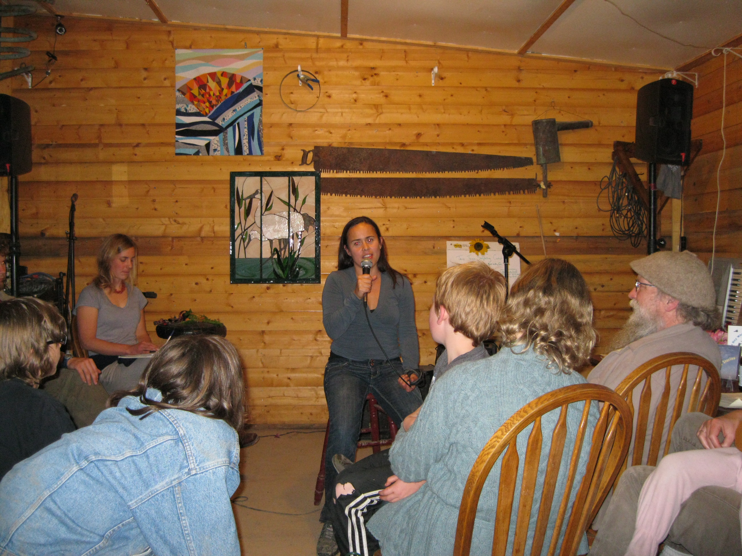
Going to the McCarthy Lodge for a night out on the town is great fun. It’s a cosy little place where you will meet fellow travellers and locals which is such a cool experience. They may also have a competition on “tall tales” which is quite entertaining. A “tall tale” is a story with incredible elements that can be both true and fictional. It is often told as if the storyteller is a part of the story and is normally humorous. If you walk down to the lodge from the campsite before dusk or at night, remember your flashlight otherwise it will be impossible for you to find your way back in the dark as there are no streetlights and it will be pitch black.

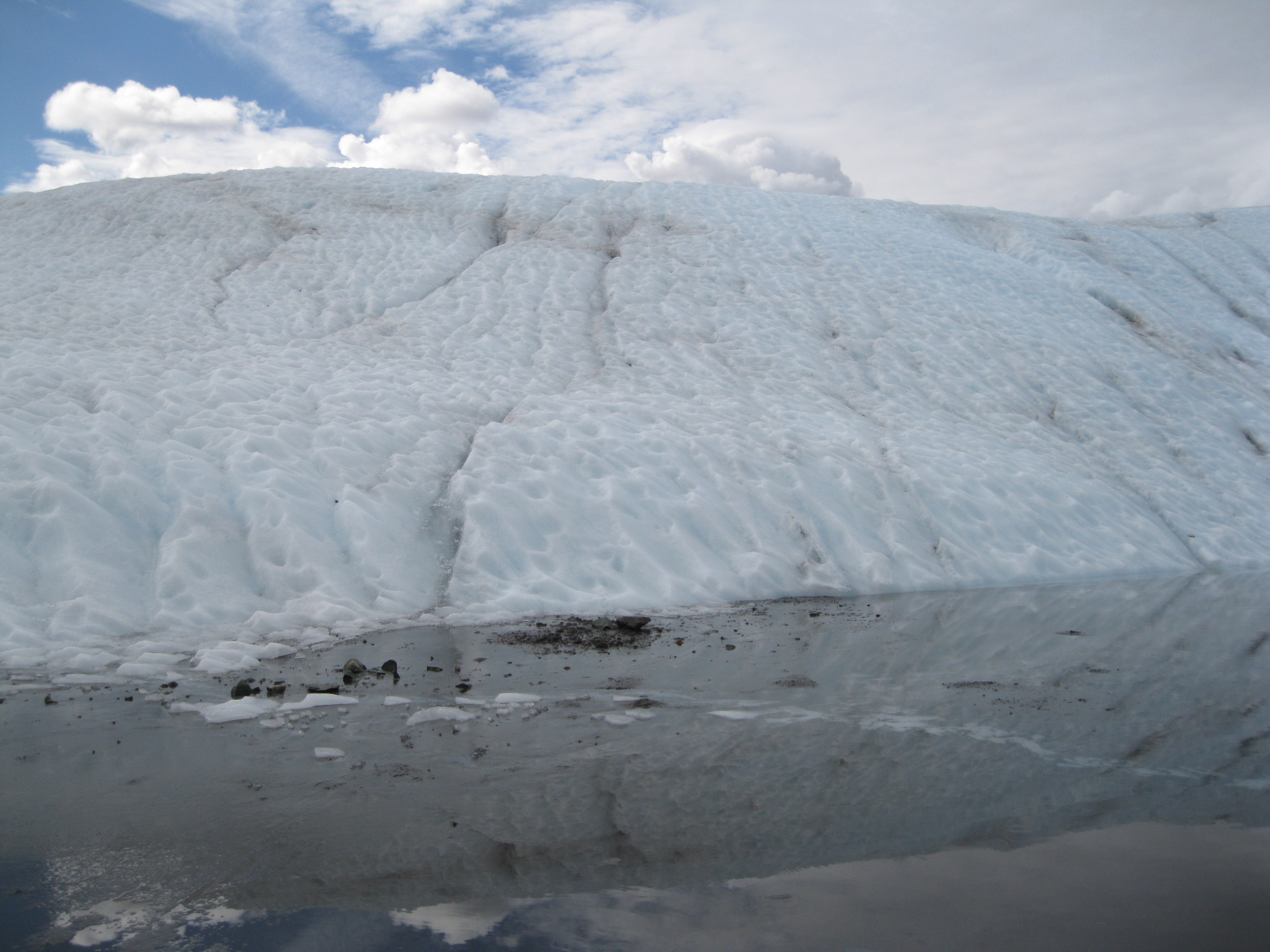
An absolutely awesome activity is ice hiking on Root Glacier. Alternatively you can also go ice climbing. Hiking trails lead to this glacier from the Kennecott Mill Town, so you can also check out the Mill on the way to the glacier. Mind you, depending on whether you are on a tour or by yourself, you may not have time to explore the mill too much if you’re on a guided tour. The first part of the tour is walking down the hiking trail to Root Glacier where you will cross Jumbo Creek on the way. Once you get to the glacier, if you are on a tour, you will be given crampons to attach to your boots so you will have a firm grip on the glacier while walking on it. The tour guides will instruct you how to walk with the crampons. It is pretty easy, but be a bit careful and bear in mind that after you have walked around for a while, you feel more confident and you will tend to be less cautious. So just remember to be a tad careful. Not that it is particularly dangerous, just walk like the tour guides have instructed you.
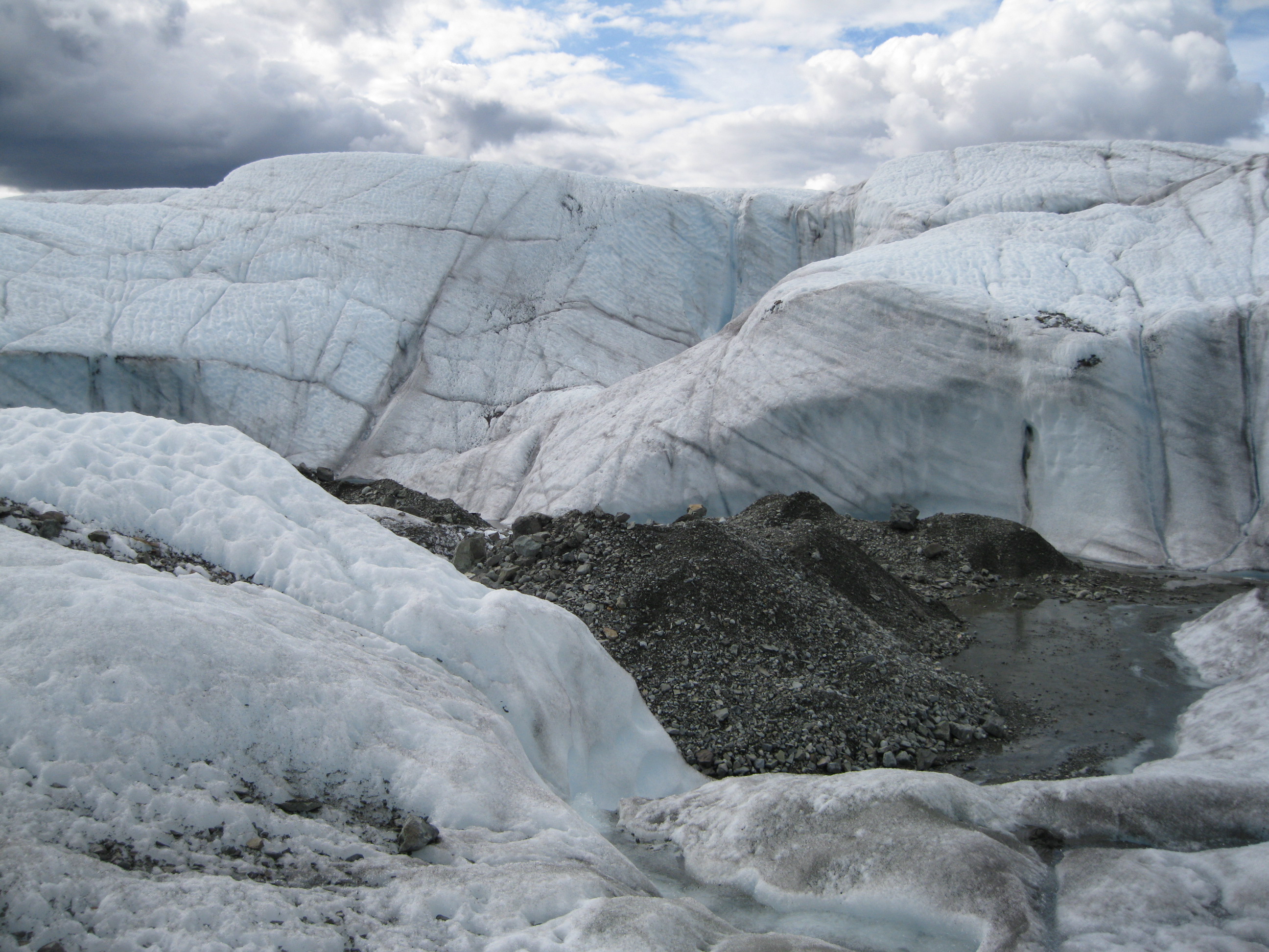
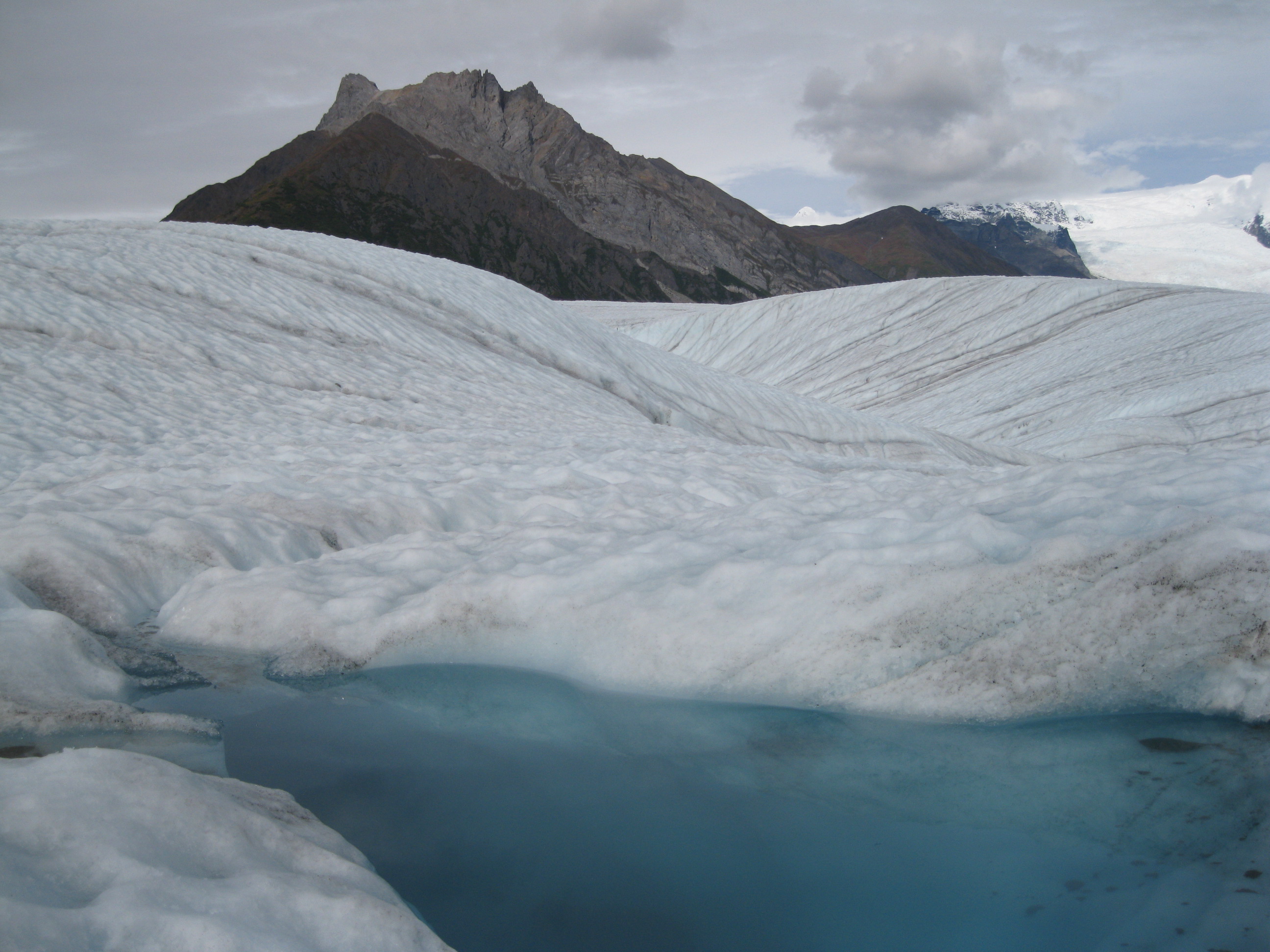
A part of the glacier looks like gravel, but this is ice with a thin layer of dirt on top. Doing the hike is absolutely amazing. It’s great fun itself and you will have some killer views of the glacier and the surrounding Wrangell Mountains such as Mt. Blackburn, Regal Mountain and Donaho Peak.
On the tour you will enter a couple of ice caves which is so cool. The colours in here are amazing and has to be experienced. Note that if you look closely at the cave walls you can see pieces of gravel inside it. Really stunning.

There will also be ice pools on the glacier where you can have a dip if you are adventurous enough and don’t mind the extreme cold. In many different areas there will be all sorts of screams. Fascinating with all the activity nature creates on the glacier. There is a spot on the glacier which looks like a shallow lake which is also the place where the ice climbing is done. Here you will also find waterfalls.
Further down the glacier there’s a deep hole in the glacier as well. You have to be very careful when approaching it. Don’t get too close. Furthermore you can also have your lunch on the glacier itself. Most of the hike is relatively level with some slight elevation in certain places.
Driving through Wrangell-St. Elias National Park & Preserve you will also be able to see the Trans-Alaska Pipeline System or more commonly known simply as the Alaska Pipeline. This is really cool. It was built between 1974 and 1977 after the 1973 oil crisis which made the Prudhoe Bay oil field attractive. It conveys oil all the way from Prudhoe Bay in the very Northern part of Alaska all the way down to Valdez (pronounced Valdees by the Americans) in the south, a stretch of 1,287 km (800 miles). Building the pipeline was a challenge due to the extreme cold weather and the permafrost. Therefore new construction techniques were developed to deal with the frozen ground. The first barrel of oil travelled through the pipeline in 1977 and full production began by the end of that year.
A great hiking trail worth exploring is the the Historic Valdez Trail. When you walk down this trail you will experience really neat forest landscapes but you will also find evidence of the building technique of the army which built it and left it abandoned in 1907. Much of the original rock work from 1899 still remains but is hidden by the lush costal rain forest. The army used available materials such as wood, rocks and hand-crushed rock fragments. Many poor gold rushers found jobs hackings and blasting the trail out of the canyon walls with very basic hand tools.