Amazing Picturesque Scenery
If you like to get into the Outback and explore landscape that resembles paradise, then you should pay the gorges of Mount Barnett Station a visit
The property is privately owned and is a cattle station located in the Kimberley region in the northern part of Western Australia. There are two main attractions based on the estate which are Manning Gorge and Galvans Gorge.
Camping at Mount Barnett Station
You can camp at Mount Barnett Roadhouse from where you will have easy access down to the trail leading to Manning Gorge. The camping area is located 7 km (4.4 miles) from the roadhouse.
Camping here is a bit of an experience. When you are sleeping in your swag or in your tent at night you may notice the occasional cow walking around in the dark. Welcome to the Outback. It’s the real deal, authentic and quite funny. This is the way to go.
The facilities are pretty good with toilets and showers. Furthermore there are spots where you can prepare your meals and chill out around the campfire. I you want to set up a campfire you have to remember to bring firewood before entering the camping area.
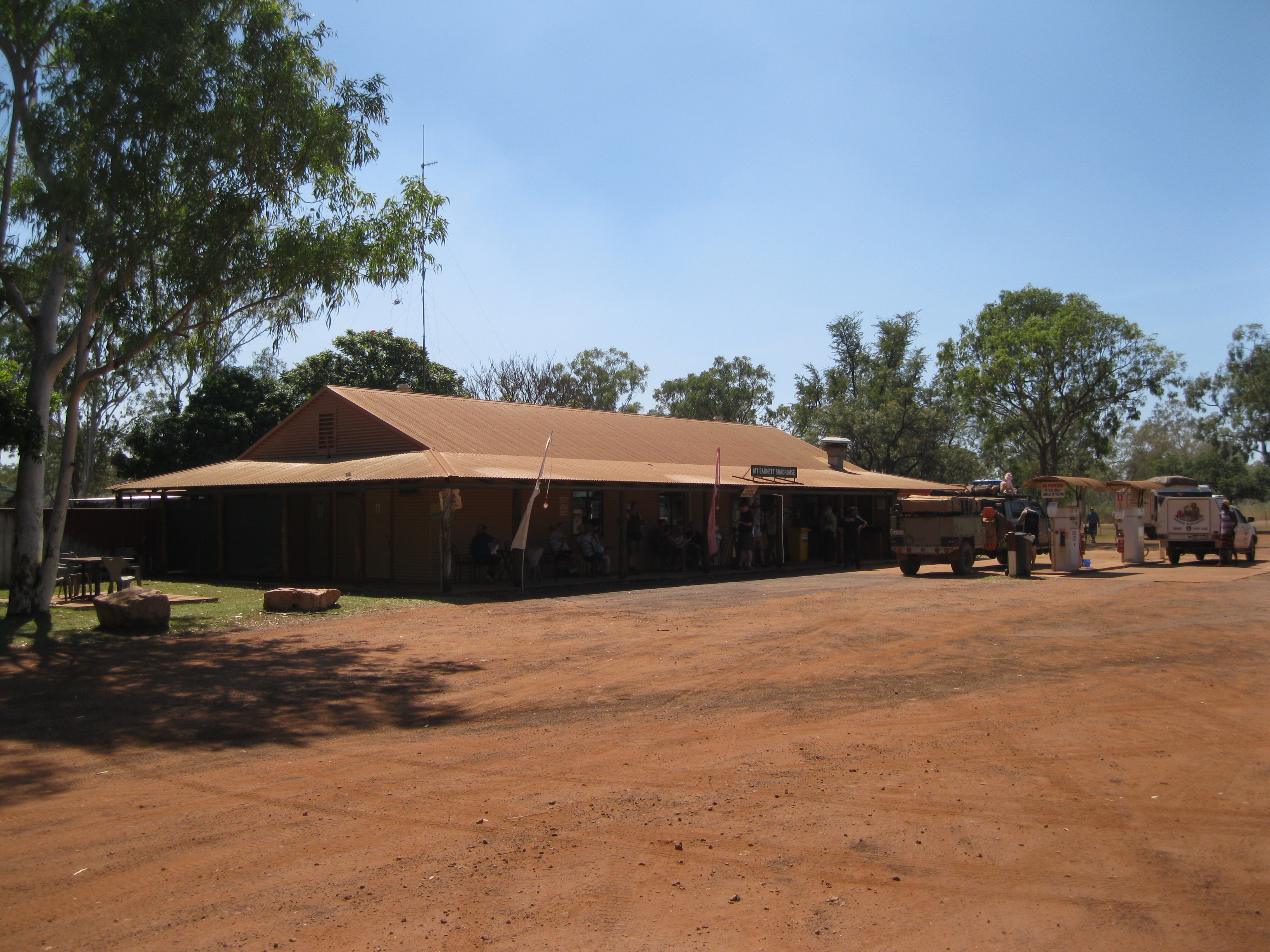
Mount Barnett Roadhouse
The roadhouse itself includes a pretty big shop and is the only one in the area and for miles. Here you are able to purchase food and snacks. You can also deliver a post card here which will be picked up every Friday morning. A public phone is available which could be useful as there is no mobile phone reception in the area.
Furthermore it is also a petrol station and mind you this is the only option to fill up your vehicle for miles. From Mt Barnett Station there are 337 km (209 miles) to El Questro Station Township.
Have a chill outside the roadhouse or take a little stroll around the area. Roadhouses like these are such a cool and classic Australian Outback institution. There is nothing like it elsewhere in the world.
Take in the atmosphere of the place. You will see people travelling around the Outback, coming to refill their vehicles, to get various supplies for their further endeavours.
There will be all sorts of vehicles all dusted up from driving down the Gibb River Road. It is just one of these great Outback experiences. Take a walk a bit further down the road and take it all it. Just check out the dirt road and the road leading down to the camping area. It’s awesome.
You will also have the opportunity to fill up your drinking water supply, especially if you are driving in a big vehicle such as a van or a minibus.
The Gibb River Road
Mount Barnett Roadhouse is located on the Gibb River Road which was originally constructed for cattle transportation going from Derby to Wyndham from the surrounding cattle stations. The construction of the road started in 1950 and by 1956 the southern part was completed. Up through the 1960s it was continuously extended.
It was a bit of a challenge due to the rugged terrain around the Napier and King Leopold Ranges and the numerous of watercourses as well. It was known at the Mt House Road until 1962. On the old road, which was handmade by using picks and shovels, it would take a month to transport supplier from Mt House to Derby by wagon.
Since the roadhouses on the Gibb River Road opened for visitors it has become a very popular tourist destination. The road stretches 660 km (410 miles), is closed most of the wet season and is pretty much only open during the dry season which is from around May to September. There may be delays in opening of the roads from year to year due to flooding.
There are only two major roads cutting through the Kimberley region which is the extreme Northern part of the Great Northern Highway and the Gibb River Road. When driving on the Gibb River Road you will have some great views of the Outback of the Kimberley region. Everything from stunning rock formations, open plains, rainforests, savannah and woodlands. Furthermore you will have access to spectacular gorge such as Manning and Galvans Gorges on the Mount Barnett Station property.
Bear in mind that you will also have to cross creeks and rivers in your vehicle. Therefore make sure you travel in a vehicle appropriate for these kind of challenges such as a high clearance robust vehicle or a 4WD. Caravans are definitely not recommended.
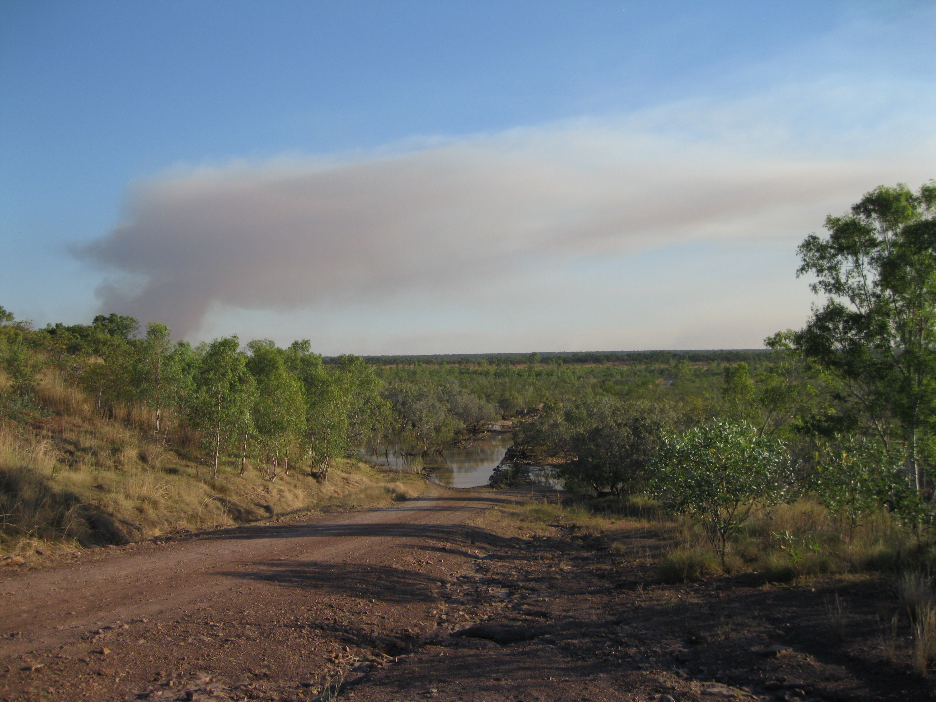
When driving around in an Outback area like this you will see some bushfires either fairly close up or in the distances. They are most likely controlled bushfires and there is a lot of debate about these in Australia, whether is it necessary or not.
The Gibb River Road is for the most part an unsealed road. During the 2000s the road was upgraded to a formed gravel two-lane road and included a few sections with asphalt. A lot of the land along the way is either owned by Aboriginal Communities or are pastoral leases.
A pastoral lease is an arrangement where crown land is leased by the government for the purpose of grazing and breeding of livestock. The area was rich in fresh water and food sources which made it possible for the Aboriginals to live a rich cultural life. It wasn’t until 1898 the white man arrived. Frank Hann who was a gold prospector and explorer was the first to describe the southern region of the Kimberley plateau. Many of the features in the area still have the names he gave them at the time.
Geology: The Formation of the Beautiful Landscape
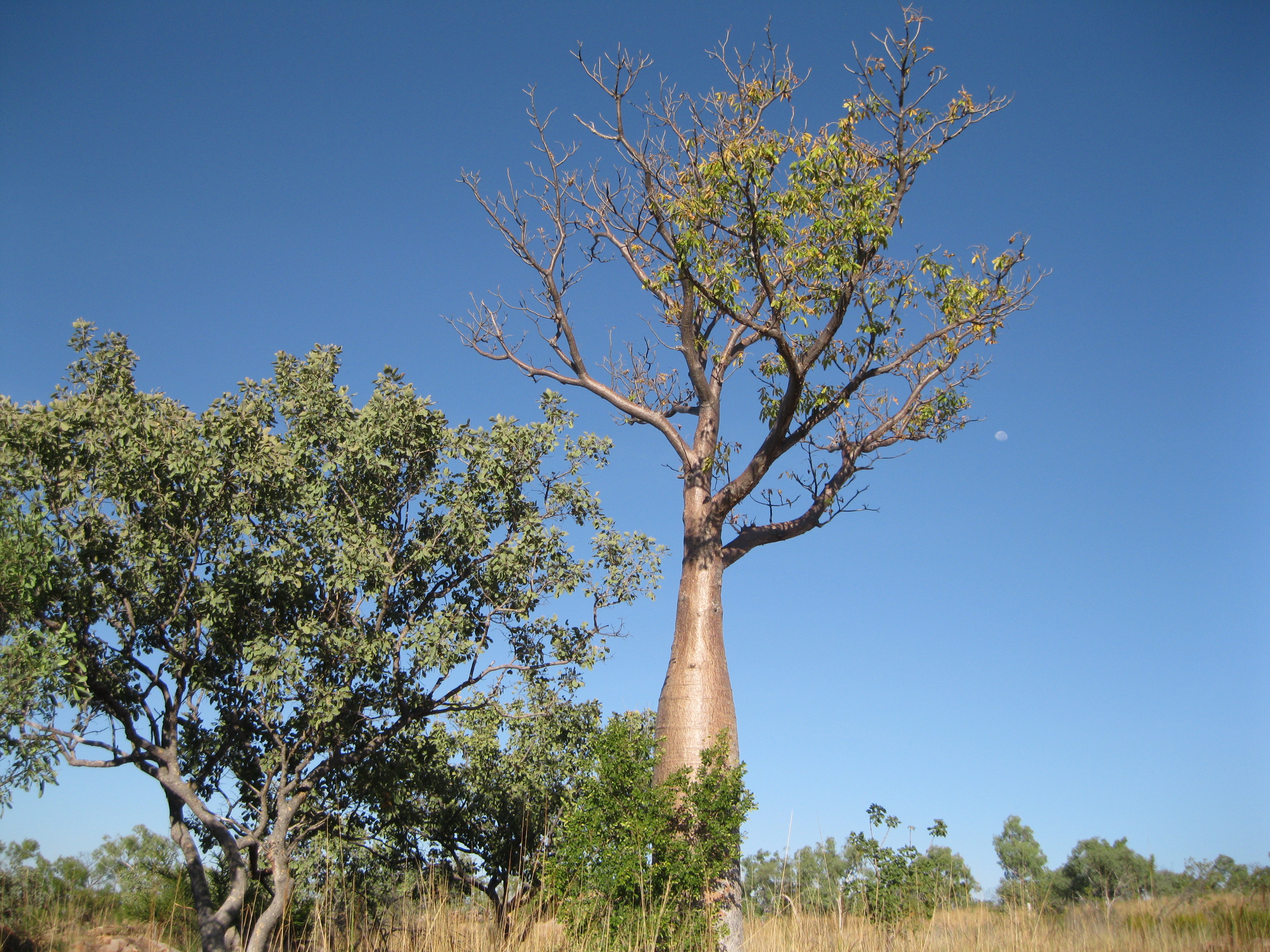
The Gibb River Road goes through a country of granite outcrops between the Devonian Reef and the King Leopold Ranges. In the area you will see what is known as rounded tors and whalebacks. The former are hills made up of jumbled blocks of rock. The latter are boulder-strewn rock formations which have an appearance similar to the look of the back of a whale. The low rounded hills are the characteristic of areas with underlying volcanic rock. There are sandy valleys, rivers, creeks and boab trees in the region as well.
The main rocks are varieties of grey and pink rock granite dating back 1,800 to 1,865 million years ago. They consist of a varying amounts of mineral quartz, plagioclase, feldspar, potassium feldspar, biotite mica and amphibole. Mixed in with the granite are large areas of dark green to black gabbro which are made up of the minerals olivine, pyroxene, amphibole, plagioclase feldspar and biotite mica. The granite rocks have been interspersed with volcanic rocks of a similar age that reached the surface of the Earth by a massive eruption. Pyroclastic rocks were formed by the lava flows.
The land was formed by erosion from flowing rivers and creeks for the past 20 million years. In the massive rock units such as granite, the erosion and weathering have been controlled by the cracks, patterns and joints in them.
The tors have been created where the caps in the joints were small unlike the whalebacks which were formed where the caps are more spaced out and made a huge single standing granite block. Granite is usually coarse-grained rock with feldspar crystals. They were thought to have been formed when the magma from deep in the Earth’s crust was cooling slowly. Large crystals were grown to a higher level in the crust where they would cool much faster so the remaining liquid formed smaller crystals.
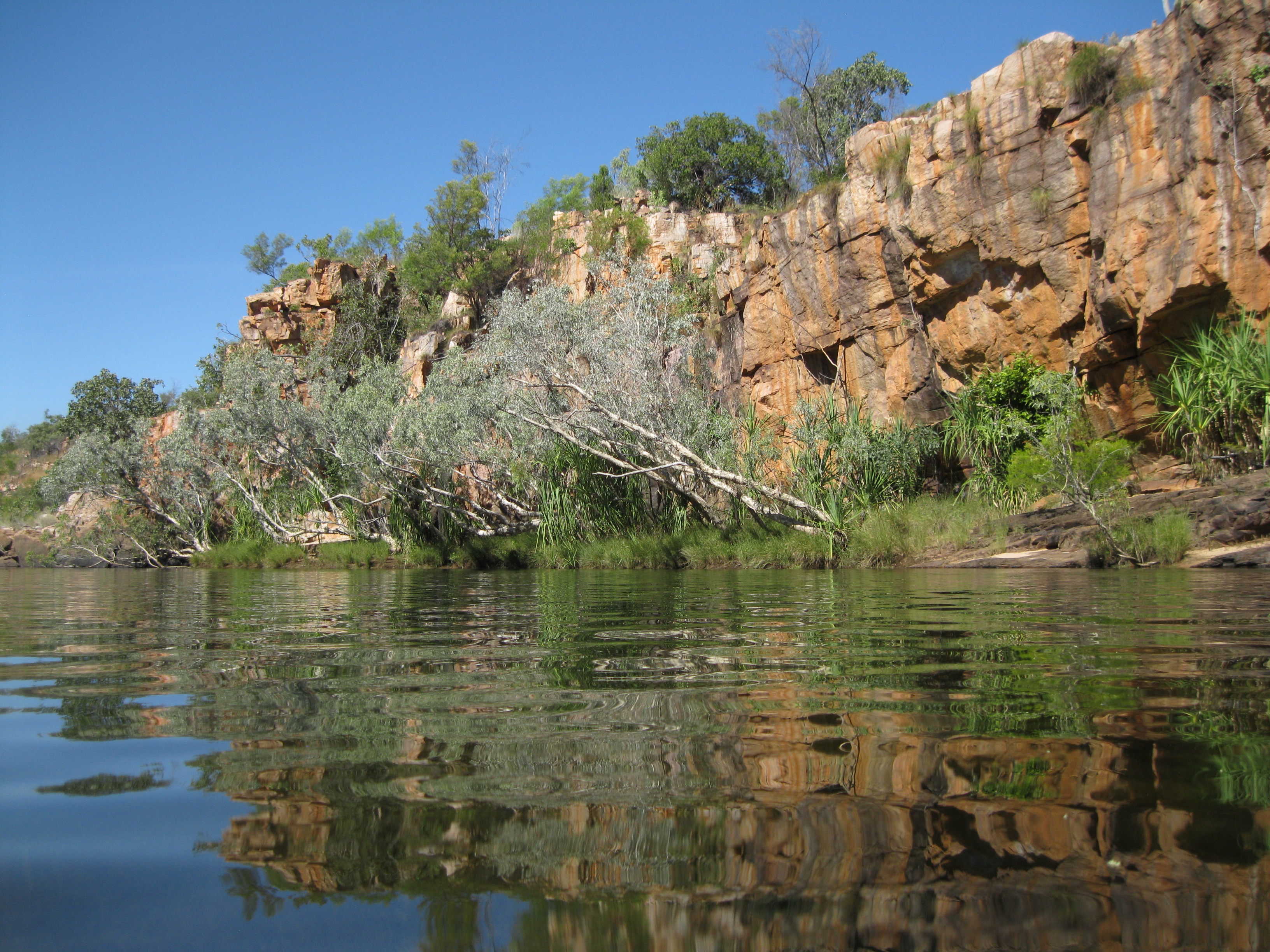
Manning Gorge
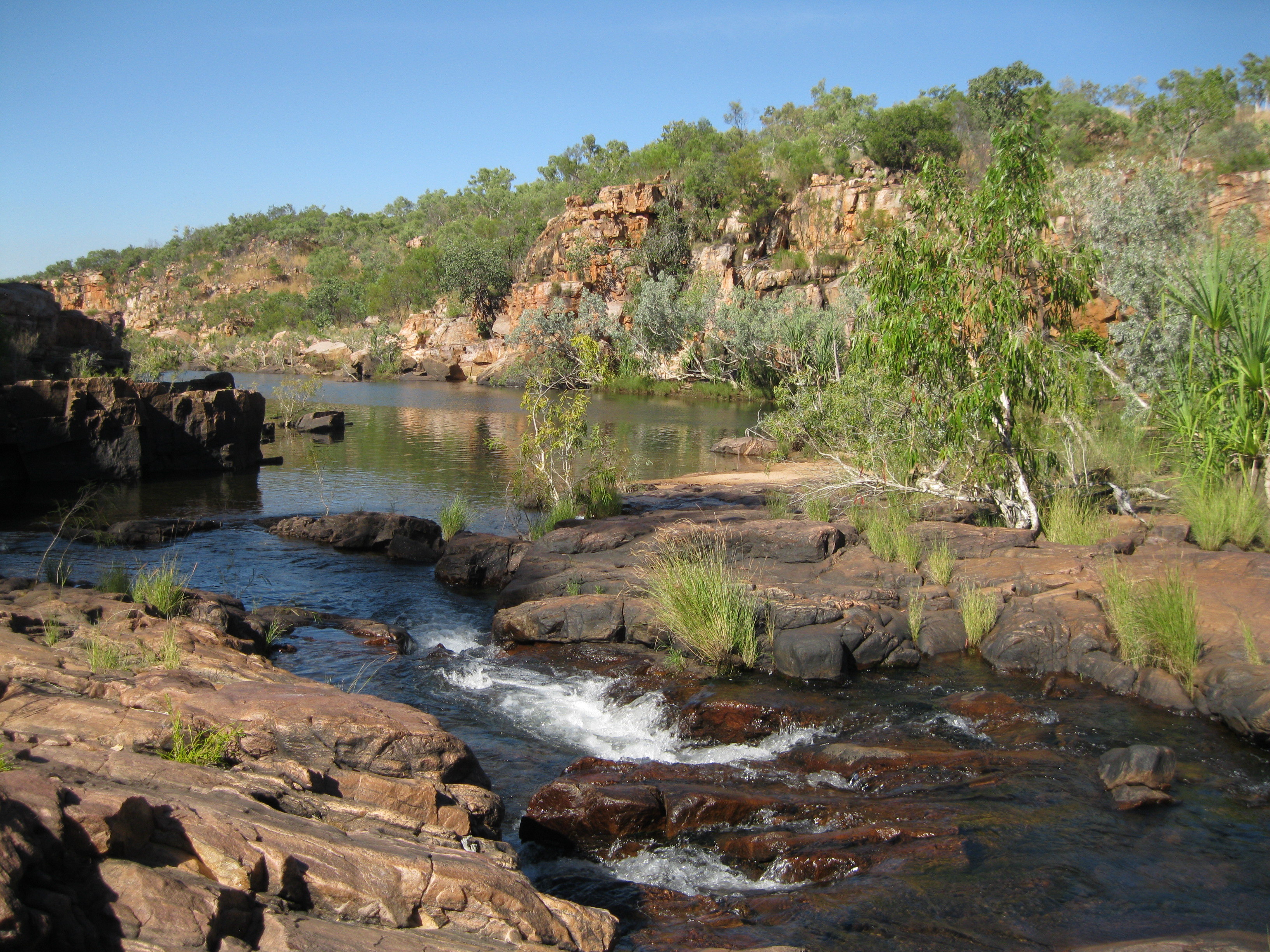
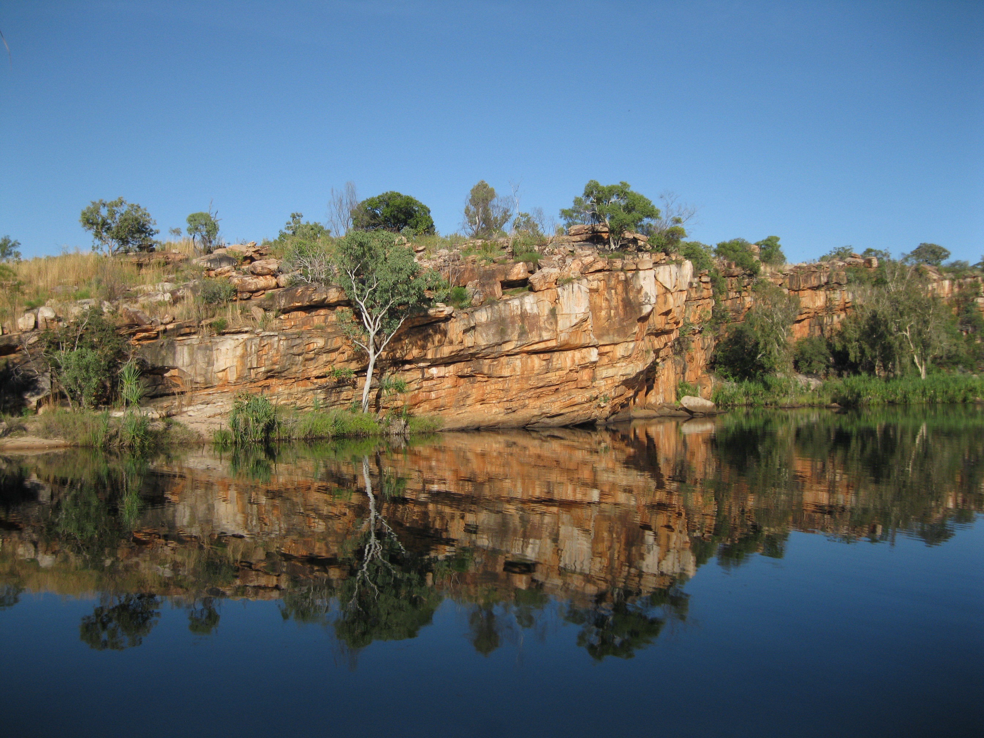
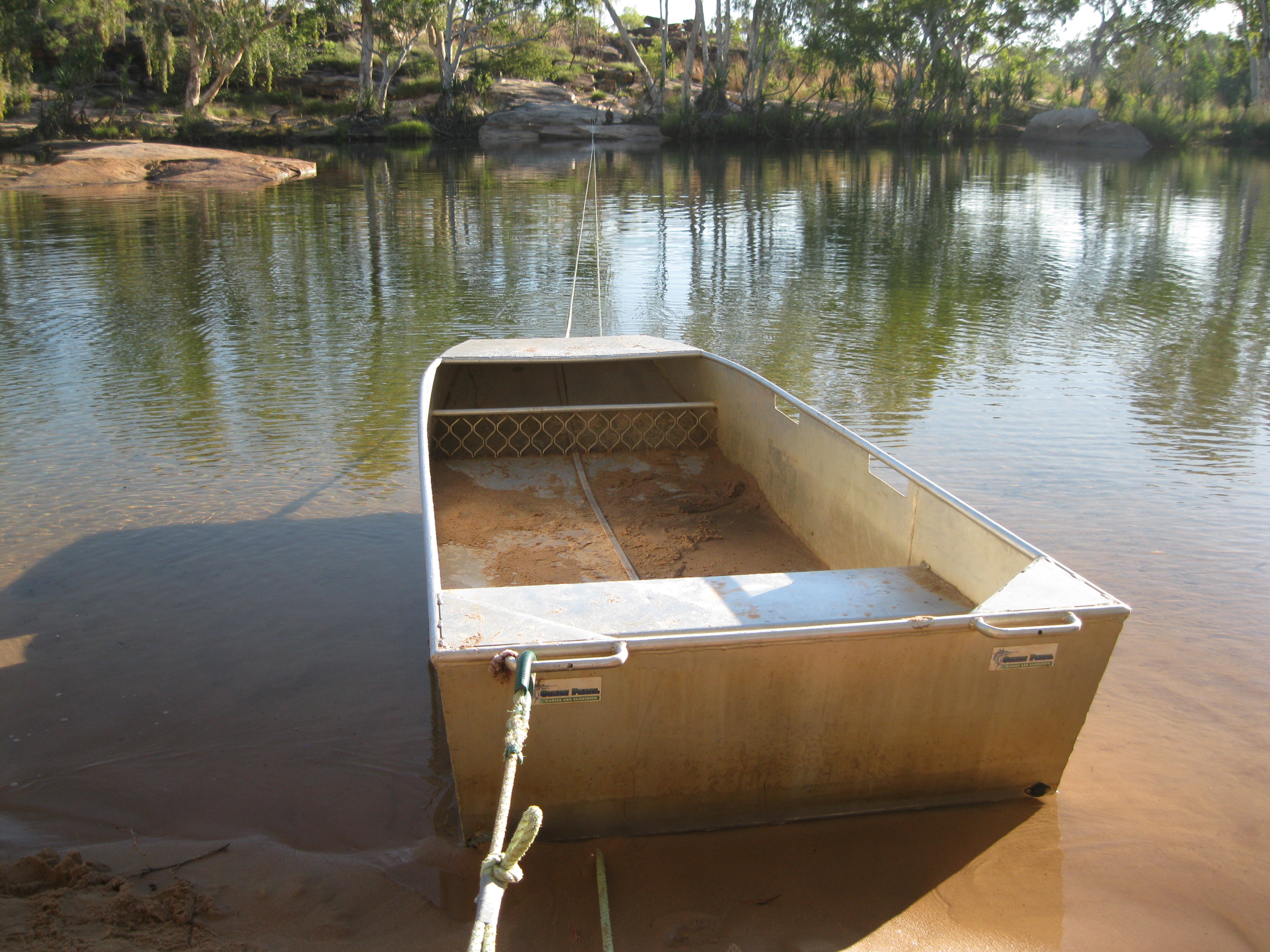
Close to the camping area at Manning Gorge you will find a pretty big water hole where you can have a dip if that takes your fancy. There scenery here is really awesome as well. You have to cross this water hole to get on the Manning Gorge trail. The crossing can be done in a small metal dingy which takes about 4-6 passengers. You can pull yourself across by the rope attached to it or you can get your fellow travellers to it. When you have come across you will have some great views of the pool. This is a great photo opportunity.
When heading off to Manning Gorge, it’s a good option to leave early in the morning so it won’t be too hot on the way. The walk from the campsite to the gorge will take about an hour and is not too strenuous. Along the way you will have great views of boab trees, beautiful flowers, open plains and rocky terrain. Take your time to experience this beautiful landscape of the remote untouched Outback.
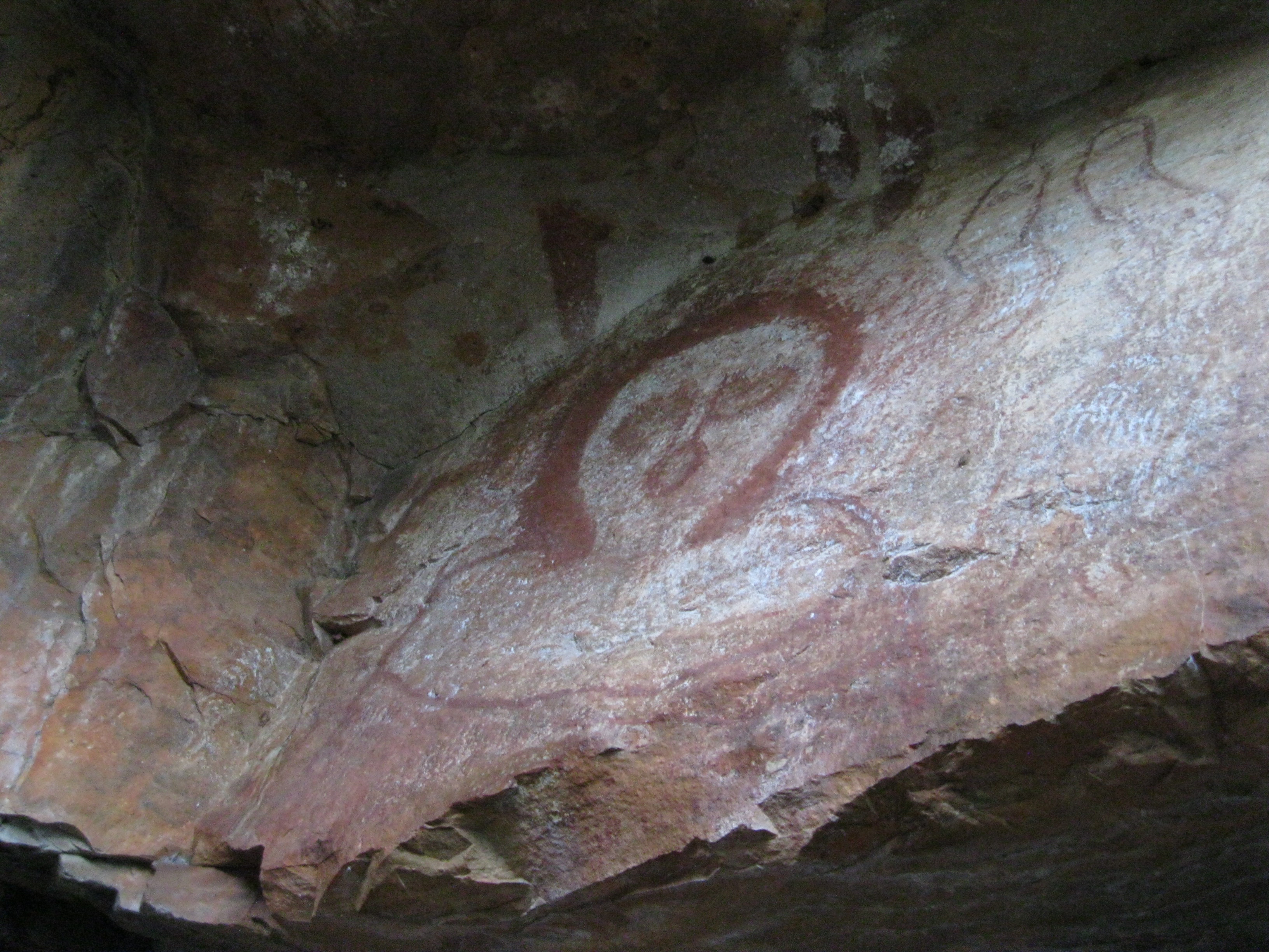
Upon arrival at the gorge you have to climbs down some rocks to get to the pool where you can have a dip on the way you many notice some Aboriginal art work on the rock walls which is pretty cool.
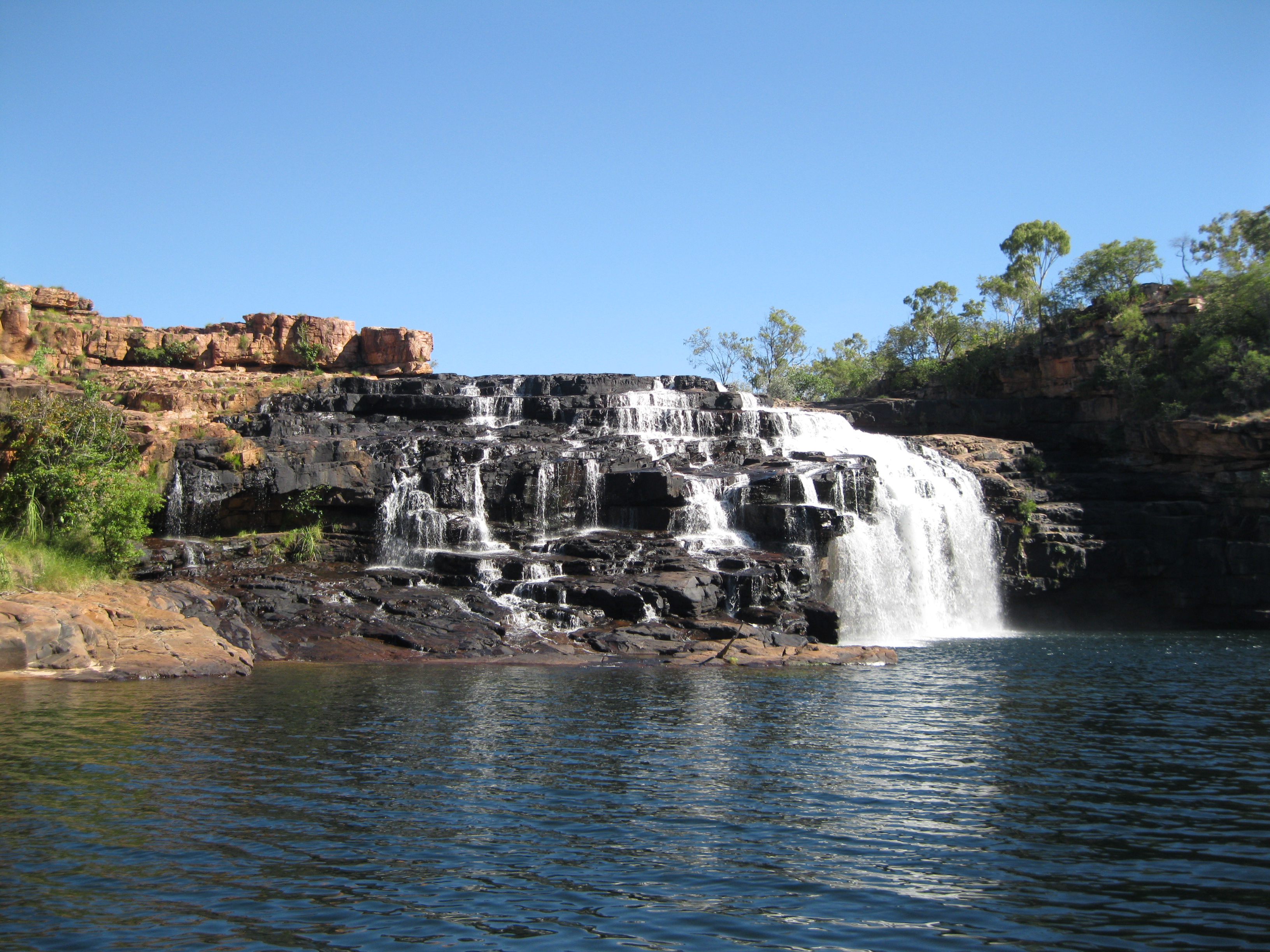
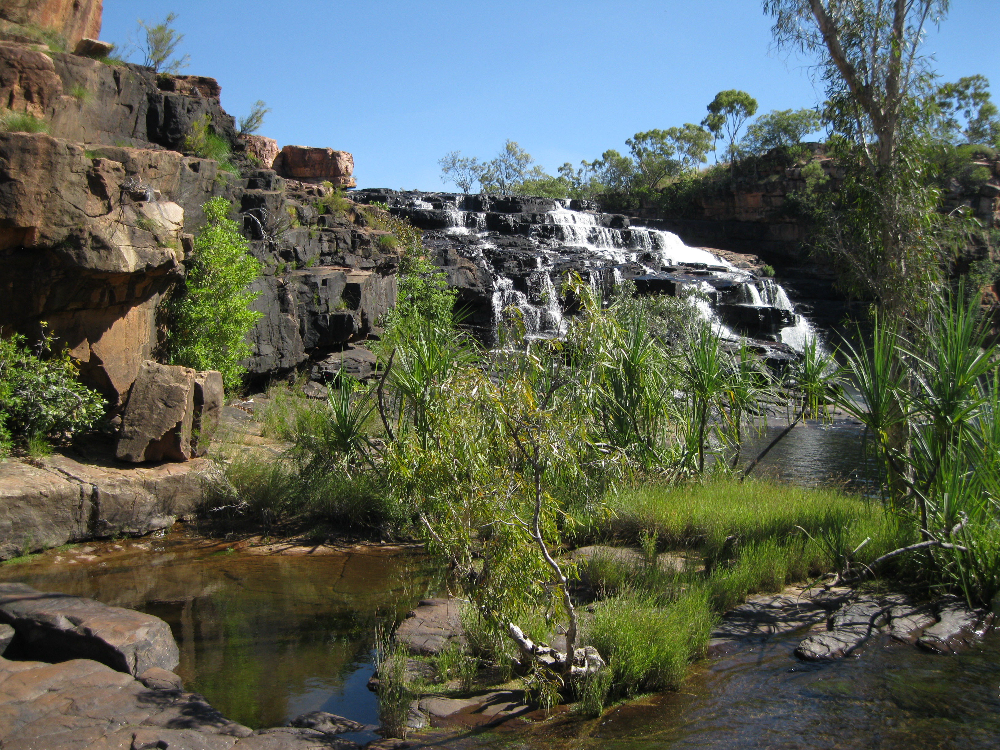
The area is split into two. A large pool to the left and a small pool to the right where the stunning Manning Waterfall is located. The two areas are divided by a rocky area where you can have a lie down and sunbake, have a sit down or leave your belonging for when you take a swim. It is recommended that you bring a pair on thongs to manoeuvre around in as it can be a bit hot and hard on the rocks in your bare feet.
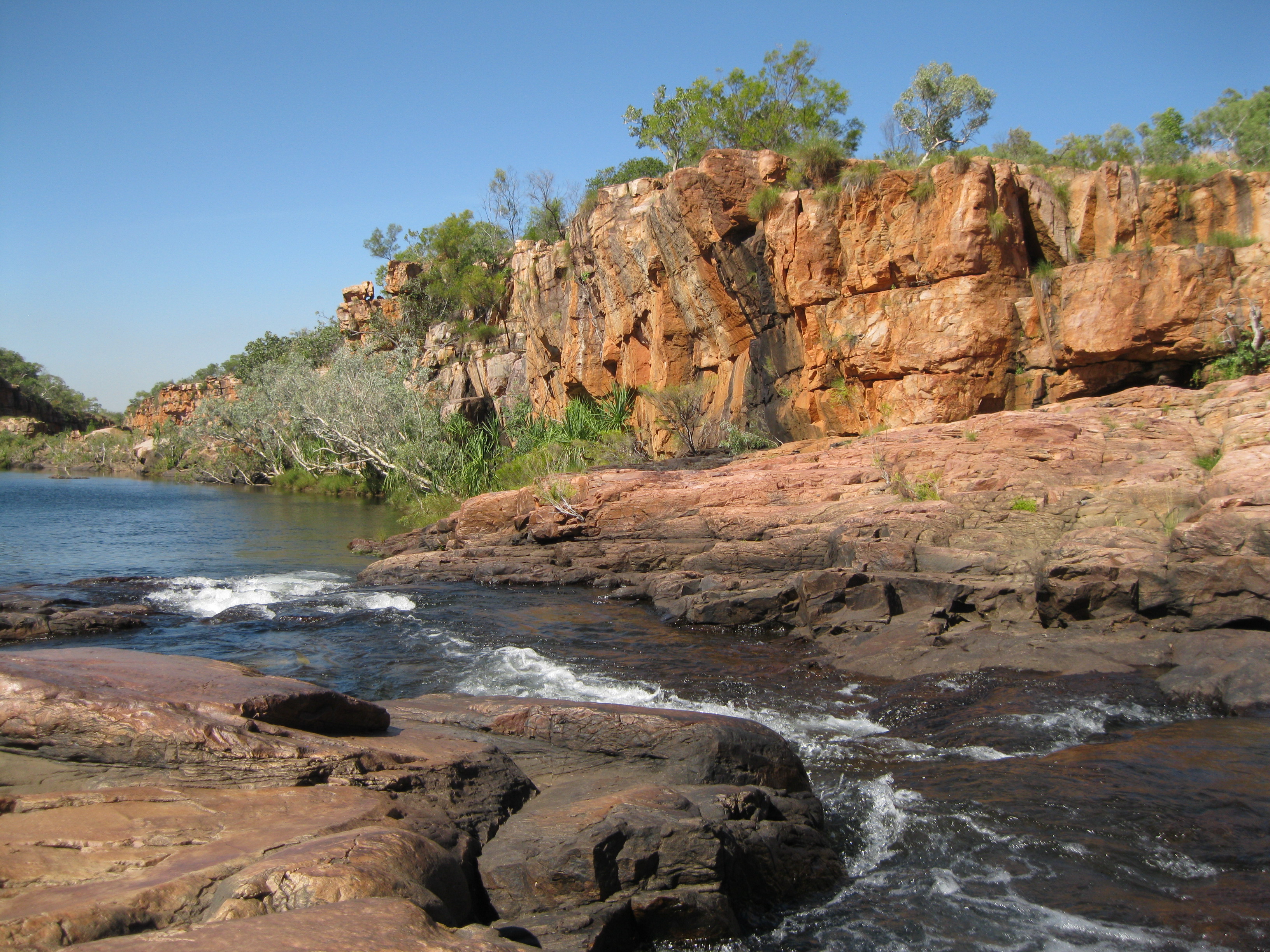
On this rocky area you can have a walk around and take great photos of the waterfall, the pools and the surrounding rock formations from all sorts of angles. There are a couple of small creeks flows between the two pools through the rocky area. Absolutely beautiful scenery.
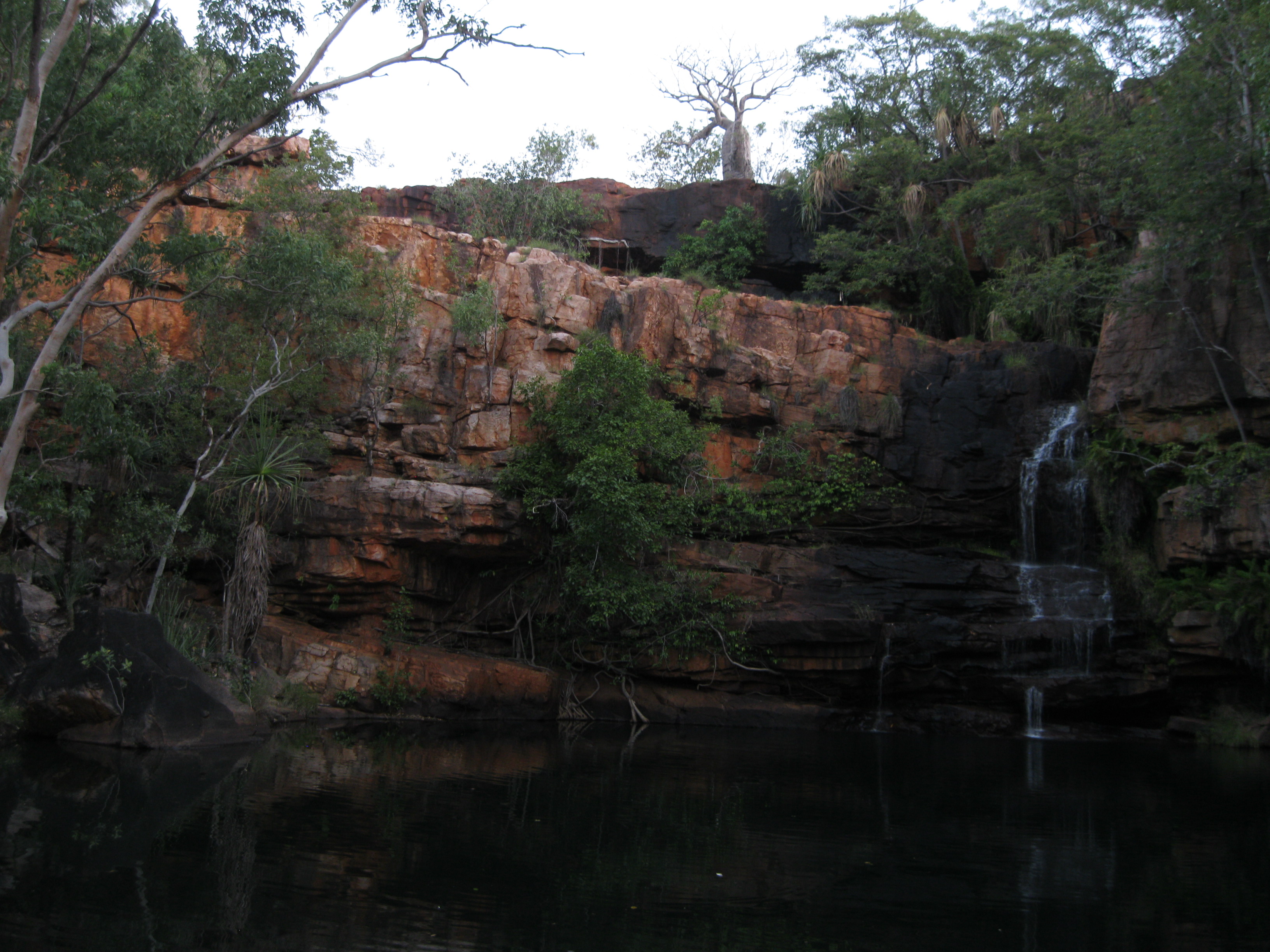
A really cool thing to do is swimming towards the waterfall and climb on top of the rocks at the fall. Just be careful as it can be really slippery. There are a couple of spots what you can have a nice sit down with the water flowing down onto and around you. Now that is nice! It’s will be your own personal spa created by the forces of nature. Sit back, chill and check out the wonderful view in front of you.
Afterwards you could take a stroll over to the big pool, walk into it with your camera and you can take some great shots at the water level of the pool and the surrounding rocks. Awesome. You can easily spend an hour or so in this areas swimming around, chilling and taking photos. When you head back to the campground you have to do it via the same trail you came from. Bear in mind that the sun sets early, so don’t leave too late and allow an hours to 1½ hours for your return walk.
Galvans Gorge
You are not able to camp here at Galvans Gorge. If you want to camp at Mount Barnett Station it has to be at the Manning Gorge campsite next to the Roadhouse. If you are staying here you have to drive down to Galvans Gorge in your vehicle and the access here is free of charge.
Going to Galvans Gorge is a short walk of about 1 km (0.6 miles) when going from the trail head where you will also find the parking area. It’s not strenuous at all and is pretty much on a level walking path. It will be a tad rocky at the end where you also have to cross a creek. The walk will take about 15 minutes through this bushland to get to the gorge.
On the way you will see some pretty amazing boab trees and a nice creek as well. When you get to the gorge you will be met by a big water hole and steep rock walls. There are vegetation and trees growing on along the rock walls and on top you will see a boab tree as well. Furthermore there is a perfect example of Aboriginal rock art as well. This is a prime example of Wandjina rock art. The gorge is a perfect spot to take a dip as well. So remember your bathers.