Stunning Rock Formations…Out of this World
Limmen National Park is one the most amazing nature preserves in Australia and you will be absolutely floored by its beauty of otherworldly scenery
The Park is located in the north eastern part of Northern Territory in the Gulf of Carpentaria region not too far from the Queensland border. It’s quite a new national park that opened to the public in 2012. The park is absolutely stunning and it’s highly recommended to go there exploring.
It’s pretty remote and not that many organised tours go to the park. Therefore it’s still fairly untouched and not that developed with regard to road access which is quite an appealing aspect as well.
The park doesn’t have many visitors and is not well-known to the public. In a way a real shame as people are missing out, but good for the tourists visting as they will have it pretty much to themselves to explore.
Geology: Formation of the Breathtaking Rocks
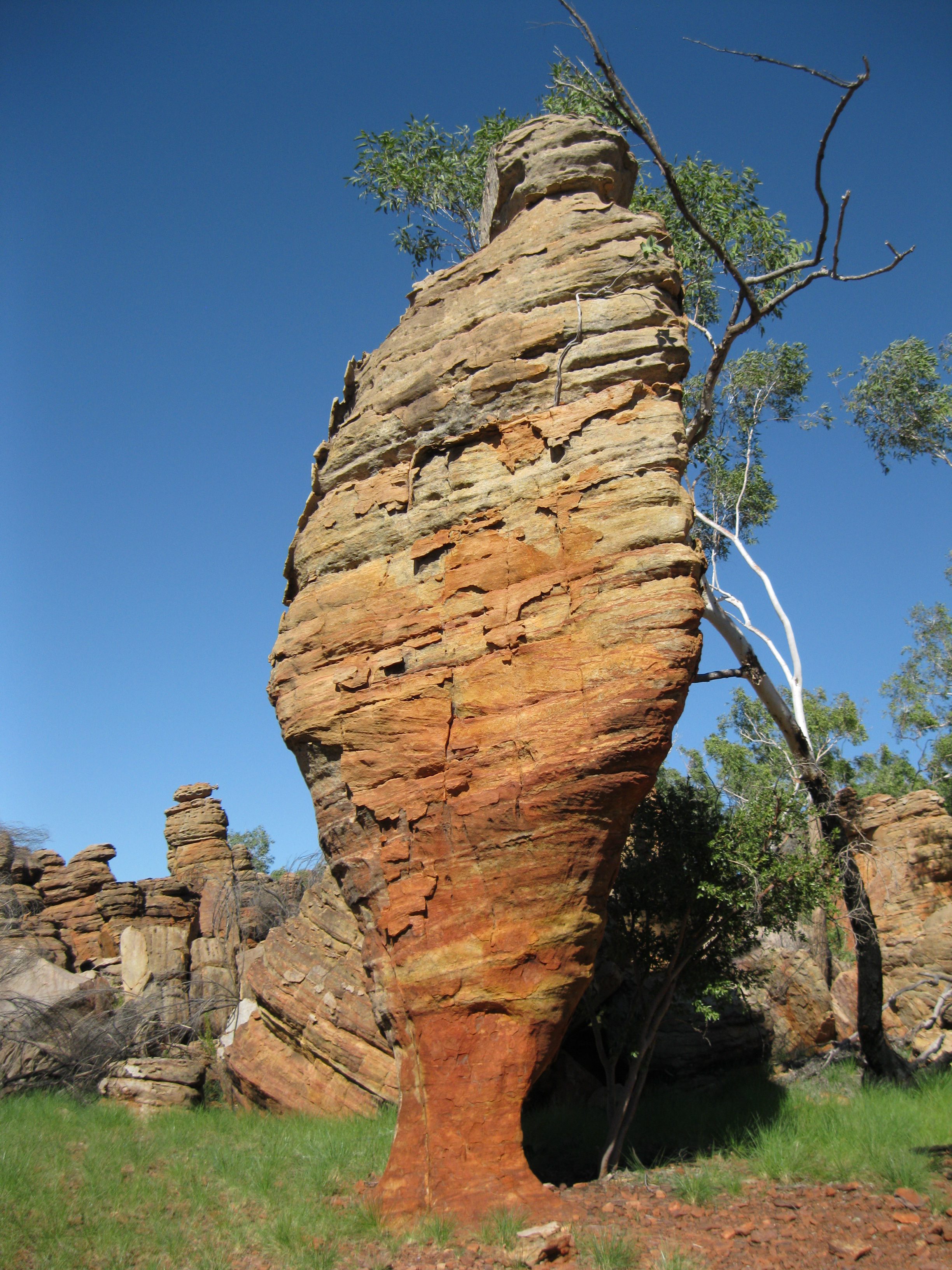
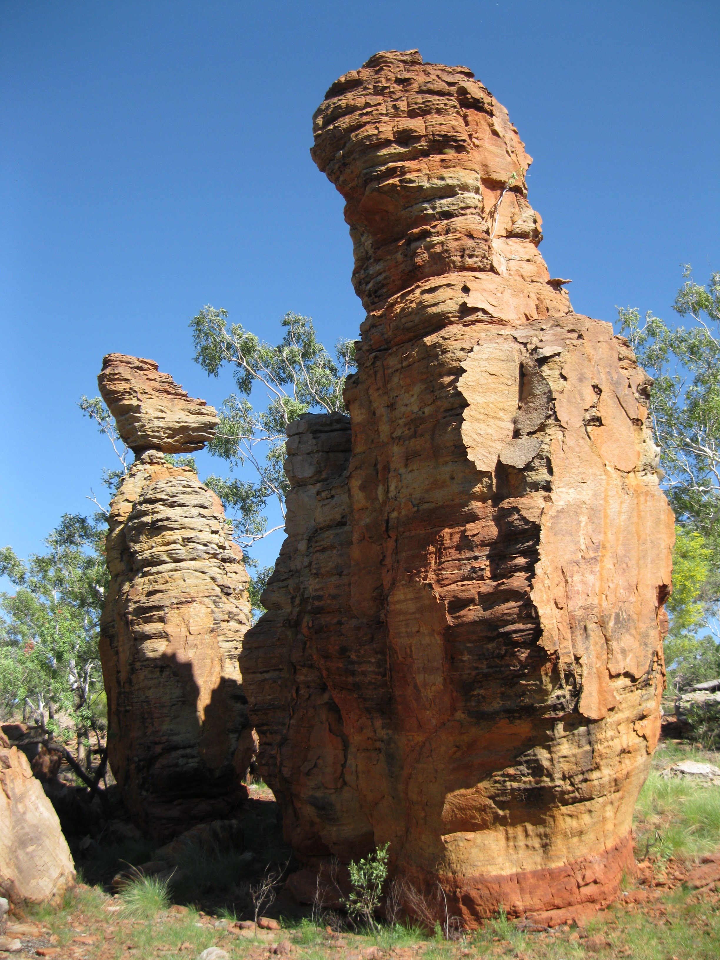
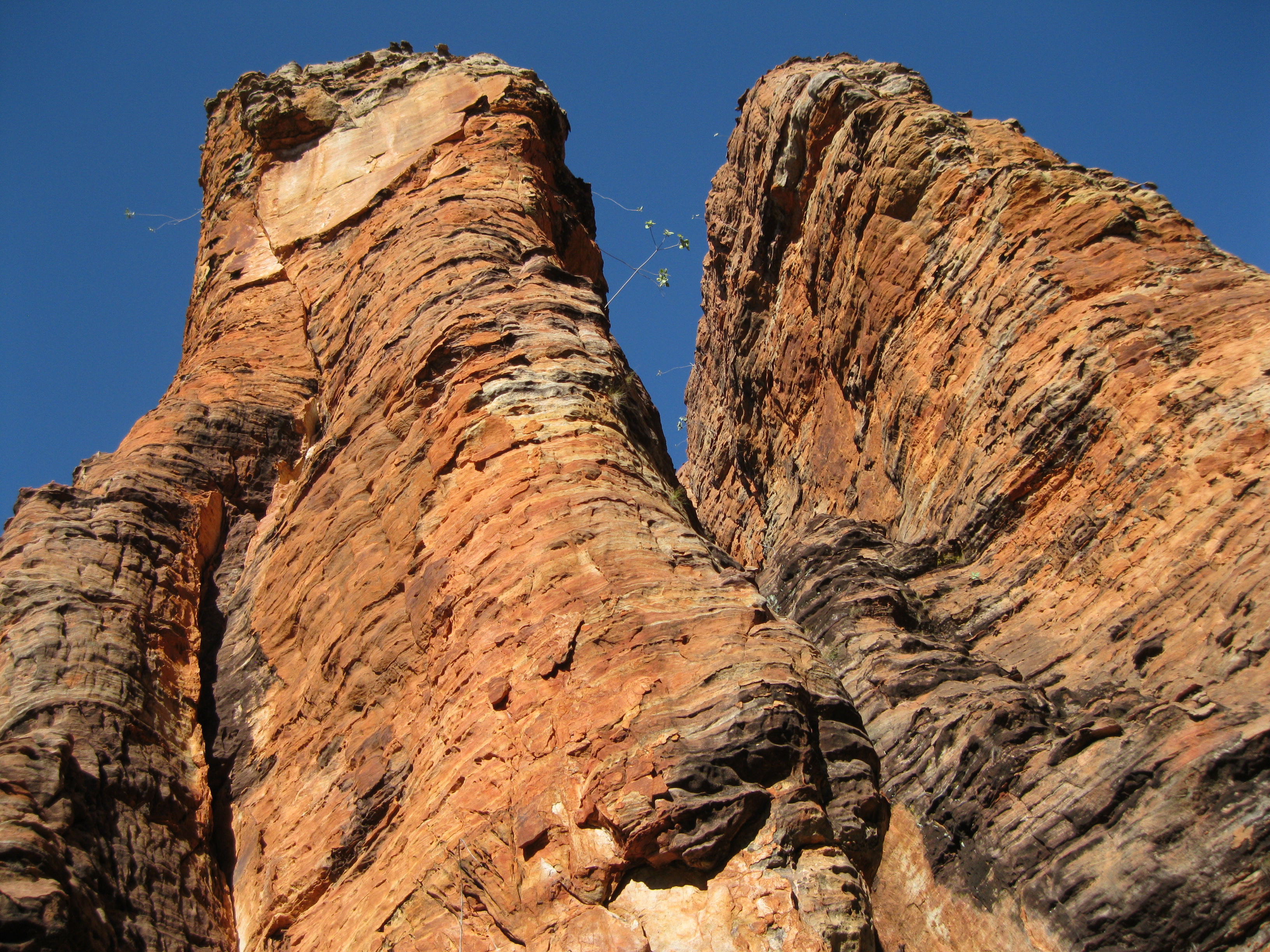
Both the Southern and the Western Lost Cities were created and shaped by weathering around 1,500 million years ago. As a result, rock broke down. Sediments washed via rivers into the sea and created the foundation. As layers of sand built up under the sea, hard sandstone was formed over millions of years as the sand was compacted and cemented.
The cement was a silica solution consisting of quartz grains that were dissolved under pressure or were squeezed out of surrounding mud and shale beds and spread slowly through the remaining sand.
After the sandstone had been buried for millions of years, uplift occurred and it was raised out of the sea. The sandstone cracked as pressure released formed a network of joints. The city would be carved around these joints.
Over millions of years, after processes of wind and water, and plant roots that had slowly broken away at the cracks, it made the cracks bigger. Joints became chasms and pillars began to form.
The wet season soaked dissolved silica inside the cement. During the dry season the solution would rise to the surface and redeposited as a hard crust. In spite of having this hard layer of rock and dissolved silica, the cemented sandstone was carried away and left the sandstone inside softer and weaker. Therefore the pillars continued to shrink and the sandstone was weathered and carried away.
The varied colours on the sandstone pillars are due to the mineral composition and the amount of light they are exposed to. The very dark colours are usual created by moss or algae are rarely in direct sun.
History: The Explorers and the Pastoralists
The first European to explore Roper River, located in the outskirts of what now is the park, was naturalist and explorer Ludwig Leichhardt in 1845 when he and his part were on an expedition from Moreton Bay to Port Essington. The party left Sydney on 13 August 1844 for Moreton Bay on a steamer by the name The Sovereign. In the party was John Roper who discovered the river two days before Leichhardt’s arrival.
According fellow traveller John Gilbert, Roper was not a bushman and at times foolhardy. He got lost in the bush several times and was kicked in the chest by his horse while he was trying to catch it by its tail. On 28 June 1845 Roper lost an eye when the party was attacked by Aboriginals. The party reached Port Essington on 17 December 1845.
Leichhardt had said that Roper was inexperienced, a limited young man and that he failed to obey him. In spite of that he still named the Roper River after John Roper.
A significant pioneer in the region was John Costello, a pastoralist from Yass, New South Wales. As a child he was adventurous and by the age of 16 he was already a seasonal stockman, well-known as a rider, horse breaker and for his determination.
His sister Mary married Patrick Durack in 1862 who was another pastoral pioneer. Both Durack and Costello were passionate about horses and fascinated by the reports of explorers who had travelled through southwest Queensland. In 1863 Costello led a party on their first attempt to take up land in southwest Queenland.
By 1879 Costello acquired a huge property by the name of Lake Nash in Northern Territory close to the Queensland border where he would stock horses and cattle from his coastal properties. After an expedition in the early 1880s he leased a property stretching from McArthur River to Roper River (5,180 square km/2,000 square miles).
Lake Nash was put in charge of a manager, he sold his coastal properties and sent his eldest son Michael to establish a homestead on the Limmen River, Valley of Springs. Their journey was made through a drought and they arrived at Limmen in 1884 just before the wet season. Costello brought his family to Limmen in 1885 and they managed to live in this stunning remote area for six years through malaria, other diseases, white flies and bush fires.
Costello was hit by more back luck as their cattle were ravaged by hostile Aboriginals, dingoes, crocodiles, tick, red water disease and by plundering prospectors heading for the Kimberley Gold Rush. A depression also hit in 1890 so Costello was forced to leave his Gulf properties and retreat to Lake Nash.
Starting Your Adventure to Limmen National Park
The Park is remote so you have to be fully self-reliant. Ensure you have enough fuel and food for your visit as there are no services between Roper Bar and Cape Crawford for 338 km (211 miles). You can access the park by Stuart Highway via Roper Highway where you have to turnoff 10 km (6.3 miles) south of Mataranka. You can also go via Carpentaria Highway that runs through the Gulf region.
All roads in the park are unsealed, therefore drive carefully. They can be closed due to flooding from November to May. Also roads leading to the park may be closed during this period due to the same reason. Therefore it is highly recommended that you check up on the road conditions a couple of days in advance. If you’ve joined an organised tour, this will be done for you.
There are different places where you can camp. Within the park you can stay at short-term campsites with facilities at Towns River, Butterfly Falls, Limmen Bight River, Southern Lost City, Yurrlmundji, Mountain Creek Didi Bab and Munbililla. The camp fees are payable on site. You can also stay outside the park at Limmen Bight Fishing Camp or Lorella Springs Wilderness Park. The latter is a nice spot where can also go on hikes or drives to check out the scenery within this wilderness park.
Swimming is not allowed in the park as the rivers and creek are inhabited by estuarine crocodiles (saltwater crocodiles). The only place suitable for swimming is at Butterfly Falls.
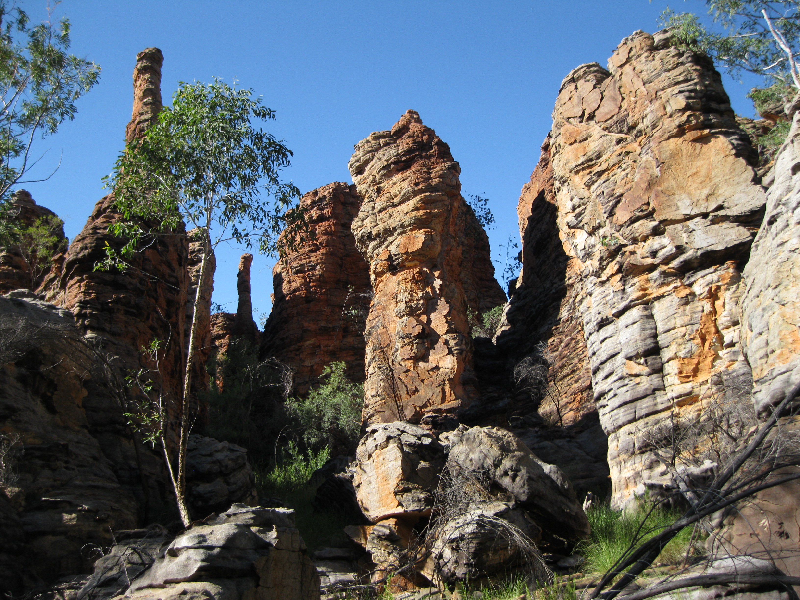
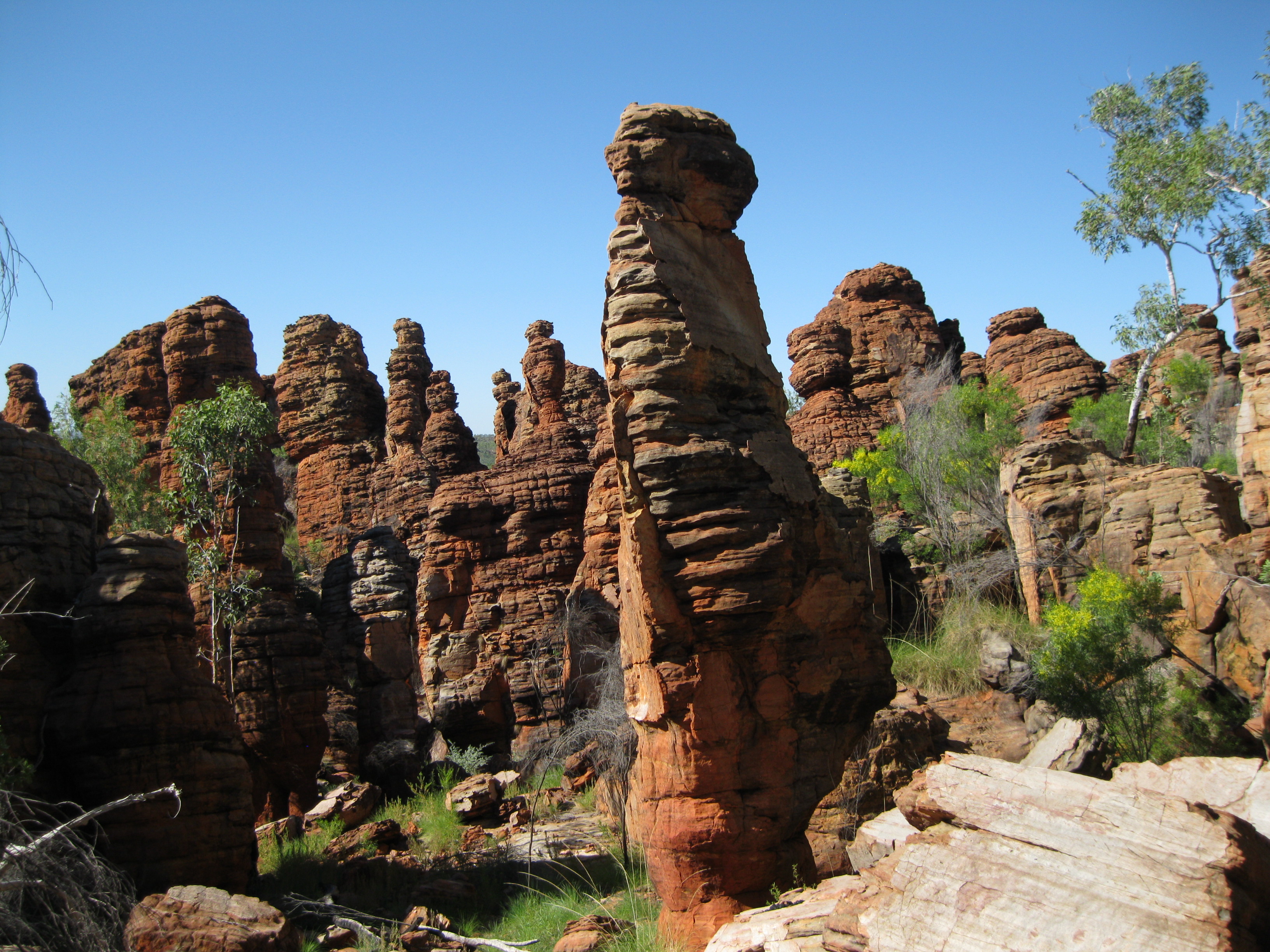
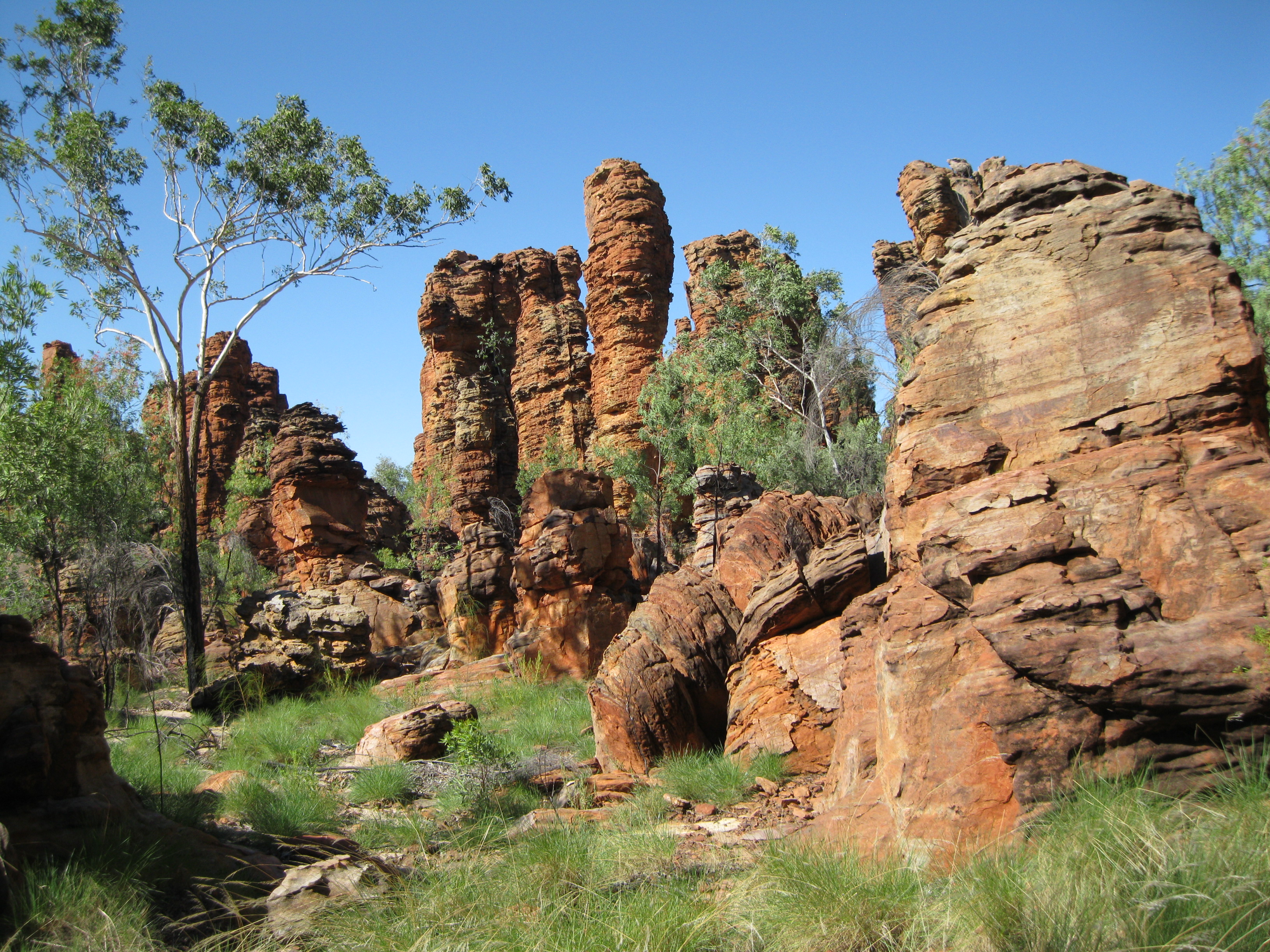
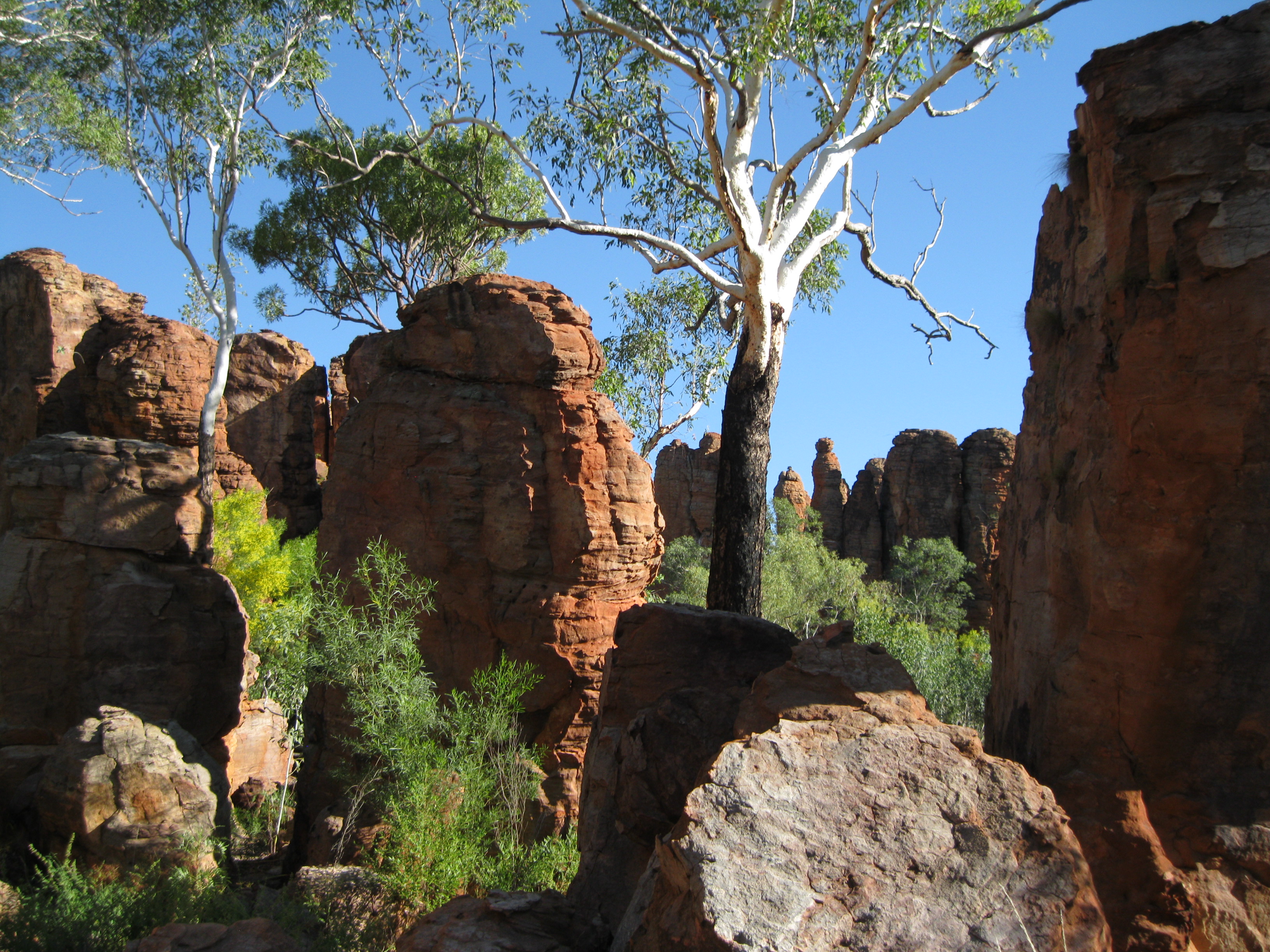
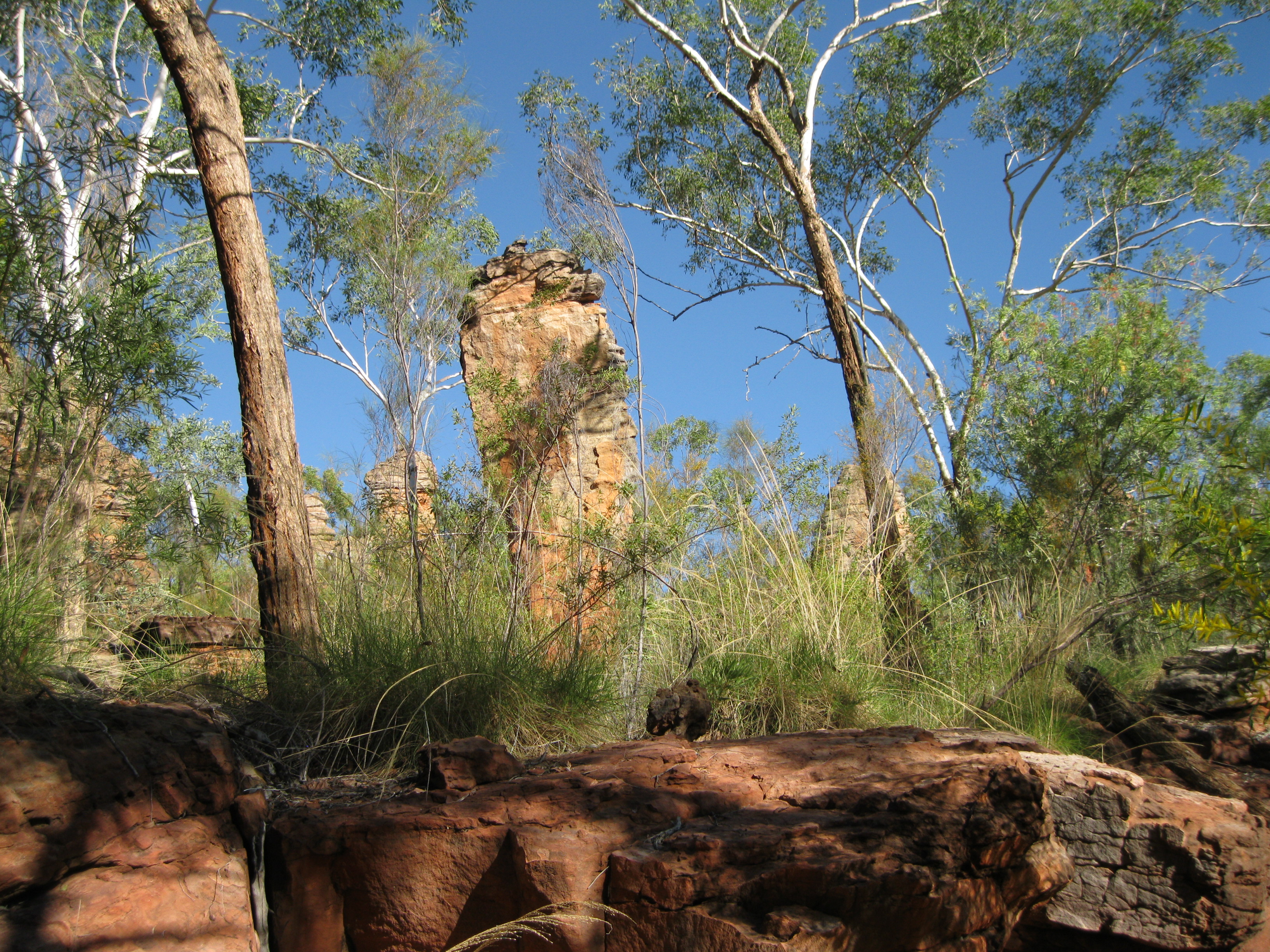
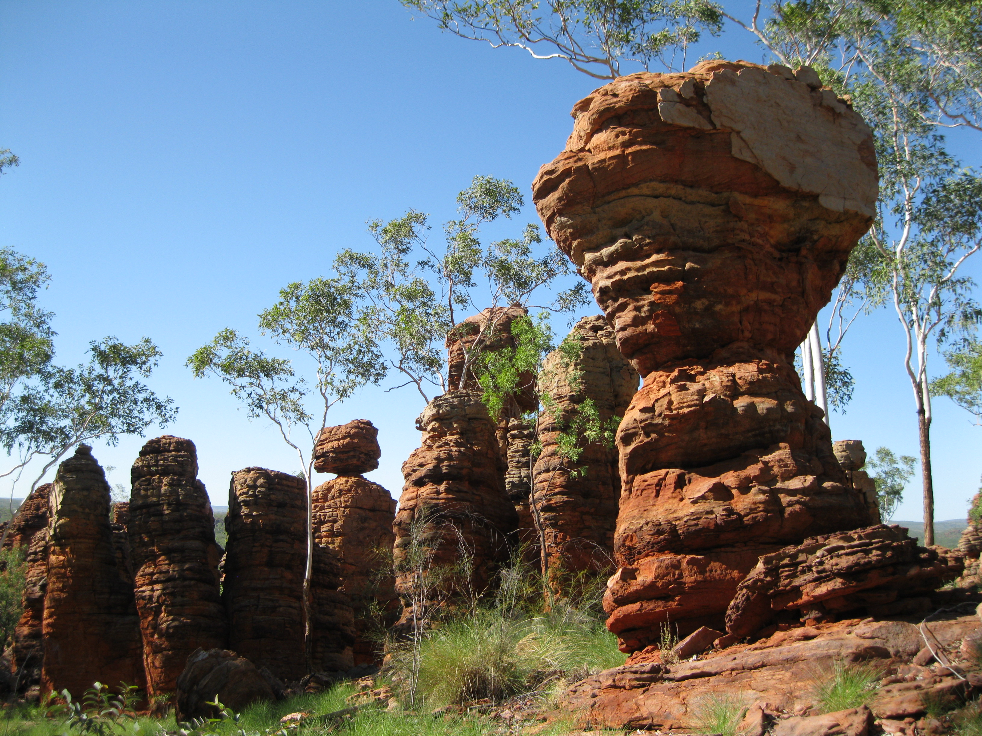
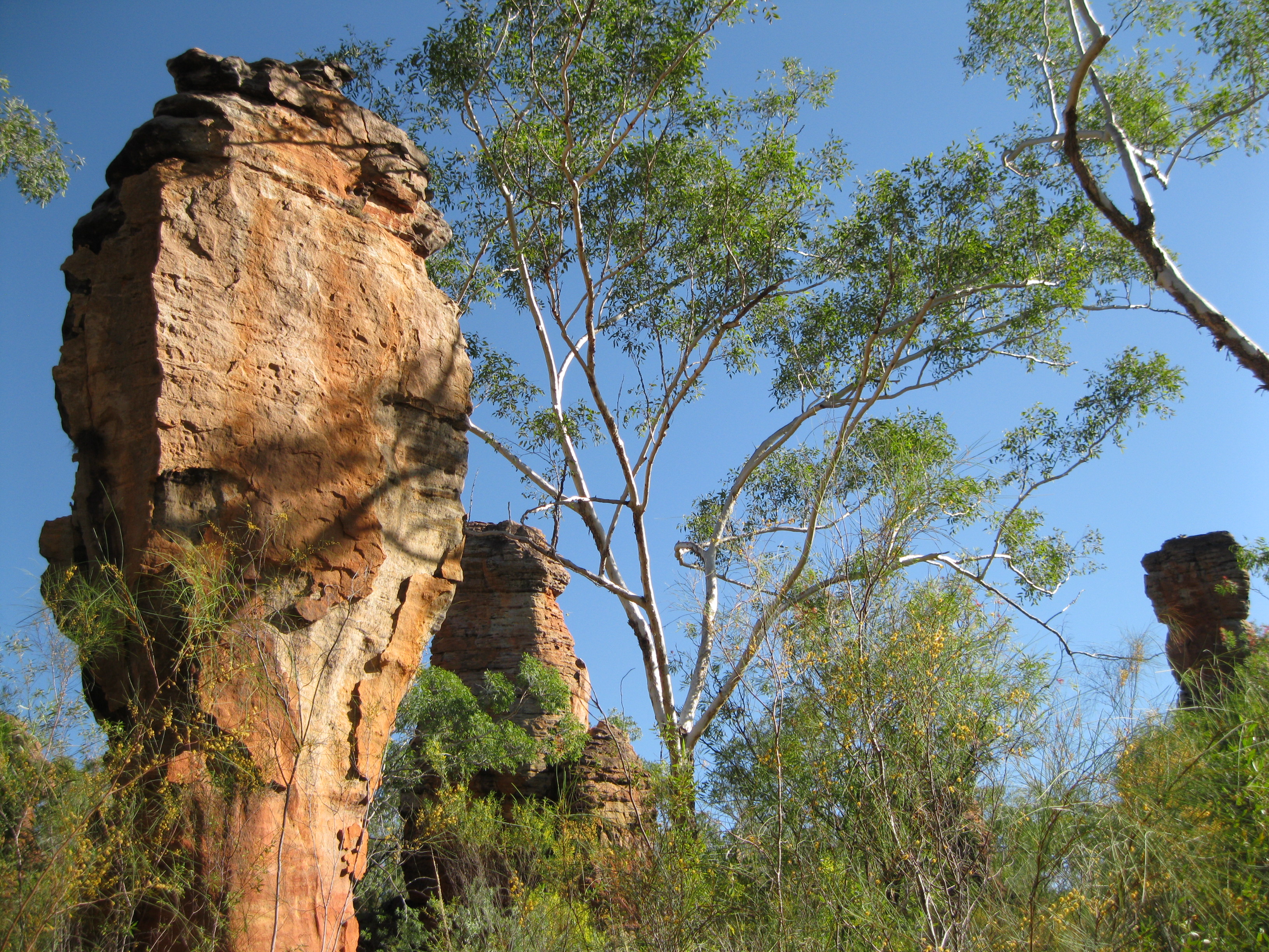
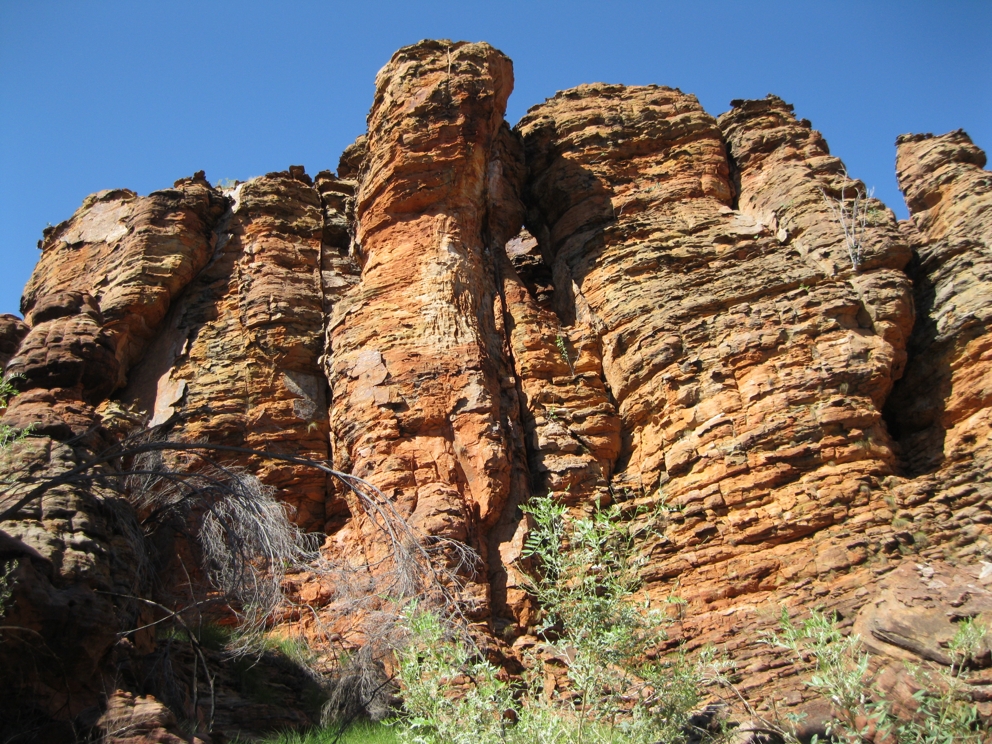
The highlight of the park is the location of amazing rock formations called the Lost City which is split into two sections, the Southern Lost City and the Western Lost City. The part that is the easiest to access is the Southern Section.
The Southern Lost City…Amazing Scenery
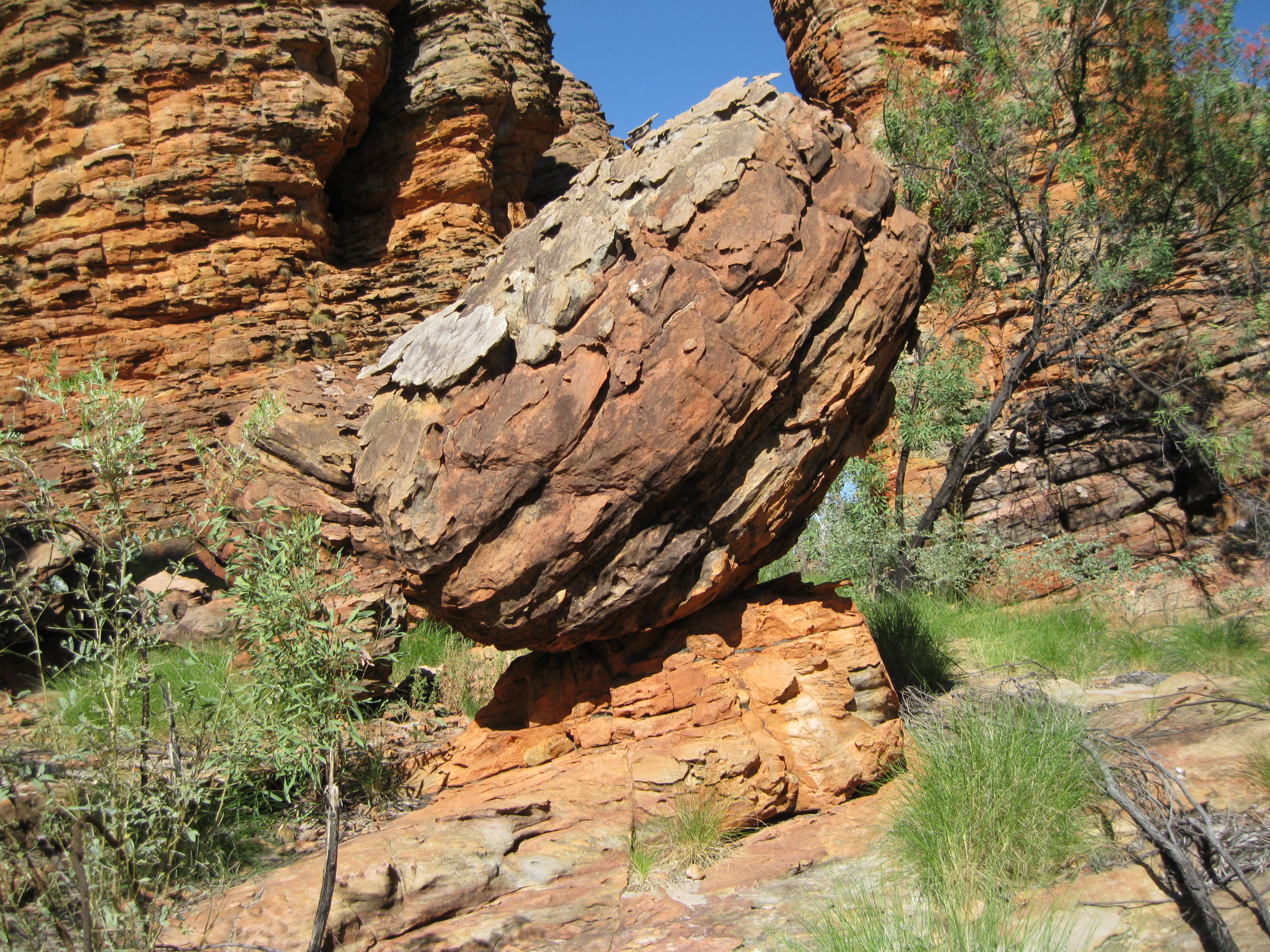
The Southern Lost City is located 35 km (21.9 miles) south of the Nathan River Ranger Station. There is a really awesome loop walk you can do here which is highly recommended. The trail is 2.5 km (1.6 miles) long, is easy, not strenuous at all and goes through amazing rock formations such as towering rock walls and pillars. You can easily spend two hours having a stroll around here through the track which is pretty level but also leads you through some of the chasms and narrow walkways.
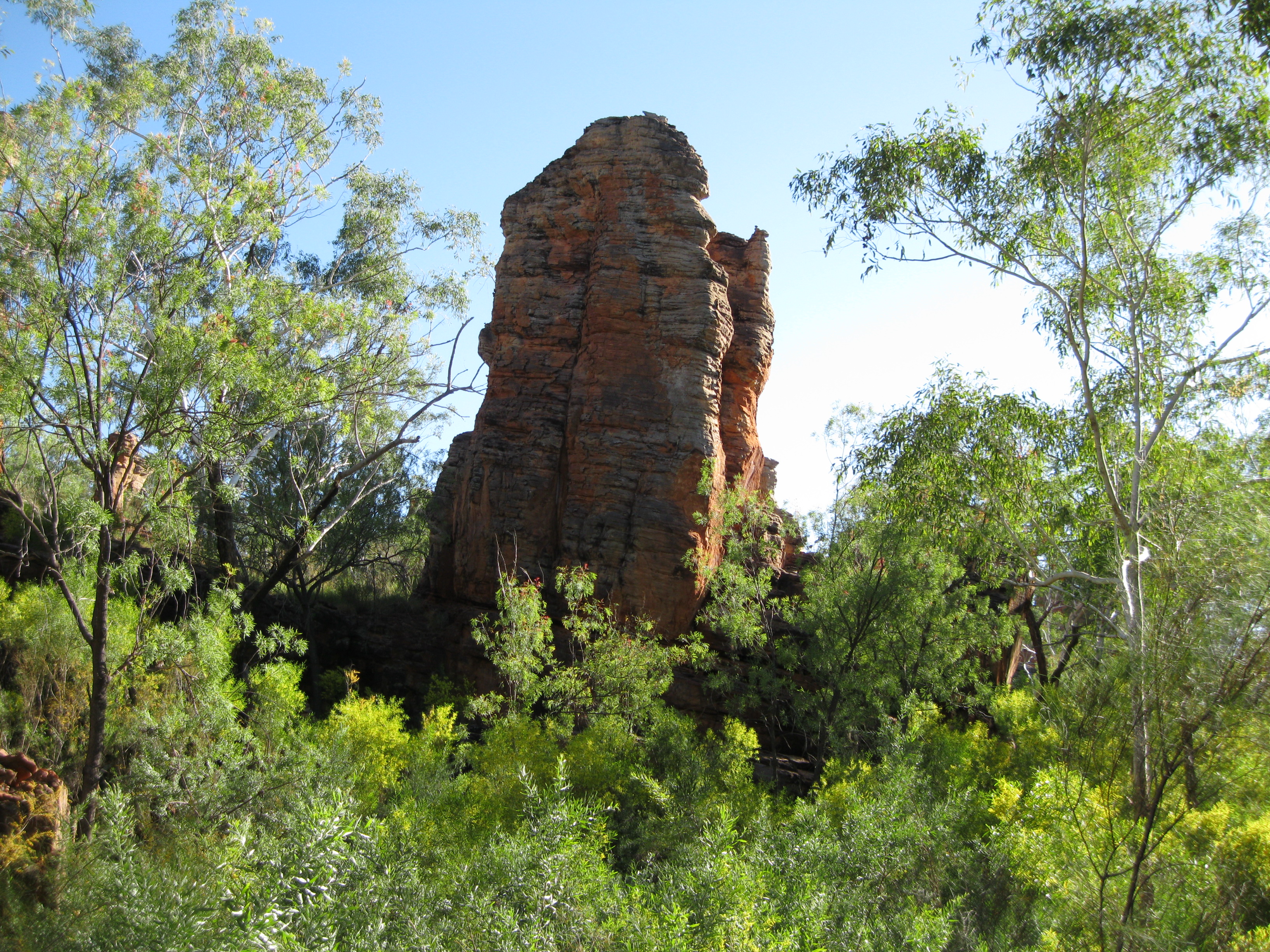
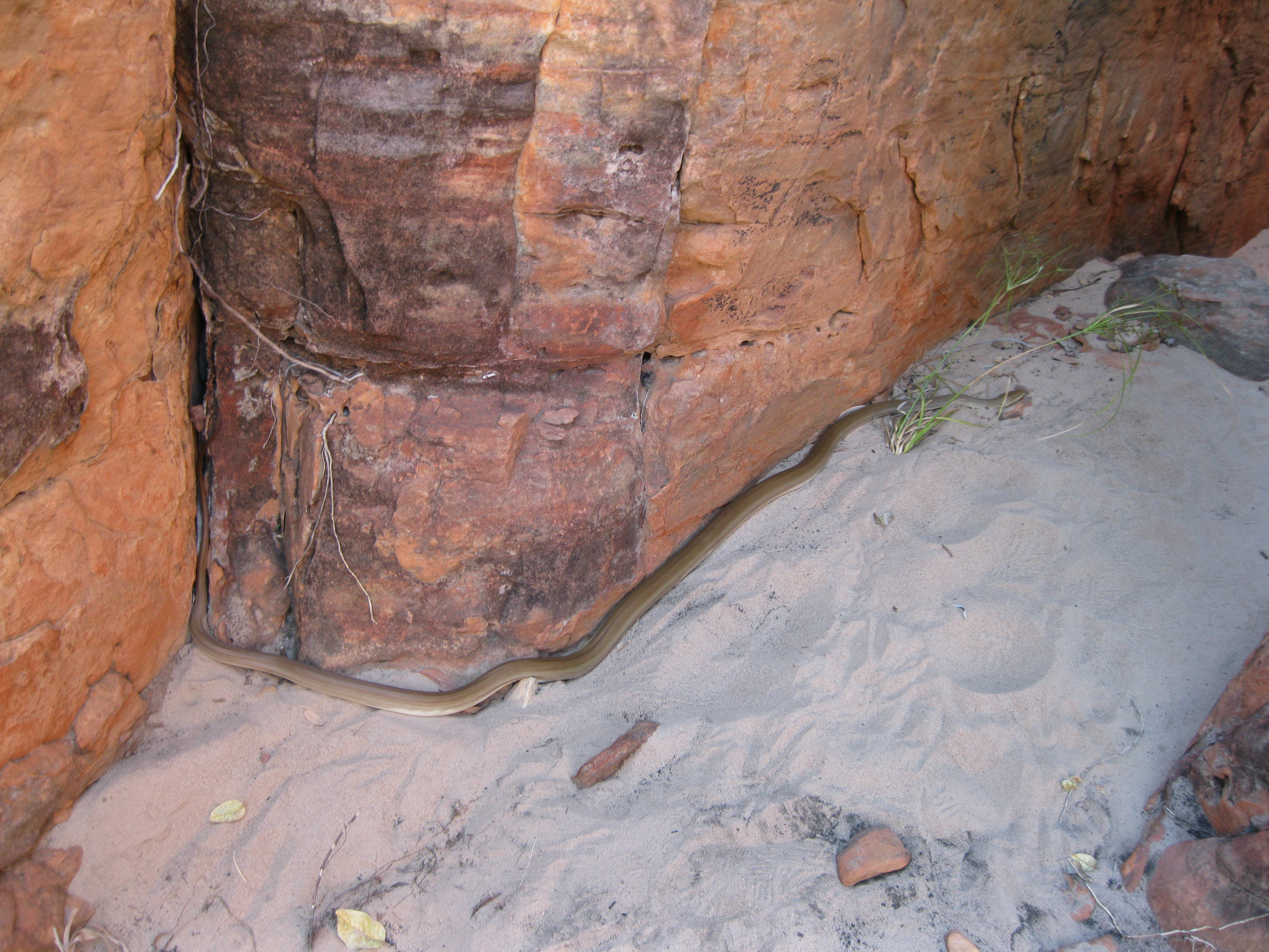
The scenery is absolutely mind blowing and the views just changes as you walk on. You can keep taking photos as new towers, pillars and rock walls will constantly come into view along the way. Sidetrack and walk through the chasms you may spot a bit of wildlife such as lemon pythons and other creatures. The rocky ledges, overhangs and chasms are handy for the animals as they provide shade and a cool refuge.
The short-eared rock wallaby likes to chill in the shade when it’s hot and moves out to feed in the early hours of the morning and in the evening. Many animals base their days on a similar schedule as temperatures often are above 40 degrees Celsius (104 degrees Fahrenheit) during the day. By doing this they can also avoid predators.
At one point after you have walked through a series of towering rock pillars, you will get to a ridge where you will have an awesome vista across a valley of a scenery of rock walls and pillars in the distance. This is the western part of the Southern Lost City. You cannot get there by road so if you want to go you have to walk from the area around the ridge which will take you about two hours.
The area around the ridge contains a lot of woollybutt trees with spinifex and other grasses. When the woollybutt blossoms it’s a feast for the rock ringtail possum, it comes out during cool evenings from its daytime shelter in the rock crevices. Among the rocks at the woollybutt there will be pockets of leaves with a variety of skinks and other lizards looking for insects.
From this ridge you can continue on the Loop Walk as well. It will take you through even more amazing scenery of pillars. Walk a bit off the track and you will see the pillars from different angles and you may also spot some formations you can’t see from the track. There are some really interesting formations where you can clearly see the effect of erosion. So awesome.
Bear in mind that the sandstone is fragile. Therefore do not climb onto the pillars.
The Western Lost City
If you are going to the Western Lost City it has to be done in a high clearance 4WD vehicle. When you arrive at the entrance of this section of the park you will find a gate. You will need a code to unlock the gate. This code is provided on the white board at the Nathan River Ranger Station which is it changed weekly. The 28 km (17.5 miles) track to the Western Lost City starts northwest of the ranger station and commences from the gate.
When you enter you have to lock the gate behind you and register yourself in the logbook located at the gate. The track is rough, so you should drive carefully and keep an eye out for other vehicles. You have to return the same way. The travel time from the gate to the Western Lost City is about 1.5 hours.
On your way you will be crossing several rocky creeks with dense vegetation which is also the home of several bird species. You will be crossing Limmen Bight River which flows north east for another 60 km (37.5 miles) into the Gulf of Carpentaria. This river can flow all year but is most likely dry by July or August.
After about 22 km (13.8 miles) you will see evidence of the pastoral history of the area with open black soil plains and old fences. When you get to the Western Lost City the track will take you 2 km (1.3 miles) down to a turn-around area. You can go hiking but just bear in mind that there are no hiking trail so be careful.
Butterfly Springs
In the eastern part of the park, not too far from the ranger station, Butterfly Springs is located. It’s an interesting spot as it’s an oasis where you can cool down a bit and have a dip.
You will most likely see some butterflies here, hence the name. A good spot is the shady rock wall to the right of the pool where you may see the common crow butterfly. You may also see the great bowerbird, a peaceful dove, a common bronze-wing or an azure kingfisher in the area.

Look out for the fern-leaf grevillea which is found on the edges of the seasonally flooded areas. It’s got bright orange flowers during the dry season. If you are lucky you may also spot a mertens’ water monitor either laying around on a log or a rock, or swimming around the pool looking for some grub.
Butterfly Springs stays wet well into the dry season due to the source of water. During the wet season the rainwater falls down the rocky slopes and filters through the cracks and crevices. These become a leaking reservoir that feeds waterfalls during the wet season and slowly trickles through during the dry season. This sometimes continues into the next wet season.
You may notice lily covered billabongs with wetland wildlife when travelling through the park. These wetlands are what remain of the heavy rain and flooding of the previous wet season. During the dry season these waters drain and evaporate. By the end of the dry season they will be dried out or reduced to a few waterholes.
Butterfly Springs was once known as the Valley of the Springs, a name given by the aforementioned pioneer John Costello who first brought cattle into the area. Introducing and running cattle in this land is difficult due to the extremes of the seasons and poor pastures. During the wet season there is a massive source of water but the challenge is either how to capture it or how to get away from it. The muddy floodplains can also be dangerous to the heavy cattle trying to get a drink and also the risk of being stranded if floodwaters rise.
Roper Bar
In the outskirts of the park to the very northwest you will find a small settlement called Roper Bar where there is a store and motel, a police station, a caravan park and roadhouse facilities. As mentioned earlier, this is also the only place from here to Cape Crawford where you will have any opportunity to get food or fuel.
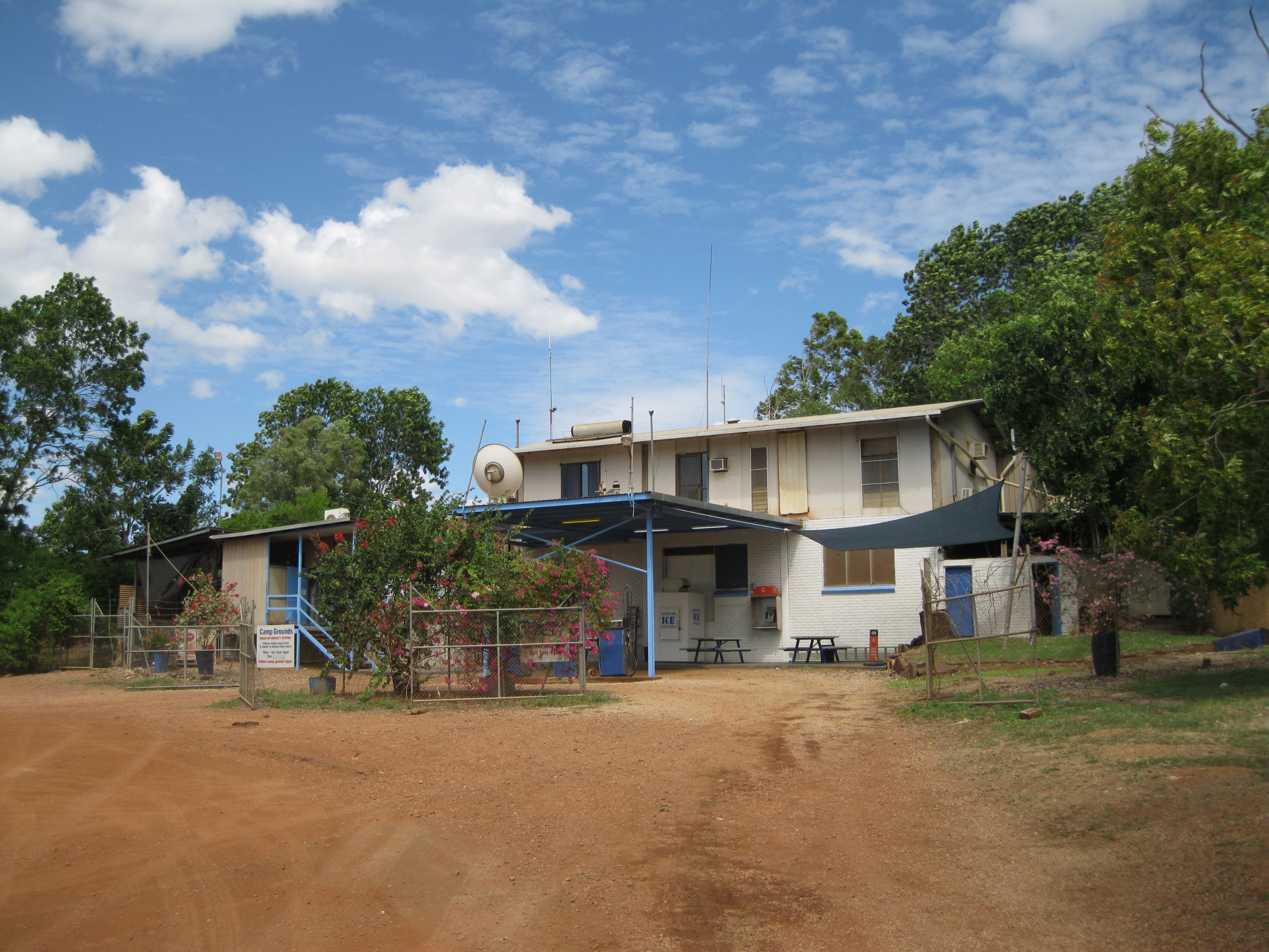
It’s quite an experience when you are exploring this remote part of Australia and visiting these spots in the middle of nowhere. There is a nice little picnic area just on the other side of the road from the store where you could have lunch if you’re there around that time of day. You can also get a bit of shade underneath the trees.
Have stroll around the area. Take in the wonderful nature and just walking down the Outback dirt road is cool. You will notice some abandoned and burnt out cars which is sadly the doing of the local Aboriginals. This is a sight you see pretty often in the Outback and you would just hope that the local governments could do something about this horrible sight. But when you are travelling, this is all a part of the experience.