Stunning Beauty, Crocodiles and Fascinating History
Explore an amazing lake all created by man with a fascinating wildlife and scenery. The experience will leave you amazed
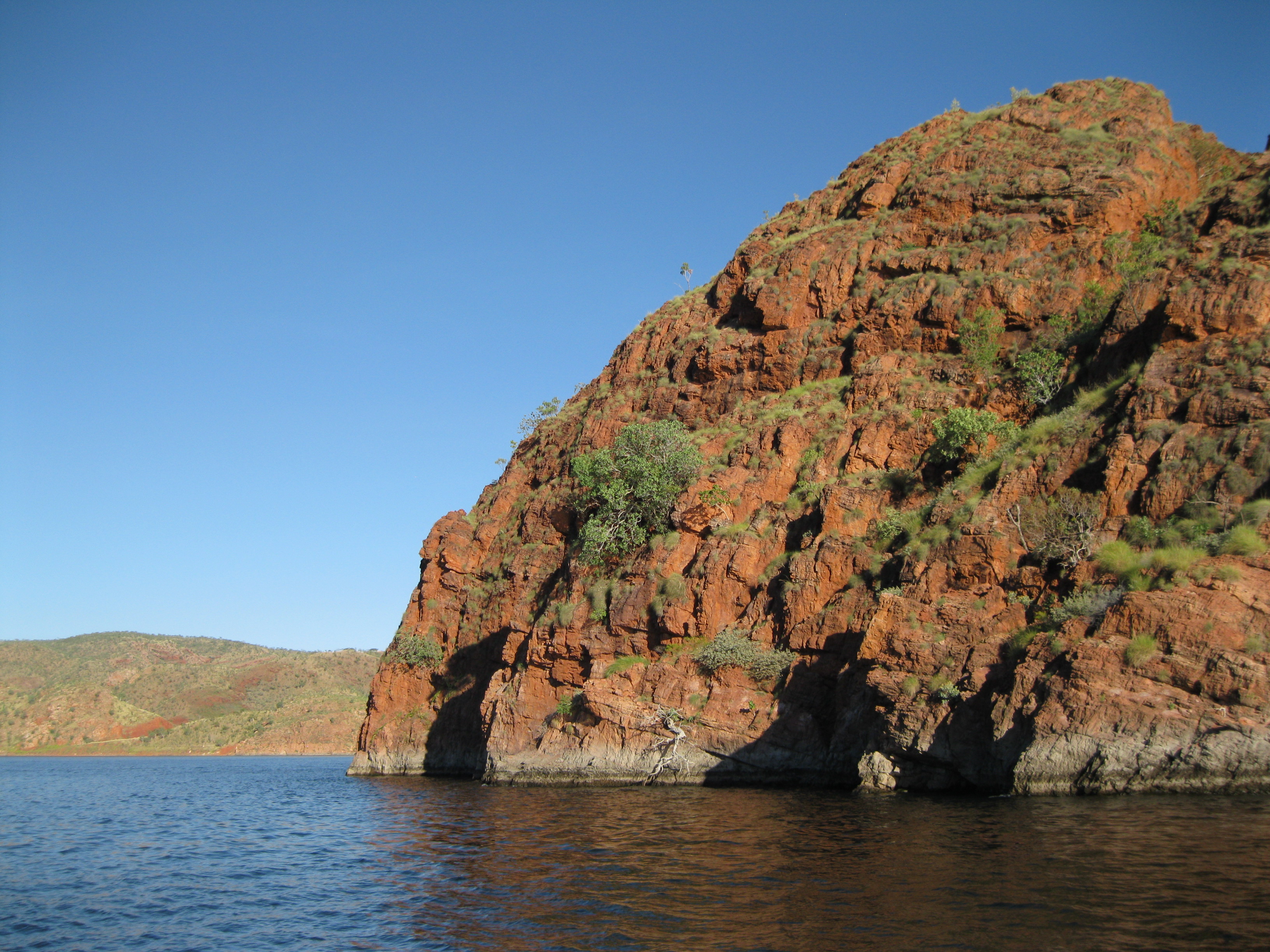
Lake Argyle is located in the Kimberley region in Top End of Western Australia and is an amazing spot to visit. It is the second largest manmade lake in Australia and is a 1,000 square kilometre (625 square miles) body of water. For navigation it’s considered an inland sea and when you get beyond the main island groups it’s a big open stretch of water for 55 kilometres (34.4 miles) where it can get pretty rough with winds up to 100 kilometres (62.5 miles) an hour.
But has long as you don’t pass the main islands and stay fairly close to the coast, it will normally be a pretty tranquil. The primary inflow to the lake comes from the Ord River and the two are separated by the Ord River Dam which is a quite an impressive construction.
Geology, Precious Gems and Diamonds
The landforms around Lake Argyle are more than a billion years old. Around 350 million years ago a huge upheaval took place which created the surrounding beautiful scenery. The upheaval resulted in the Halls Creek Fault which runs in the south west to the north east of the lake. On the eastern side among the black soil plains you will find some cool limestone formations, agates, semi precious crystals and geodes.
Going west into the black soil plains small hills of sedimentary shales will appear scattered among quartz outcrops. Also on the western side of the lake, the Carr Boyd Range can be seen which are mainly composed by quartzite, sandstone and shale. The area is very rich in minerals such as uranium, copper and has the richest concentration of diamonds in the world.

Diamonds were discovered in the region in 1979 when geologists tracked the sources up the Ord River to Smoke Creek. The deposit was much bigger than they had initially realised and what is now known as the Argyle Diamond Mine is the biggest producer of diamonds in the world by volume. The highly desired pink diamonds are also extracted here and are renowned for their quality and sell for more than 1 million AUD per carat.
The only known deposits of the so-called Zebra Stone is also found in the area. Most sites have been found underneath Lake Argyle. Since it was first discovered in 1924 the geology and the unique patterns of the rock have baffled scientists. The stones are very fine grained Siliceous Argillite with alternating black and white bands hence the name Zebra Stone. The stone are mostly used for jewelry.
Explorers and Cattlemen: The Homestead
The first Europeans started exploring the region in 1875-1879. The explorer Alexander Forrest reported about this vast area of fertile land which created great interest. Cattlemen from the East of the country were constantly looking for new well-watered pastures where they could settle. They would travel up to 5,600 km (3,500 miles) across the trackless north with a huge herd of cattle to reach these areas. Among these were the Duracks, Buchanans and Osmonds who would lay the foundations of what would become the huge cattle stations of the Kimberley. When you travel around the Kimberley region you will notice that many places are named after these families including the Durack River and the Osmond Ranges.

In 1882 Michael Durack and a party landed at Cambridge Gulf which is opposite the location of present day Wyndham. After travelling southward from Queensland with carts, wagons and 7,500 head of cattle they started the beef industry in the Kimberley as some of the first settlers. They selected land in the Ord River Valley that would become Argyle Station and the centre of Durack Holdings. Lake Argyle was named after this property which it would submerge with.
In 1894, Patsy Durack started constructing a home for his large family, which would become Argyle Downs Homestead. It was completed the following years and was a solid structure of stone boulders and mud mortar walls.
The Ord River Scheme threatened the Homestead and the building had to be removed to make way for the lake. In 1971 it was decided that building would be preserved. The homestead was dismantled piece by piece, each stone was labelled with a number and reconstructed at a site around the Ord River Dam near the Lake Argyle Tourist Village with close attention to historic detail. The homestead was reopened in 1979 as a museum on pioneer history and stands as a homage to the courage of the Duracks and other fellow Kimberley settlers.
Some of the rooms in the Argyle Downs Homestead Museum include utensils and other artefacts used in the 1890’s by pioneer families living on an Outback station. Original items from the Argyle Downs Station are on display as well. On the veranda, in the garden surrounding the building, you will find furniture and station equipment from the day as well. In addition, the species of trees, plant and creepers which the Duracks had, have been planted to make it as authentic as possible.
The Ord River Dam
The Ord River is one of the fastest flowing rivers in Australia during the wet season. The fertile plains in the area had attracted farmers to the East Kimberley but in spite of the heavy rainfall during the wet season, it was reduced to a series of waterholes during the dry season. Therefore in order to make the agricultural industry successful in the area the water had to be harnessed which would transform this semi-desert of cattle stations into a rich agricultural land. To capture the water a dam had to be built which would prevent much of the 2,500 gigalitres from flowing into the ocean during the wet season, which it normally would. This amount of water would be enough to supply Perth for 10 years.
Damming the Ord River was first considered in 1939 but work didn’t begin until 20 years later by construction the Diversion Dam in Kununurra as part of the Ord Irrigation Scheme. In 1941, an experimental farm was placed on the Ord River while engineers investigated possible dam sites upstream. In 1945, the farm was abandoned. By 1958, the Western Australian government was convinced by the viability of an irrigation scheme on the Ord River. The federal government agreed to share the cost for the first part of the project that was completed in 1963 at a cost of 20 million AUD.
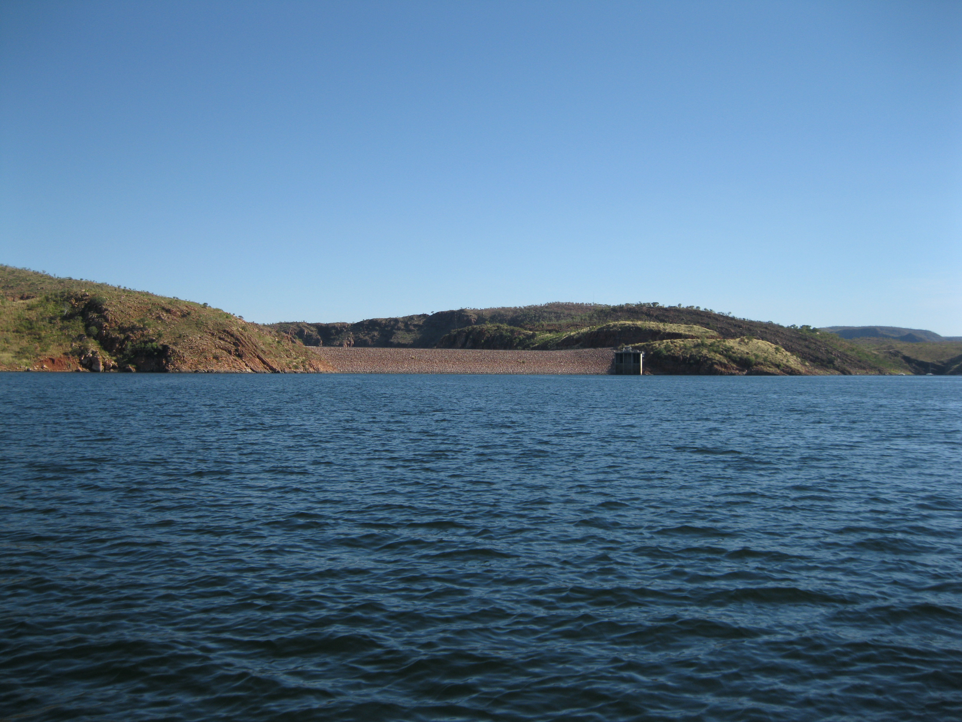
31 farms had been reallocated by 1966. The second stage would be the completion of the Ord River Dam and the storage reservoir which would become Lake Argyle, one of the biggest man made bodies of water by volume in the world. The cost of the second part was 22 million AUD and it was opened in June 1972 being constructed during three dry seasons. By January 1974, Lake Argyle was filled to storage volume.
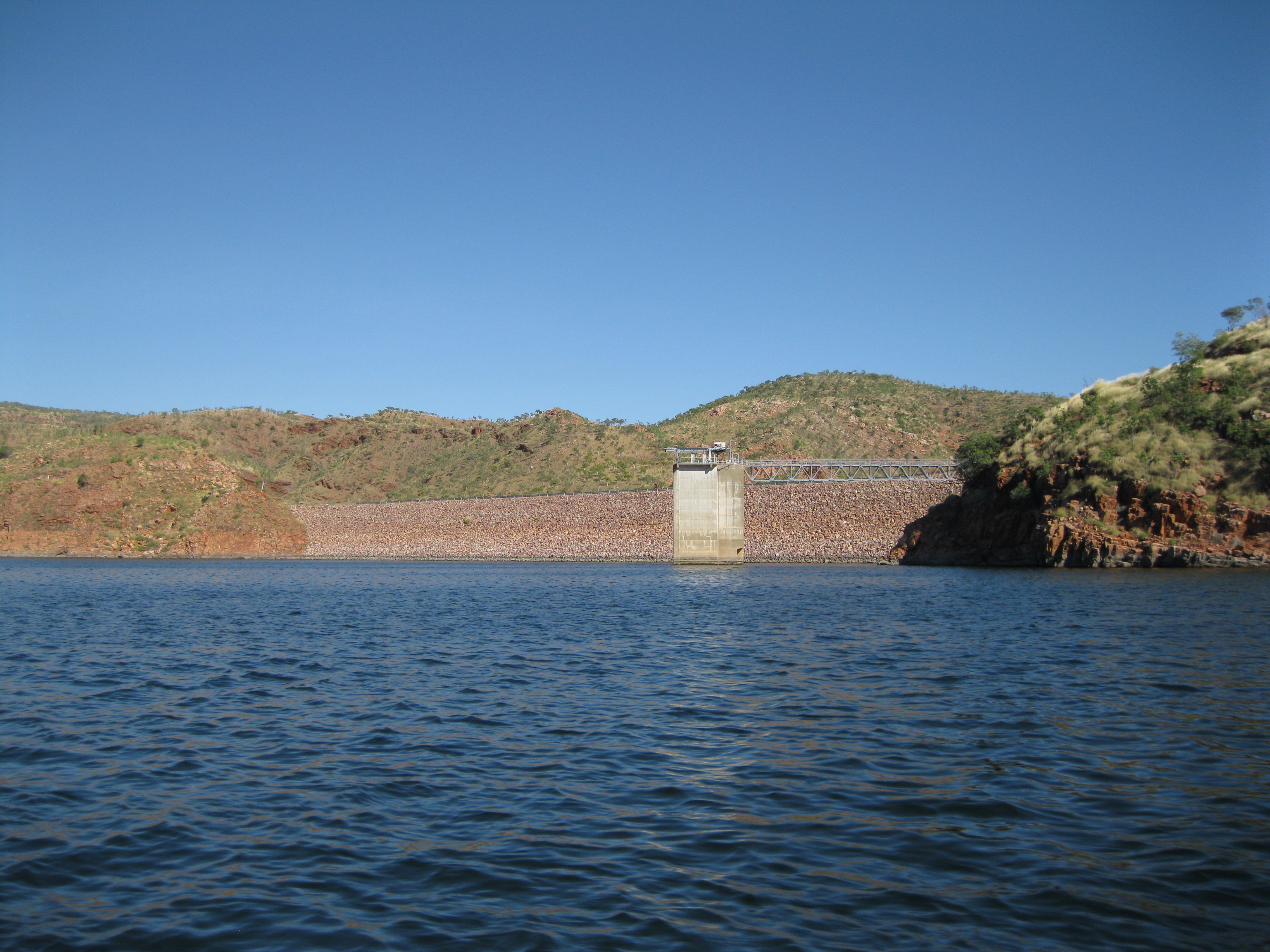
The Ord River Dam was designed to never overflow at the main embankment by having a 2.2 kilometre (1.4 miles) overflow cut made between two hills 8 kilometres (5 miles) from the Dam wall. When The Ord River Dam was completed, it became the largest capacity Dam in Australia with a volume of 5,641 gigalitres. The flow of both the Ord River Dams and the Kununurra Diversion Dam are regulated to keep a steady flow in Lake Kununurra which is located at the end of the Ord River opposite Lake Argyle. The permanent water flow to Lake Kununurra made the development of the irrigated land possible on the adjacent Packsaddle Plain.
In 1990 is was decided to construct a hydroelectric power station at the base of the Main Ord Dam and in order to guarantee a reliable supply of energy, a higher level of water was needed in the lake. This increased the capacity from 5,641 gigalitres to 10,763. In 2009 it was decided by the federal government to expand the area for agriculture. Therefore, the work was initiated on a second main irrigation channel.
The Ord Irrigation Scheme led to the establishment of the town Kununurra which was constructed as a service centre for the scheme.
Visiting and Exploring Lake Argyle
When visiting Lake Argyle you could fly into Kununurra which is the closest town and do a full day tour of both the lake and the Ord River. Doing both is a fantastic option and is highly recommended. By doing both you will have the unique opportunity of not only experiencing the lake but also the stunning nature of the Ord River by Jet Boat. It’s a real kick and you will see the beautiful surrounding red rock walls, bush and animal life. The guides on the tour are normally very knowledgeable about the area, the geology, zoology and biology. Very impressive and it just makes the tour so much better. If you are on an organised tour of the Top End or the Kimberley you may only get the option of doing Lake Argyle.
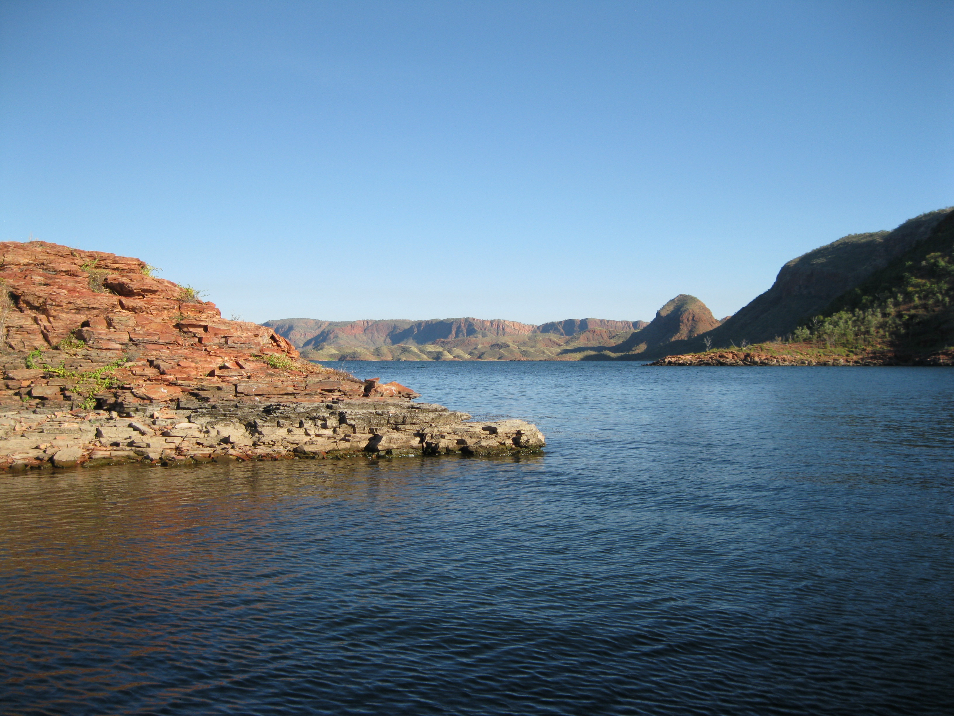
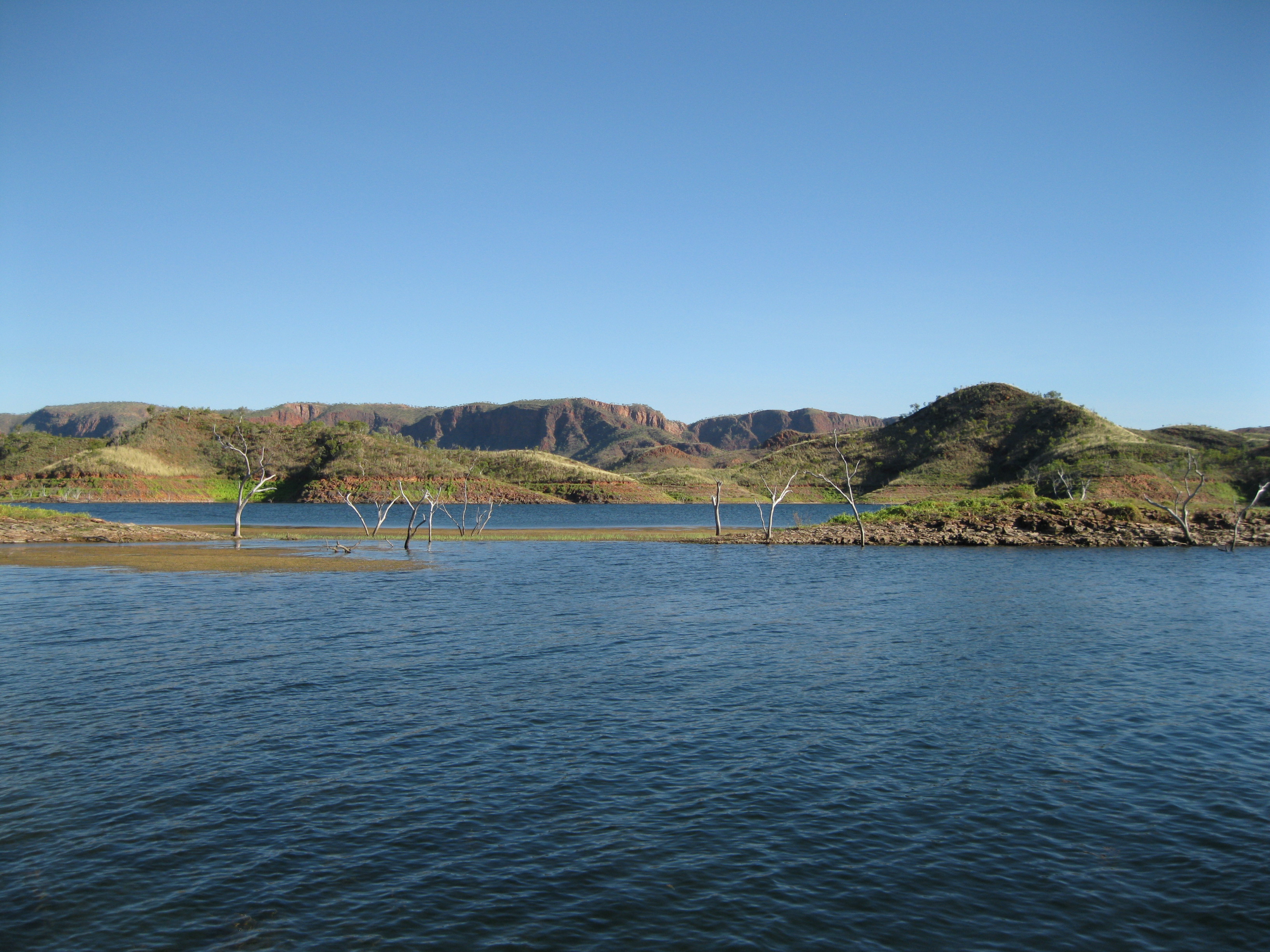
A great way of exploring Lake Argyle is by going on a cruise. If you do the full day tour of the lake and Ord River this will be included. There is a guided cruise you can join which will take you to some very cool spots of the lake. The lake is huge so you will only see a very small part of it. On the cruise you can sit back and chill, take in the scenery of the lake and the surrounding hills and mountain ranges.
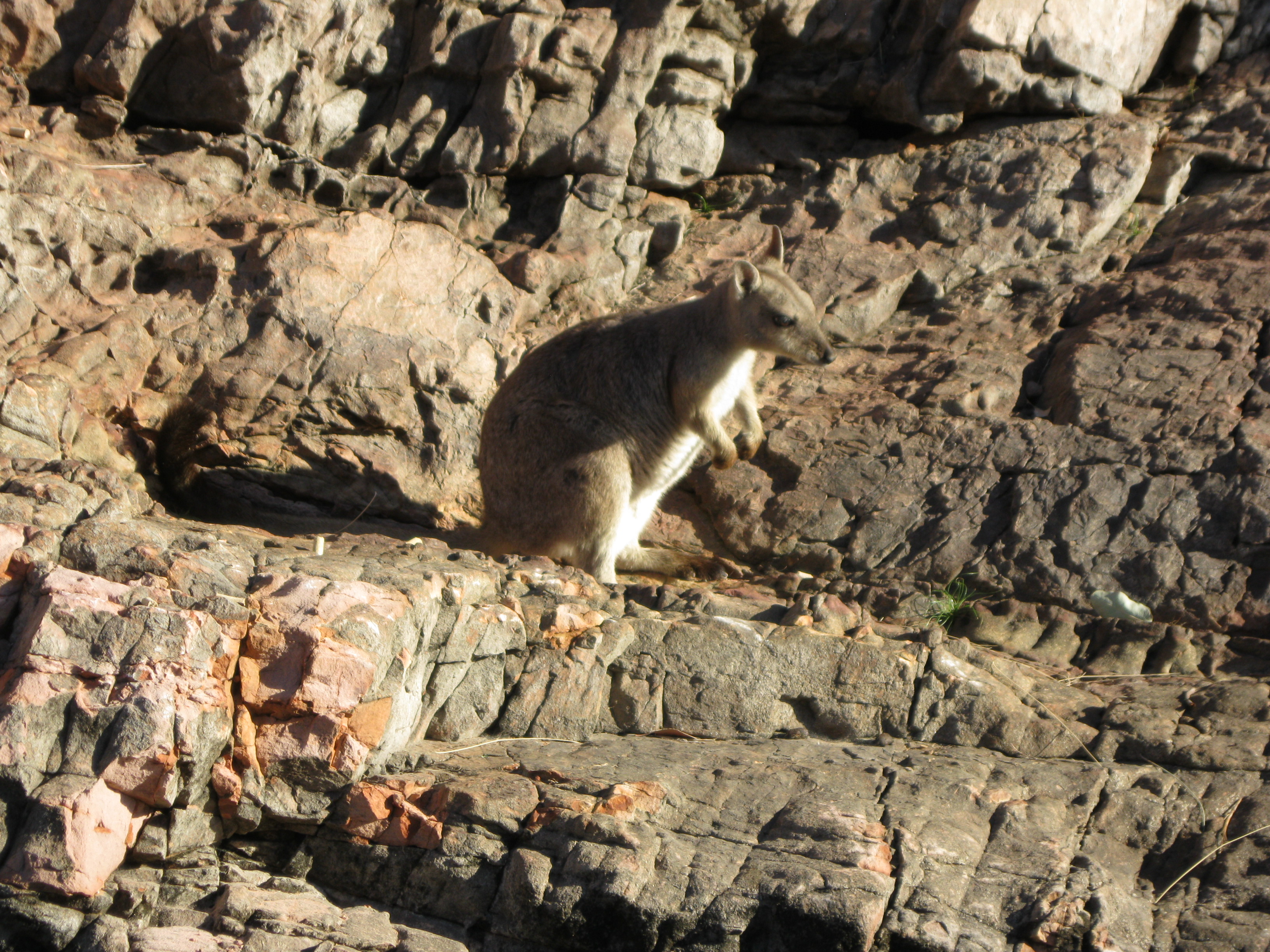
You will see some awesome vegetation in the lake itself on the way and pass for of the many islands which are nameless. You may also be lucky and spot rock wallabies along the rock walls. They will most likely be the short-eared rock wallaby. They are only found in the northern most parts of Australia, mostly in rocky hills, escarpments and gorges on slopes, outcrops and cliffs. Their appearance varies a bit but they are grey-brown in most cases with white areas around the face and on the legs. They are between 82 to 107 cm tall (32.5 to 42 inches) and weighs 4-5 kg (8.8-11 pounds).
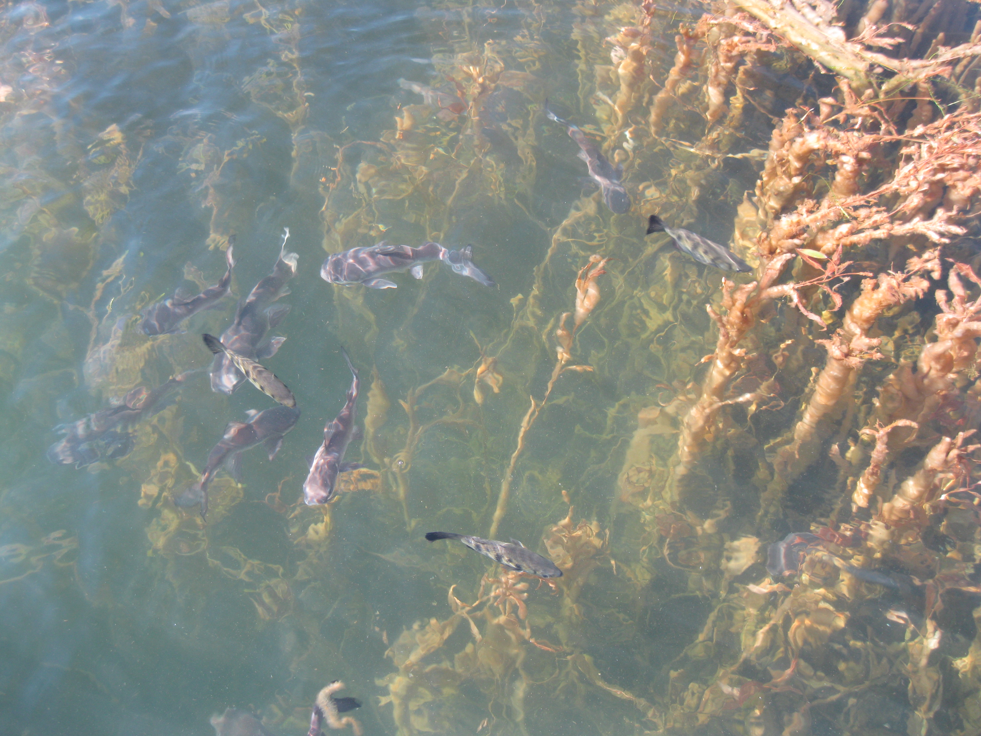
There is also a vast birdlife on and around the lake. There have been recorded more than 270 difference species of birds like the Yellow Chat which inhabits floodplains of the Southern and Eastern part, the Purple Crowned Fairy Wren found in riverine forest in the southern part or the Sandstone Shrike Thrush seen on the sandstone cliffs on the islands of the lake. Furthermore there are 28 species of fish such as the bottlenose catfish and anglerfish. You will most likely see some fish too as they will feed some on the cruise.
Originally there were about 350 freshwater crocodiles in waterholes in the Ord River but now there are about 20,000 in the lake, some even estimate the number to 30,000 which in any case is the world largest population of freshwater crocodiles. You may be lucky to spot some freshwater crocodiles sunbaking on the banks. They are pretty timid and are not dangerous to humans unlike estuarine (saltwater) crocodiles. They live of small fish and insects. So do not hesitate to take a dip in the lake, it is quite safe. Bear in mind though, that swimming in the lake as at your own risk. On the cruise a swin may be suggested and it is a cool option and great fun. Obviously, the tour company would not allow it if it wasn’t safe.
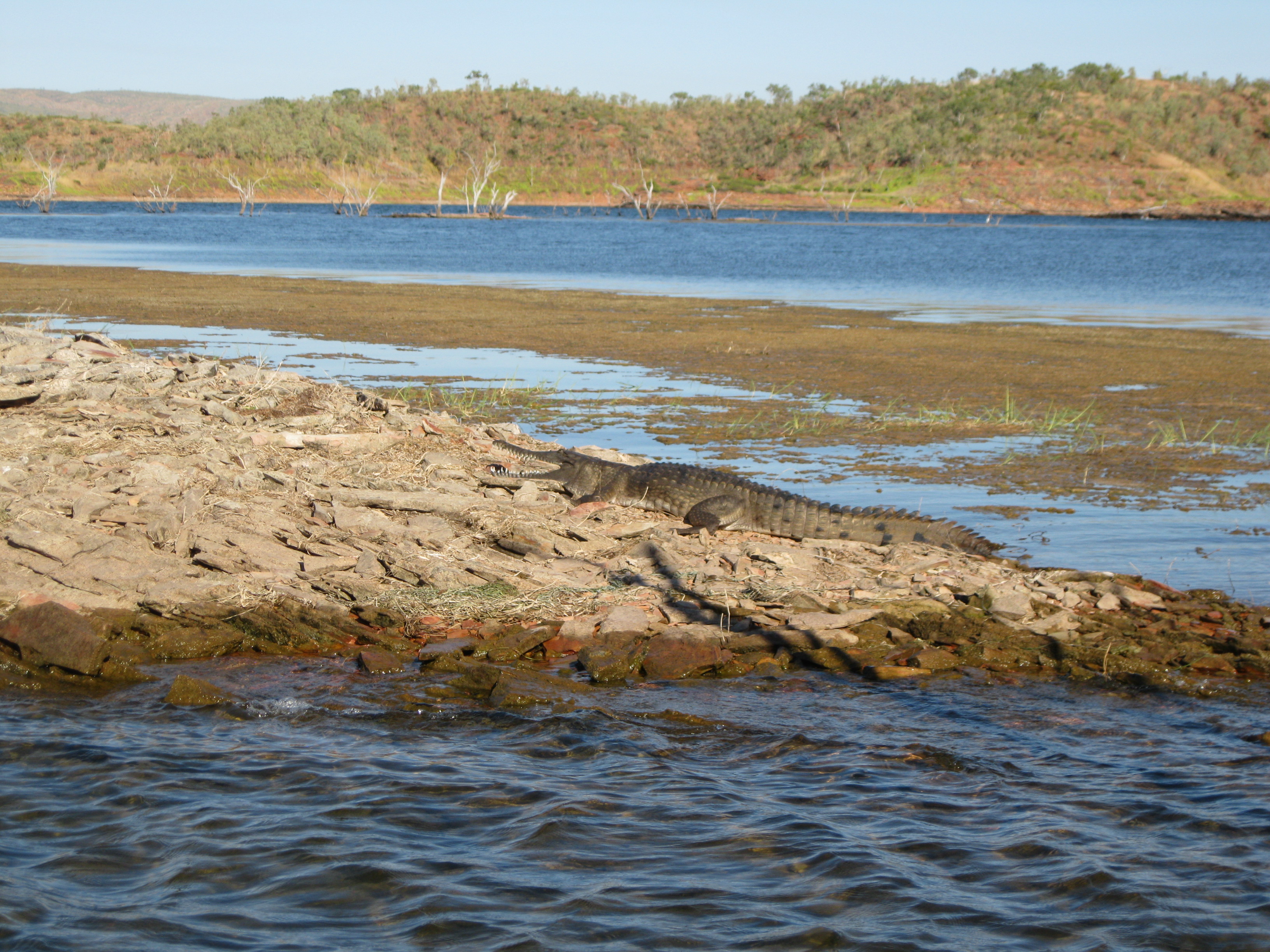
When the lake started to fill up more than 70 islands were created. Many of the animals adapted to the new surroundings and it turned out to be a great breeding habitat for the freshwater crocodiles as the waves washing up on the banks of the islands created the perfect conditions of loose stones and gravel for the crocodiles to lay their eggs. Furthermore as the islands are quite small the usual predators of crocodile eggs are not able to survive which resulted in the huge boost in the number of freshwater crocodiles. Normally 90% of crocodile eggs are eaten by predators.
If you are doing the Ord River cruise after exploring Lake Argyle you have to cross the dam. This is pretty cool as well. When you get across, you will find a little parking area where there are restrooms as well. In the men’s room you will find quite a funny sign definitely worth checking out. You will find a picture of it below.

The Future for Lake Argyle
There has been some debate about Lake Argyle being the ideal spot for a major city in the Top End. This is mainly due to the vast water resources and the stunning scenery. The proposed plan is to create a city for 150,000 people with an international airport as well which could connect the East Kimberley with the Asian capitals. It is debatable whether the area would be too hot and harsh to attract that many people. Plans also include creating resorts on some of the 70 islands on the lake. These kind of plans will always stir up a big debate.
The beauty of Lake Argyle and the surrounding area is the remoteness which makes it so fascinating. To spoil this area of unique natural beauty would be such a shame. If such a major city is built, it would completely change the region forever and history shows that you just can’t go back to what it was. It is pretty unlikely it will change to the better. In other cases where unique areas of natural beauty have been populated or commercialised it has not been for the better, as it tends to be a distraction. In some cases you have instances where resorts and the like located in a natural area of beauty are a bit of a thorn in the eye.